Download Cape Verde Administrative Boundary GIS Data –Shapefiles-National , Municipality and more

Cape Verde Shapefile Download Map – Free Polygon Administrative Download. Shapefiles showing National , Municipalities.

Are you struggling to find accurate and up-to-date GIS data for your desired country? Worry no more, as MAPOG is here to be your ultimate solution! Our platform offers a comprehensive collection of GIS data covering more than 150 countries. You’ll find an impressive selection of over 150 GIS datasets available for each nation in the MAPOG GIS Data Collection. The hallmark of our GIS data lies in its exceptional accuracy, especially when representing administrative divisions. Moreover, our users can access a diverse range of data pertaining to natural and man-made geographic features, including rivers, roads, railway lines, airport locations, and much more, all meticulously represented in appropriate geometric structures (points, lines, and polygons). Facilitating seamless access to this invaluable data are two essential tools – Download GIS Data and Add GIS Data, thoughtfully integrated into the MAPOG platform. To delve deeper into the functionalities of the Add GIS Data tool, check out our enlightening article – “Add GIS data from IGISMap GIS data collection

With MAPOG’s versatile toolkit, you can effortlessly upload vector and raster filesadd WMS (Web Map Service) layers, upload Excel or CSV data, incorporate existing files, perform polygon splitting and merging, generate new polygon and polyline data, use the converter for various formats, conduct buffer analysiscreate gridstransform points into polygons, calculate isochrones, and utilize the geocoder for precise location information.

We offer an extensive array of data formats, including KML, SHP, CSV, GeoJSON, Tab, SQL, Tiff, GML, KMZ, GPKZ, SQLITE, Dxf, MIF, TOPOJSON, XLSX, GPX, ODS, MID, and GPS, ensuring compatibility and accessibility for various applications and analyses.

Note:

  • All data available are in GCS datum EPSG:4326 WGS84 CRS (Coordinate Reference System).
  • You need to login for downloading the shapefile.

Download Shapefile Data of Cape Verde

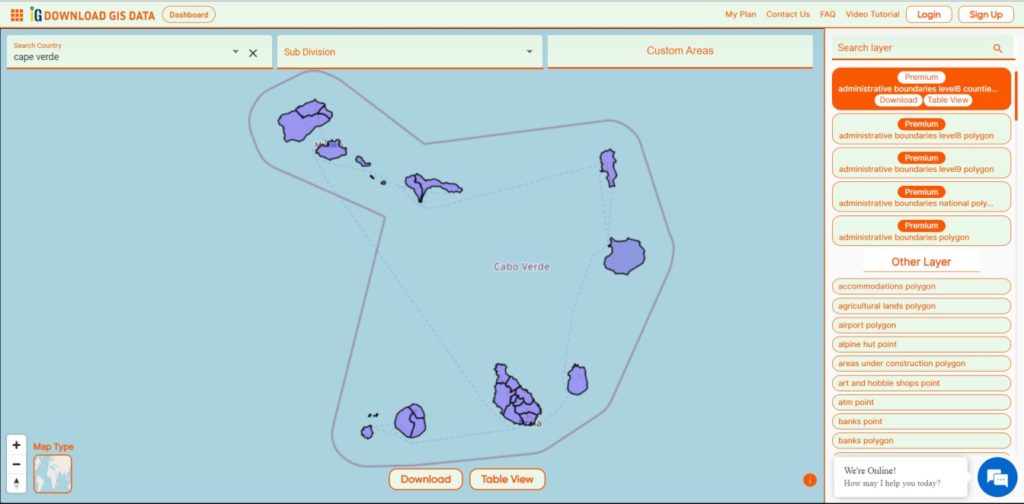
The Cape Verde archipelago is in the Atlantic Ocean, approximately 570 kilometers (350 mi) off the western coast of the African continent, near Senegal, The Gambia, and Mauritania as well as part of the Macaronesia ecoregion. It lies between latitudes 14° and 18°N, and longitudes 22° and 26°W. The country is a horseshoe-shaped cluster of ten islands (nine inhabited) and eight islets, that constitute an area of 4033 km2 (1557 sq mi).
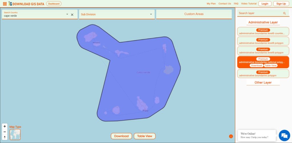
Cape Verde National Boundary

Download Cape Verde National Boundary Shapefile

Download Cape Verde Municipalities Shapefile Data

 Cape Verde is divided into 22 concelhos municipalities.

  • Tarrafal
  • São Miguel
  • São Salvador do Mundo
  • Santa Cruz
  • São Domingos
  • Praia
  • Ribeira Grande de Santiago
  • São Lourenço dos Órgãos
  • Santa Catarina
  • Brava
  • São Filipe
  • Santa Catarina do Fogo
  • Mosteiros
  • Maio
  • Boa Vista
  • Sal
  • Ribeira Brava
  • Tarrafal de São Nicolau
  • São Vicente
  • Porto Novo
  • Ribeira Grande
  • Paul
Cape Verde Municipalities Boundaries

Download Cape Verde Municipalities Boundaries Shapefile

Other GIS Data:

Download Shapefile for the following:

  1. World Countries Shapefile
  2. Australia
  3. Argentina
  4. Austria
  5. Belgium
  6. Brazil
  7. Canada
  8. Denmark
  9. Fiji
  10. Finland
  11. Germany
  12. Greece
  13. India
  14. Indonesia
  15. Ireland
  16. Italy
  17. Japan
  18. Kenya
  19. Lebanon
  20. Madagascar
  21. Malaysia
  22. Mexico
  23. Mongolia
  24. Netherlands
  25. New Zealand
  26. Nigeria
  27. Papua New Guinea
  28. Philippines
  29. Poland
  30. Russia
  31. Singapore
  32. South Africa
  33. South Korea
  34. Spain
  35. Switzerland
  36. Tunisia
  37. United Kingdom Shapefile
  38. United States of America
  39. Vietnam
  40. Norway
  41. Chile
  42. Crotia

Disclaimer : If you find any shapefile data of country provided is incorrect do contact us or comment below, so that we will correct the same in our system as well we will try to correct the same in OpenStreetMap.
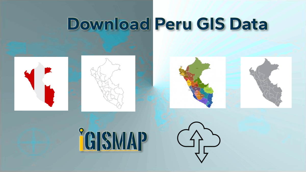
Download Peru Administrative Boundary Shapefiles – National, Regions, Province, Districts and More

Download Peru administrative boundaries shapefiles Peru National , regions , provinces , districts and more.

It’s fantastic to hear that IGISMAP has expanded its GIS data collection to include data for more than 100 new countries, bringing the total coverage to over 150 countries. This is undoubtedly a valuable resource for GIS enthusiasts and professionals around the world. The availability of detailed information on administrative divisions, rivers, roads, and airports can greatly enhance various geospatial projects and analyses.

The option to access the data through tools like “Download GIS Data” and “Add GIS Data” seems convenient and user-friendly. Providing data in different formats such as Shapefile, KML, GeoJSON, and CSV ensures compatibility with a wide range of GIS software and applications, making it easier for users to integrate the data into their workflows.

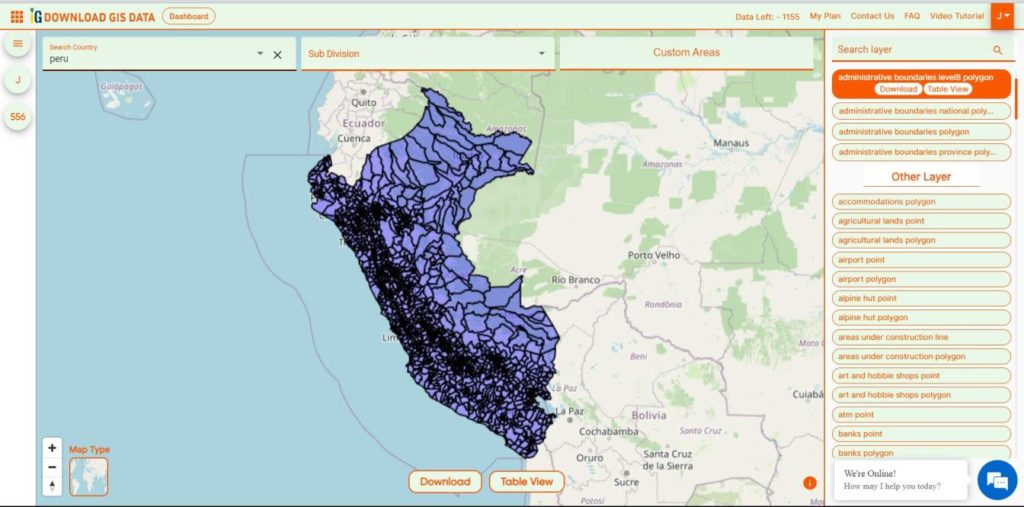
This article will walk you through downloading administrative-level GIS data for Peru using the Download GIS Data tool. Experience a seamless geospatial journey with IGISMAP as your trusted partner!

Note:

  • All data available are in GCS datum EPSG:4326 WGS84 CRS (Coordinate Reference System).
  • You need to login for downloading the shapefile.

Download Shapefile Data of Peru

A virtual guide to Peru, the third largest country in South America, with a 2,400 km long coastline at the South Pacific Ocean (what a beach). Countries with international borders to Peru are Bolivia, Brazil, Chile, Colombia, and Ecuador.

The country extends along the Andes, the world’s longest exposed mountain range, it covers an area of 1,285,216 km², making it 2.5 times the size of Spain, or slightly smaller than Alaska.

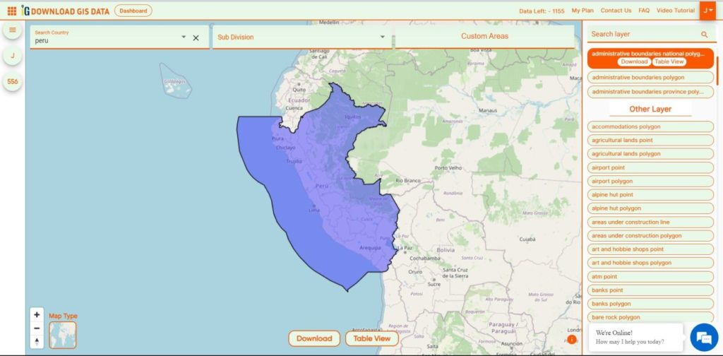
Peru National Boundary

Download Peru National Boundary Shapefile

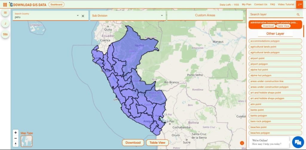
Download Peru Provinces Shapefile Data

The provinces of Peru (Spanish: provincias) are the second-level administrative subdivisions of the country.

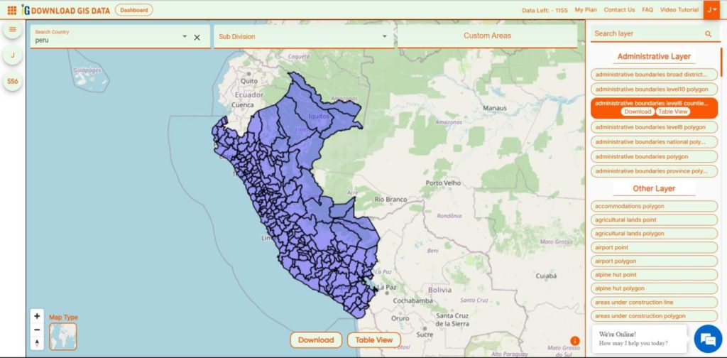
Peru Provinces Boundaries

Download Peru Provinces Boundaries Shapefile

Download Peru Regions Shapefile Data

 There are 196 provinces in Peru, grouped into 25 regions, except for Lima Province which does not belong to any region. This makes an average of seven provinces per region.

Peru Regions Boundaries

Download Peru Regions Boundaries Shapefile

Download Peru Districts Shapefile Data

The districts of Peru (Spanish: distritos) are the third-level country subdivisions of Peru.

Peru Districts Boundaries

Download Peru Districts Boundaries Shapefile

Other GIS Data:

Download Free Shapefile for the following:

  1. World Countries Shapefile
  2. Australia
  3. Argentina
  4. Austria
  5. Belgium
  6. Brazil
  7. Canada
  8. Denmark
  9. Fiji
  10. Finland
  11. Germany
  12. Greece
  13. India
  14. Indonesia
  15. Ireland
  16. Italy
  17. Japan
  18. Kenya
  19. Lebanon
  20. Madagascar
  21. Malaysia
  22. Mexico
  23. Mongolia
  24. Netherlands
  25. New Zealand
  26. Nigeria
  27. Papua New Guinea
  28. Philippines
  29. Poland
  30. Russia
  31. Singapore
  32. South Africa
  33. South Korea
  34. Spain
  35. Switzerland
  36. Tunisia
  37. United Kingdom Shapefile
  38. United States of America
  39. Vietnam
  40. Norway
  41. Chile
  42. Croatia
  43. Estonia
  44. Laos
  45. Hungary
  46. Libya
  47. Comoros
  48. Colombia
  49. Bhutan
  50. Maldives
  51. Iraq
  52. Azerbaijan
  53. Portugal
  54. Macedonia

Disclaimer : If you find any shapefile data of country provided is incorrect do contact us or comment below, so that we will correct the same in our system as well we will try to correct the same in OpenStreetMap.
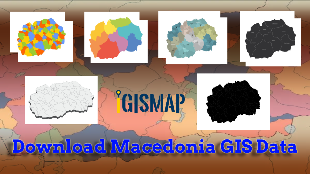
Download Macedonia Administrative Boundary Shapefiles – National , Regions , Villages and More

Download Macedonia administrative boundary shapefiles- Macedonia National , Regions , Villages Shapefile and more.

It’s fantastic to hear that IGISMAP has expanded its GIS data collection to include data for more than 100 new countries, bringing the total coverage to over 150 countries. This is undoubtedly a valuable resource for GIS enthusiasts and professionals around the world. The availability of detailed information on administrative divisions, rivers, roads, and airports can greatly enhance various geospatial projects and analyses.

The option to access the data through tools like “Download GIS Data” and “Add GIS Data” seems convenient and user-friendly. Providing data in different formats such as Shapefile, KML, GeoJSON, and CSV ensures compatibility with a wide range of GIS software and applications, making it easier for users to integrate the data into their workflows.

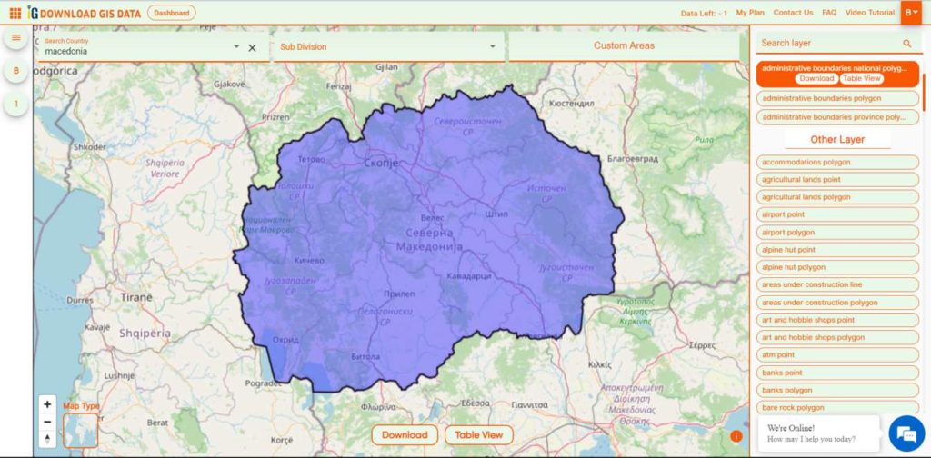
This article will walk you through downloading administrative-level GIS data for Macedonia using the Download GIS Data tool. Experience a seamless geospatial journey with IGISMAP as your trusted partner!

Note:

  • All data available are in GCS datum EPSG:4326 WGS84 CRS (Coordinate Reference System).
  • You need to login for downloading the shapefile.

Download Shapefile Data of Macedonia

North Macedonia is a country situated in southeastern Europe with geographic coordinates 41°50′N 22°00′E, bordering Kosovo and Serbia to the north, Bulgaria to the east, Greece to the south and Albania to the west. The country is part of the wider region of Macedonia and makes up most of Vardar Macedonia. The country is a major transportation corridor from Western and Central Europe to Southern Europe and the Aegean Sea. North Macedonia is a landlocked country but has three major natural lakes: Lake Ohrid, Lake Prespa and Lake Dojran. It has a water area of 857 km2, while its land area is 24,856 km2.

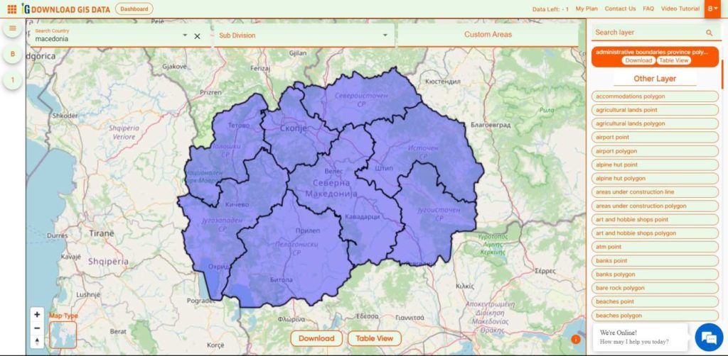
Macedonia National Boundary

Download Macedonia National Boundary Shapefile

Download Macedonia Regions Shapefile Data

 Macedonia is divided into 8 regions.

  • Eastern
  • Northeastern
  • Pelagonia
  • Polog
  • Skopje
  • Southeastern
  • Southwestern
  • Vardar
Macedonia Regions Boundaries

Download Macedonia Regions Boundaries Shapefile

Download Macedonia Villages Shapefile Data

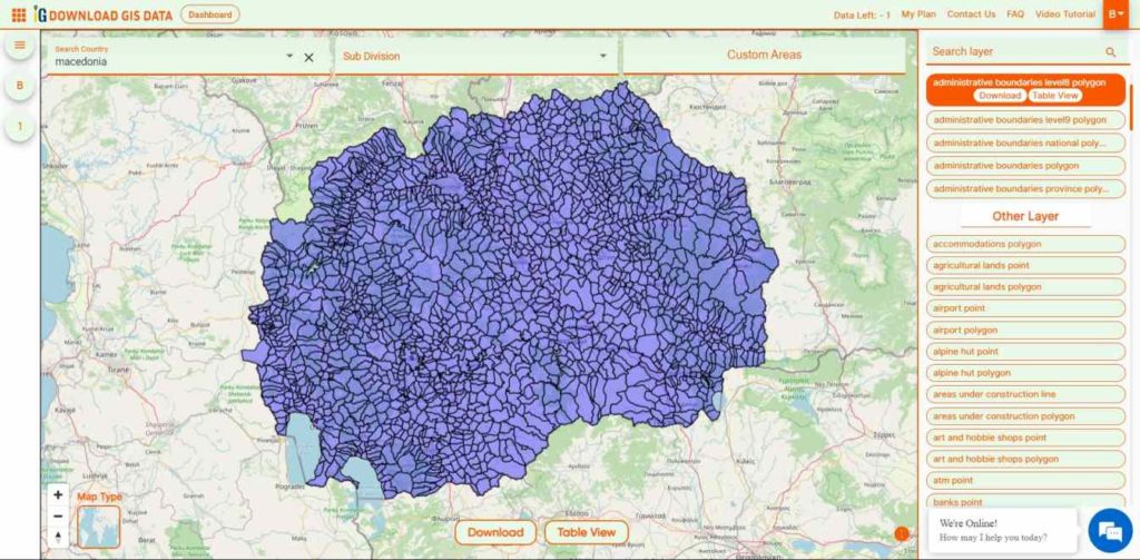
There are Total 1725 Villages in Macedonia.

Macedonia Villages Boundaries

Download Macedonia Villages Boundaries Shapefile

Other GIS Data:

Download Free Shapefile for the following:

  1. World Countries Shapefile
  2. Australia
  3. Argentina
  4. Austria
  5. Belgium
  6. Brazil
  7. Canada
  8. Denmark
  9. Fiji
  10. Finland
  11. Germany
  12. Greece
  13. India
  14. Indonesia
  15. Ireland
  16. Italy
  17. Japan
  18. Kenya
  19. Lebanon
  20. Madagascar
  21. Malaysia
  22. Mexico
  23. Mongolia
  24. Netherlands
  25. New Zealand
  26. Nigeria
  27. Papua New Guinea
  28. Philippines
  29. Poland
  30. Russia
  31. Singapore
  32. South Africa
  33. South Korea
  34. Spain
  35. Switzerland
  36. Tunisia
  37. United Kingdom Shapefile
  38. United States of America
  39. Vietnam
  40. Norway
  41. Chile
  42. Croatia
  43. Estonia
  44. Laos
  45. Hungary
  46. Libya
  47. Comoros
  48. Colombia
  49. Bhutan
  50. Maldives
  51. Iraq
  52. Azerbaijan
  53. Portugal

Disclaimer : If you find any shapefile data of country provided is incorrect do contact us or comment below, so that we will correct the same in our system as well we will try to correct the same in OpenStreetMap.
Geoserver Importer Extension API – Upload and Publish Data

In our previous articles we went through how vector and raster data can be publish on Geoserver using stores. Here, in this article we would be discussing what is importer and how this extension can be used to upload and publish the data i.e with Geoserver Importer Extension API.  If you haven’t looked over how to install geoserver, here is the article to install geoserver in linux or install geoserver in windows.

Geoserver Importer Extension API – Upload and Publish Data

Install Importer Extension in GeoServer

As this an official extension, it can be downloaded from its website that is http://geoserver.org/release/stable/   link.

Follow the steps to install extension-

  1. Download the extension from given website according to your geoserver version.
  2. Extract the archive in WEB-INF/lib directory.
  3. After this, restart the Geoserver.
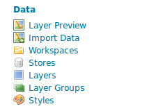
  4. To check the availability of extension, open the geoserver in browser and check the Data section and find import data.

Geoserver Importer Extension API

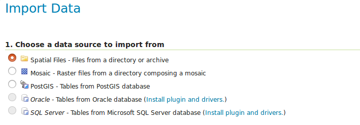
Supported Data format by Importer Extension GeoServer

For spatial data it supports
  1.  Shapefile and
  2.  GeoTiff
For DataBases it supports
  1. PostGIS
  2. Oracle
  3. Microsoft SQL Server

Geoserver Importer Extension API

Upload and Publish Data – Geoserver Importer Extension API

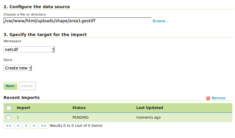
There are two simple steps to upload and publish data. To upload data you can click on browse and find the file to upload, select workspace and store then click to next . If data is successfully uploaded an import id is generated  with status pending. The status shows that data has been added but it is not published.

Geoserver Importer Extension

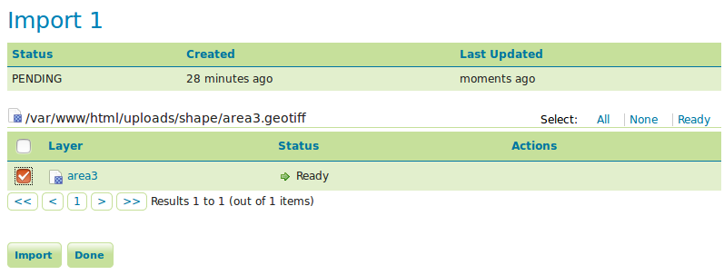
To publish data you can click on import id. New page will open. Here you can click on layer name to change any setting or style.  Geoserver Importer Extension

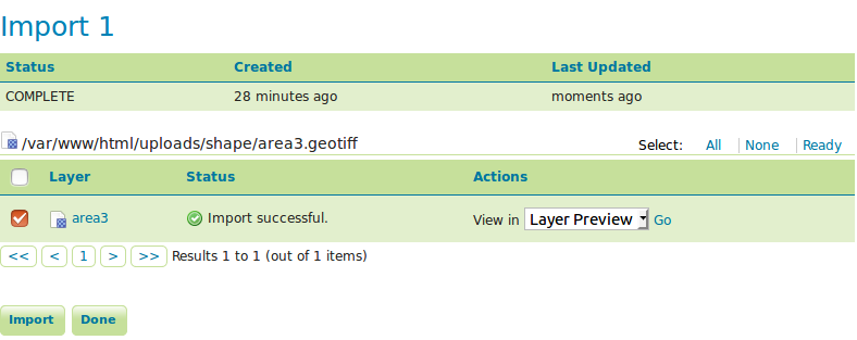
To publish click on check box and hit import button. Now published data is available to you to view in layer preview and google earth. Select the desired option and click to go.

Geoserver Importer Extension

Publish Data using REST API-  Geoserver Importer Extension

To upload and import data we can also use REST API (Representational state transfer Application programming interface). For this you need to follow the code.

private function create_a_task($workspace)
 {
 $headers = ['Content-Type: application/json', 'accept: application/json'];
 $data['import']=array('targetWorkspace'=> array('workspace'=> array('name'=>$workspace)));
 $settings = [
 CURLOPT_HTTPHEADER => $headers,
 CURLOPT_USERPWD => $this->passwordString,
 CURLOPT_RETURNTRANSFER => TRUE,
 CURLOPT_POST => TRUE,
 CURLOPT_POSTFIELDS=> json_encode($data),
 ];

$endpoint = "rest/imports";
 $response = $this->call($endpoint, $settings);
 if($response)
 {
 return $response;
 }else{
 return FALSE;
 }
 }

Whether task has created or not, you can check by browsing http://localhost:8080/geoserver/rest/imports link. you will get the following output.

{"imports":[{"id":1,"href":"http://localhost:8080/geoserver/rest/imports/1","state":"PENDING"}]}

After creating a task you can publish the task by executing the given function.

private function upload_task_data($fileName,$id,$workspace)
 {
 $headers = ['Content-Type: multipart/form-data', 'accept: application/json'];
 $finfo = finfo_open(FILEINFO_MIME_TYPE);
 $finfo = finfo_file($finfo, $fileName);
 $cFile = new CURLFile($fileName, $finfo, basename($fileName));
 $data = array( "filedata" => $cFile, "filename" => $cFile->postname);
 $settings = [
 CURLOPT_HTTPHEADER => $headers,
 CURLOPT_USERPWD => $this->passwordString,
 CURLOPT_RETURNTRANSFER => TRUE,
 CURLOPT_POST => TRUE,
 CURLOPT_POSTFIELDS => $data,
 CURLOPT_INFILESIZE => filesize($fileName),
 ];

$endpoint = "rest/imports/".$id."/tasks";
 $response = $this->call($endpoint, $settings);
 if($response)
 {
 return $response;
 }else{
 return FALSE;
 }
 }

To check the output of code follow the link and get the output.

http://localhost:8080/geoserver/rest/imports/1/tasks

{"tasks":[{"id":0,"href":"http://localhost:8080/geoserver/rest/imports/1/tasks/0","state":"READY"}]
private function ready_imports($import_id,$workspace)
 {
 $headers = ['Content-Type: application/json', 'accept: application/json'];
 $settings = [
 CURLOPT_HTTPHEADER => $headers,
 CURLOPT_USERPWD => $this->passwordString,
 CURLOPT_RETURNTRANSFER => TRUE,
 CURLOPT_POST => TRUE,
 ];

$endpoint = "rest/imports/".$import_id;
 $response = $this->call($endpoint, $settings);
 if($response)
 {
 return $response;
 }else{
 return FALSE;
 }
 }

Output will be

{"import":{"id":1,"href":"http://localhost:8080/geoserver/rest/imports/1","state":"COMPLETE","archive":false,"targetWorkspace":{"workspace":{"name":"netcdf"}},"data":{"type":"file","format":"GeoTIFF","file":"area3.geotiff"},"tasks":[{"id":0,"href":"http://localhost:8080/geoserver/rest/imports/1/tasks/0","state":"COMPLETE"}]}}

After publishing your data, you can also look for how to sytle your raster layer in geoserver and how to style vector layer in geoserver. Simultaneously you can check the data on geoserver. In this way you can upload and publish the data on geoserver with importer api. For any help and suggestions you can comment us in given box.

Upload or add kml or KML file on Google Earth

Upload or add kml or KML file on Google Earth. KML or KMZ is a file which models geographic features for displaying in Google Earth or Google Maps. You can easily add and upload KML file on Google Earth. This files can be easily created on Google Map or on Google Earth or on Any GIS tool. You may need to upload a shared or newly created KML file from third party, and want to verify whether the overlapped KML or KMZ file is valid or not. You may use Google Earth Pro instead Google Earth as it is now free to download.

Before following the below steps, download or create one of the KML file to taking demo. You can either create and export KML file from Google Map or from Google Earth or you may also convert your shapefile to KML or KMZ file from QGIS.

Upload or add kml or KML file on Google Earth

Steps to Upload or add kml or KML file on Google Earth

1.) Launch Google Earth in your desktop either Mac or Windows OS.

2.) Click on File menu, and select Open. Now browse to the KML or KMZ file which you want to upload on Google Earth. This will upload KML or KMZ file which may either be point, multipoint, line or polygon.

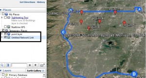
3.) In the places panel, you may file a new folder with Temporary Places containing your KML map. Double click on the KML map appear in panel to explore all layers and all associated elements(point, line or polygon).
To every element present in layer, you can either cut, copy, paste and delete,  and save – download the KML map to my places folder of Google Earth. Also you change the properties i.e Description, Style or Color of markers and line, Altitue and Measurement.

Upload or add kml or KML file on Google Earth

Steps to Upload or Add multiple KML maps on Google Earth:

1.) To add multiple KML file, you first need to follow the above steps to add the one.

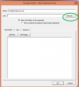
2.) Now on the folder where your maps is actually loaded i.e in my case in “Temporary Places” right click and select add -> Network link. This will open up a New network link window.

3.) Select browse, and navigate to another KML file which you want to upload.

Upload or add kml or KML file on Google Earth

4.) Ok. Now your system is ready with multiple KML file on Google Earth. You can customize the uploaded KML file in same way as described above. Now you can perform GIS operation and analysis on Google Earth with uploaded overlayed KML file.

Hope this tutorial would have help you. If you find any problem in uploading KML file, do comment below. Also do share which type of data file you frequently upload on Google earth.

Create save digitize and download kml or kmz from Google Earth

Create save digitize and download kml or kmz from Google Earth. Google earth can be named a virtual globe or map of earth, which provide high resolution view of any area in recent years or any period of time from last decades. Always its not possible to go for field survey and prepare the layers like roads, places, river, water-body , settlements etc for any GIS application as it need resources and manual work which increases cost and project duration. Why do not one use a efficient way for the creation of layers like digitize kmz from the Google earth and convert it to shape-file or use directly. You can also see for how to save, create and export kml file from Google map. To digitize and save kmz from Google earth following steps need to be followed.
Steps to Create save digitize and download  kml or kmz from Google Earth

1) Start with running the application of Google earth on desktop or laptop, wait till the globe appears in the Google earth application window.

Create save digitize and download kml or kmz from Google Earth

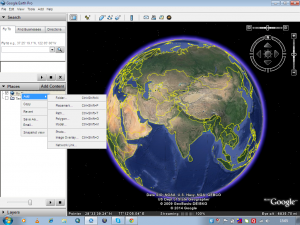
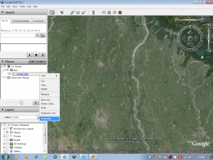
2) Add a folder to the My places contained by Places window of Google earth as shown in fig below.

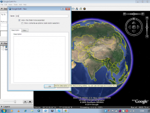
3) Give name which you want to give to kmz in the tab opened clicking on the My place>add>folder button.Create save digitize and download kml or kmz from Google Earth

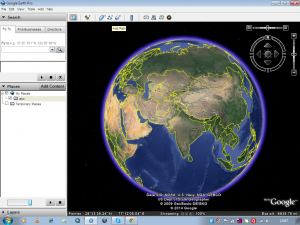
4) To plot a kmz of line type click on the Add Path button on the toolbar placed on the top of the window.Create save digitize and download kml or kmz from Google Earth

Create save digitize and download kml or kmz from Google Earth

5) Start digitizing with the left click of the mouse and scrolling the window up, down, left and right by pressing the scroll wheel and zoom in and zoom out by rotating the scroll wheel inward and outward. To undo plotted points adjoining line press right click.

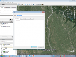
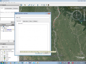
6) Save every line feature in the same folder named for kmz. Name of the feature can be edited by right click on the feature in the place window and going to properties of the feature. Create save digitize and download kml or kmz from Google EarthCreate save digitize and download kml or kmz from Google Earth

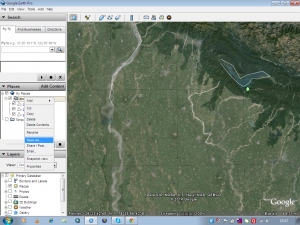
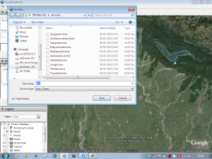
7) Now after digitizing all feature save the kmz to the desired destination by right clicking on the folder in the My places.Create save digitize and download kml or kmz from Google Earth

Create save digitize and download kml or kmz from Google Earth

8) Lastly the question may arise how to digitize kmz with polygon and point feature. For polygon feature click on Add Polygon on the tool bar and for point feature click on Add Place marks on the toolbar.                                                                 Create save digitize and download kml or kmz from Google Earth

Create save digitize and download kml or kmz from Google Earth

Note: Google provides Google Earth and this kind of service for free. But i suppose, if you are going to extract and create KML file with your program in bulk, then Google may notify you for the same.

You may also look on some other tutorial:

Thus Kmz is digitized and saved from Google earth. One may convert the kmz to shp in any GIS software like ArcGIS, QGIS, Global Mapper. Do comment below if you are getting any issue in performing above steps. Also do let us know in what way and in which application you are using KML file for performing GIS operation, by putting the information in the below provided space.

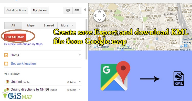
Create save Export and download KML file from Google map

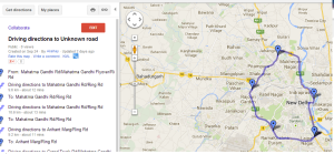
Create save Export and download KML file from Google map.  Google map or Google Earth makes use of KML or keyhole markup language, to display features, which actually stores geographic features in Vector format. You can create KML file from Google map for mapping and displaying the same by again uploading the same KML file on Google map or created KML file converted from Shapefile. Before creating KML file on Google map, you should have an Google account and should be logged in wtih that. So that once KML file created, you would be able to see it in My Places of Google map after wards. You can also look link for how to create KML file from Google earth.

Create save Export and download KML file from Google map

Note: Google provides Google map and this kind of service for free. But i suppose, if you are going to extract and create KML file with your program in bulk, then Google may notify you for the same.

Create save Export and download KML file from Google map

Steps to Create save Export and download KML file from Google map

1.) Open Google map and sign in with all in one Google account.

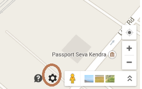
2.) Click the setting button which appears at the bottom right corner of map as shown below (New Google map), and select My places. Or if you are using old map theme, then choose my places from top right corner.

Create save Export and download KML file from Google map

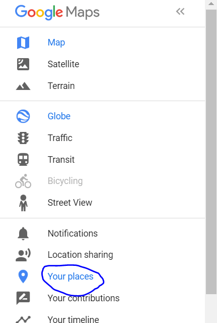
  • Update: If you are not getting my places option from here, then you click on left side Menu icon (three lines) and select your places and tap on Maps.

Create save Export and download KML file from Google map

Once you clicked your places select the Maps.

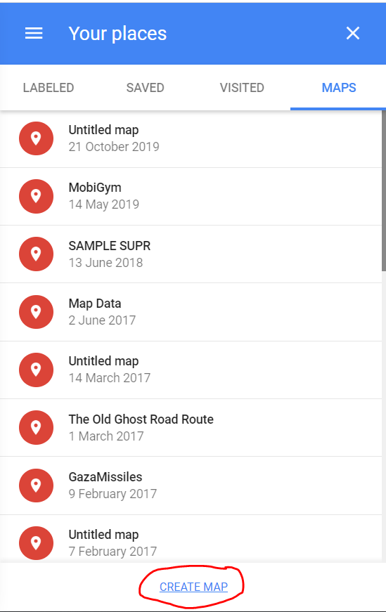
3.) Now click on Create Map (in the last with blue font) which will open new link in new tab and select Create Map again.

4.) Perform and create a map, with the help of tool bars as shown below, Which has following options i.e

  • Undo
  • Redo
  • Select item
  • Add a Marker
  • Draw a line
  • Add direction
  • Measure distance and Area.
Create save Export and download KML file from Google map

5.)Name your map, by clicking on untitled map. You can now Add layers too, i.e for Adding Markers, which will be treated as point feature, make different layer while for Adding direction or line
you can have different layer.

  • Note: You cannot have more than 3 layers for the same map project for Free. You need to go for Google map pro.
Create save Export and download KML file from Google map

Here is the look, i had created 3 layers, i.e 1st one is Point layer, 2nd is Direction layer and 3rd is Line layer, as shown above.

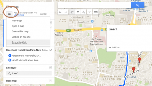
6.) Once you are done with creating map, click the folder icon, shown just below your title of map project and Select Export as KML. Now you can export the entire map or either of the layer by selecting the options. Done.

Create save Export and download KML file from Google map

You can now share your map you created map and can also embed it in your website. What are your plannings with the newly created KML file? Do you want to convert kml file to shapefile. Do comment below, how you use KML file so that me as well as our visitors will come to know about new technology and uses. Your valuable suggestion and questions are always welcomed by commenting below in the section provided.

Upload or Import KML file on Google map

Upload or import KML file on Google map. KML or Keyhole Markup Language is file which models and stores geographic features for display in Google Earth or Google maps. You can upload and view the KML file you already created on Google Map, to verify Whether the overlapped feature of KML uploaded has proper valid geometry or not in respect to the Google Map Feature. Before uploading the KML on Google Map, you need to have a Google account. The file uploaded will be saved to “My Places“, you don’t need to upload it twice when require. If you are not having an already built KML file, you can look at How to create KML file on Google map or How to create KML file on Google earth.

You can also try MAPOG Map Analysis Product to upload or import the KML file Online and View on map for free. Along with that you can further process the GIS Data with different operation and finally create a brief Analysis report.

Upload or Import KML file on Google map

Upload or import KML file on Google map

Here are the steps to upload or import KML file on Google map

1.) Open Google map, and sign in for all in one Google account.
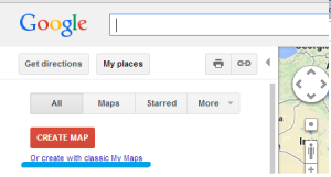
2.) Move to My Places, a button on left upper side of Google map, and then select the Create with classic My Maps as shown below.

Upload or import KML file on Google map

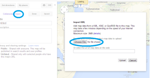
3.) Select import option, and then browse the KML file you want to upload on Google map.

Upload KML file on Google map

4.) Done, edit the title and description. You can make the map public or private. Save the map.

Upload KML file on Google map

  • Note: You can upload KML file of Maximum size of 3MB on Google Map, as per Google instructions. While i found some lose of data while uploading KML file of greater than 2MB. Alternative to Google map is Google earth for the same.

The map saved, can be again viewed and downloaded by going to “My Places -> click on the title of map -> then the KML” option appearing just below the title of your map. You can also find the tutorial to convert KML to Shapefile and Shapefile to KML, with the help of QGIS an open source GIS tool. Want to know more technically on the KML and shapefile, i will provide you soon, related tools and coding for the same with explanation.