Download Algeria Administrative Boundary Shapefiles – National, Districts, Municipalities and more

Algeria Shapefile Download Map – Free Polygon Administrative Download. Shapefiles showing Districts , Municipalities and Town and Cities.

Have you been searching too long for accurate GIS data for your country of interest? Well the wait is over with MAPOG, your one-stop destination for comprehensive GIS data covering 150+ countries. You can find more than 150 GIS data for each nation in MAPOG GIS Data Collection. The distinctive feature of MAPOG GIS data collection lies in its commitment to providing highly accurate GIS data of the administrative divisions. Users can also find data of other natural and man made geographic features such as river, roads, railway lines, airport locations etc. that are represented in appropriate geometric structures (point, line and polygon). MAPOG provides two important tools for accessing these GIS datasets – Download GIS Data and Add GIS Data.

With MAPOG’s versatile toolkit, you can effortlessly upload vector and raster filesadd WMS (Web Map Service) layers, upload Excel or CSV data, incorporate existing files, perform polygon splitting and merging, generate new polygon and polyline data, use the converter for various formats, conduct buffer analysiscreate gridstransform points into polygons, calculate isochrones, and utilize the geocoder for precise location information.

We offer an extensive array of data formats, including KML, SHP, CSV, GeoJSON, Tab, SQL, Tiff, GML, KMZ, GPKZ, SQLITE, Dxf, MIF, TOPOJSON, XLSX, GPX, ODS, MID, and GPS, ensuring compatibility and accessibility for various applications and analyses.

Note:

  • All data available are in GCS datum EPSG:4326 WGS84 CRS (Coordinate Reference System).
  • You need to login for downloading the shapefile.

Download Shapefile Data of Algeria

Algeria is bordered to the northeast by Tunisia; to the east by Libya; to the southeast by Niger; to the southwest by Mali, Mauritania, and Western Sahara; to the west by Morocco; and to the north by the Mediterranean Sea. It is considered part of the Maghreb region of North Africa. It has a semi-arid geography, with most of the population living in the fertile north and the Sahara dominating the geography of the south. Algeria covers an area of 2,381,741 square kilometres (919,595 sq mi), making it the world’s, tenth largest nation by area and the largest nation in Africa, more than 200 times as large as the continent’s smallest country, The Gambia. With a population of 44 million, Algeria is the tenth-most populous country in Africa, and the 32nd most populous country in the world. The capital and largest city is Algiers, located in the far north on the Mediterranean coast.
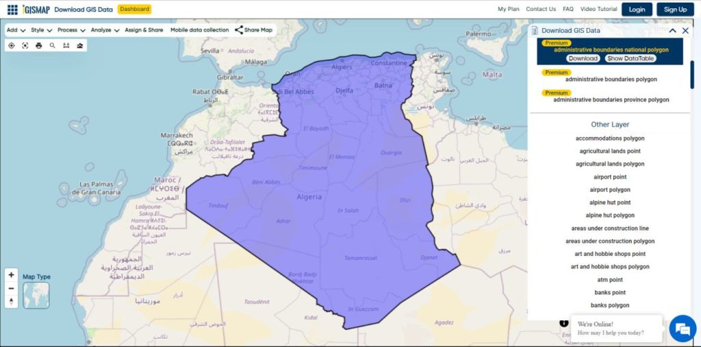
Algeria National Boundary

Download Algeria National Boundary Shapefile

Download Algeria Districts Shapefile Data

Algeria’s districts were created as arrondissements when Algeria was a colony of France and they had a status equal to those of mainland France. They were, like France’s arrondissements, part of departements, which are further part of a région (which was called a territory, territoire, in French Algeria). They were maintained 6 years after the country’s independence (until 1968) when they were renamed “daïras” and had their functions slightly changed.
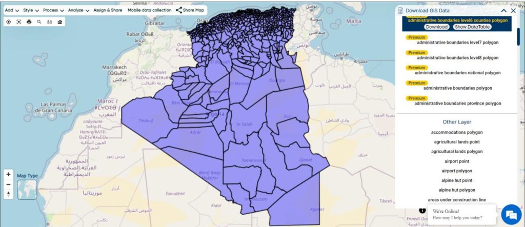
Algeria Districts Boundaries

Download Algeria Districts Boundaries Shapefile

Download Algeria Municipalities Shapefile Data

The municipalities of Algeria form the third level of administrative subdivisions of Algeria. As of 2002, there were 1,541 municipalities in the country.
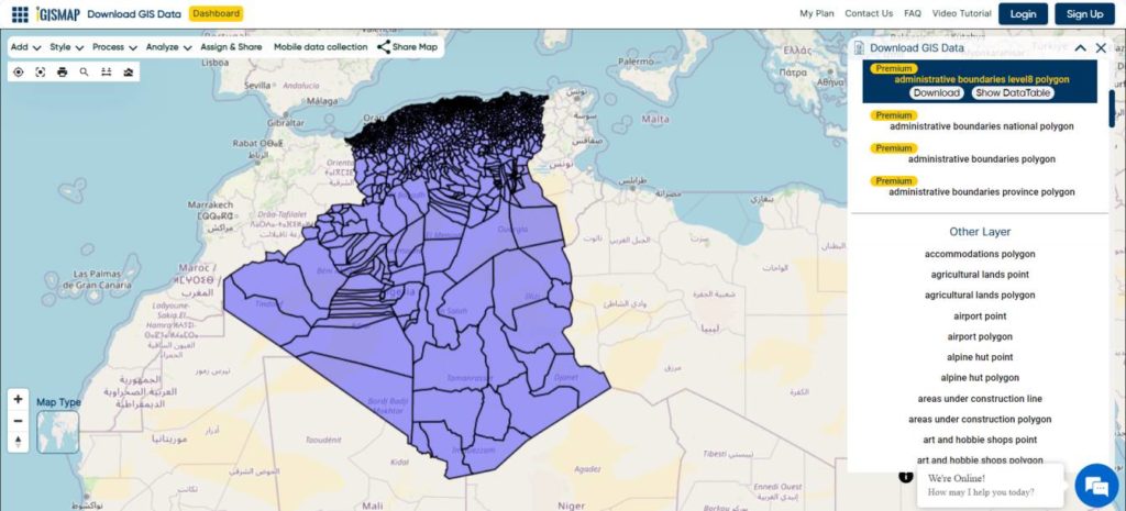
Algeria Municipalities Boundaries

Download Algeria Municipalities Boundaries Shapefile

Other Administrative Boundary Data:

Other GIS Data:

Download Shapefile for the following:

  1. World Countries Shapefile
  2. Australia
  3. Argentina
  4. Austria
  5. Belgium
  6. Brazil
  7. Canada
  8. Denmark
  9. Fiji
  10. Finland
  11. Germany
  12. Greece
  13. Greenland
  14. India
  15. Indonesia
  16. Ireland
  17. Italy
  18. Japan
  19. Kenya
  20. Lebanon
  21. Madagascar
  22. Malaysia
  23. Mexico
  24. Mongolia
  25. Netherlands
  26. New Zealand
  27. Nigeria
  28. Papua New Guinea
  29. Philippines
  30. Poland
  31. Russia
  32. Singapore
  33. South Africa
  34. South Korea
  35. Spain
  36. Switzerland
  37. Tunisia
  38. United Kingdom Shapefile
  39. United States of America
  40. Vietnam
  41. Norway
  42. Chile
  43. Crotia

Disclaimer : If you find any shapefile data of country provided is incorrect do contact us or comment below, so that we will correct the same in our system as well we will try to correct the same in openstreetmap.
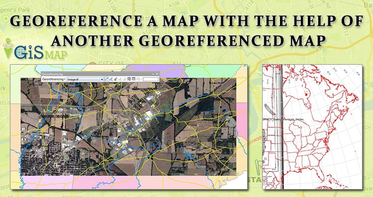
Georeference a map with the help of another georeferenced map

Here we will see how to georeference a map with the help of another georeferenced map in QGIS (Quantum GIS). Georeference is a process to associate geographic location coordinates to any kind of physical object which is physically present over a Raster image map or to a physical map, with help of other georeferenced data or with know location coordinates of some points of image which is effectively called as control points. It is one of the important concept of GIS (Geographical Information System). We have already discussed about how to Georeference Map with the help of know control points.

New to QGIS – Check other tutorial in QGIS.

Georeference a map with the help of another georeferenced map:

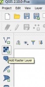
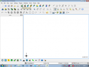
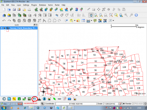
1.) Open QGIS and Load the georeferenced map, by selecting Layer -> Add Layer -> Add Raster Layer or by directly selecting Add Raster Layer from Layer panel as shown below.

Georeference a map with the help of another georeferenced map

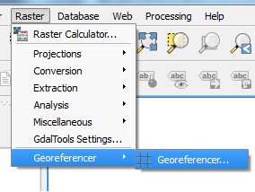
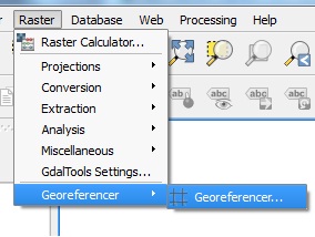
2.) After loading the file, from the menu select Raster and click on Georeferencer to select Georeferencer.

Georeference a map with the help of another georeferenced map

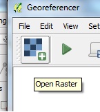
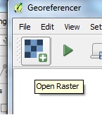
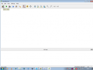
3.) In the Georeferencer window which is open up by above step, select Add Raster Layer icon to load non georeference map.

Georeference a map with the help of another georeferenced map

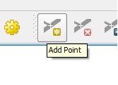
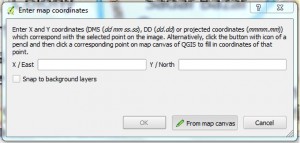
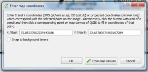
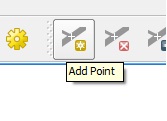
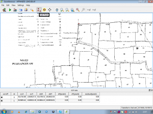
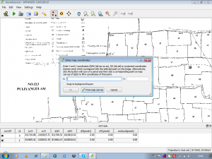
4.) Click add point and select a point on your map. In the pop up window click from map canvas.

Georeference a map with the help of another georeferenced map

Georeference a map with the help of another georeferenced map

5.) Select location in the georeferenced map same as the location you selected in non-georeferenced map. You will see it will load the coordinates.

Georeference a map with the help of another georeferenced map

6.) Click ok.

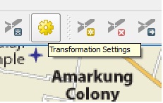
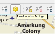
7.) Likewise select at least four points in different direction. Click transformation setting icon button as shown below in image.

Georeference a map with the help of another georeferenced map

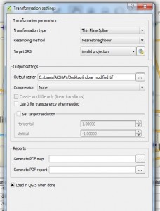
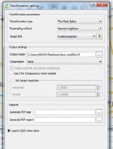
8.) Select any one Transformation Type and provide your output raster name.

Georeference a map with the help of another georeferenced map

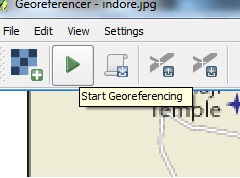
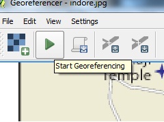
9.) Click start Georeferencing button from the Georeferencer window.

Georeference a map with the help of another georeferenced map

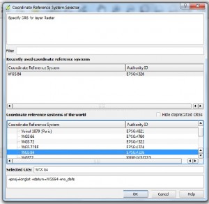
10.) Select CRS same as the georeferenced map. In our case it is WGS 84. Close georeferencer. You will see georeferenced image in canvas. Note the coordinates.

Georeference a map with the help of another georeferenced map

I hope this article would be helpful for you to know the basics of how to georeference raster image with the help of another georeferenced map. If you are facing problem in implementing the process do comment below, so that we can discuss over it.

You May Like :

Geo – Referencing raster image in QGIS w.r.t. vector file

Raster Data File Formats


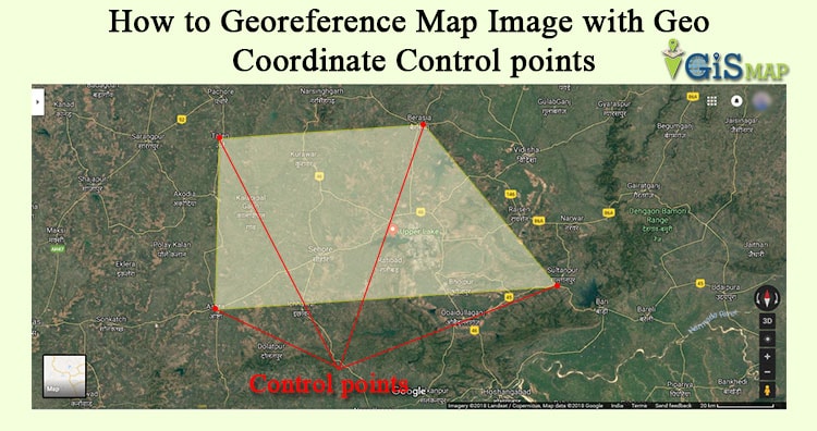
How to Georeference Map Image with Geo Coordinate Control points

How to Geo-reference Map Image with Geo Coordinate points in QGIS (Quantum GIS). Georeference is a process to associate geographic location coordinates to any kind of physical object which is physically present over a Raster image map or to a physical map, with help of other georeferenced data or with know location coordinates of some points of image which is effectively called as control points. Georeference is one of the important concept of GIS (Geographic Information System). Here we will see how to Georeference map manually in QGIS. You can also see how to georeference from one map to another and other QGIS tutorial.

Here is the steps to georeference raster image map in QGIS:

1.) Open QGIS and Import your image map using ADD RASTER LAYER in QGIS.

Georeference Map Image with Geo Coordinate Control points in QGIS2.) We need to find the control point and known geolocation coordinates. I prefer Google Maps to get the Latitude and Longitude values.

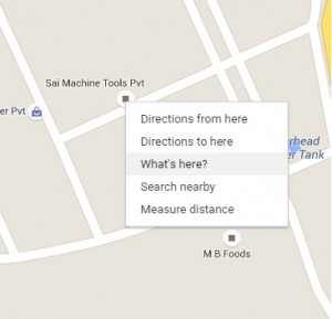
Go to google map and search the location which matches your image map location on it. Select a point in google map which matches in your map. You can also switch to satellite view. Select a point such as any land mark place as per your convenience. Right click on that point in Google Map and click what’s here you will see it will display latitude and longitude of the point.

Georeference Map Image with Geo Coordinate Control points in QGIS 1

Georeference Map Image with Geo Coordinate Control points in QGIS 1

3.) Latitude is written first and the second one is longitude. Also notice (-) sign (if present). Note down the points. Likewise select at least 4 points in different directions and note down the latitude and longitude of them.

4.) Moving to QGIS tool, Right click on the Raster layer and click remove.

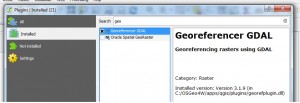
5.) Now go to Georeferencer, you will find it in Raster tab, if you already have installed georeferencer plugin. If you don’t see the option, click Plugins and then select manage and install plugins. Search for georeferencer and install the same as shown below.

Georeference Map Image with Geo Coordinate Control points in QGIS

Georeference Map Image with Geo Coordinate Control points in QGIS 56.) Import your map here and click add points. You can pan and zoom here.

Georeference Map Image with Geo Coordinate Control points in QGIS

Georeference Map Image with Geo Coordinate Control points in QGIS

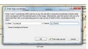
7.) Click on the location on your map which you selected on google map as control points. You will see a window demanding X,Y values. Put longitude value in X and latitude value in Y.

Georeference Map Image with Geo Coordinate Control points in QGIS8.) Like wise add all the points. Go to Settings and click Transformation Setting.

Georeference Map Image with Geo Coordinate Control points in QGIS9.) Select any one Transformation Type and Give your output raster name.

Georeference Map Image with Geo Coordinate Control points in QGIS

10.) Click load in to map canvas when done or if you forget to do so you can import the georeferenced map from the location where you saved it. The extension for the map will be .GeoTiff.

11.) Select CRS WGS: 84 because we are using Latitude and Longitude.

Georeference Map Image with Geo Coordinate Control points in QGIS12.) Now click start Georeferencing symbol as shown below:

Georeference Map Image with Geo Coordinate Control points in QGIS

13.) Close georeferencer. You will see georeferenced image in canvas. Note the coordinates.

Georeference Map Image with Geo Coordinate Control points in QGIS

I hope this article would be helpful for you to know the basics of how to georeference raster image with the help of control points. You are getting problem in implementing the process do comment below, so that we can discuss over it.

Geo-Referencing raster image in QGIS w.r.t. vector file

Geo-Referencing raster image in QGIS with respect to vector file. Geo referencing is the process used to provide geographical information to the raster images like cadastral maps, physical maps and satellite imagery with the help of projection or coordinate system. As an ordinary raster image formed by the number of pixel which has no particular size,  Geo-referencing gives a particular coordinate to a pixel with respect to the ground point, it represents. Thus every individual pixel get its coordinate and size.

Look for other QGIS tutorial.

There are many GIS tools which perform Geo-referencing like ArcGIS, PCI Geomatica, Erdas Imagine, QGIS etc. Here Geo-referencing is shown in QGIS:

Geo-Referencing raster image in QGIS with respect to vector file

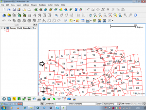
In QGIS first start with loading the vector file in QGIS environment by click on add vector layer.

Geo-Referencing raster image in QGIS with respect to vector file
Geo-Referencing raster image in QGIS

Once the vector layer is loaded it can be given symbology by right click on the layer in the layers window. For geo-referencing the click on the georefrencer tab present at bottom of the QGIS environment window as shown below.

Geo-Referencing raster image in QGIS with respect to vector file
Geo-Referencing raster image in QGIS

This will open a new window named Georeferencer . In this window open the raster image to be referenced by click on the tab open raster layer present on the top left corner.

Geo-Referencing raster image in QGIS with respect to vector file

When raster is open in the georefrencer window to add control points according to which raster will be georefrenced click on the add point button on the tool bar. Control points are the coordinate points of the ground or the projected coordinates.

Geo-Referencing raster image in QGIS with respect to vector file
Geo-Referencing raster image in QGIS

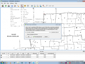
These control points may be enter manually or from the map canvas as here reference is vector layer which is present on the map canvas. click on from map canvas on Enter map coordinates window.

Geo-Referencing raster image in QGIS with respect to vector file

This will open the map canvas or main QGIS window , select the point of reference on the vector layer.

Geo-Referencing raster image in QGIS with respect to vector file

Selection of point on vector layer will fill in the XY coordinates on the Enter map coordinates window. In this way first control point is marked.

Geo-Referencing raster image in QGIS with respect to vector file

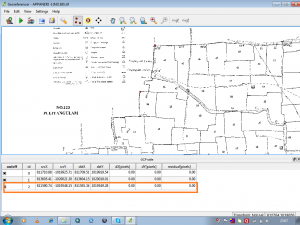
Following same procedure select more and more points with minimum residual error which is generated by the tool and shown in the GCP table window.

Geo-Referencing raster image in QGIS with respect to vector file

Residual error is the difference between the actual coordinate of the control points and the geographic coordinate created by control points. The residuals represent the level of accuracy of the georefrenced images.

Check more :

Georeference on Map image with Geo Coordinates Control

Change projection of a georeference

These georefrenced images can be placed in the layers of any Geographic information system and can be used to locate points on the ground. Feel free to comment below, if you are having any problem to Geo-Referencing raster image  or if you want to discuss for the same topic.