Download Cape Verde Administrative Boundary GIS Data –Shapefiles-National , Municipality and more

Cape Verde Shapefile Download Map – Free Polygon Administrative Download. Shapefiles showing National , Municipalities.

Are you struggling to find accurate and up-to-date GIS data for your desired country? Worry no more, as MAPOG is here to be your ultimate solution! Our platform offers a comprehensive collection of GIS data covering more than 150 countries. You’ll find an impressive selection of over 150 GIS datasets available for each nation in the MAPOG GIS Data Collection. The hallmark of our GIS data lies in its exceptional accuracy, especially when representing administrative divisions. Moreover, our users can access a diverse range of data pertaining to natural and man-made geographic features, including rivers, roads, railway lines, airport locations, and much more, all meticulously represented in appropriate geometric structures (points, lines, and polygons). Facilitating seamless access to this invaluable data are two essential tools – Download GIS Data and Add GIS Data, thoughtfully integrated into the MAPOG platform. To delve deeper into the functionalities of the Add GIS Data tool, check out our enlightening article – “Add GIS data from IGISMap GIS data collection

With MAPOG’s versatile toolkit, you can effortlessly upload vector and raster filesadd WMS (Web Map Service) layers, upload Excel or CSV data, incorporate existing files, perform polygon splitting and merging, generate new polygon and polyline data, use the converter for various formats, conduct buffer analysiscreate gridstransform points into polygons, calculate isochrones, and utilize the geocoder for precise location information.

We offer an extensive array of data formats, including KML, SHP, CSV, GeoJSON, Tab, SQL, Tiff, GML, KMZ, GPKZ, SQLITE, Dxf, MIF, TOPOJSON, XLSX, GPX, ODS, MID, and GPS, ensuring compatibility and accessibility for various applications and analyses.

Note:

  • All data available are in GCS datum EPSG:4326 WGS84 CRS (Coordinate Reference System).
  • You need to login for downloading the shapefile.

Download Shapefile Data of Cape Verde

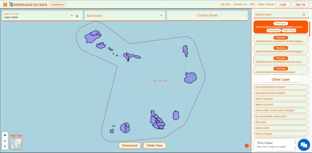
The Cape Verde archipelago is in the Atlantic Ocean, approximately 570 kilometers (350 mi) off the western coast of the African continent, near Senegal, The Gambia, and Mauritania as well as part of the Macaronesia ecoregion. It lies between latitudes 14° and 18°N, and longitudes 22° and 26°W. The country is a horseshoe-shaped cluster of ten islands (nine inhabited) and eight islets, that constitute an area of 4033 km2 (1557 sq mi).
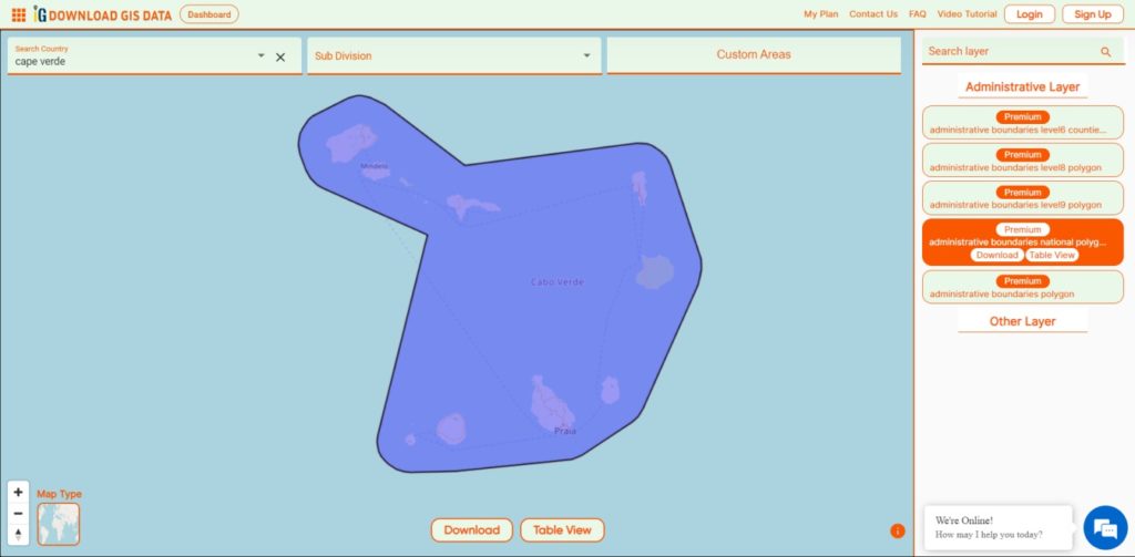
Cape Verde National Boundary

Download Cape Verde National Boundary Shapefile

Download Cape Verde Municipalities Shapefile Data

 Cape Verde is divided into 22 concelhos municipalities.

  • Tarrafal
  • São Miguel
  • São Salvador do Mundo
  • Santa Cruz
  • São Domingos
  • Praia
  • Ribeira Grande de Santiago
  • São Lourenço dos Órgãos
  • Santa Catarina
  • Brava
  • São Filipe
  • Santa Catarina do Fogo
  • Mosteiros
  • Maio
  • Boa Vista
  • Sal
  • Ribeira Brava
  • Tarrafal de São Nicolau
  • São Vicente
  • Porto Novo
  • Ribeira Grande
  • Paul
Cape Verde Municipalities Boundaries

Download Cape Verde Municipalities Boundaries Shapefile

Other GIS Data:

Download Shapefile for the following:

  1. World Countries Shapefile
  2. Australia
  3. Argentina
  4. Austria
  5. Belgium
  6. Brazil
  7. Canada
  8. Denmark
  9. Fiji
  10. Finland
  11. Germany
  12. Greece
  13. India
  14. Indonesia
  15. Ireland
  16. Italy
  17. Japan
  18. Kenya
  19. Lebanon
  20. Madagascar
  21. Malaysia
  22. Mexico
  23. Mongolia
  24. Netherlands
  25. New Zealand
  26. Nigeria
  27. Papua New Guinea
  28. Philippines
  29. Poland
  30. Russia
  31. Singapore
  32. South Africa
  33. South Korea
  34. Spain
  35. Switzerland
  36. Tunisia
  37. United Kingdom Shapefile
  38. United States of America
  39. Vietnam
  40. Norway
  41. Chile
  42. Crotia

Disclaimer : If you find any shapefile data of country provided is incorrect do contact us or comment below, so that we will correct the same in our system as well we will try to correct the same in OpenStreetMap.
Download Macedonia Administrative Boundary Shapefiles – National , Regions , Villages and More

Download Macedonia administrative boundary shapefiles- Macedonia National , Regions , Villages Shapefile and more.

It’s fantastic to hear that IGISMAP has expanded its GIS data collection to include data for more than 100 new countries, bringing the total coverage to over 150 countries. This is undoubtedly a valuable resource for GIS enthusiasts and professionals around the world. The availability of detailed information on administrative divisions, rivers, roads, and airports can greatly enhance various geospatial projects and analyses.

The option to access the data through tools like “Download GIS Data” and “Add GIS Data” seems convenient and user-friendly. Providing data in different formats such as Shapefile, KML, GeoJSON, and CSV ensures compatibility with a wide range of GIS software and applications, making it easier for users to integrate the data into their workflows.

This article will walk you through downloading administrative-level GIS data for Macedonia using the Download GIS Data tool. Experience a seamless geospatial journey with IGISMAP as your trusted partner!

Note:

  • All data available are in GCS datum EPSG:4326 WGS84 CRS (Coordinate Reference System).
  • You need to login for downloading the shapefile.

Download Shapefile Data of Macedonia

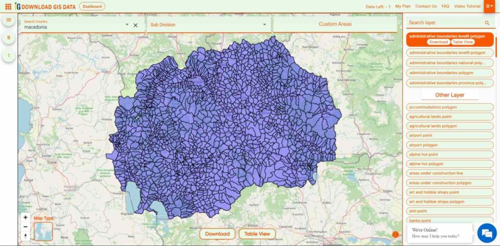
North Macedonia is a country situated in southeastern Europe with geographic coordinates 41°50′N 22°00′E, bordering Kosovo and Serbia to the north, Bulgaria to the east, Greece to the south and Albania to the west. The country is part of the wider region of Macedonia and makes up most of Vardar Macedonia. The country is a major transportation corridor from Western and Central Europe to Southern Europe and the Aegean Sea. North Macedonia is a landlocked country but has three major natural lakes: Lake Ohrid, Lake Prespa and Lake Dojran. It has a water area of 857 km2, while its land area is 24,856 km2.

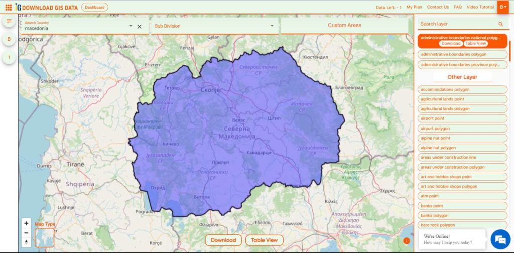
Macedonia National Boundary

Download Macedonia National Boundary Shapefile

Download Macedonia Regions Shapefile Data

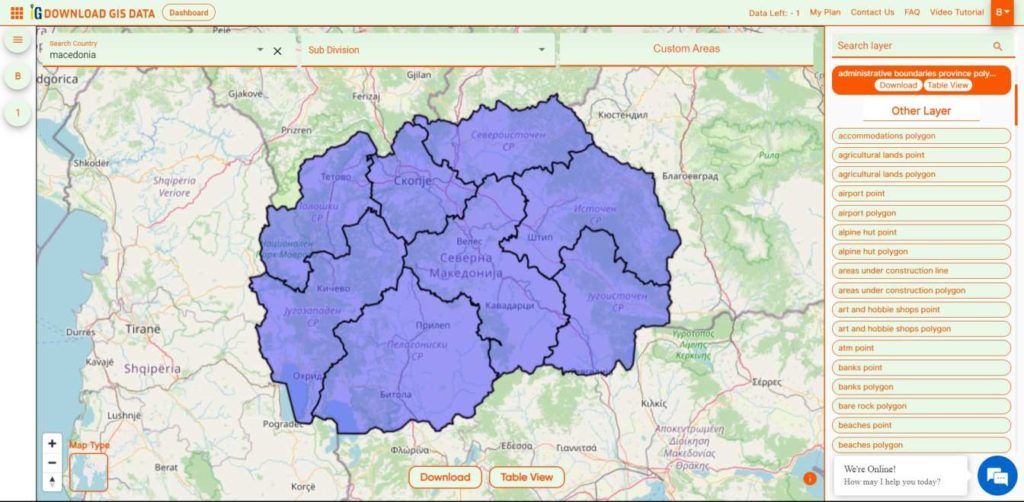
 Macedonia is divided into 8 regions.

  • Eastern
  • Northeastern
  • Pelagonia
  • Polog
  • Skopje
  • Southeastern
  • Southwestern
  • Vardar
Macedonia Regions Boundaries

Download Macedonia Regions Boundaries Shapefile

Download Macedonia Villages Shapefile Data

There are Total 1725 Villages in Macedonia.

Macedonia Villages Boundaries

Download Macedonia Villages Boundaries Shapefile

Other GIS Data:

Download Free Shapefile for the following:

  1. World Countries Shapefile
  2. Australia
  3. Argentina
  4. Austria
  5. Belgium
  6. Brazil
  7. Canada
  8. Denmark
  9. Fiji
  10. Finland
  11. Germany
  12. Greece
  13. India
  14. Indonesia
  15. Ireland
  16. Italy
  17. Japan
  18. Kenya
  19. Lebanon
  20. Madagascar
  21. Malaysia
  22. Mexico
  23. Mongolia
  24. Netherlands
  25. New Zealand
  26. Nigeria
  27. Papua New Guinea
  28. Philippines
  29. Poland
  30. Russia
  31. Singapore
  32. South Africa
  33. South Korea
  34. Spain
  35. Switzerland
  36. Tunisia
  37. United Kingdom Shapefile
  38. United States of America
  39. Vietnam
  40. Norway
  41. Chile
  42. Croatia
  43. Estonia
  44. Laos
  45. Hungary
  46. Libya
  47. Comoros
  48. Colombia
  49. Bhutan
  50. Maldives
  51. Iraq
  52. Azerbaijan
  53. Portugal

Disclaimer : If you find any shapefile data of country provided is incorrect do contact us or comment below, so that we will correct the same in our system as well we will try to correct the same in OpenStreetMap.
Download Norway Administrative Boundary Shapefiles – Regional State Administrative Agencies, Municipalities

Hey! GIS user here in this blog you can download Norway shapefile GIS data. IGISMAP have collection for more than 100 new countries. Links for downloading the shapefiles of the important administrative divisions of Norway are provided in the following. You can also download these data in any format like KML, GeoJSON, or CSV etc.

Note:

  • All data available are in GCS datum EPSG:4326 WGS84 CRS (Coordinate Reference System).
  • You need to login for downloading the shapefile.

Here is the video tutorial to download data:

Download Free Shapefile Data of Norway

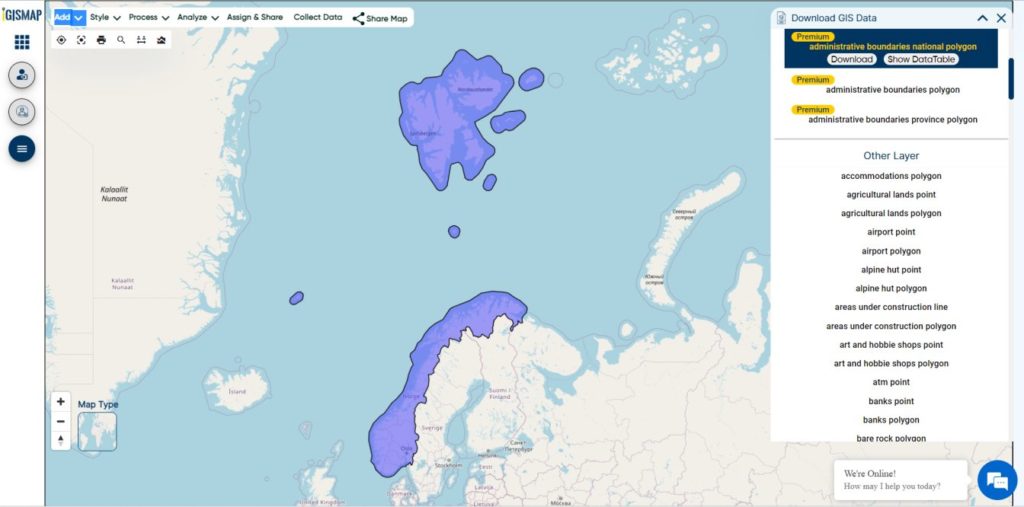
Norway is a country located in Northern Europe in the northern and western parts of the Scandinavian Peninsula. It has a land border with Sweden to the east and a shorter border with Finland and an even shorter border with Russia to the northeast. The country’s average elevation is 460 meter’s (1,510 ft), and 32 percent of the mainland is located above the tree line. The regional climate was up to 1–3 °C (1.8–5.4 °F) warmer in 7000 BC to 3000 BC in the Holocene Climatic Optimum, (relative to the 1961-90 period), melting the remaining glaciers in the mountains almost completely during that period.

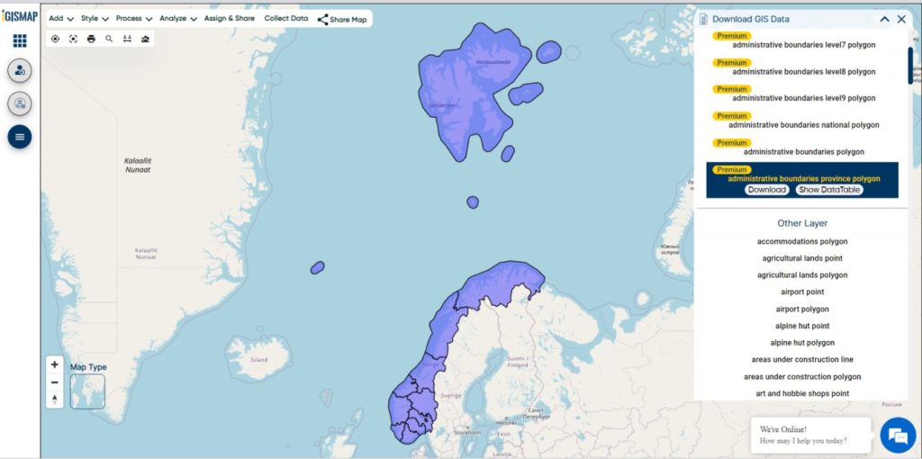
Norway National Boundary

Download Norway National Boundary Shapefile

Download Norway Counties Shapefile Data

Norway is divided into 11 administrative regions, called counties . The island territories of Svalbard and Jan Mayen are outside the county division and ruled directly at the national level. The capital Oslo is both a county and a municipality.

Norway Counties Boundary

Download Norway Counties Boundaries Shapefile

This shapefile covers following Counties of Norway listed below:

  • Agder
  • Innlandet
  • More og Romsdal
  • Nordland
  • Oslo
  • Rogaland
  • Vestfold og Telemark
  • Troms og Finnmark
  • Trondelag
  • Vestland
  • Viken

Download Norway Municipalities Shapefile Data

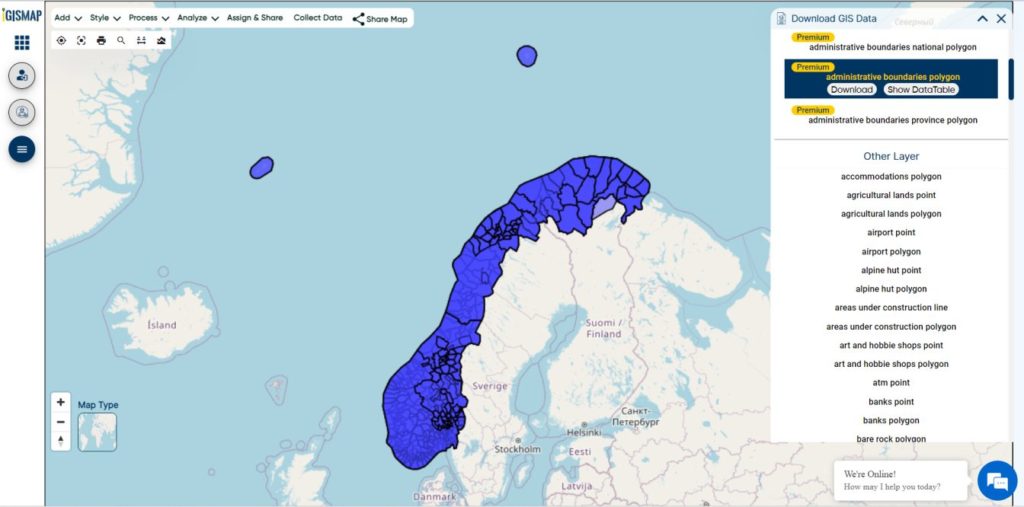
Municipalities are the atomic unit of local government in Norway and are responsible for primary education (until 10th grade), outpatient health services, senior citizen services, unemployment and other social services, zoning, economic development, and municipal roads. Law enforcement and church services are provided at a national level in Norway.

Norway Municipality Boundaries Shapefiles
Norway Municipalities Boundary

Download Norway Municipality Boundaries Shapefiles

Other Administrative Boundary Data:

Download Free Shapefile for the following:

  1. World Countries Shapefile
  2. Australia
  3. Argentina
  4. Austria
  5. Belgium
  6. Brazil
  7. Canada
  8. Denmark
  9. Fiji
  10. Finland
  11. Germany
  12. Greece
  13. India
  14. Indonesia
  15. Ireland
  16. Italy
  17. Japan
  18. Kenya
  19. Lebanon
  20. Madagascar
  21. Malaysia
  22. Mexico
  23. Mongolia
  24. Netherlands
  25. New Zealand
  26. Nigeria
  27. Papua New Guinea
  28. Philippines
  29. Poland
  30. Russia
  31. Singapore
  32. South Africa
  33. South Korea
  34. Spain
  35. Switzerland
  36. Tunisia
  37. United Kingdom Shapefile
  38. United States of America
  39. Vietnam
  40. Croatia
  41. Chile
  42. Norway
  43. Maldives

Disclaimer : If you find any shapefile data of country provided is incorrect do contact us or comment below, so that we will correct the same in our system as well we will try to correct the same in OpenStreetMap.