In this guide, you’ll learn how to effortlessly convert GPS files into PDF format using the Converter Tool in MAPOG. Whether you’re new to the process or an experienced user, this step-by-step guide will walk you through the entire conversion process in a straightforward manner.
Understanding the Conversion Process
The Converter Tool in MAPOG Map Analysis is designed to transform your data from one format to another with ease. It’s like having a digital wizard at your fingertips! You simply input your data, and the tool outputs it in a format that best suits your analytical needs. Additionally, GIS Data is versatile and can be downloaded in various formats, making it adaptable for multiple uses.
Online GPS to PDF GIS Converter
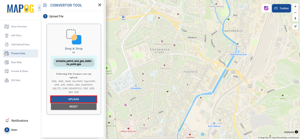
Step 1: Upload Your Data
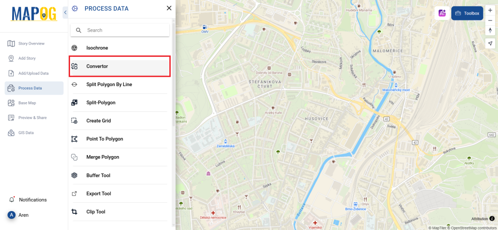
First, you’ll need to navigate to the “Converter Tool” via “Process Data.”
Upload your GPS file, which serves as the starting point for your conversion process.
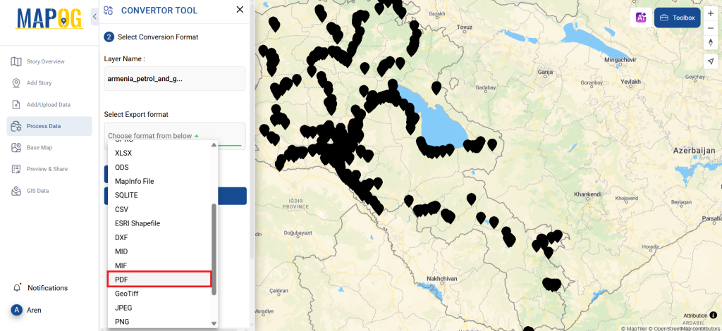
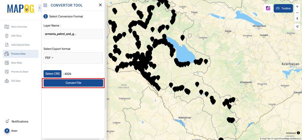
Step 2: Choose the Conversion Format
Next, select PDF as your desired output format. The tool offers various output options, but for this guide, we’ll focus on converting your file to PDF.
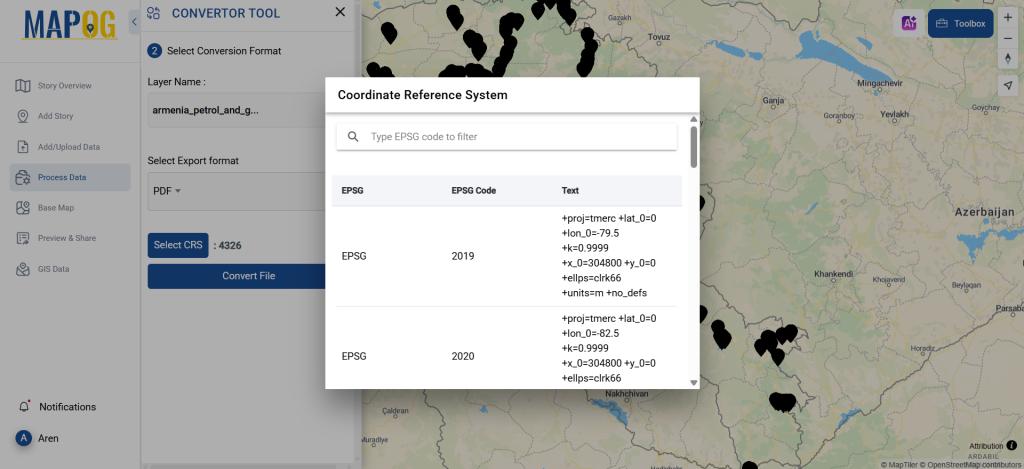
Additionally, this is a good time to set the CRS (Coordinate Reference System) to ensure your data aligns correctly with your spatial analysis requirements.
Step 3: Execute the Conversion
After setting up your data and selecting the appropriate format, click on ‘Convert Files’ to begin the conversion. The Converter Tool will seamlessly transform your GPS data into a PDF file.
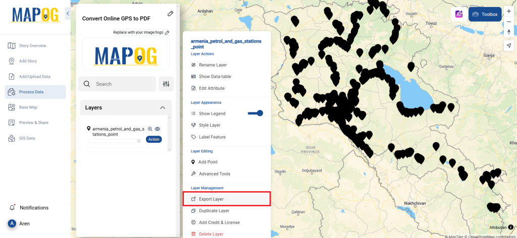
Step 4: Review and Download Your PDF
Finally, take a moment to review your converted PDF file to ensure all data has been accurately transferred. Once satisfied, you can even download the file. This final review step is crucial to confirm that the conversion was successful and that your data remains intact.
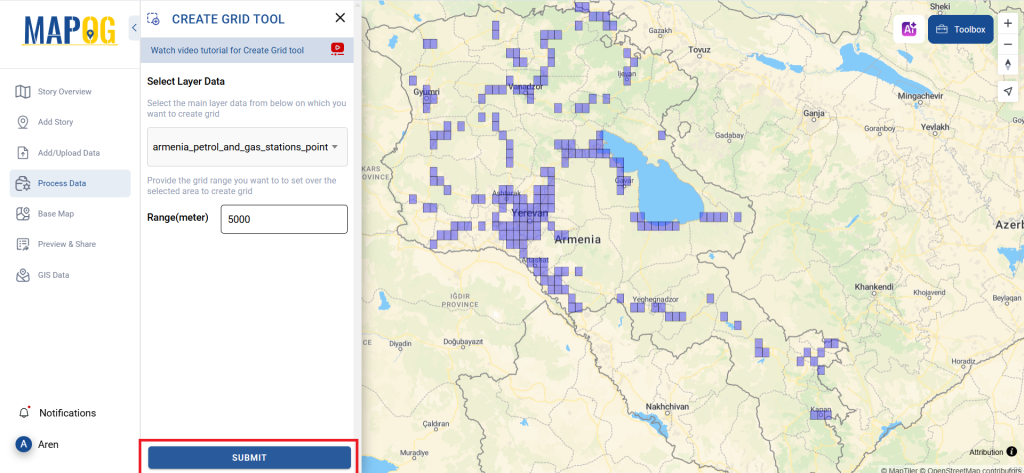
Step 5: Create Grid
You can create Grid around the stations. Just click on the action button of new converted file, and select advanced tools, there you’ll find create grid tool. Then select your layer, provide range and submit!
And there you have it! You’ve successfully used the MAPOG Converter Tool to convert your GPS files into PDFs. This feature simplifies the process of handling various data formats, making your workflow smoother and more efficient, ready for any analysis you might need.
MAPOG has a lot of feature tool. These feature tools allow us to perform a variety of tasks. For example, you can create buffer zones using Buffer Tool, style your numeric data with the quantity style tool, create isochrones on your map using Isochrone tool, and more.
Here are some other blogs you might be interested in:
- Convert Online GIS data : KML to PDF file
- Converting KML to GeoTIFF , Online Gis Data Converter
- Converting KMZ to SHP : Online GIS Data Conversion
- Converting TopoJSON to SHP Online : GIS Data Converter
- Converting GeoJSON to TopoJSON with MAPOG
- Converting GeoJSON to CSV with MAPOG
- Converting KMZ to KML with MAPOG
- Converting GML to KML with MAPOG
- Convert KMZ to TopoJSON Online
- Converting KMZ to GeoJSON Online
- Convert KML to MID Online
- Online Conversion KML to MIF