This guide simplifies the process of converting DXF files to GPX format using the Converter Tool in MAPOG Map Analysis. Whether you’re a beginner or have prior experience with MAPOG, this tutorial will walk you through each step to efficiently convert DXF files to GPX.
What is DXF Data Format:
DXF is short for Drawing Exchange Format or Drawing Interchange Format and is a type of vector file. Engineers, designers and architects often use the DXF format for 2D and 3D drawings during product design. This data format can be used in case of analyzing the maps. It can be of many types like point, line and polygon or any boundaries.
Converting DXF Data into GPX Format:
MAPOG’s Map Analysis includes an advanced Converter Tool that enables users to easily switch between various data formats to meet their specific needs. This tool simplifies the process of converting data for multiple GIS applications, offering both flexibility and efficiency in handling different formats. For instance, MAPOG’s Converter Tool can convert DXF data into the GPX format, reducing file size while preserving essential geographic details. This makes the data more suitable for web-based mapping and interactive platforms, ultimately enhancing workflows and significantly improving GIS data usability.
Steps to Convert DXF to GPX:
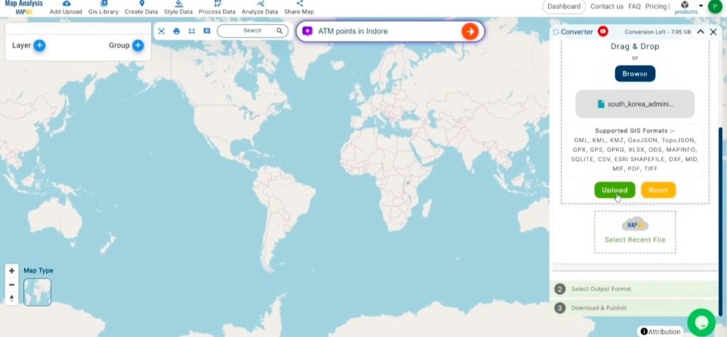
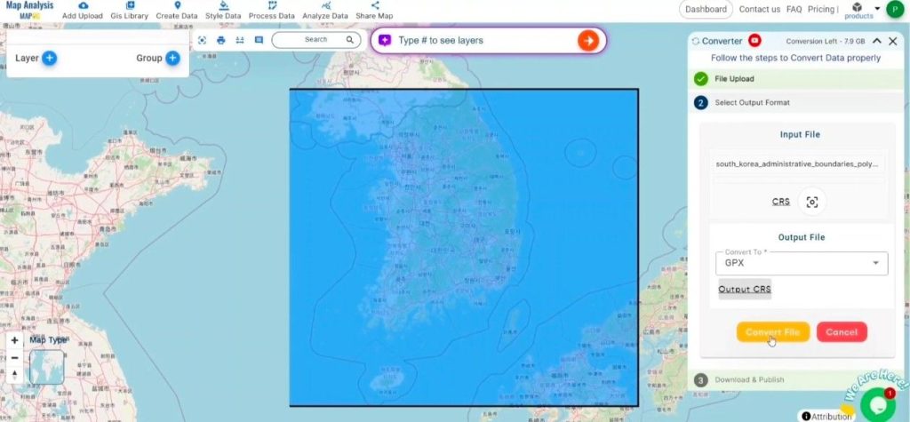
Step 1: Upload Your File:
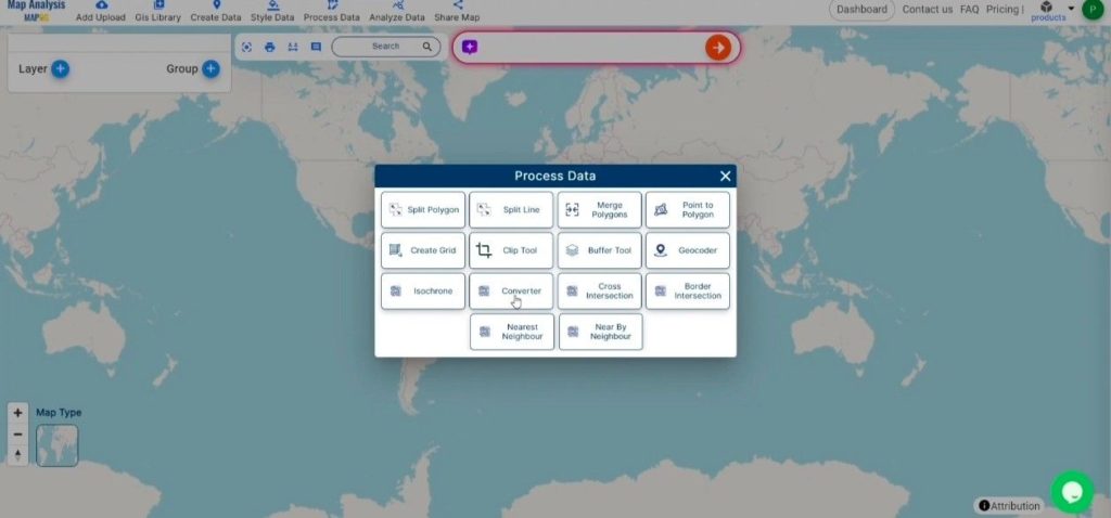
- In the MAPOG platform, go to the header menu, select “Process Data,” and then click on “Converter Tool” to start the process.
2. To start the conversion, upload your DXF file by selecting the data you want to convert.
Step 2: Choose the Output Format:
- After uploading your file, select GPX as the desired output format. The Converter Tool provides various export options, but for this guide, ensure that GPX is chosen to properly convert your DXF data into the appropriate format.
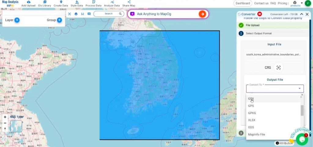
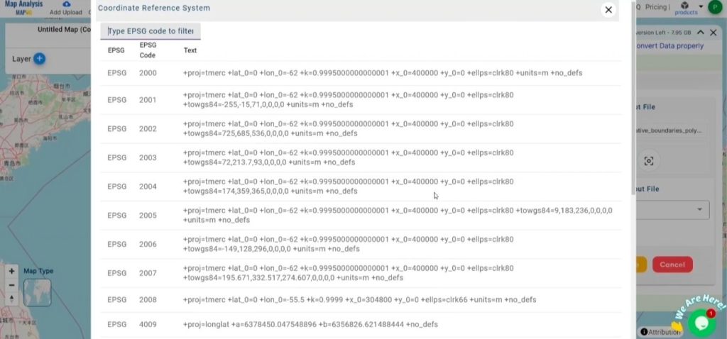
2. You can also Choose the Output Coordinate Reference System (CRS) according to your spatial analysis requirement.
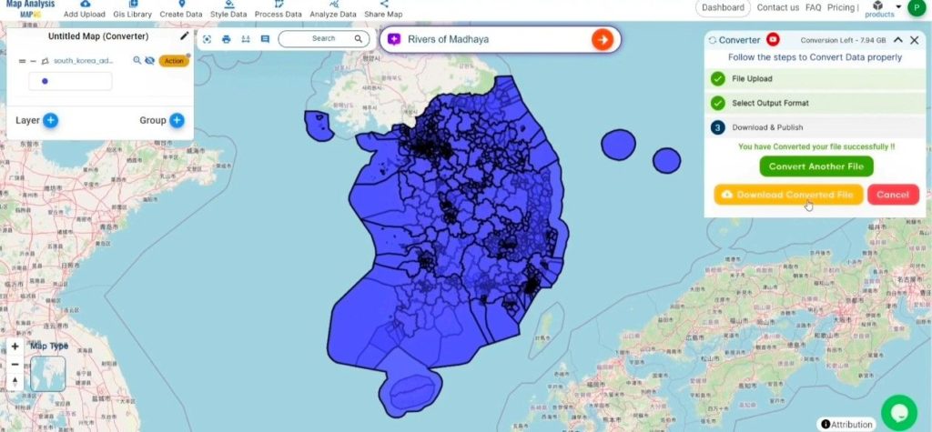
Step 3: Execute the Conversion:
Navigate to the “Convert Files” section and start the conversion process. Upload your DXF file, and the Converter Tool will automatically handle the conversion, transforming it into GPX format quickly and efficiently for your convenience.
Step 4: Review and Download:
Review your converted GPX file to confirm its accuracy. After ensuring that the conversion is correct and meets your requirements, proceed to download the file. This step is crucial to validate that the conversion was successful and that your data has been accurately preserved.
Conclusion :
MAPOG Map Analysis offers a range of tools designed to enhance your workflow. These include the Clip Tool for refining datasets, the Basic Style Tool for formatting numerical data, and the Create Point Tool for adding point features to your map. Additionally, the Create Grid Tool lets you generate grids by uploading various types of data, providing increased flexibility for your projects.
Story by MAPOG:
Story by MAPOG is an ideal solution for users looking to make their data come alive with interactive and visually appealing maps. This tool enables you to craft compelling narratives that combine maps with multimedia components such as images and text. Whether you’re highlighting a project, sharing research findings, or leading a virtual tour, Story by MAPOG simplifies the process of creating content that can be easily shared and enjoyed by others.
Other Feature Tools contain:
- Clip Tool
- Isochrones Tool
- Create Polygon Data
- Spatial Join
- Merge Polygon Tool
- Cross Intersection
- Nearest Neighbour
- Create Point Data