Download Angola Administrative Boundary Shapefiles – National, Provinces and more

Download GIS data of Angola such as Angola National Boundary, Provinces, Municipalities and more. Download in Shapefile or CSV formats

Are you struggling to find accurate and up-to-date GIS data for your desired country? Worry no more, as MAPOG is here to be your ultimate solution! Our platform offers a comprehensive collection of GIS data covering more than 150 countries. You’ll find an impressive selection of over 150 GIS datasets available for each nation in the MAPOG GIS Data Collection. The hallmark of our GIS data lies in its exceptional accuracy, especially when representing administrative divisions. Moreover, our users can access a diverse range of data pertaining to natural and man-made geographic features, including rivers, roads, railway lines, airport locations, and much more, all meticulously represented in appropriate geometric structures (points, lines, and polygons). Facilitating seamless access to this invaluable data are two essential tools – Download GIS Data and Add GIS Data, thoughtfully integrated into the MAPOG platform. To delve deeper into the functionalities of the Add GIS Data tool, check out our enlightening article – “Add GIS data from IGISMap GIS data collection

With MAPOG’s versatile toolkit, you can effortlessly upload vector and raster filesadd WMS (Web Map Service) layers, upload Excel or CSV data, incorporate existing files, perform polygon splitting and merging, generate new polygon and polyline data, use the converter for various formats, conduct buffer analysiscreate gridstransform points into polygons, calculate isochrones, and utilize the geocoder for precise location information.

We offer an extensive array of data formats, including KML, SHP, CSV, GeoJSON, Tab, SQL, Tiff, GML, KMZ, GPKZ, SQLITE, Dxf, MIF, TOPOJSON, XLSX, GPX, ODS, MID, and GPS, ensuring compatibility and accessibility for various applications and analyses.

Note:

  • All data available are in GCS datum EPSG:4326 WGS84 CRS (Coordinate Reference System).
  • You need to login for downloading the shapefile.

Download Shapefile Data of Angola

Angola is located on the western Atlantic Coast of Southern Africa between Namibia and the Republic of the Congo. It also is bordered by the Democratic Republic of the Congo and Zambia to the east. The country consists of a sparsely watered and somewhat sterile coastal plain extending inland for a distance varying from 50 to 160 km (31 to 99 mi). Slightly inland and parallel to the coast is a belt of hills and mountains and behind those a large plateau. The total land size is 1,246,700 km2 (481,400 sq mi). It has an Exclusive Economic Zone of 518,433 km2 (200,168 sq mi).
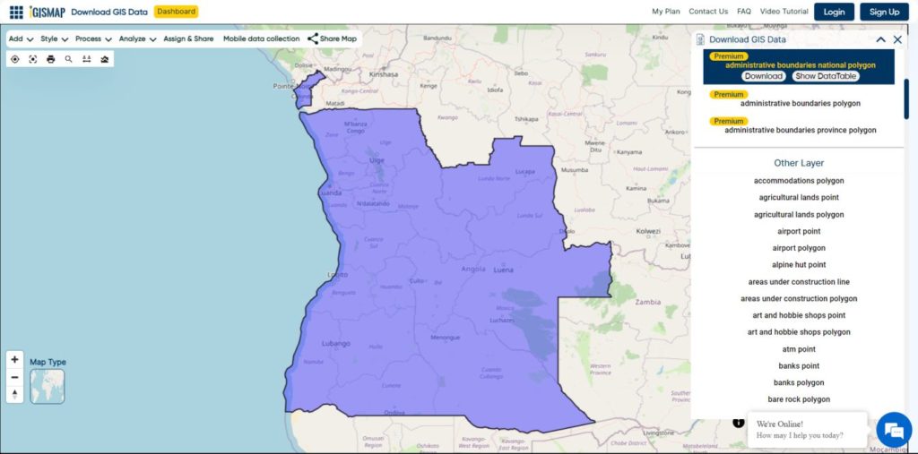
Angola National Boundary

Download Angola National Boundary Shapefile

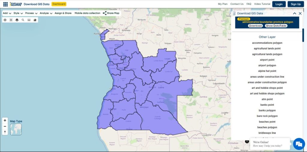
Download Angola Provinces Shapefile Data

Angola is divided into eighteen provinces, known in Portuguese as províncias:

  • Bengo
  • Caxito
  • Benguela
  • Bié
  • Cabinda
  • Cuando Cubango
  • Cuanza Norte
  • Cuanza Sul
  • Cunene
  • Huambo
  • Huíla
  • Luanda
  • Lunda Norte
  • Lunda Sul
  • Malanje
  • Moxico
  • Namibe
  • Uíge
  • Zaire
Angola Provinces Boundaries

Download Angola Provinces Boundaries Shapefiles

Other GIS Data:

Download Shapefile for the following:

  1. World Countries Shapefile
  2. Australia
  3. Argentina
  4. Austria
  5. Belgium
  6. Brazil
  7. Canada
  8. Denmark
  9. Fiji
  10. Finland
  11. Germany
  12. Greece
  13. India
  14. Indonesia
  15. Ireland
  16. Italy
  17. Japan
  18. Kenya
  19. Lebanon
  20. Madagascar
  21. Malaysia
  22. Mexico
  23. Mongolia
  24. Netherlands
  25. New Zealand
  26. Nigeria
  27. Papua New Guinea
  28. Philippines
  29. Poland
  30. Russia
  31. Singapore
  32. South Africa
  33. South Korea
  34. Spain
  35. Switzerland
  36. Tunisia
  37. United Kingdom Shapefile
  38. United States of America
  39. Vietnam
  40. Norway
  41. Chile
  42. Crotia

Disclaimer : If you find any shapefile data of country provided is in correct do contact us or comment below, so that we will correct the same in our system as well we will try to correct the same in OpenStreetMap.
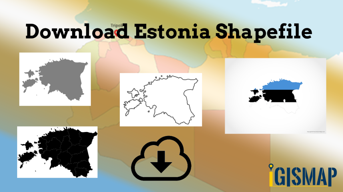
Download Estonia Administrative Boundary Shapefiles – National , Counties, Villages and More

Download Shapefile Maps –Estonia National Boundary, Estonia Counties, Municipalities, Estonia Villages and Districts Shapefile.

Great news for all GIS admirers. IGISMAP have recently published the GIS data collection for more than 100 new countries. Currently we hold GIS data, covering 150+ countries with 150+ datasets available for each nation. Our data provides precise information on administrative divisions and various geographic features like rivers, roads, and airports. Accessing this valuable resource is easy through two tools: Download GIS Data and Add GIS Data. You can download data in different formats such as Shapefile, KML, GeoJSON, or CSV. To learn more about the Add GIS Data tool, check out our article “Add GIS data from IGISMap GIS data collection.” This article will walk you through downloading administrative-level GIS data for Estonia using the Download GIS Data tool. Experience a seamless geospatial journey with IGISMAP as your trusted partner!

Note:

  • All data available are in GCS datum EPSG:4326 WGS84 CRS (Coordinate Reference System).
  • You need to login for downloading the shapefile.

Download Free Shapefile Data of Estonia

Between 57.3 and 59.5 latitude and 21.5 and 28.1 longitude, Estonia lies on the eastern coast of the Baltic Sea on the level northwestern part of the rising East European Platform. Estonia’s continental mainland is bordered to the north by the Gulf of Finland (part of the Baltic Sea) across from Finland, to the east by Lake Peipus and Russia, and to the south by Latvia. Besides the part of the European continent, Estonian territory also includes the larger islands of Saaremaa and Hiiumaa, and over 2,200 other islands and islets in the Baltic Sea, off the western and northern shores of the country’s mainland. Average elevation in Estonia reaches 50 m (164 ft).

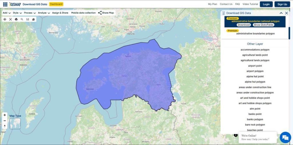
Estonia National Boundary

Download Estonia National Boundary Shapefile

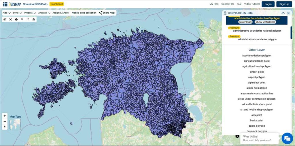
Download Estonia Counties Shapefile Data

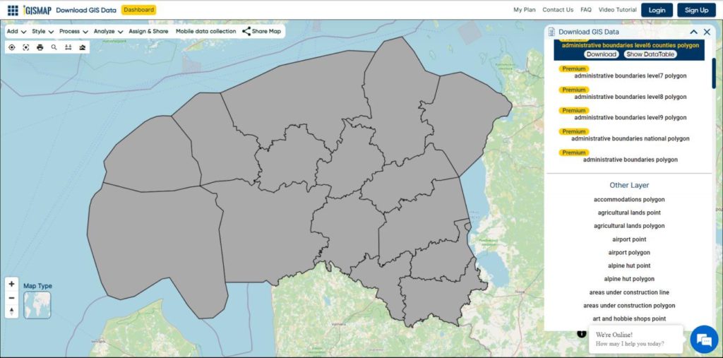
Counties (Estonian: maakond, plural maakonnad) are the state administrative subdivisions of Estonia. Estonian territory is composed of 15 counties, including 13 on the mainland and 2 on islands.

Estonia Counties Boundaries

Download Estonia Counties Boundaries Shapefile

Download Estonia Villages Shapefile Data

Free Shapefile of Villages in Estonia.

Estonia Villages Boundaries

Download Estonia Villages Boundaries Shapefile

Other Administrative Boundary Data:

Other GIS Data:

Download Free Shapefile for the following:

  1. World Countries Shapefile
  2. Australia
  3. Argentina
  4. Austria
  5. Belgium
  6. Brazil
  7. Canada
  8. Denmark
  9. Fiji
  10. Finland
  11. Germany
  12. Greece
  13. India
  14. Indonesia
  15. Ireland
  16. Italy
  17. Japan
  18. Kenya
  19. Lebanon
  20. Madagascar
  21. Malaysia
  22. Mexico
  23. Mongolia
  24. Netherlands
  25. New Zealand
  26. Nigeria
  27. Papua New Guinea
  28. Philippines
  29. Poland
  30. Russia
  31. Singapore
  32. South Africa
  33. South Korea
  34. Spain
  35. Switzerland
  36. Tunisia
  37. United Kingdom Shapefile
  38. United States of America
  39. Vietnam
  40. Norway
  41. Chile
  42. Croatia

Disclaimer : If you find any shapefile data of country provided is incorrect do contact us or comment below, so that we will correct the same in our system as well we will try to correct the same in OpenStreetMap.
HDF MultiDimensional Data

Hierarchical Data Format HDF multidimensional data, which can grow in space and time dimension. It is specially designed by National Center for Supercomputing Applications (NCSA) for storing scientific data in mosaic datasets. You may also look over GRIB, netcdf and all multidimensional data.

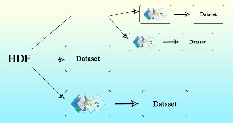
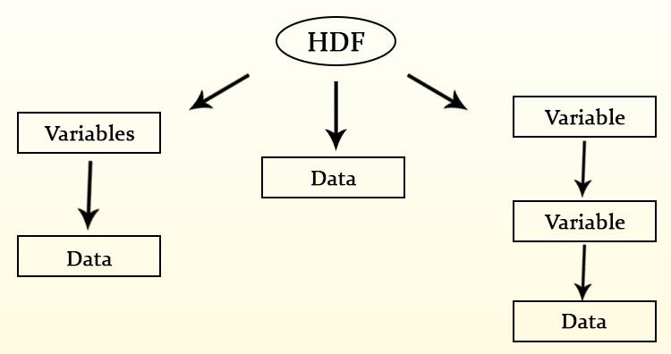
Here the data is stored in hierarchical format i.e. in tree like structure. It contains band information in variables. Variables may have one or more variable. Each band data in this variables may differ in size and dimension. Also each data can contain information of different regions.

 HDF Multi-Dimensional Data

HDF 4 (Hierarchical data format release 4) – HDF MultiDimensional Data

HDF supports two formats, both are completely different and NOT compatible. It supports multidimensional arrays, raster images and table data. It has some limitations as it supports multiple (arrays, table and images) data hence makes complex API.

HDF 5 (Hierarchical data format release 5)- HDF MultiDimensional Data

This format is designed to overcome the limitations of HDF 4. This structure consist of datasets and groups.

  • Groups, which are container structures which can hold datasets
  • Datasets, which are multidimensional arrays of a homogeneous type.

Get information of HDF multidimensional data bands-

As data is arranged in hierarchical format, we need to run two command to get band details, both from GDAL utility.

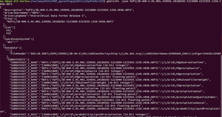
1. Gdalinfo- This commands gives the information about number of  subdatasets present in file. Each sub-dataset detail is stored in SUBDATASET_n_NAME metadata item. The related description is stored in SUBDATASET_n_DESC metadata item.

HDF Multi-Dimensional Data

2. Gdal_translate- The gdal_translate utility is used to import the bands or convert in desired format. Here we have converted HDF data in NetCDF format.

HDF Multi-Dimensional Data

Hope this article help you to understand HDF data format. You can also visit multidimensional data for more information. Please let us know if you require any help, by commenting in given comment box.

GRIB Multidimensional Data

General Regularly-distributed Information in Binary GRIB multidimensional Data that can grow in space (Latitude, Longitude and altitude) and time. GRIB data is standardized by World Meteorological Organization (WMO). This contains various raster data in mosaic datasets.  This stores data from meteorological department and weather forecast. You may also look over NetCDF multidimensional data, HDF multidimensional data and all multidimensional data format.

GRIB Multidimensional Data versions

It has two versions GRIB1 and GRIB2.

  1. GRIB 1: This format is no longer used. It is recognized just because it is stilling using by World Area Forecast system of the ICAO. The CMC (Canadian Meteorological Center) will stop producing data in this format.
  2. GRIB 2: This is a great modernization of GRIB data format. It does not support and compatible for GRIB 1 version.

Get Details Of GRIB Multidimensional data

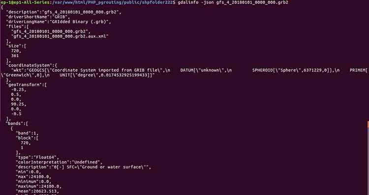
To get details of GRIB data we can use gdalinfo utility from GDAL library. This command helps us to see the sub datasets present in GRIB file with their description, bounding box etc.

GRIB Multi-dimensional Data

To convert it in NetCDF format or any other format we can use gdal_translate command. Here with the help of gdal_translate options with can also assign SRS (Spatial reference system) of output file.

–> gdalwarp -overwrite -to SRC_METHOD=NO_GEOTRANSFORM -t_srs EPSG:4326 Input_GRIB.grb -of netCDF Output_NETCDF.nc

GRIB Multi-dimensional Data

If you need any other information regarding multidimensional data such as NetCDF or HDF you can visit are tutorials and also comment in given comment box. We are always available for your help.