Converting geospatial data from CSV to ESRI Shapefile (SHP) format is crucial for users needing to utilize spatial data in various GIS platforms. The ESRI Shapefile format is widely recognized in GIS, representing spatial features such as points, lines, and polygons.
What is CSV File?
A CSV file (Comma-Separated Values) is a simple text file that stores data in a table format. Each line represents a row, and the values in each row are separated by commas, making it easy to organize and share information like a spreadsheet.
Key Concept for Conversion CSV to ESRI Shapefile:
MAPOG MapAnalysis‘s Converter Tool provides a user-friendly platform for converting CSV data into the ESRI Shapefile format. Here’s how to complete the conversion process using MAPOG.
Step-by-Step Guide to Converting CSV to ESRI Shapefile
Step 1: Upload the Data
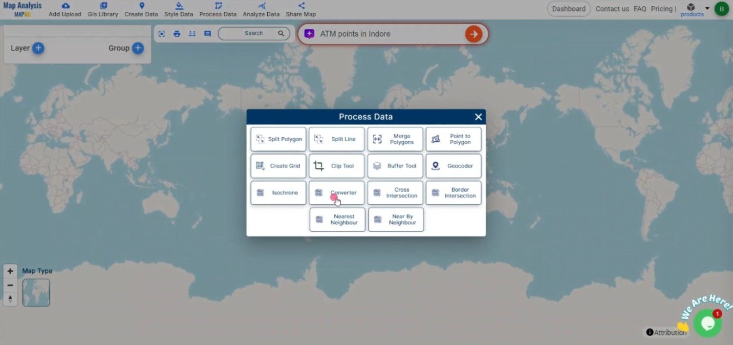
Navigate to the “Process Data” section in MAPOG MapAnalysis and select the “Converter Tool” option. Upload your CSV file, ensuring that it contains the necessary spatial coordinates.
Step 2: Select the Format for Conversion
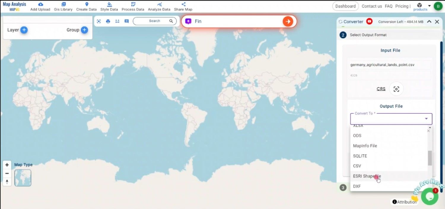
Choose “ESRI Shapefile” as the output format. This format is widely used for spatial data analysis and sharing across different GIS platforms.
Step 3: Choose the Coordinate Reference System (CRS)
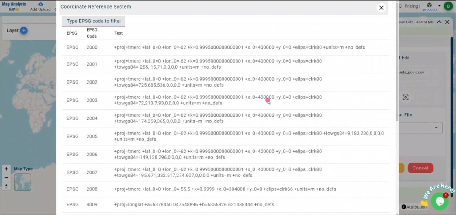
Select the appropriate CRS to ensure proper geographic representation in the shapefile. The CRS determines how the spatial features will be projected and interpreted.
Step 4: Execute the Conversion
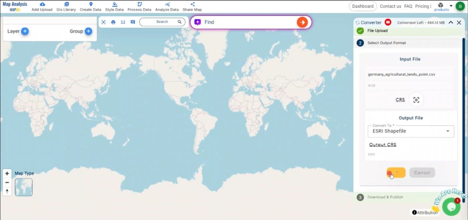
Initiate the conversion process. MAPOG’s tool will convert the CSV file into the Shapefile format, preserving spatial attributes and associated data.
Step 5: Review and Download
Once the conversion is complete, review the output to ensure that the spatial features and data were correctly processed. Download the Shapefile, which is now ready for use in GIS software like ArcGIS or QGIS.
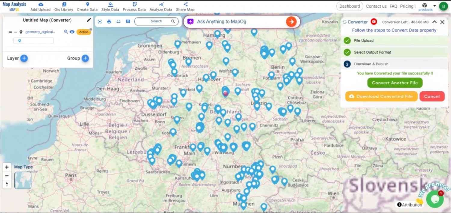
Conclusion:
MAPOG’s Converter Tool makes the process of converting CSV files to ESRI Shapefile format simple and efficient. By following these steps, you can easily integrate your CSV data into any GIS application that supports shapefiles. If you need to download any data file in CSV or in any other formats like KML, SHP, GEOJSON. visit GIS DATA. Here we have 900+ data layers for 200+ countries.
Feature Tool:
Story by MAPOG:
If you want to create maps that bring your data to life, Story by MAPOG is ideal for you. With maps and multimedia components like text and images, you can create engrossing stories. Whether you’re presenting research or showcasing a project.
Here are some other blogs you might be interested in:
- Convert Online Gis data : KML to PDF file
- Converting KML to GeoTIFF , Online Gis Data Converter
- Converting KMZ to SHP : Online GIS Data Conversion
- Converting TopoJSON to SHP Online : GIS Data Converter
- Converting GeoJSON to TopoJSON with MAPOG
- Converting GeoJSON to CSV with MAPOG
- Converting KMZ to KML with MAPOG
- Converting GML to KML with MAPOG
- Convert KMZ to TopoJSON Online
- Converting KMZ to GeoJSON Online
- Convert KML to MID Online
- Online Conversion KML to MIF
- Convert KML to GML Online
- Convert KML to GPKG Online
- Convert KML to KMZ Online
- Convert GML to SHP Online
- Convert KML to GML Online
- Convert KML to GeoJSON file online
- Convert KML to TopoJSON Online
- GeoJSON to GeoTIFF – Vector to Raster Conversion
- KML to GeoTIFF – Vector to Raster Conversion
- SHP to GPX / GPS
- Convert GeoJSON to KML
- Convert Geojson to MIF MapInfo file
- GeoJSON to Shapefile
- Convert GML to CSV
- Convert KMZ to GPX