Download Sierra Leone Administrative Boundary GIS Data for – Provinces, Districts, Chiefdoms and more

Access and download Sierra Leone administrative boundary GIS data, including provinces, districts, and chiefdoms.

Delve into the heart of Sierra Leone’s geography with MAPOG! Uncover a wealth of datasets encompassing administrative boundaries, rivers, roads, and airports. Effortlessly download GIS data in formats like Shapefile, KML, GeoJSON, and CSV using our user-friendly tools. Empower your exploration of Sierra Leone’s GIS data with confidence – choose MAPOG!

With MAPOG’s versatile toolkit, you can effortlessly upload vector and raster filesadd WMS (Web Map Service) layers, upload Excel or CSV data, incorporate existing files, perform polygon splitting and merging, generate new polygon and polyline data, use the converter for various formats, conduct buffer analysiscreate gridstransform points into polygons, calculate isochrones, and utilize the geocoder for precise location information.

We offer an extensive array of data formats, including KML, SHP, CSV, GeoJSON, Tab, SQL, Tiff, GML, KMZ, GPKZ, SQLITE, Dxf, MIF, TOPOJSON, XLSX, GPX, ODS, MID, and GPS, ensuring compatibility and accessibility for various applications and analyses.

Note:

  • All data available are in GCS datum EPSG:4326 WGS84 CRS (Coordinate Reference System).
  • You need to login for downloading the shapefile.

Download Shapefile Data of Sierra Leone

Sierra Leone is a West African nation on the Atlantic coast. Bordered by Guinea to the north and Liberia to the southeast, it boasts a tropical climate and diverse landscapes, from savannas to rainforests. Freetown, the capital and largest city, governs this country divided into five administrative regions with 16 districts.
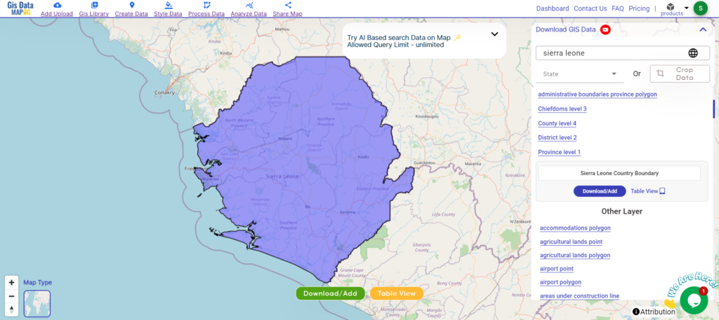
Sierra Leone National Boundary

Download Sierra Leone National Boundary Shapefile

After successfully logging in with a legitimate email address, select the country you want to work with. Next, choose the specific layer you need and click on the download option. Once that’s done, pick the desired format to acquire the essential GIS data. Before proceeding with the data download, make sure to review the data table for any relevant information.

Download Sierra Leone Provinces Shapefile Data

Sierra Leone is administratively divided into four provinces and a Western Area for the capital Freetown.
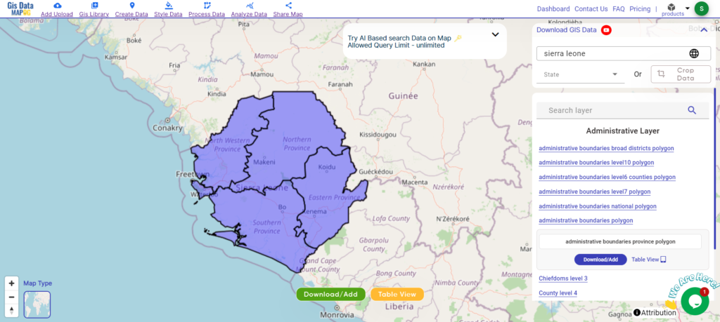
Sierra Leone Provinces Boundary

Download Sierra Leone Provinces Boundary Shapefile

Sierra Leone is administratively divided into four provinces:

  • Eastern Province
  • Northern Province
  • Southern Province
  • North West Province

Download Sierra Leone Districts Shapefile Data

Sierra Leone is divided into 16 districts across four provinces and a Western Area:
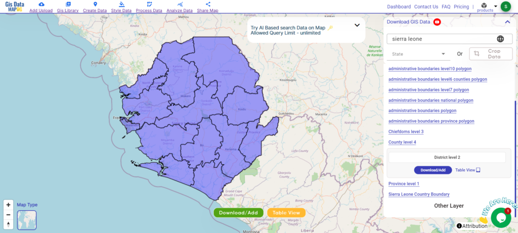
Sierra Leone Districts

Download Sierra Leone Districts Boundary Shapefile

Other Administrative Boundary Data:

Other GIS Data:

Above all links are provided for GIS data of Sierra Leone if you are looking for any specific data please write us on support@mapog.com

Download Shapefile for the following:

  1. World Countries Shapefile
  2. Australia
  3. Argentina
  4. Austria
  5. Belgium
  6. Brazil
  7. Canada
  8. Denmark
  9. Fiji
  10. Finland
  11. Germany
  12. Greece
  13. India
  14. Indonesia
  15. Ireland
  16. Italy
  17. Japan
  18. Kenya
  19. Lebanon
  20. Madagascar
  21. Malaysia
  22. Mexico
  23. Mongolia
  24. Netherlands
  25. New Zealand
  26. Nigeria
  27. Papua New Guinea
  28. Philippines
  29. Poland
  30. Russia
  31. Singapore
  32. South Africa
  33. South Korea
  34. Spain
  35. Switzerland
  36. Tunisia
  37. United Kingdom Shapefile
  38. United States of America
  39. Vietnam
  40. Croatia
  41. Chile
  42. Norway
  43. Maldives
  44. Bhutan
  45. Colombia
  46. Libya
  47. Comoros
  48. Hungary
  49. Laos
  50. Estonia
  51. Iraq
  52. Portugal
  53. Azerbaijan
  54. Macedonia
  55. Romania
  56. Peru
  57. Marshall Islands
  58. Slovenia
  59. Nauru
  60. Guatemala
  61. El Salvador
  62. Afghanistan
  63. Cyprus
  64. Syria
  65. Slovakia
  66. Luxembourg
  67. Jordan
  68. Armenia
  69. Haiti And Dominican Republic
  70. Malta
  71. Djibouti
  72. East Timor
  73. Micronesia
  74. Morocco
  75. Liberia
  76. Kosovo
  77. Isle Of Man
  78. Paraguay
  79. Tokelau
  80. Palau
  81. Ile De Clipperton
  82. Mauritius
  83. Equatorial Guinea
  84. Tonga
  85. Myanmar
  86. Thailand
  87. New Caledonia
  88. Niger
  89. Nicaragua
  90. Pakistan
  91. Nepal
  92. Seychelles
  93. Democratic Republic of the Congo
  94. China
  95. Kenya
  96. Kyrgyzstan
  97. Bosnia Herzegovina
  98. Burkina Faso
  99. Canary Island
  100. Togo
  101. Israel And Palestine
  102. Algeria
  103. Suriname
  104. Angola
  105. Cape Verde
  106. Liechtenstein
  107. Taiwan
  108. Turkmenistan
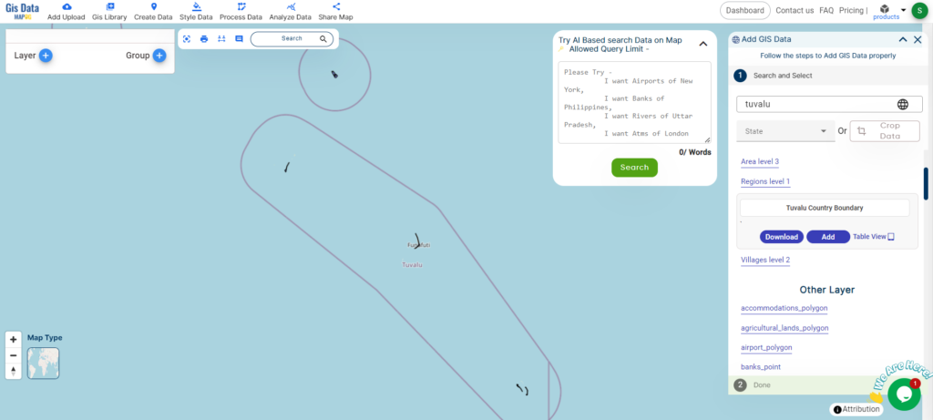
  109. Tuvalu
  110. Ivory Coast
  111. Moldova
  112. Somalia
  113. Belize
  114. Swaziland
  115. Solomon Islands
  116. North Korea
  117. Sao Tome And Principe
  118. Guyana
  119. Serbia
  120. Senegal And Gambia
  121. Faroe Islands
  122. Guernsey Jersey
  123. Monaco
  124. Tajikistan
  125. Pitcairn

Disclaimer : If you find any shapefile data of country provided is incorrect do contact us or comment below, so that we will correct the same in our system as well we will try to correct the same in openstreetmap.
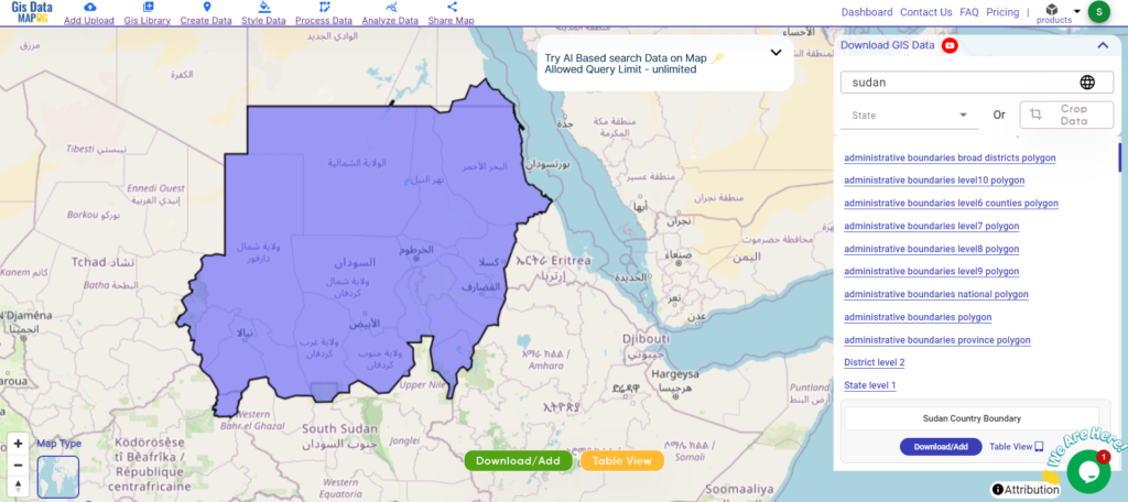
Download Sudan Administrative Boundary GIS Data for – National, States, Districts and more

Access and download Sudan administrative boundary GIS data, including national, states, districts and more

Sudan’s vast landscapes beckon you to explore with MAPOG! Delve into a treasure chest of GIS data, revealing the intricate details of administrative boundaries. Navigate the lifeblood of the Nile River and its tributaries. Trace the veins of transportation that crisscross the nation – the roads, and the vital air hubs – its airports. Effortlessly download this wealth of Sudanese GIS data in formats like Shapefile, KML, GeoJSON, and CSV using our user-friendly tools. Empower your analysis of Sudan’s geography – choose MAPOG for all your Sudanese GIS data needs!

With MAPOG’s versatile toolkit, you can effortlessly upload vector and raster filesadd WMS (Web Map Service) layers, upload Excel or CSV data, incorporate existing files, perform polygon splitting and merging, generate new polygon and polyline data, use the converter for various formats, conduct buffer analysiscreate gridstransform points into polygons, calculate isochrones, and utilize the geocoder for precise location information.

We offer an extensive array of data formats, including KML, SHP, CSV, GeoJSON, Tab, SQL, Tiff, GML, KMZ, GPKZ, SQLITE, Dxf, MIF, TOPOJSON, XLSX, GPX, ODS, MID, and GPS, ensuring compatibility and accessibility for various applications and analyses.

Note:

  • All data available are in GCS datum EPSG:4326 WGS84 CRS (Coordinate Reference System).
  • You need to login for downloading the shapefile.

Download Shapefile Data of Sudan

Sudan is a country located in Northeast Africa. It borders eight other countries: Chad to the west, Central African Republic to the southwest, Egypt to the north, Eritrea and Ethiopia to the northeast, Libya to the northwest, and South Sudan to the south. The Red Sea lies to the east of Sudan.

With a population of 45.7 million, Sudan is the third largest country by area in Africa and the Arab League. Khartoum is the capital and most populous city in Sudan.

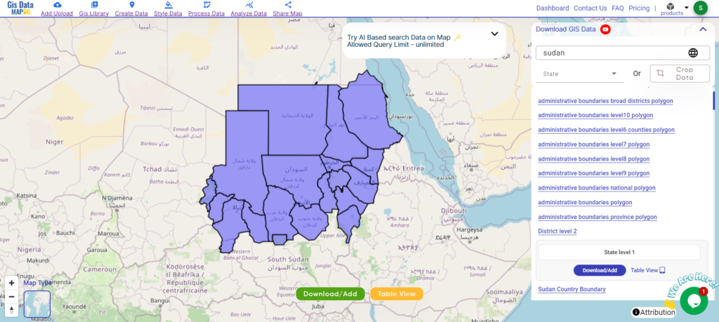
Sudan National Boundary

Download Sudan National Boundary Shapefile

After successfully logging in with a legitimate email address, select the country you want to work with. Next, choose the specific layer you need and click on the download option. Once that’s done, pick the desired format to acquire the essential GIS data. Before proceeding with the data download, make sure to review the data table for any relevant information.

Download Sudan States Shapefile Data

Sudan is divided into 18 states, known as “wilayat” in Arabic.

Sudan States Boundary

Download Sudan States Boundary Shapefile

Here is a list of the states:

  1. Khartoum
  2. Al Jazirah
  3. River Nile (Nahr an Nil)
  4. Northern (Ash-Shamaliyah)
  5. Red Sea (Al-Bahr Al-Ahmar)
  6. Kassala
  7. Gedaref (Al-Qadarif)
  8. Sennar
  9. Blue Nile (An-Nil al-Azraq)
  10. White Nile (An-Nil al-Abyad)
  11. North Kordofan (Shamal Kurdufan)
  12. South Kordofan (Janub Kurdufan)
  13. West Kordofan (Gharb Kurdufan)
  14. North Darfur (Shamal Darfur)
  15. South Darfur (Janub Darfur)
  16. West Darfur (Gharb Darfur)
  17. East Darfur (Sharq Darfur)
  18. Central Darfur (Wasat Darfur)

Other Administrative Boundary Data:

Other GIS Data:

Above all links are provided for GIS data of Sudan if you are looking for any specific data please write us on support@mapog.com

Download Shapefile for the following:

  1. World Countries Shapefile
  2. Australia
  3. Argentina
  4. Austria
  5. Belgium
  6. Brazil
  7. Canada
  8. Denmark
  9. Fiji
  10. Finland
  11. Germany
  12. Greece
  13. India
  14. Indonesia
  15. Ireland
  16. Italy
  17. Japan
  18. Kenya
  19. Lebanon
  20. Madagascar
  21. Malaysia
  22. Mexico
  23. Mongolia
  24. Netherlands
  25. New Zealand
  26. Nigeria
  27. Papua New Guinea
  28. Philippines
  29. Poland
  30. Russia
  31. Singapore
  32. South Africa
  33. South Korea
  34. Spain
  35. Switzerland
  36. Tunisia
  37. United Kingdom Shapefile
  38. United States of America
  39. Vietnam
  40. Croatia
  41. Chile
  42. Norway
  43. Maldives
  44. Bhutan
  45. Colombia
  46. Libya
  47. Comoros
  48. Hungary
  49. Laos
  50. Estonia
  51. Iraq
  52. Portugal
  53. Azerbaijan
  54. Macedonia
  55. Romania
  56. Peru
  57. Marshall Islands
  58. Slovenia
  59. Nauru
  60. Guatemala
  61. El Salvador
  62. Afghanistan
  63. Cyprus
  64. Syria
  65. Slovakia
  66. Luxembourg
  67. Jordan
  68. Armenia
  69. Haiti And Dominican Republic

Disclaimer : If you find any shapefile data of country provided is incorrect do contact us or comment below, so that we will correct the same in our system as well we will try to correct the same in openstreetmap.
Download Taiwan Administrative Boundary GIS Data for – National, County, Townships and more

Access and download Taiwan administrative boundary GIS data, including national, county, and townships, for comprehensive geographic analysis and mapping.

Dive into the dynamic island of Taiwan with MAPOG! Unearth a treasure trove of GIS data, revealing the intricate details of its administrative districts. Trace the winding paths of Taiwan’s majestic rivers and their tributaries. Map your journey along the island’s vital transportation network – navigate the intricate web of roads and soar over the skies with data on essential air gateways, its airports. Download this wealth of Taiwan GIS data with ease in formats like Shapefile, KML, GeoJSON, and CSV using our user-friendly tools. Empower your analysis of Taiwan’s geography – choose MAPOG for all your Taiwan GIS data needs!

With MAPOG’s versatile toolkit, you can effortlessly upload vector and raster filesadd WMS (Web Map Service) layers, upload Excel or CSV data, incorporate existing files, perform polygon splitting and merging, generate new polygon and polyline data, use the converter for various formats, conduct buffer analysiscreate gridstransform points into polygons, calculate isochrones, and utilize the geocoder for precise location information.

We offer an extensive array of data formats, including KML, SHP, CSV, GeoJSON, Tab, SQL, Tiff, GML, KMZ, GPKZ, SQLITE, Dxf, MIF, TOPOJSON, XLSX, GPX, ODS, MID, and GPS, ensuring compatibility and accessibility for various applications and analyses.

Note:

  • All data available are in GCS datum EPSG:4326 WGS84 CRS (Coordinate Reference System).
  • You need to login for downloading the shapefile.

Download Shapefile Data of Taiwan


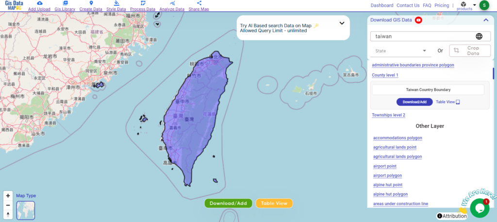
Taiwan, officially the Republic of China (ROC), is a country in East Asia. It is located at the junction of the East and South China Seas in the northwestern Pacific Ocean, with the People’s Republic of China (PRC) to the northwest, Japan to the northeast, and the Philippines to the south. The ROC controls 168 islands with a combined area of 36,193 square kilometers (13,974 square miles). The main island of Taiwan, also known as Formosa, has an area of 35,808 square kilometers (13,826 square miles). Mountain ranges dominate the eastern two-thirds of the island, while plains in the western third host its highly urbanized population. The capital, Taipei, together with New Taipei City and Keelung, forms the largest metropolitan area. With around 23.9 million inhabitants, Taiwan is among the most densely populated countries.

Taiwan National Boundary

Download Taiwan National Boundary Shapefile

After successfully logging in with a legitimate email address, select the country you want to work with. Next, choose the specific layer you need and click on the download option. Once that’s done, pick the desired format to acquire the essential GIS data. Before proceeding with the data download, make sure to review the data table for any relevant information.

Download Taiwan Counties Shapefile Data

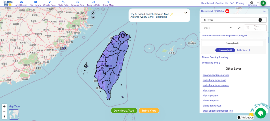
Taiwan boasts 13 counties scattered across the island. From the agricultural heartland of Changhua County to the natural beauty of Hualien County with its stunning Taroko Gorge, each county offers unique experiences.

Taiwan Counties Boundary

Download Taiwan Counties Boundary Shapefile

Here’s a list of the 13 counties in Taiwan:

  • Changhua County
  • Chiayi County
  • Hsinchu County
  • Hualien County
  • Kaohsiung County
  • Miaoli County
  • Nantou County
  • Penghu County
  • Pingtung County
  • Taichung County
  • Tainan County
  • Taipei County
  • Taitung County

Download Taiwan Townships Shapefile Data

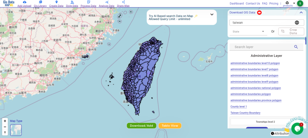
Taiwan’s administrative divisions include counties, some of which have been merged with cities. There are no townships that govern the entire island, but there are 184 townships spread across the counties.

Taiwan Townships
Taiwan Townships

Download Taiwan Townships Boundary Shapefile

Other GIS Data:

Above all links are provided for GIS data of Taiwan if you are looking for any specific data please write us on support@mapog.com

Download Shapefile for the following:

  1. World Countries Shapefile
  2. Australia
  3. Argentina
  4. Austria
  5. Belgium
  6. Brazil
  7. Canada
  8. Denmark
  9. Fiji
  10. Finland
  11. Germany
  12. Greece
  13. India
  14. Indonesia
  15. Ireland
  16. Italy
  17. Japan
  18. Kenya
  19. Lebanon
  20. Madagascar
  21. Malaysia
  22. Mexico
  23. Mongolia
  24. Netherlands
  25. New Zealand
  26. Nigeria
  27. Papua New Guinea
  28. Philippines
  29. Poland
  30. Russia
  31. Singapore
  32. South Africa
  33. South Korea
  34. Spain
  35. Switzerland
  36. Tunisia
  37. United Kingdom Shapefile
  38. United States of America
  39. Vietnam
  40. Croatia
  41. Chile
  42. Norway
  43. Maldives
  44. Bhutan
  45. Colombia
  46. Libya
  47. Comoros
  48. Hungary
  49. Laos
  50. Estonia
  51. Iraq
  52. Portugal
  53. Azerbaijan
  54. Macedonia
  55. Romania
  56. Peru
  57. Marshall Islands
  58. Slovenia
  59. Nauru
  60. Guatemala
  61. El Salvador
  62. Afghanistan
  63. Cyprus
  64. Syria
  65. Slovakia
  66. Luxembourg
  67. Jordan
  68. Armenia
  69. Haiti And Dominican Republic

Disclaimer : If you find any shapefile data of country provided is incorrect do contact us or comment below, so that we will correct the same in our system as well we will try to correct the same in openstreetmap.
Download Tuvalu Administrative Boundary GIS Data for – National, Regions, Villages and more

Access and download Tuvalu administrative boundary GIS data, including national, regions, and villages, for detailed geographic analysis and mapping.

Unleash the captivating charm of Tuvalu with MAPOG! Dive deep into a treasure trove of GIS data, unveiling the intricate details of its island havens. Trace the courses of Tuvalu’s turquoise lagoons and map your exploration across its coral reefs teeming with life. Navigate the turquoise expanse with data on Tuvalu’s vital transportation network – chart a course across the intricate web of island connections and explore the skies with information on Tuvalu’s essential air gateways. Download this wealth of Tuvalu GIS data with ease in formats like Shapefile, KML, GeoJSON, and CSV using our user-friendly tools. Empower your exploration of Tuvalu’s unique geography – choose MAPOG for all your Tuvalu GIS data needs!

With MAPOG’s versatile toolkit, you can effortlessly upload vector and raster files, add WMS (Web Map Service) layers, upload Excel or CSV data, incorporate existing files, perform polygon splitting and merging, generate new polygon and polyline data, use the converter for various formats, conduct buffer analysiscreate gridstransform points into polygons, calculate isochrones, and utilize the geocoder for precise location information.

We offer an extensive array of data formats, including KML, SHP, CSV, GeoJSON, Tab, SQL, Tiff, GML, KMZ, GPKZ, SQLITE, Dxf, MIF, TOPOJSON, XLSX, GPX, ODS, MID, and GPS, ensuring compatibility and accessibility for various applications and analyses.

Note:

  • All data available are in GCS datum EPSG:4326 WGS84 CRS (Coordinate Reference System).
  • You need to login for downloading the shapefile.

Download Shapefile Data of Tuvalu

Tuvalu, formerly known as the Ellice Islands, is an island country in the Polynesian subregion of Oceania in the Pacific Ocean. It is situated about midway between Hawaii and Australia. Tuvalu lies east-northeast of the Santa Cruz Islands (part of the Solomon Islands), northeast of Vanuatu, southeast of Nauru, south of Kiribati, west of Tokelau, northwest of Samoa and Wallis and Futuna, and north of Fiji.

Tuvalu National Boundary

Download Tuvalu National Boundary Shapefile

After successfully logging in with a legitimate email address, select the country you want to work with. Next, choose the specific layer you need and click on the download option. Once that’s done, pick the desired format to acquire the essential GIS data. Before proceeding with the data download, make sure to review the data table for any relevant information.

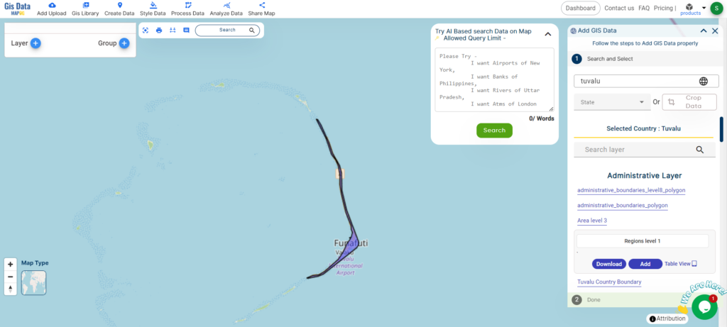
Download Tuvalu Regions Shapefile Data

Tuvalu is divided into nine islands, which function as administrative regions. These islands are:

  1. Funafuti
  2. Nanumanga
  3. Nanumea
  4. Niulakita
  5. Niutao
  6. Nui
  7. Nukufetau
  8. Nukulaelae
  9. Vaitupu
Tuvalu Regions Boundary

Download Tuvalu Regions Boundary Shapefile

Other Administrative Boundary Data:

Other GIS Data:

Above all links are provided for GIS data of Tuvalu if you are looking for any specific data please write us on support@mapog.com

Download Shapefile for the following:

  1. World Countries Shapefile
  2. Australia
  3. Argentina
  4. Austria
  5. Belgium
  6. Brazil
  7. Canada
  8. Denmark
  9. Fiji
  10. Finland
  11. Germany
  12. Greece
  13. India
  14. Indonesia
  15. Ireland
  16. Italy
  17. Japan
  18. Kenya
  19. Lebanon
  20. Madagascar
  21. Malaysia
  22. Mexico
  23. Mongolia
  24. Netherlands
  25. New Zealand
  26. Nigeria
  27. Papua New Guinea
  28. Philippines
  29. Poland
  30. Russia
  31. Singapore
  32. South Africa
  33. South Korea
  34. Spain
  35. Switzerland
  36. Tunisia
  37. United Kingdom Shapefile
  38. United States of America
  39. Vietnam
  40. Croatia
  41. Chile
  42. Norway
  43. Maldives
  44. Bhutan
  45. Colombia
  46. Libya
  47. Comoros
  48. Hungary
  49. Laos
  50. Estonia
  51. Iraq
  52. Portugal
  53. Azerbaijan
  54. Macedonia
  55. Romania
  56. Peru
  57. Marshall Islands
  58. Slovenia
  59. Nauru
  60. Guatemala
  61. El Salvador
  62. Afghanistan
  63. Cyprus
  64. Syria
  65. Slovakia
  66. Luxembourg
  67. Jordan
  68. Armenia
  69. Haiti And Dominican Republic

Disclaimer : If you find any shapefile data of country provided is incorrect do contact us or comment below, so that we will correct the same in our system as well we will try to correct the same in openstreetmap.
Download Bosnia Herzegovina Administrative Boundary Shapefiles – National, Cantons and more

Exciting news for GIS enthusiasts! MAPOG offers the opportunity to download administrative boundary shapefiles for Bosnia Herzegovina, featuring national and cantonal divisions. Elevate your mapping projects with comprehensive GIS data sets. Don’t miss out on this chance for enriched exploration and mapping!


Exciting news for GIS enthusiasts! MAPOG now covers Bosnia and Herzegovina in our comprehensive GIS dataset, featuring detailed geographical and administrative data. From water bodies to road networks and airports, our user-friendly formats like Shapefile, KML, and GeoJSON make accessing the data a breeze. Join us in enhancing your mapping projects with the latest Bosnia and Herzegovina GIS data!

With MAPOG’s versatile toolkit, you can effortlessly upload vector and raster filesadd WMS (Web Map Service) layers, upload Excel or CSV data, incorporate existing files, perform polygon splitting and merging, generate new polygon and polyline data, use the converter for various formats, conduct buffer analysiscreate gridstransform points into polygons, calculate isochrones, and utilize the geocoder for precise location information.

We have a diverse range of data formats, including KML, SHP, CSV, GeoJSON, Tab, SQL, Tiff, GML, KMZ, GPKZ, SQLITE, Dxf, MIF, TOPOJSON, XLSX, GPX, ODS, MID, and GPS, ensuring compatibility and accessibility for various applications and analyses.

Note:

  • All data available are in GCS datum EPSG:4326 WGS84 CRS (Coordinate Reference System).
  • You need to login for downloading the shapefile.

Download Bosnia Herzegovina National, Cantons, Municipalities Shapefile data

Bosnia and Herzegovina, often shortened as BiH or B&H, is a country located in Southeastern Europe within the Balkans. It shares borders with Serbia to the east, Montenegro to the southeast, and Croatia to the north and southwest. Along its southern edge, it boasts a narrow 20-kilometre coastline along the Adriatic Sea, encompassing the town of Neum. The capital and largest city is Sarajevo, accompanied by other major cities like Banja Luka, Tuzla, Zenica, and Mostar.

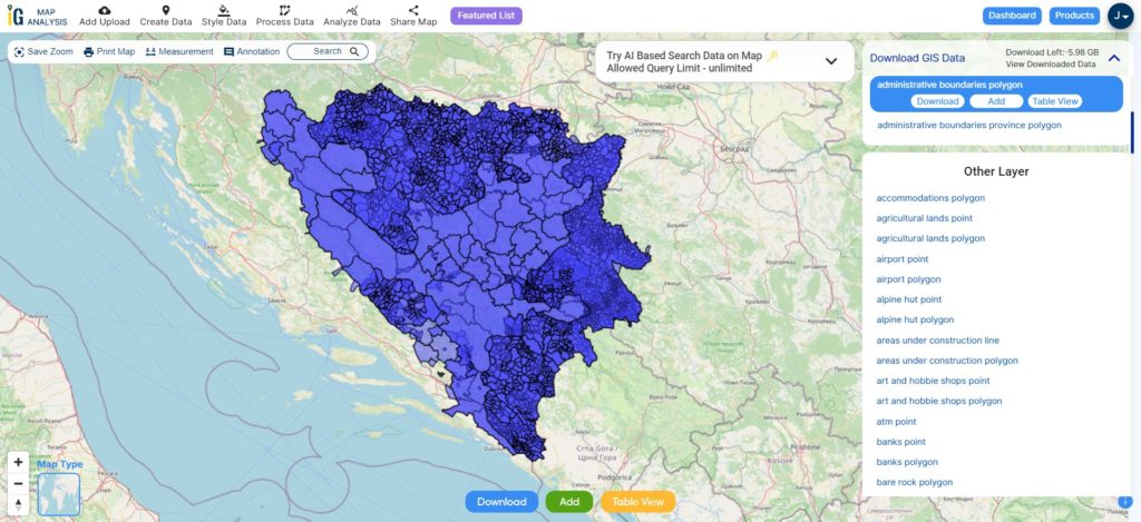
Bosnia National, Cantons, Municipality Boundaries

Download Bosnia National, Cantons, Municipality Shapefile

After successfully logging in with a legitimate email address, select the country you want to work with. Next, choose the specific layer you need and click on the download option. Once that’s done, pick the desired format to acquire the essential GIS data. Before proceeding with the data download, make sure to review the data table for any relevant information.

Download Bosnia Herzegovina Cantons Shapefile Data

Bosnia and Herzegovina is divided into two entities: the Federation of Bosnia and Herzegovina (FBiH) and the Republika Srpska (RS). The FBiH is further divided into 10 cantons, while the RS is divided into 7 municipalities. The Brčko District is a self-governing district that is located within the FBiH and RS.

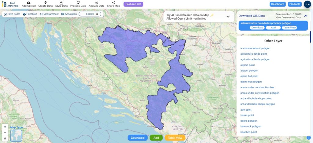
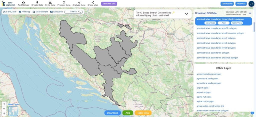
Bosnia Cantons Boundaries

Download Bosnia Cantons Shapefile

This shapefile covers following Cantons of Bosnia listed below:

  • Canton of Una-Sana (Bihać)
  • Canton of Tuzla (Tuzla)
  • Canton of Zenica-Doboj (Zenica)
  • Canton of Sarajevo (Sarajevo)
  • Canton of West Herzegovina (Mostar)
  • Canton of Central Bosnia (Kiseljak)
  • Canton of Herzegovina-Neretva (Mostar)
  • Canton of Posavina (Orašje)
  • Canton 10 (Livno)
  • Canton of Goražde (Goražde)

Download Bosnia – Republika Srpska Autonomous Region Shapefile Data

Republika Srpska is an entity within Bosnia and Herzegovina, predominantly inhabited by Serbs. It holds significant autonomy in various sectors, including politics and administration. The capital of Republika Srpska is Banja Luka.

Bosnia-Republika Srpska Boundary

Download Bosnia-Republika Srpska Shapefile

Other Administrative Boundary Data:

Other GIS Data:

Above all links are provided for GIS data of Bosnia Herzegovina if you are looking for any specific data please write us on support@mapog.com

Download Shapefile for the following:

  1. World Countries Shapefile
  2. Australia
  3. Argentina
  4. Austria
  5. Belgium
  6. Brazil
  7. Canada
  8. Denmark
  9. Fiji
  10. Finland
  11. Germany
  12. Greece
  13. India
  14. Indonesia
  15. Ireland
  16. Italy
  17. Japan
  18. Kenya
  19. Lebanon
  20. Madagascar
  21. Malaysia
  22. Mexico
  23. Mongolia
  24. Netherlands
  25. New Zealand
  26. Nigeria
  27. Papua New Guinea
  28. Philippines
  29. Poland
  30. Russia
  31. Singapore
  32. South Africa
  33. South Korea
  34. Spain
  35. Switzerland
  36. Tunisia
  37. United Kingdom Shapefile
  38. United States of America
  39. Vietnam
  40. Croatia
  41. Chile
  42. Norway
  43. Maldives
  44. Bhutan
  45. Colombia
  46. Libya
  47. Comoros
  48. Hungary
  49. Laos
  50. Estonia
  51. Iraq
  52. Portugal
  53. Azerbaijan
  54. Macedonia
  55. Romania
  56. Peru
  57. Marshall Islands
  58. Slovenia
  59. Nauru
  60. Guatemala
  61. El Salvador
  62. Afghanistan
  63. Cyprus
  64. Syria
  65. Slovakia
  66. Luxembourg
  67. Jordan
  68. Armenia
  69. Haiti And Dominican Republic

Disclaimer : If you find any shapefile data of country provided is incorrect do contact us or comment below, so that we will correct the same in our system as well we will try to correct the same in openstreetmap.
Download Armenia Administrative Boundary Shapefile – Provinces, Districts and more

Unlock the potential of mapping! MAPOG introduces a unique opportunity: download Armenia’s administrative boundary shapefile, covering provinces, districts, and more. Elevate your mapping projects with these comprehensive GIS datasets. Seize the opportunity for enriched exploration and mapping experiences!

Searching for accurate and up-to-date GIS data for your chosen country? Look no further than MAPOG! We offer an extensive GIS Data Collection covering 150+ countries, with over 150 datasets available for each nation. Our data is known for its exceptional accuracy, particularly in representing administrative divisions. Explore a wide range of geographic features such as rivers, roads, railway lines, airport locations, and more, meticulously represented in appropriate geometric structures (points, lines, and polygons). Accessing this valuable data is easy with our two essential tools – Download GIS Data and Add GIS Data, designed to simplify your data acquisition process. Choose from ESRI Shapefile, KML, GeoJSON, or CSV formats to download the data from Download GIS Data tool.

In this article, we’ll focus on the administrative level GIS data of Armenia and walk you through how to download it using the Download GIS Data tool. MAPOG ensures a user-friendly experience, making GIS data acquisition a breeze. Don’t miss the chance to enhance your geospatial projects with MAPOG‘s accurate and reliable GIS data solutions!

Check the article Add GIS data from MAPOG GIS data collection for understanding more about Add GIS Data tool.

Note:

  • All data available are in GCS datum EPSG:4326 WGS84 CRS (Coordinate Reference System).
  • You need to login for downloading the shapefile.

Download Shapefile Data of Armenia

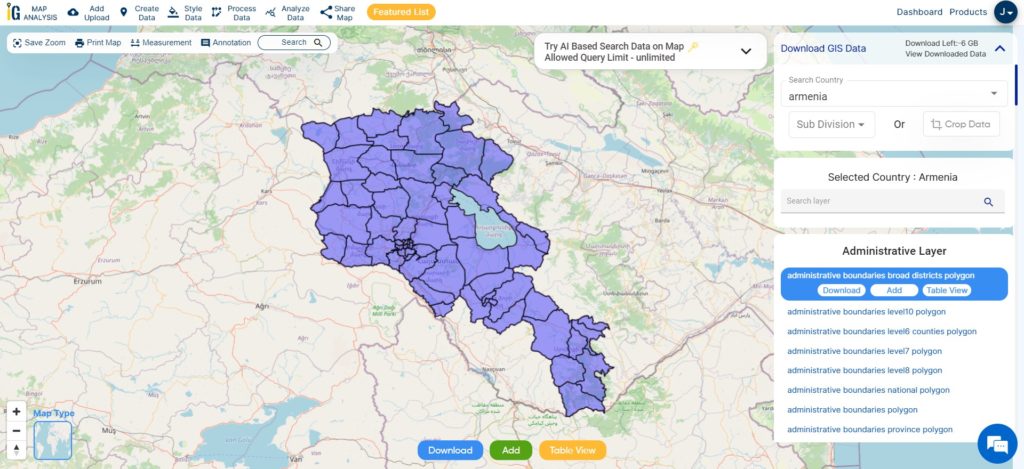
Armenia, a landlocked country in the Armenian Highlands of West Asia, shares borders with Turkey, Georgia, Azerbaijan, Iran, and the Azerbaijani exclave of Nakhchivan. Due to its connections with Europe, Armenia is considered part of the Caucasus region. Yerevan, the capital and largest city, serves as the country’s financial center. Administratively, Armenia is divided into 11 regions known as Marzes, which include Yerevan. Municipalities within each Marz oversee the governance of cities, towns, and villages. At a smaller scale, communities called Hamaynkner have their own local governments led by mayors or village heads. This well-structured administrative system ensures effective governance and service delivery throughout the nation.

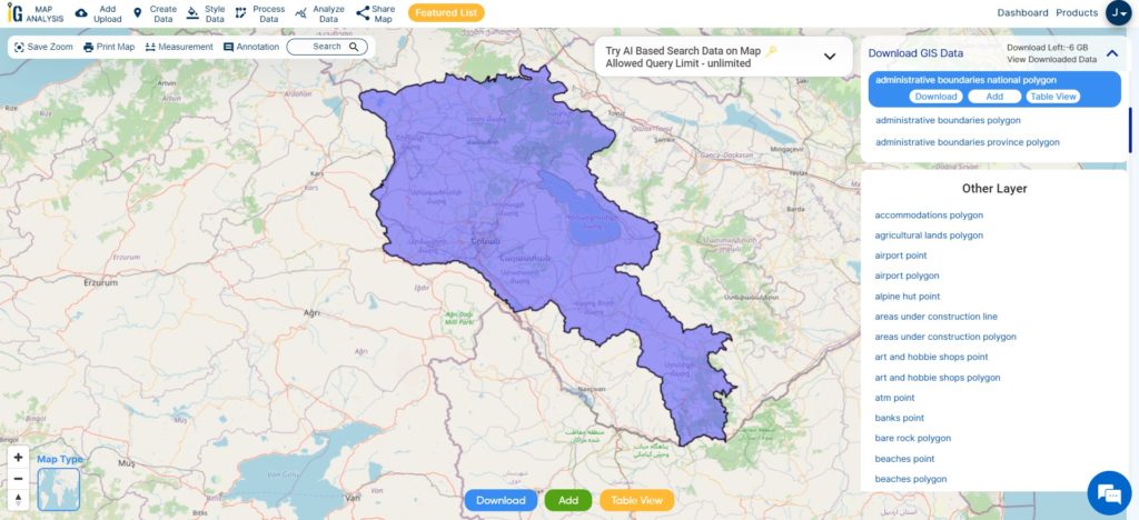
Armenia National Boundary

Download Armenia National Boundary Shapefile

Once you have successfully logged in with your verified email ID, select Armenia as your desired country. Proceed by choosing the specific layer and format for the GIS data you require. Before initiating the download Armenia administrative boundaries GIS data, you have the option to review the data table for additional details. Finally, click on the download button to start downloading the data and seize the opportunity to enhance your mapping endeavors.

Download Armenia Provinces Shapefile Data

In Armenia, there are eleven administrative divisions, consisting of ten provinces referred to as “marzer” or “marz” in Armenian. The provinces have the crucial responsibility of local governance and are under the leadership of a chief executive known as the “marzpet.” The government of Armenia appoints the marzpets to their respective provinces. It’s important to note that Yerevan, the capital, has a distinct status and operates with its own separate administrative structure. Unlike the other provinces, it is not affiliated with any specific province and maintains its own governance system.

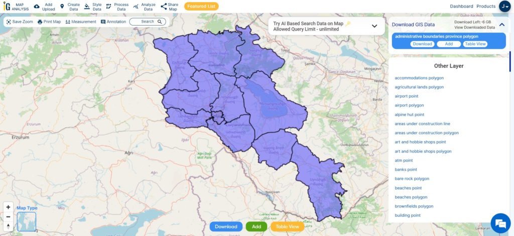
Armenia Provinces Boundaries

Download Armenia Province Boundary Shapefile

This shapefile covers following Provinces of armenia listed below:

  1. Aragatsotn
  2. Ararat
  3. Armavir
  4. Gegharkunik
  5. Kotayk
  6. Lori
  7. Shirak
  8. Syunik
  9. Tavush
  10. Vayots Dzor
  11. Yerevan (capital city, also considered a province)

Download Armenia Municipality, Towns and villages Shapefile Data

Municipalities, towns, and villages form an integral part of the administrative structure in Armenia, playing crucial roles in local governance and community development. Municipalities are responsible for the governance and management of specific areas, such as cities or towns.

Towns, as urban areas with larger populations and more developed infrastructure, have their own local governments. Villages, on the other hand, represent rural settlements with smaller populations and less developed infrastructure.

Armenia Municipality, Towns, Villages Boundaries

Download Armenia Municipality Towns And Villages Boundary Shapefile

Other Administrative Boundary Data:

Other GIS Data:

Download Shapefile for the following:

  1. World Countries Shapefile
  2. Australia
  3. Argentina
  4. Austria
  5. Belgium
  6. Brazil
  7. Canada
  8. Denmark
  9. Fiji
  10. Finland
  11. Germany
  12. Greece
  13. India
  14. Indonesia
  15. Ireland
  16. Italy
  17. Japan
  18. Kenya
  19. Lebanon
  20. Madagascar
  21. Malaysia
  22. Mexico
  23. Mongolia
  24. Netherlands
  25. New Zealand
  26. Nigeria
  27. Papua New Guinea
  28. Philippines
  29. Poland
  30. Russia
  31. Singapore
  32. South Africa
  33. South Korea
  34. Spain
  35. Switzerland
  36. Tunisia
  37. United Kingdom Shapefile
  38. United States of America
  39. Vietnam
  40. Croatia
  41. Chile
  42. Norway
  43. Maldives
  44. Bhutan
  45. Colombia
  46. Libya
  47. Comoros
  48. Hungary
  49. Laos
  50. Estonia
  51. Iraq
  52. Portugal
  53. Azerbaijan
  54. Macedonia
  55. Romania
  56. Peru
  57. Marshall Islands
  58. Slovenia
  59. Nauru
  60. Guatemala
  61. El Salvador
  62. Afghanistan
  63. Cyprus
  64. Syria

Disclaimer : If you find any shapefile data of country provided is incorrect do contact us or comment below, so that we will correct the same in our system as well we will try to correct the same in openstreetmap.
Download Guatemala Administrative Boundary GIS Data for – National, Department, Municipality and more

Elevate your mapping pursuits! IGISMAP presents a special offer: download Guatemala’s administrative boundary GIS data, including national, department, municipality, and more.

Discover Guatemala’s geographical features effortlessly through IGISMAP. Explore a diverse range of datasets, including comprehensive information on borders, rivers, roads, and airports. Using tools like Download GIS Data and Add GIS Data is straightforward. You have the flexibility to choose from formats such as Shapefile, KML, GeoJSON, and CSV using the Download GIS Data tool. Use IGISMAP with confidence to delve into the fascinating geography of Guatemala GIS Data.

With MAPOG’s versatile toolkit, you can effortlessly upload vector and raster files, add WMS (Web Map Service) layers, upload Excel or CSV data, incorporate existing files, perform polygon splitting and merging, generate new polygon and polyline data, use the converter for various formats, conduct buffer analysis, create grids, transform points into polygons, calculate isochrones, and utilize the geocoder for precise location information.

We offer an extensive array of data formats, including KML, SHP, CSV, GeoJSON, Tab, SQL, Tiff, GML, KMZ, GPKZ, SQLITE, Dxf, MIF, TOPOJSON, XLSX, GPX, ODS, MID, and GPS, ensuring compatibility and accessibility for various applications and analyses.

Note:

  • All data available are in GCS datum EPSG:4326 WGS84 CRS (Coordinate Reference System).
  • You need to login for downloading the shapefile.

Download Shapefile Data of Guatemala

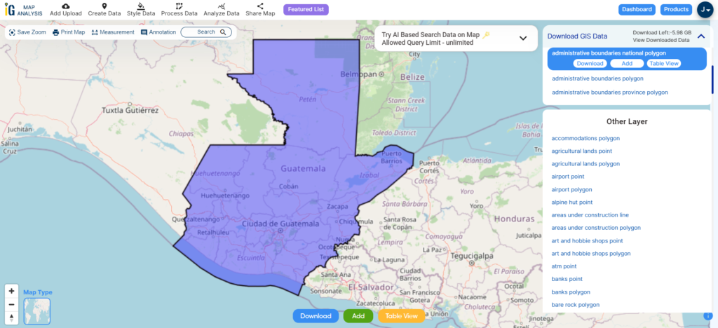
Guatemala, officially known as the Republic of Guatemala, is situated in Central America. It shares its borders with Mexico to the north and west, Belize to the northeast, Honduras to the east, and El Salvador to the southeast. To the south, it is bordered by the Pacific Ocean, and to the northeast, it is touched by the Gulf of Honduras. With an estimated population of approximately 17.6 million people, Guatemala stands as the most populous country in Central America and ranks as the 11th most populous nation in the Americas. Guatemala operates as a representative democracy, with its capital and largest city being Nueva Guatemala de la Asunción, also commonly known as Guatemala City, which happens to be the most populous city in Central America.

Guatemala National Boundaries

Download Guatemala National Boundary Shapefile

After successfully logging in with a legitimate email address, select the country you want to work with. Next, choose the specific layer you need and click on the download option. Once that’s done, pick the desired format to acquire the essential GIS data. Before proceeding with the data download, make sure to review the data table for any relevant information.

Download Guatemala departments Shapefile Data

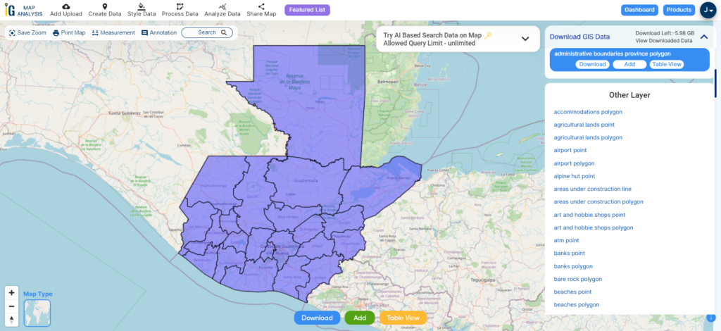
Guatemala is divided into 22 administrative divisions known as “departments” (departamentos in Spanish). Each department is further subdivided into municipalities.

Guatemala Departments Boundaries

Download Guatemala Departments Shapefile

Here is a list of the 22 departments of Guatemala:

  1. Alta Verapaz
  2. Baja Verapaz
  3. Chimaltenango
  4. Chiquimula
  5. El Progreso
  6. Escuintla
  7. Guatemala
  8. Huehuetenango
  9. Izabal
  10. Jalapa
  11. Jutiapa
  12. Petén
  13. Quetzaltenango
  14. Quiché
  15. Retalhuleu
  16. Sacatepéquez
  17. San Marcos
  18. Santa Rosa
  19. Sololá
  20. Suchitepéquez
  21. Totonicapán
  22. Zacapa

Download Guatemala Municipalities Shapefile Data

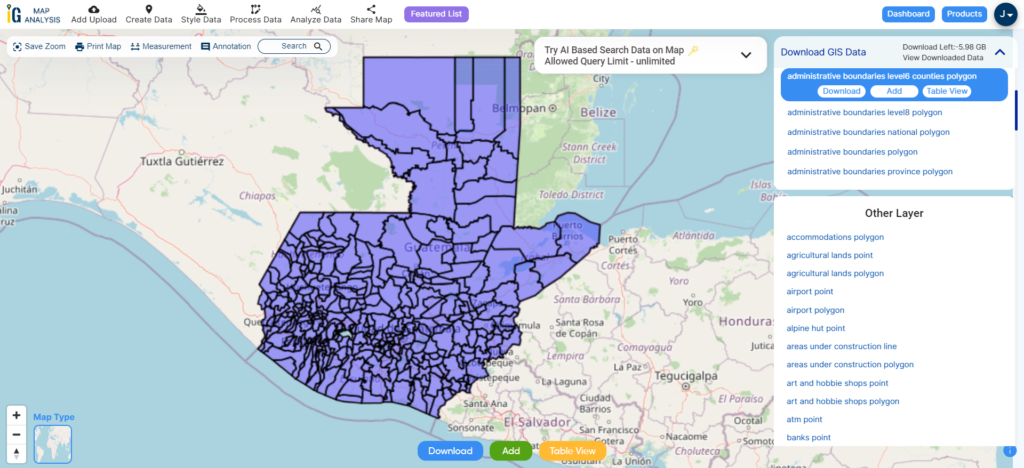
Guatemala is divided into numerous municipalities, each of which falls within one of the country’s 22 departments. There are a total of 340 municipalities in Guatemala. These municipalities serve as the basic administrative divisions within the country.

Guatemala Municipalities Boundaries

Download Guatemala Municipalities Shapefile

Other Administrative Boundary Data:

Other GIS Data:

Above all links are provided for GIS data of Guatemala if you are looking for any specific data please write us on support@igismap.com

Download Shapefile for the following:

  1. World Countries Shapefile
  2. Australia
  3. Argentina
  4. Austria
  5. Belgium
  6. Brazil
  7. Canada
  8. Denmark
  9. Fiji
  10. Finland
  11. Germany
  12. Greece
  13. India
  14. Indonesia
  15. Ireland
  16. Italy
  17. Japan
  18. Kenya
  19. Lebanon
  20. Madagascar
  21. Malaysia
  22. Mexico
  23. Mongolia
  24. Netherlands
  25. New Zealand
  26. Nigeria
  27. Papua New Guinea
  28. Philippines
  29. Poland
  30. Russia
  31. Singapore
  32. South Africa
  33. South Korea
  34. Spain
  35. Switzerland
  36. Tunisia
  37. United Kingdom Shapefile
  38. United States of America
  39. Vietnam
  40. Croatia
  41. Chile
  42. Norway
  43. Maldives
  44. Bhutan
  45. Colombia
  46. Libya
  47. Comoros
  48. Hungary
  49. Laos
  50. Estonia
  51. Iraq
  52. Portugal
  53. Azerbaijan
  54. Macedonia
  55. Romania
  56. Peru
  57. Marshall Islands
  58. Slovenia
  59. Nauru
  60. Guatemala
  61. El Salvador
  62. Afghanistan
  63. Cyprus
  64. Syria
  65. Slovakia
  66. Luxembourg
  67. Jordan
  68. Armenia
  69. Haiti And Dominican Republic

Disclaimer : If you find any shapefile data of country provided is incorrect do contact us or comment below, so that we will correct the same in our system as well we will try to correct the same in openstreetmap.
Download Libya Administrative Boundary Shapefiles – National, Districts and more

Access Libya GIS data of administrative boundaries, national, districts, in formats – shapefile, KML, GeoJSON, CSV, KMZ

Thrilling updates for those passionate about Geographic Information Systems (GIS)! IGISMAP’s GIS data collection has now expanded to include Libya, among over 100 other countries. Dive into the comprehensive and up-to-date GIS data for Libya, encompassing a wide array of geographic and administrative features like water bodies, roads, airport locations, and more. This dataset encompasses various administrative boundaries, providing valuable insights for your mapping projects, whether on a national or local scale. You have the flexibility to choose from formats such as ESRI Shapefile, KML, GeoJSON, and CSV for easy downloads. Don’t miss out on this exceptional opportunity to elevate your mapping projects with the latest GIS data for Libya, complete with administrative boundaries. Enjoy your exploration and mapping!

With MAPOG’s versatile toolkit, you can effortlessly upload vector and raster files, add WMS (Web Map Service) layers, upload Excel or CSV data, incorporate existing files, perform polygon splitting and merging, generate new polygon and polyline data, use the converter for various formats, conduct buffer analysis, create grids, transform points into polygons, calculate isochrones, and utilize the geocoder for precise location information.

We provide an extensive range of data formats, including KML, SHP, CSV, GeoJSON, Tab, SQL, Tiff, GML, KMZ, GPKZ, SQLITE, Dxf, MIF, TOPOJSON, XLSX, GPX, ODS, MID, and GPS, ensuring compatibility and accessibility for a variety of applications and analyses.

If you want to know how to use Add GIS Data tool, check out this article Add GIS data from IGISMap GIS data collection.

Note:

  • All data available are in GCS datum EPSG:4326 WGS84 CRS (Coordinate Reference System).
  • You need to login for downloading the shapefile.

Download Shapefile Data of Libya

Nestled within the Maghreb region of North Africa, Libya stands as a country of substantial importance, officially known as the State of Libya. It shares its borders with the Mediterranean Sea to the north, Egypt to the east, Sudan to the southeast, Chad to the south, Niger to the southwest, Algeria to the west, and Tunisia to the northwest. Comprising the historical regions of Tripolitania, Fezzan, and Cyrenaica, Libya’s vast expanse covers 1.8 million km2 (700,000 sq mi), ranking it as Africa’s fourth-largest and the Arab world’s, as well as the 16th largest globally. The dynamic capital, Tripoli, nestled in the northwest, not only houses over a million residents but also resonates as a center of cultural and societal vibrancy within the nation’s seven million-strong population.

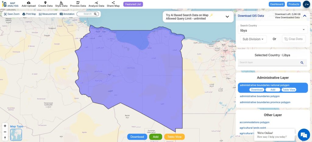
Libya National Boundary

Download Libya National Boundary Shapefile

After successfully logging in with a legitimate email address, select the country you want to work with. Next, choose the specific layer you need and click on the download option. Once that’s done, pick the desired format to acquire the essential GIS data. Before proceeding with the data download, make sure to review the data table for any relevant information.

Download Libya District Shapefile Data

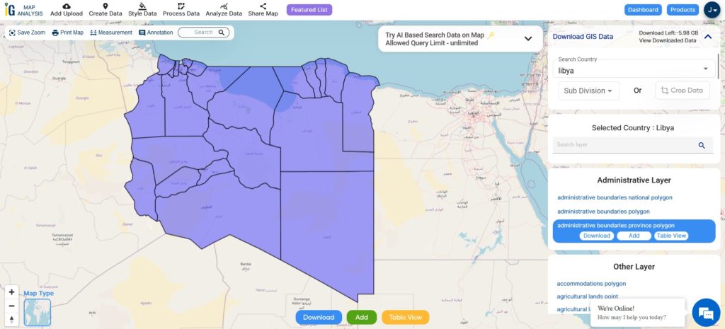
Libya is divided into twenty-two districts. Districts are the highest administrative regions in Libya.

Libya Districts Boundaries

Download Libya Districts Shapefile

This shapefile covers following districts of Libya listed below:

  1. Tripoli
  2. Murqub
  3. Jabal al Gharbi
  4. Nalut
  5. Zawiya
  6. Jafara
  7. Misrata
  8. Sirte
  9. Benghazi
  10. Marj
  11. Butnan
  12. Al Wahat
  13. Kufra
  14. Al Jufra
  15. Wadi al Shatii
  16. Murzuq
  17. Sabha
  18. Wadi al Hayaa
  19. Nalut
  20. Yafran
  21. Ghadamis
  22. Ghat

Download Libya Administrative Boundaries Combined Shapefile Data

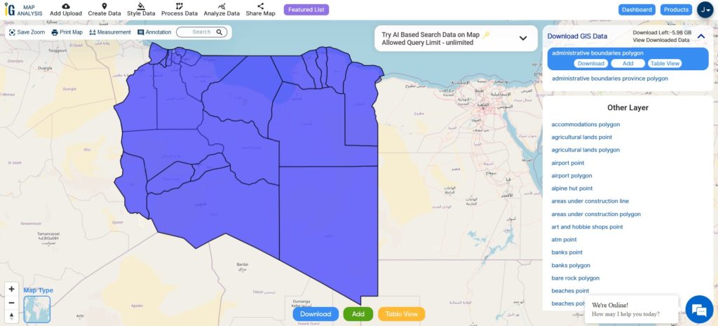
There are currently 22 districts in Libya, according to the 2007 Administrative Divisions Law.These districts are further subdivided into municipalities (baladiyat). The municipalities are the basic administrative units in Libya. They are responsible for providing basic services to the people, such as education, healthcare, and infrastructure.

Libya National District Boundaries

Download Libya National, District Shapefile

Other GIS Data:

Above all links are provided for GIS data of Libya if you are looking for any specific data please write us on support@igismap.com

Download Shapefile for the following:

  1. World Countries Shapefile
  2. Australia
  3. Argentina
  4. Austria
  5. Belgium
  6. Brazil
  7. Canada
  8. Denmark
  9. Fiji
  10. Finland
  11. Germany
  12. Greece
  13. India
  14. Indonesia
  15. Ireland
  16. Italy
  17. Japan
  18. Kenya
  19. Lebanon
  20. Madagascar
  21. Malaysia
  22. Mexico
  23. Mongolia
  24. Netherlands
  25. New Zealand
  26. Nigeria
  27. Papua New Guinea
  28. Philippines
  29. Poland
  30. Russia
  31. Singapore
  32. South Africa
  33. South Korea
  34. Spain
  35. Switzerland
  36. Tunisia
  37. United Kingdom Shapefile
  38. United States of America
  39. Vietnam
  40. Croatia
  41. Chile
  42. Norway
  43. Maldives
  44. Bhutan
  45. Colombia
  46. Libya
  47. Comoros
  48. Hungary
  49. Laos
  50. Estonia
  51. Iraq
  52. Portugal
  53. Azerbaijan
  54. Macedonia
  55. Romania
  56. Peru
  57. Marshall Islands
  58. Slovenia
  59. Nauru
  60. Guatemala
  61. El Salvador
  62. Afghanistan
  63. Cyprus
  64. Syria
  65. Slovakia
  66. Luxembourg
  67. Jordan
  68. Armenia
  69. Haiti And Dominican Republic

Disclaimer : If you find any shapefile data of country provided is incorrect do contact us or comment below, so that we will correct the same in our system as well we will try to correct the same in openstreetmap.
Download Maldives Administrative Boundary GIS Data – Provinces, Atolls and more

IGISMAP introduces the Maldives’ GIS data collection, encompassing administrative boundaries such as national boundaries and atolls, available for download in various formats including ESRI Shapefile, KML, GeoJSON, and CSV, providing GIS enthusiasts with the opportunity to explore and analyze geographic and administrative features for mapping projects.

Exciting news for GIS enthusiasts! IGISMAP has just released GIS data collections for over 100 new countries. You can now access the shapefiles of all essential administrative and other geographical features. The provided links allow you to download the Maldives Administrative Boundary GIS Data in ESRI Shapefile, KML, GeoJSON, and CSV formats.

Note:

  • All data available are in GCS datum EPSG:4326 WGS84 CRS (Coordinate Reference System).
  • You need to login for downloading the shapefile.

Here is the video tutorial to download data:

Download Shapefile Data of Maldives

Maldives, officially known as the Republic of Maldives, is a picturesque island nation situated in the Indian Ocean. Comprising a total of 26 atolls, which are formed by more than 1,000 coral islands, Maldives is renowned for its breathtaking beauty, pristine beaches, and crystal-clear turquoise waters.

Geographically, Maldives is located southwest of Sri Lanka and India, spanning an area of approximately 298 square kilometers (115 square miles). The country stretches over 820 kilometers (510 miles) from north to south and 120 kilometers (75 miles) from east to west. The nearest landmass is the Indian Lakshadweep Islands.

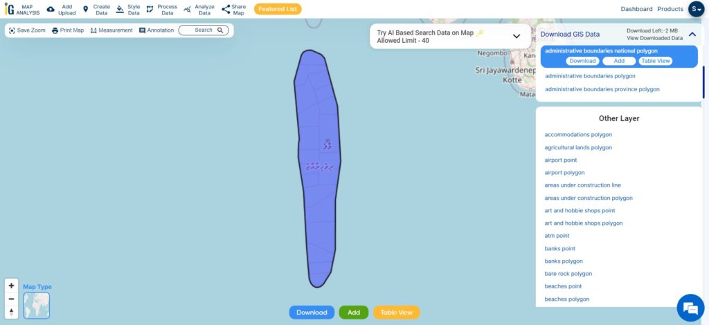
Maldives National Boundary

After logging in with a verified email ID, select the desired country. Next, choose the specific layer and format for the GIS data. Before downloading the Maldives GIS data, you have the option to check the data table for further details. Finally, click on the download button to initiate the download.

Download Maldives National Boundary Shapefile

Download Maldives Atolls Shapefile Data

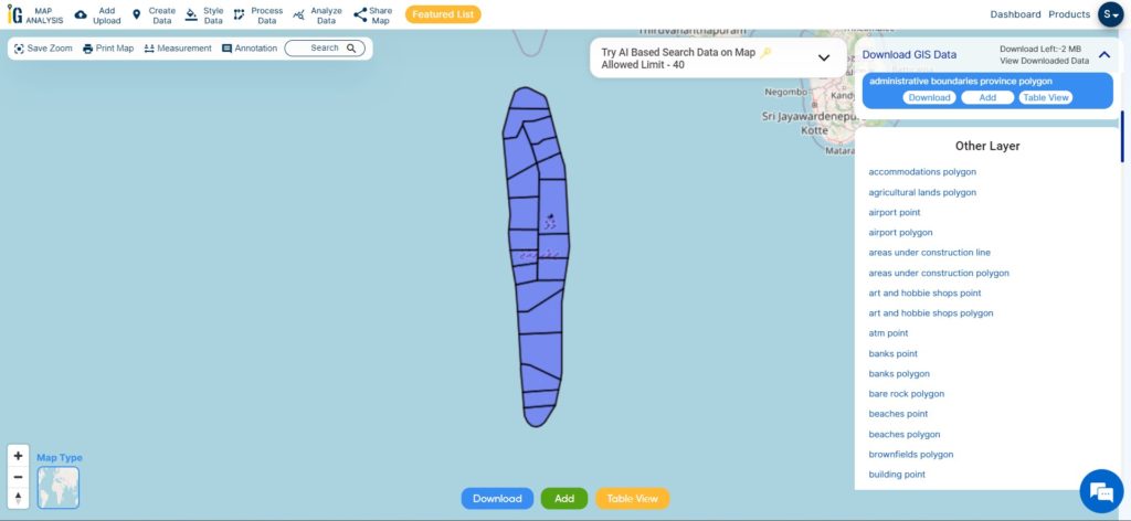
The Maldives, a tropical paradise in the Indian Ocean, is an archipelago consisting of 26 atolls, which are further divided into 20 administrative atolls. These atolls serve as the country’s primary administrative divisions. Each atoll comprises numerous coral islands, with some atolls boasting more than 200 individual islets. The capital city, Malé, located in the Kaafu Atoll, is not only the political and economic hub of the Maldives but also one of the most densely populated cities in the world. Despite facing challenges from climate change and rising sea levels, the Maldives’ administrative atolls remain a symbol of natural beauty and cultural richness, attracting tourists from around the globe.

Maldives Atolls boundaries

Download Maldives Atoll Shapefile

This shapefile covers following administrative atolls of maldives listed below:

  1. Alifu Alifu Atoll (North Ari Atoll)
  2. Alifu Dhaalu Atoll (South Ari Atoll)
  3. Baa Atoll
  4. Dhaalu Atoll
  5. Faafu Atoll
  6. Gaafu Alifu Atoll (North Huvadhoo Atoll)
  7. Gaafu Dhaalu Atoll (South Huvadhoo Atoll)
  8. Gnaviyani Atoll (Fuvahmulah)
  9. Haa Alifu Atoll (Thiladhunmathi Uthuruburi)
  10. Haa Dhaalu Atoll (Thiladhunmathi Dhekunuburi)
  11. Kaafu Atoll (Male Atoll)
  12. Laamu Atoll
  13. Lhaviyani Atoll
  14. Meemu Atoll
  15. Noonu Atoll
  16. Raa Atoll
  17. Seenu Atoll (Addu Atoll)
  18. Shaviyani Atoll
  19. Thaa Atoll
  20. Vaavu Atoll

Download  Maldives North Male Atoll Shapefile Data

North Malé Atoll is one of the most popular and frequently visited atolls in the Maldives. Located in the northern part of the archipelago, it is situated close to the capital city of Malé, making it easily accessible for tourists.

The capital city of the Maldives is Malé, and it is not specifically located within the North Malé Atoll. However, Malé is situated in close proximity to the atoll and serves as the central hub for transportation, administration, and commerce in the country. It is located on the southern edge of the North Malé Atoll, which makes it easily accessible from the various resorts and islands within the atoll.

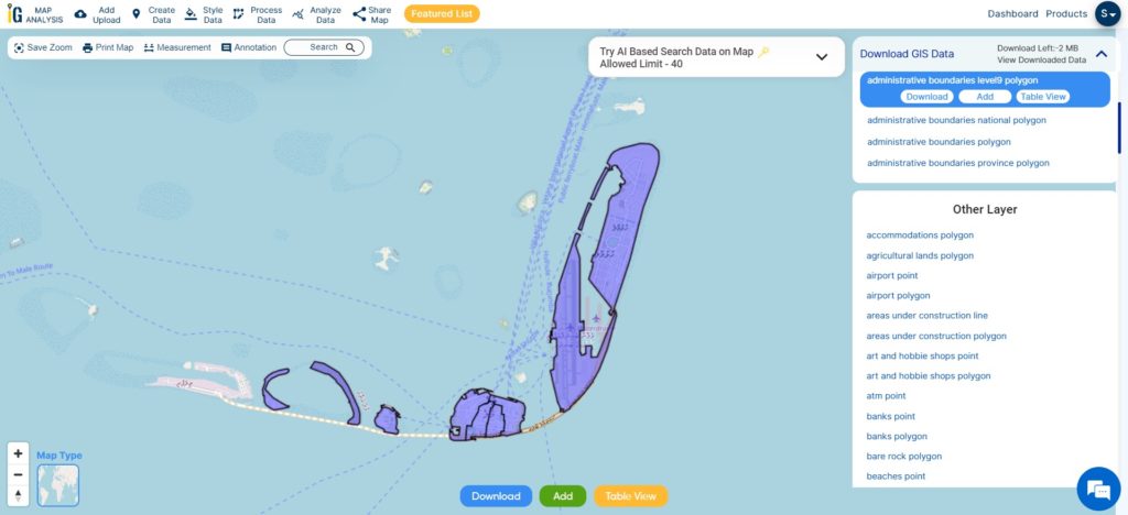
Hulhumalé is a reclaimed island located in the Maldives, situated in the southern part of the North Malé Atoll. It is an artificial island developed as a response to the growing population and urbanization pressures faced by the capital city of Malé. Hulhumalé serves as an extension of the greater Malé area and has become a key residential, commercial, and recreational hub.

Maldives North Male Atoll Boundary

Download Maldives North Male Atoll Shapefile

Other Administrative Boundary Data:

Above all links are provided for GIS data of Maldives if you are looking for any specific data please write us on sales@igismap.com

Download Shapefile for the following:

  1. World Countries Shapefile
  2. Australia
  3. Argentina
  4. Austria
  5. Belgium
  6. Brazil
  7. Canada
  8. Denmark
  9. Fiji
  10. Finland
  11. Germany
  12. Greece
  13. India
  14. Indonesia
  15. Ireland
  16. Italy
  17. Japan
  18. Kenya
  19. Lebanon
  20. Madagascar
  21. Malaysia
  22. Mexico
  23. Mongolia
  24. Netherlands
  25. New Zealand
  26. Nigeria
  27. Papua New Guinea
  28. Philippines
  29. Poland
  30. Russia
  31. Singapore
  32. South Africa
  33. South Korea
  34. Spain
  35. Switzerland
  36. Tunisia
  37. United Kingdom Shapefile
  38. United States of America
  39. Vietnam
  40. Croatia
  41. Chile
  42. Norway
  43. Maldives
  44. Bhutan
  45. Colombia
  46. Libya
  47. Comoros
  48. Hungary
  49. Libya

Disclaimer : If you find any shapefile data of country provided is incorrect do contact us or comment below, so that we will correct the same in our system as well we will try to correct the same in o

Download Croatia Administrative Boundary GIS Data – Shapefiles – County, Municipalities

IGISMAP has unveiled Croatia’s GIS data collection, including shapefiles for essential administrative divisions such as counties and municipalities. Accessible in various formats like KML, GeoJSON, and CSV, this dataset empowers GIS enthusiasts to explore and analyze Croatia’s geographical information for mapping and analysis purposes.

Exciting news for GIS data users! IGISMAP has just released GIS data for over 100 new countries, including Croatia GIS data. You can now access shapefiles for essential administrative divisions of Croatia through the provided links. Additionally, data downloads are available in various formats, such as KML, GeoJSON, and CSV. Don’t miss this opportunity to explore and analyze the geographic information of Croatia in detail!

Note:

  • All data available are in GCS datum EPSG:4326 WGS84 CRS (Coordinate Reference System).
  • You need to login for downloading the shapefile.

Here is the video tutorial to download data:

Download Shapefile Data of Croatia

Situated at the crossroads of Central and Southeast Europe, the Republic of Croatia, also known as Republika Hrvatska, entices with its stunning landscapes and vibrant cultural heritage. The country shares borders with Slovenia, Hungary, Serbia, Bosnia and Herzegovina, and Montenegro, and boasts a maritime border with Italy. Croatia’s irresistible blend of natural beauty and historical allure makes it a highly sought-after destination for travelers.

At the core of Croatia lies its lively capital and largest city, Zagreb, forming a significant administrative hub along with twenty counties. This well-organized governance system ensures efficient management and representation at the regional level. Spanning 56,594 square kilometers (21,851 square miles), this enchanting nation is home to nearly 3.9 million people, creating a captivating and welcoming atmosphere for all who visit.

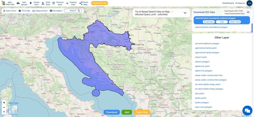
Croatia National Boundary

Once you logged in with a verified email id, select the country. Afterwards select the layer and format. Check data table before downloading Croatia Gis data. In the last click on download button. In addition to download you can crop the layer as per your requirement.

Download Croatia National Boundary Shapefile

Download Croatia county Shapefile Data

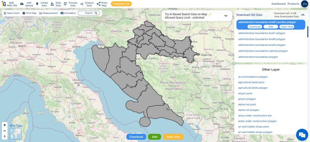
Croatia is divided into 21 counties, each contributing to efficient governance and regional development. The capital city of Zagreb holds special status as both a city and a separate administrative entity, adding to Croatia’s unique administrative structure.

Croatia Counties Boundary

Download Croatia county Boundary Shapefile

This shapefile covers following counties of croatia listed below:

  1. Bjelovar-Bilogora County
  2. Brod-Posavina County
  3. Dubrovnik-Neretva County
  4. Istria County
  5. Karlovac County
  6. Koprivnica-Križevci County
  7. Krapina-Zagorje County
  8. Lika-Senj County
  9. Međimurje County
  10. Osijek-Baranja County
  11. Požega-Slavonia County
  12. Primorje-Gorski Kotar County
  13. Šibenik-Knin County
  14. Sisak-Moslavina County
  15. Split-Dalmatia County
  16. Varaždin County
  17. Virovitica-Podravina County
  18. Vukovar-Srijem County
  19. Zadar County
  20. Zagreb County
  21. City of Zagreb (the capital)

Download Croatia National, County and Municipalities Shapefile Data

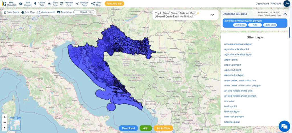
Croatia is divided into 20 counties (županije), and its capital city, Zagreb, holds a special status as both a city and a separate administrative entity. Within each county, there are municipalities (općine) and cities (gradovi) that serve as the lowest level of administrative units. These municipalities and cities are responsible for providing essential public services and meeting the local needs and interests of their residents. This layer contain national boundary of Croatia, county and municipality shapefile gis data. Furthermore, you can download it any format i.e. csv, geojson, kml or many more.

Croatia National, County and Municipalities Boundary

Download Croatia National, County, Municipality Boundary Shapefile

Other Administrative Boundary Data:

Above all links are provided for GIS data of Croatia if you are looking for any specific data please write us on support@igismap.com

Download Shapefile for the following:

  1. World Countries Shapefile
  2. Australia
  3. Argentina
  4. Austria
  5. Belgium
  6. Brazil
  7. Canada
  8. Denmark
  9. Fiji
  10. Finland
  11. Germany
  12. Greece
  13. India
  14. Indonesia
  15. Ireland
  16. Italy
  17. Japan
  18. Kenya
  19. Lebanon
  20. Madagascar
  21. Malaysia
  22. Mexico
  23. Mongolia
  24. Netherlands
  25. New Zealand
  26. Nigeria
  27. Papua New Guinea
  28. Philippines
  29. Poland
  30. Russia
  31. Singapore
  32. South Africa
  33. South Korea
  34. Spain
  35. Switzerland
  36. Tunisia
  37. United Kingdom Shapefile
  38. United States of America
  39. Vietnam
  40. Croatia
  41. Chile
  42. Norway
  43. Maldives
  44. Bhutan
  45. Colombia
  46. Libya
  47. Comoros
  48. Hungary
  49. Libya
  50. Laos
  51. Estonia
  52. Iraq
  53. Portugal
  54. Azerbaijan
  55. Macedonia
  56. Romania
  57. Peru
  58. Marshall Islands
  59. Slovenia
  60. Nauru
  61. Guatemala
  62. El Salvador
  63. Afghanistan
  64. Cyprus
  65. Syria

Disclaimer : If you find any GIS data of country provided is incorrect do contact us or comment below, so that we will correct the same in our system as well we will try to correct the same in OpenStreetMap.