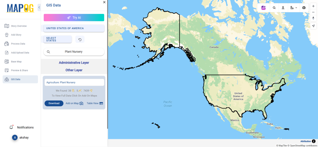
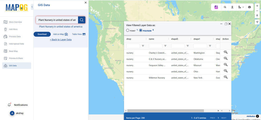
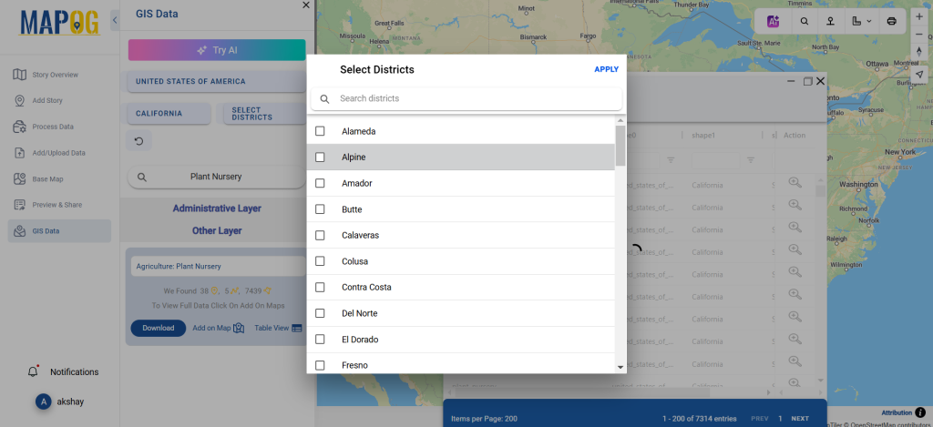
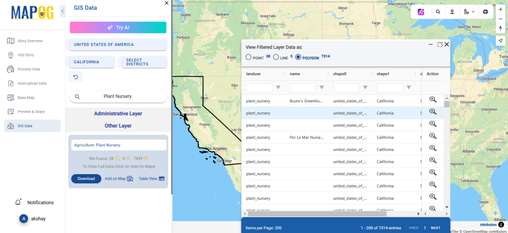
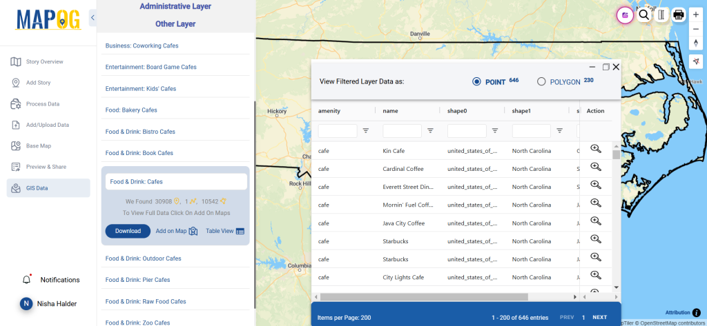
KMZ to CSV using MAPOG, you can transform gis data, making it easier to analyze, share, and integrate into various GIS applications.
In this guide, we’ll walk you through how to efficiently convert your KMZ files to CSV using the powerful Converter Tool in MAPOG Map Analysis. Whether you’re a beginner or an experienced user, Converting KMZ to CSV with MAPOG, this tutorial will help you understand the process in easy steps.
Key Concept of Converting files
The Converter Tool is a feature in MAPOG Map Analysis that helps you change your data from one format to another. It’s like magic! You give it your data in one form, and it transforms it into another form that you need for your analysis. Additionally, with GIS Data, you can download data in any format, making it versatile and adaptable for various applications.
Online KMZ to CSV GIS Converter
Now, let’s walk through the simple steps of using the Converter Tool to Converting KMZ to CSV with MAPOG.
Step 1: Upload the Data
1. Click on the “Process Data” menu and choose the “Converter Tool” option.
2.Upload your KMZ file. This is your starting point where you provide the data that needs conversion.
Step 2: Select the Format for Conversion
1.Choose the output file format as CSV. The tool offers various formats, but for this guide, we are focusing on converting to CSV.
2.You can also set the CRS at this stage.
Step 3: Run the Conversion
Click ‘Convert’ and let the tool work its magic. The Converter Tool processes your data, transforming it from KMZ to CSV format.
Step 4: Review and Download
Finally, review your converted CSV data to ensure it looks right. Once satisfied, download the converted file. This step is crucial to verify that the conversion has been successful and the data integrity is maintained.
And there you have it! You’ve successfully used the Converter Tool in MAPOG Map Analysis to convert your KMZ files to CSV. Now you can easily convert your data for all your analysis needs. This feature simplifies the process of handling different data formats, making your workflow more efficient and effective.
GIS Data by MAPOG is a user-friendly platform that provides access to diverse GIS Data formats like Shapefile, KML, and GeoJSON. It allows users to download nature reserve data efficiently, including administrative and geographic details for precise mapping and analysis. This feature supports users in exploring and preserving nature reserves globally.
How It Works
MAPOG simplifies the process of downloading nature reserve data by providing step-by-step guidance. It offers over 200 countries’ datasets and 900+ layers in multiple formats, making it adaptable to various GIS tools and workflows.
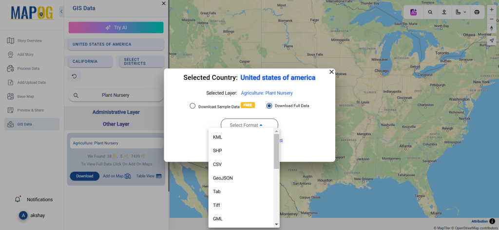
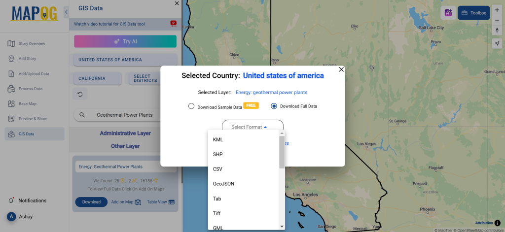
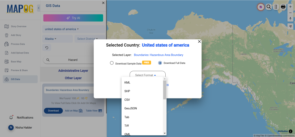
The platform supports a wide array of formats, such as KML, SHP, CSV, GeoJSON, Tab, SQL, Tiff, GML, and MID. This ensures compatibility with different applications and enhances accessibility for GIS users.
All data is provided in GCS datum EPSG:4326 WGS84 CRS (Coordinate Reference System).
Users need to log in to access and download their preferred data formats.
Step-by-Step Guide to Download Nature Reserve Data
Step 1: Locate Nature Reserve Data
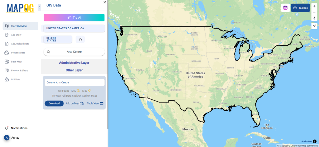
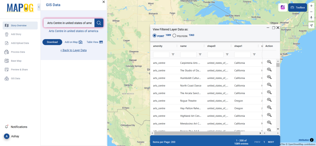
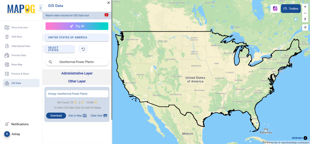
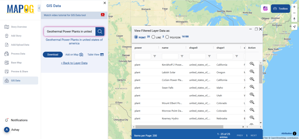
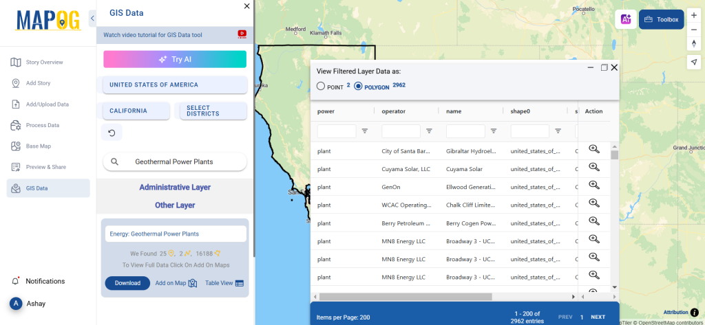
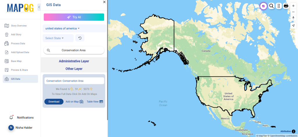
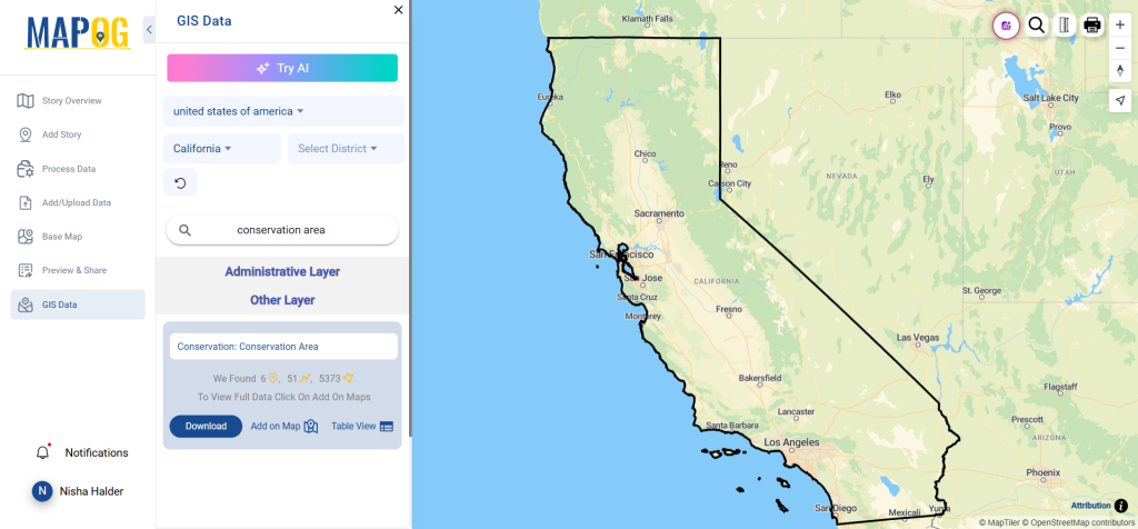
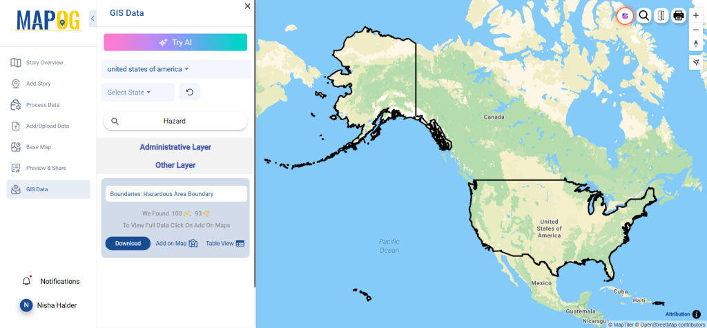
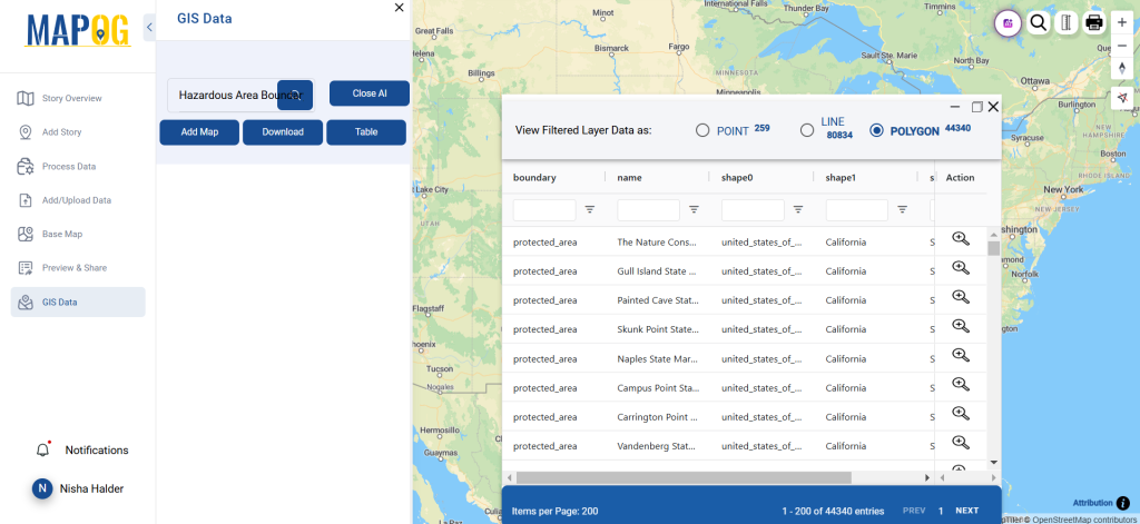
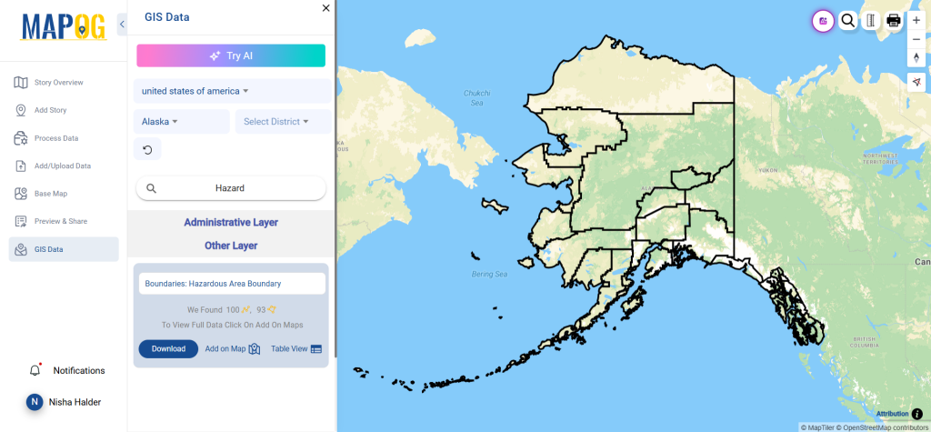
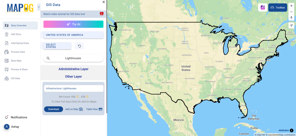
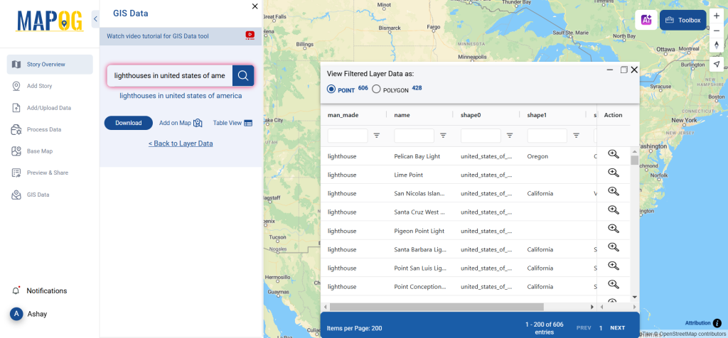
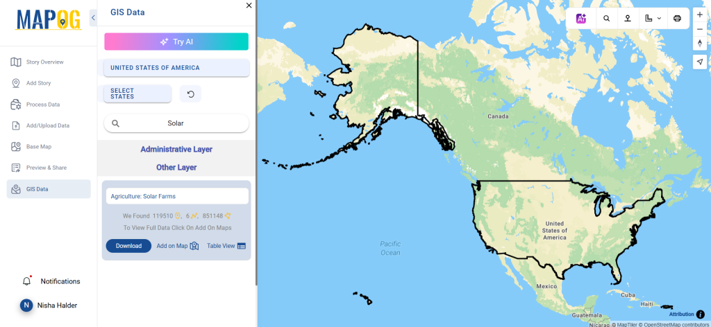
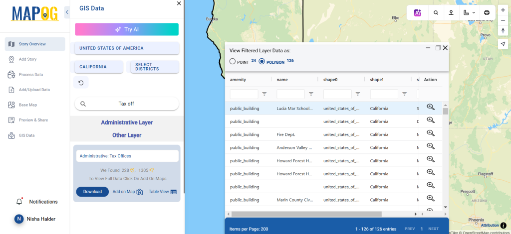
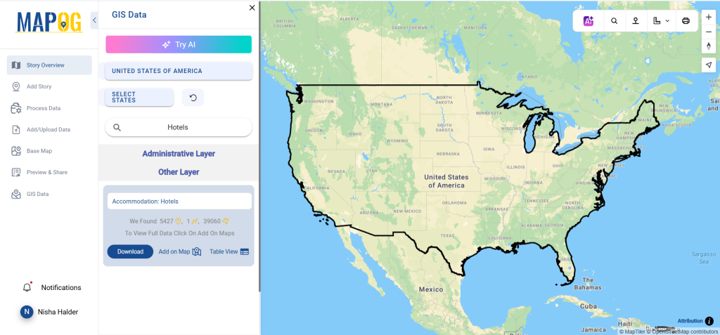
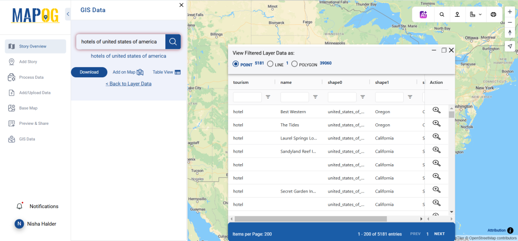
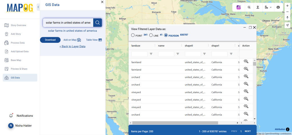
Log in and access the GIS Data interface. Select your desired country. Use the search bar to find “Nature Reserve Data.” Review attributes like point or polygon format to ensure the dataset fits your needs.
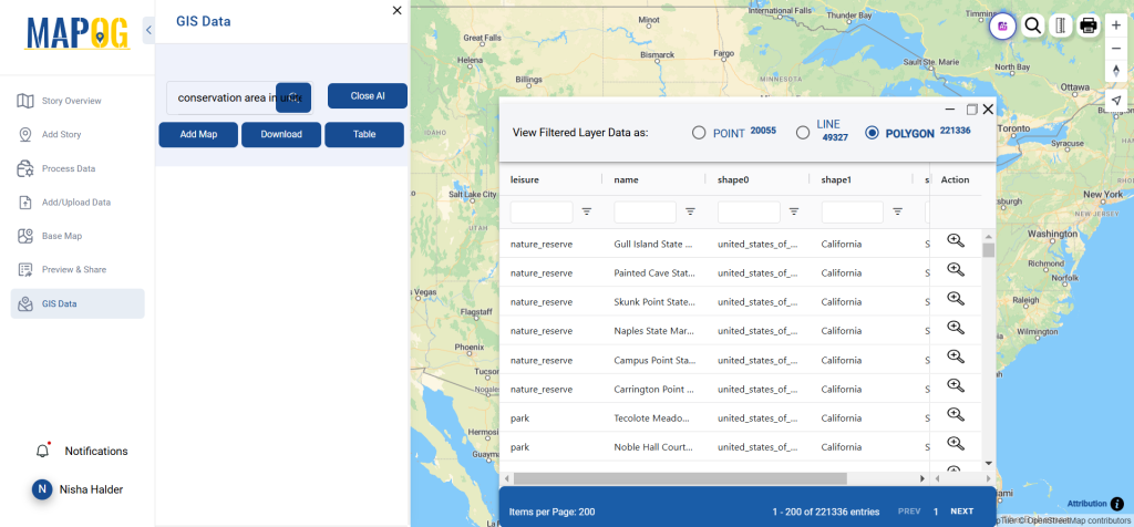
Use the “Try AI” tool for a smarter search. Input the specific data and location you’re looking for, and let AI provide instant results.
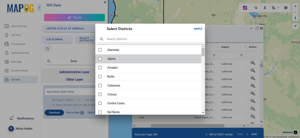
Step 3: Refine Search with Filters
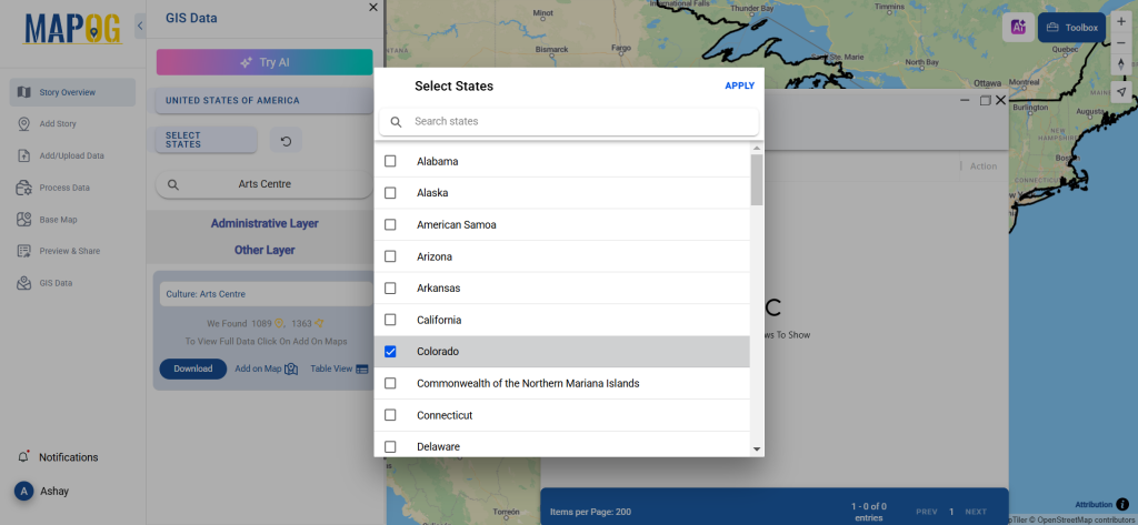
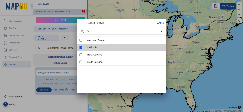
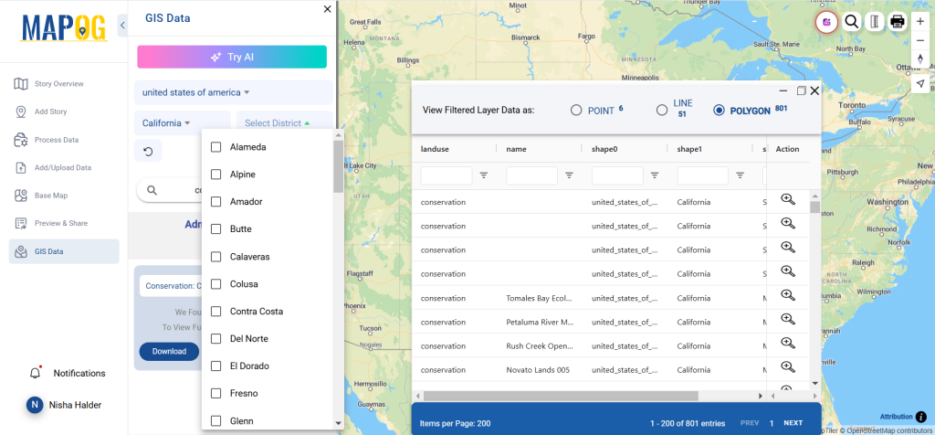
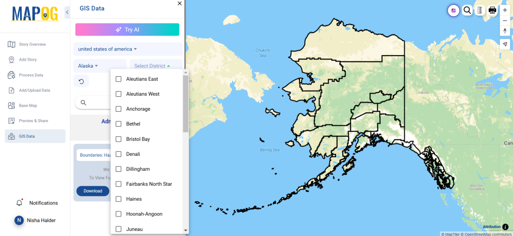
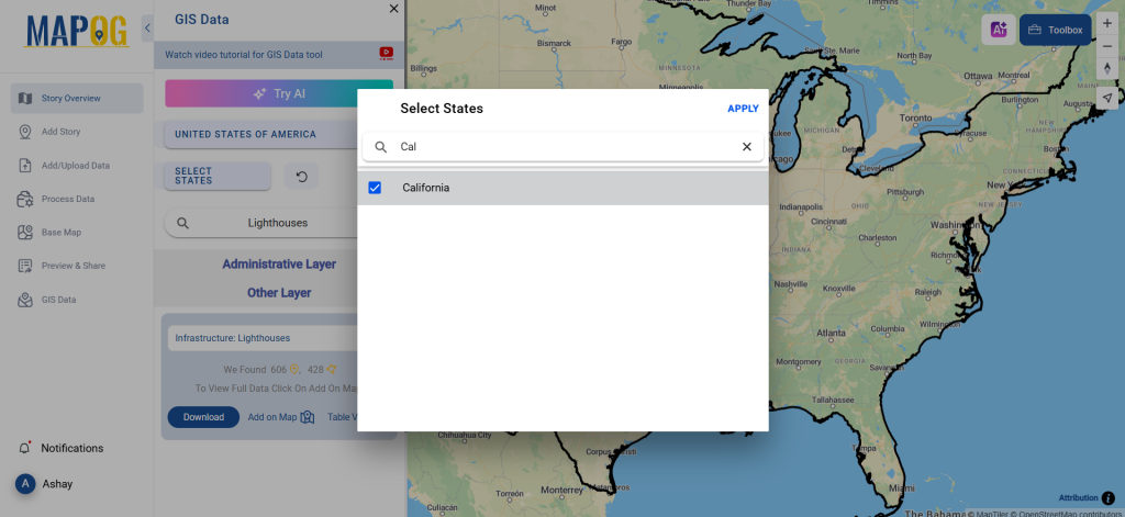
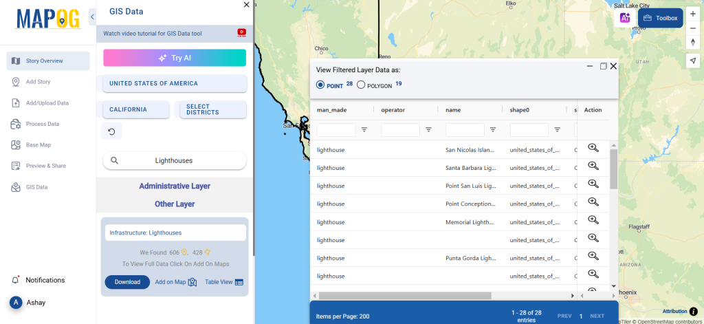
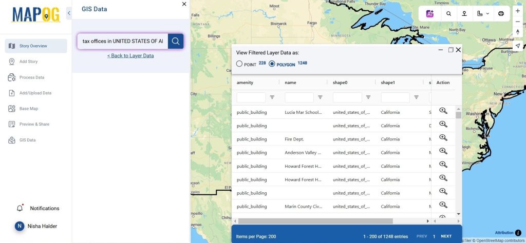
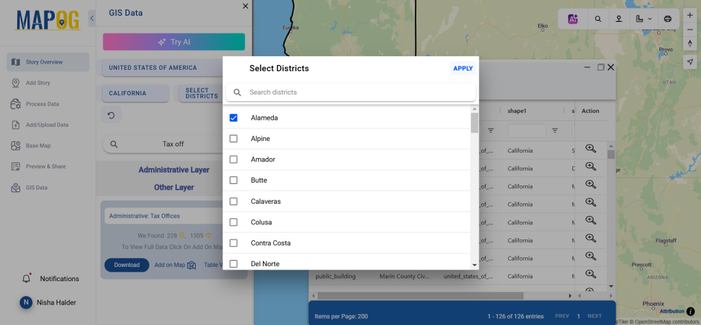
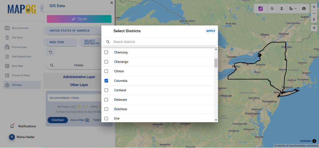
Apply filters to narrow down data by state or district. This feature makes it easy to pinpoint exact locations and ensures precision for your analysis or mapping projects.
Step 4: Add Data to Map
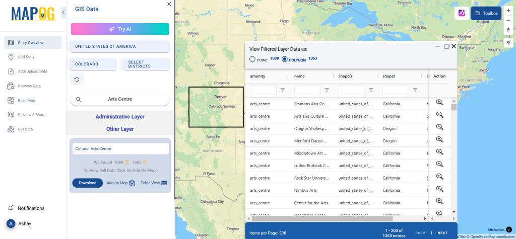
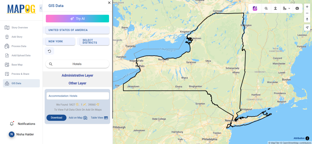
Use the “Add on Map” option to overlay selected data onto a Map analysis. You can either start a new map or enhance an existing one. This feature enables in-depth analysis of spatial patterns and relationships.
Step 5: Download Data
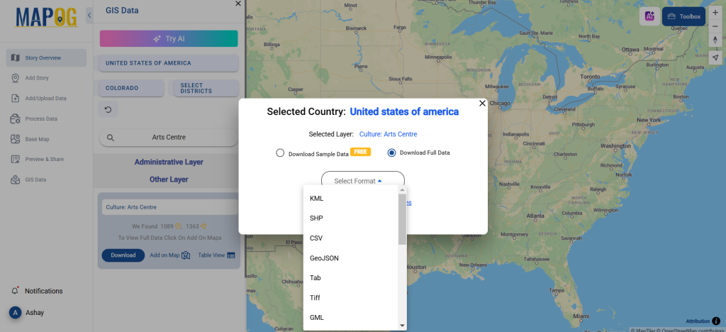
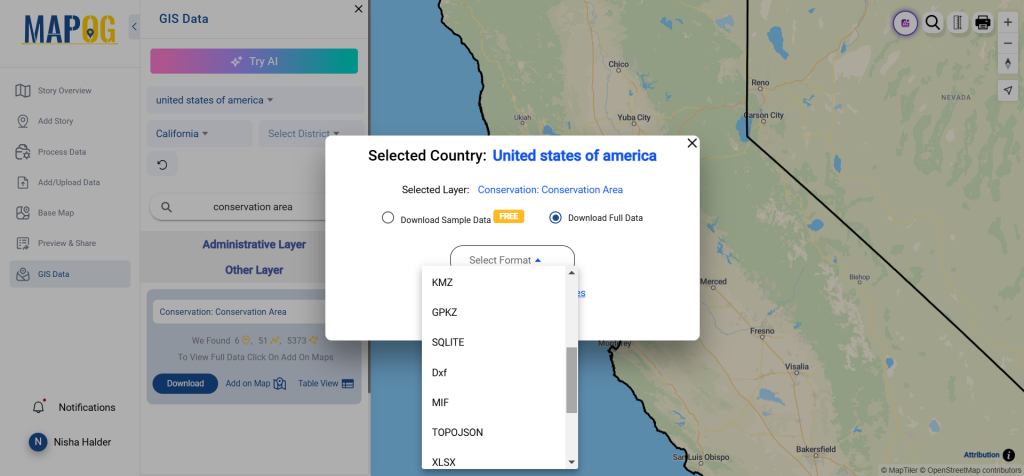
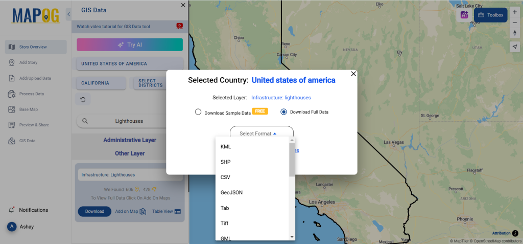
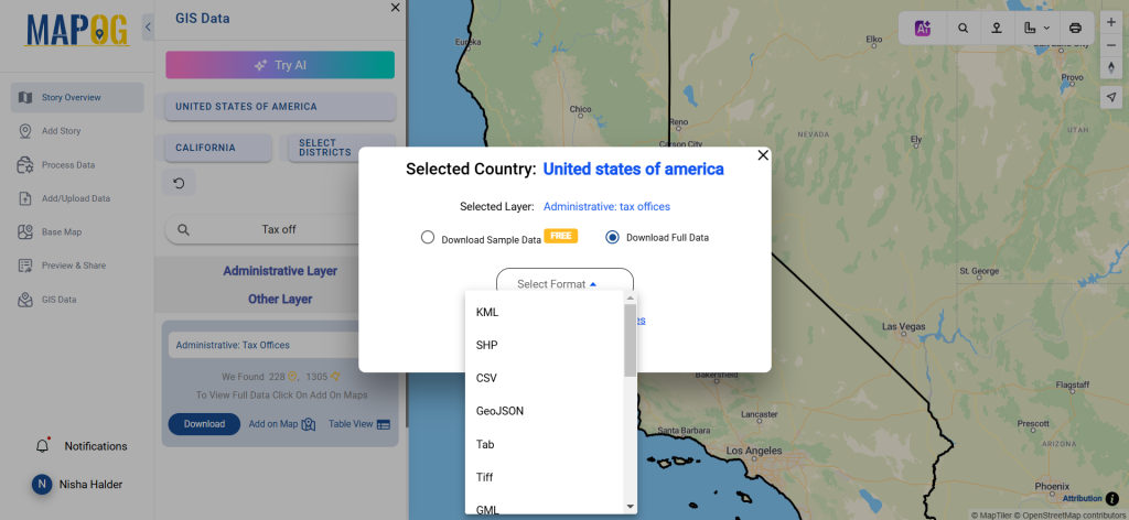
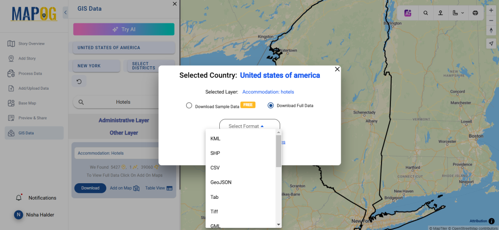
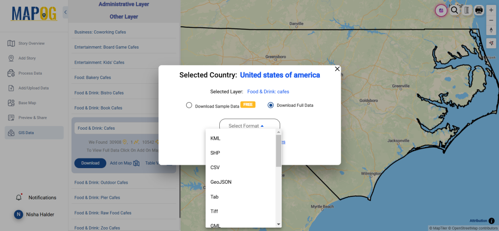
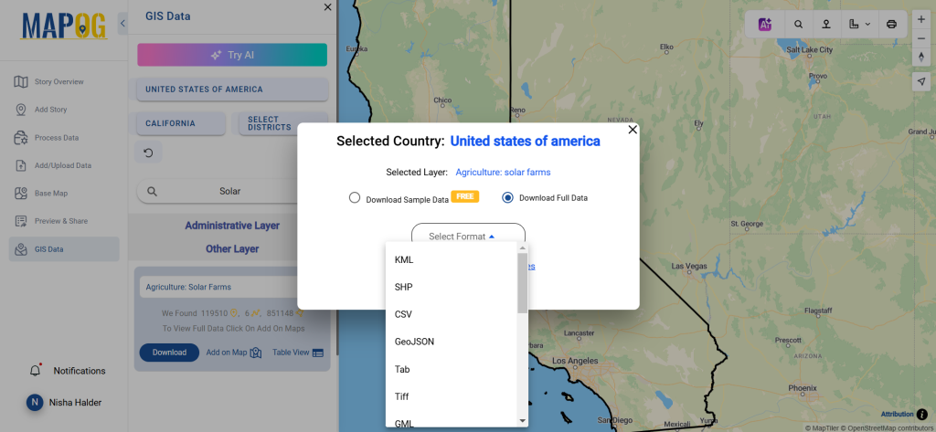
Click the “Download Data” button. Choose between sample data or the full dataset. Select your desired format, such as Shapefile, KML, or MID. Agree to the terms, confirm the download, and the data is yours.
Conclusion
Downloading nature reserve data using GIS Data by MAPOG is quick and straightforward. The platform provides detailed and accurate datasets in 15+ formats for tasks like conservation planning, environmental studies, or resource management. It’s a must-have tool for anyone working with GIS.
Disclaimer : The GIS data provided for download in this article was initially sourced from OpenStreetMap (OSM) and further modified to enhance its usability. Please note that the original data is licensed under the Open Database License (ODbL) by the OpenStreetMap contributors. While modifications have been made to improve the data, any use, redistribution, or modification of this data must comply with the ODbL license terms. For more information on the ODbL, please visit OpenStreetMap’s License Page.
GIS Data by MAPOG is an easy-to-use platform that provides access to a variety of GIS Data formats, including Shapefile, KML, and GeoJSON. Users may download rescue shelter data with ease because to its user-friendly interface, which makes it possible to map and analyse shelter sites globally in great detail. The platform streamlines the process of obtaining precise data, whether for resource allocation or emergency preparation.
How It Works
By offering detailed instructions, MAPOG simplifies the download of rescue shelter data. For smooth interaction with GIS tools, users can examine shelter data in multiple formats, including KML, SHP, MID, and more, with access to more than 200 nations and 900+ layers.
All data is provided in GCS datum EPSG:4326 WGS84 CRS (Coordinate Reference System).
Users need to log in to access and download their preferred data formats.
Step-by-Step Guide to Download Rescue Shelters Data
Step 1: Search for Rescue Shelters Data
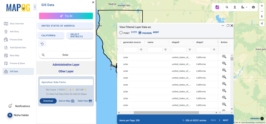
To locate information about “rescue shelters“, use the search function. After choosing your preferred nation, examine data features such as polygons or points.
The “Try AI” feature simplifies searches. Enter the type of data you need and the location. The AI tool will fetch relevant results instantly.
Step 3: Refine with Filters
Use the filter option to narrow results by state or district. This ensures precision by focusing on specific regions, enhancing relevance for your project.
Step 4: Add Data to Map
Overlay the selected data onto the map using the “Add on Map” option. Add layers to a map for better visualization and analysis.
Step 5: Download the Data
Click “Download Data” and select either sample or full data. Choose from formats like Shapefile, KML, or any of the 15+ options. Agree to terms and conditions and complete the download.
Conclusion
Downloading rescue shelter data is quick and simple with GIS Data from MAPOG. Strategic planning and emergency response are only two of the many uses for its many formats and user-friendly features. With just a few simple steps, you may obtain precise shelter data and easily streamline your GIS applications.
Disclaimer : The GIS data provided for download in this article was initially sourced from OpenStreetMap (OSM) and further modified to enhance its usability. Please note that the original data is licensed under the Open Database License (ODbL) by the OpenStreetMap contributors. While modifications have been made to improve the data, any use, redistribution, or modification of this data must comply with the ODbL license terms. For more information on the ODbL, please visit OpenStreetMap’s License Page.
GIS Data by MAPOG is an easy-to-use platform that provides smooth access to a variety of GIS Data formats, including Shapefile, KML, and GeoJSON. Users can receive precise administrative and geographic datasets for mapping and analysis thanks to its simplified download method for ATM data. With more than 900 layers and more than 200 nations, MAPOG guarantees accessibility and thorough coverage for a wide range of GIS applications.
Understanding ATM Data
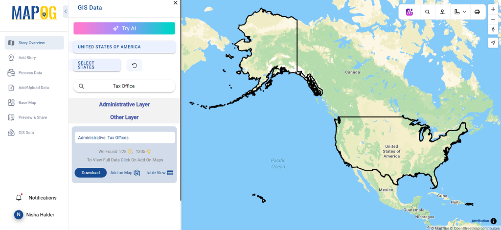
ATM data provides precise locations of ATMs worldwide. This data is crucial for banking analysis, customer access studies, and urban planning. Users can leverage it to visualize and analyze ATM distribution patterns and accessibility.
All data is provided in GCS datum EPSG:4326 WGS84 CRS (Coordinate Reference System).
Users need to log in to access and download their preferred data formats.
Step-by-Step Guide to Download ATM Data
Step 1: Locate Your Data
After logging into MAPOG, open the GIS Data interface. Use the search tool to find the “ATM Data” layer. Explore its attributes, format (point or polygon), and coverage.
Simplify your search with the “Try AI” feature. Enter your query, such as “ATM locations in urban areas,” and let the AI fetch the results.
Step 3: Apply Filters
Refine your results by selecting specific states or districts. This helps narrow down data to precise locations for targeted analysis.
Step 4: Visualize on Map
The “Add on Map” feature lets you integrate the selected ATM data into a new or existing map. This visualization supports better spatial analysis and planning.
5. Download Your Data
Click “Download Data” and choose between sample or full datasets. Select your desired format—Shapefile, KML, GeoJSON, or others. Agree to the terms, then download your file for immediate use.
Conclusion
Downloading ATM data is quick and easy with GIS Data by MAPOG. Its variety of formats guarantees compatibility with GIS tools, supporting a range of applications such as financial planning, urban development, and network optimization. For professionals that require accurate and easily available GIS data, this robust platform is indispensable.
Disclaimer : The GIS data provided for download in this article was initially sourced from OpenStreetMap (OSM) and further modified to enhance its usability. Please note that the original data is licensed under the Open Database License (ODbL) by the OpenStreetMap contributors. While modifications have been made to improve the data, any use, redistribution, or modification of this data must comply with the ODbL license terms. For more information on the ODbL, please visit OpenStreetMap’s License Page.
GIS Data by MAPOG is a user-friendly platform that makes it easier to retrieve GIS Data in Shapefile, KML, and GeoJSON formats. In addition to providing administrative and geographic datasets for in-depth mapping and analysis of structures globally, it makes it simple for users to download building data. It guarantees compatibility with a wide range of GIS applications by supporting over 15 formats.
How It Works
GIS Data by MAPOG streamlines the process of downloading building data. Covering over 200 countries and 900+ layers, it provides a variety of formats like Shapefile and KML for different uses. The platform’s intuitive design ensures users can quickly find and download the data they need.
The available formats include KML, SHP, CSV, GeoJSON, Tab, SQL, Tiff, GML, KMZ, GPKZ, SQLITE, Dxf, MIF, TOPOJSON, XLSX, GPX, ODS, MID, and GPS. This ensures compatibility with various applications.
All data is provided in GCS datum EPSG:4326 WGS84 CRS (Coordinate Reference System).
Users need to log in to access and download their preferred data formats.
Step-by-Step Guide to Download Building Data
Step 1: Search for Building Data
Start by logging into the GIS Data interface. Select your desired country, then search for the “Building Data” layer. Review its attributes, such as whether the data is in point or polygon format.
To simplify your search, use the “Try AI” tool. Enter the specific data type and location you need. The tool will provide accurate results, saving time and effort.
Step 3: Apply Filters
Refine your search using the filter feature. Narrow down results by state or district to access more granular building data. This improves accuracy and ensures relevance for analysis.
Step 4: Add Data to Map
Use the “Add on Map” feature to overlay your selected data onto the Map analysis interface. You can add it to a new or existing map for deeper insights into spatial patterns.
Step 5: Download Building Data
Click the “Download Data” button. Choose between sample data or the full dataset. Select your desired format—Shapefile, KML, GeoJSON, or others. After agreeing to the terms, click download, and your file will be ready.
Conclusion
Building data downloads are quick and easy with GIS Data from MAPOG. Users may obtain precise, current geographic data for uses such as architectural research, infrastructure management, and urban planning thanks to its many forms and user-friendly features.
Disclaimer : The GIS data provided for download in this article was initially sourced from OpenStreetMap (OSM) and further modified to enhance its usability. Please note that the original data is licensed under the Open Database License (ODbL) by the OpenStreetMap contributors. While modifications have been made to improve the data, any use, redistribution, or modification of this data must comply with the ODbL license terms. For more information on the ODbL, please visit OpenStreetMap’s License Page.
GIS Data by MAPOG is a user-friendly platform that offers seamless access to GIS Data in formats like Shapefile, KML, and GeoJSON. It simplifies the process of downloading farms data, providing detailed administrative and geographic datasets for accurate mapping and analysis. Users can quickly download farms data in over 15 GIS formats, supporting various applications in agriculture and land management.
GIS Data by MAPOG streamlines the process of obtaining farms data. With access to 200+ countries and 900+ data layers, users can find datasets tailored to their needs. Supported formats include KML, SHP, CSV, GeoJSON, and more, ensuring compatibility with most GIS tools.
All data is provided in GCS datum EPSG:4326 WGS84 CRS (Coordinate Reference System).
Users need to log in to access and download their preferred data formats.
Step-by-Step Guide to Download Farms Data
Step 1: Search for ‘Farms Data’
Once logged in, open the GIS Data interface. Select a country and search for the “Farms” layer. Review data attributes to confirm whether it’s in point or polygon format.
Utilize the “Try AI” feature in the top left corner. Enter your specific data requirements, such as “Farms in [State/District],” and let the AI retrieve precise results quickly.
Step 3: Apply Filters
Refine your search using the filter option. This allows you to narrow down datasets by state or district, ensuring a more focused analysis. It enhances data relevance, especially for large-scale farm mapping.
Step 4: Add Data to Map
The “Add on Map” feature lets users visualize their selected farms data. You can overlay it onto a new or existing map in Map analysis, gaining deeper insights into spatial patterns and relationships.
Step 5: Download Data
Click “Download Data.” Choose between sample or full datasets. Select your preferred format (Shapefile, KML, etc.), agree to the terms, and finalize the download.
Conclusion
With GIS Data by MAPOG, downloading farms data is quick and efficient. The platform provides reliable and up-to-date geographic information, making it a valuable resource for agricultural planning, land-use management, and GIS analysis.
Disclaimer : The GIS data provided for download in this article was initially sourced from OpenStreetMap (OSM) and further modified to enhance its usability. Please note that the original data is licensed under the Open Database License (ODbL) by the OpenStreetMap contributors. While modifications have been made to improve the data, any use, redistribution, or modification of this data must comply with the ODbL license terms. For more information on the ODbL, please visit OpenStreetMap’s License Page.
KMZ to ODS using MAPOG, you can transform gis data, making it easier to analyze, share, and integrate into various GIS applications.
In this guide, we’ll walk you through how to efficiently convert your KMZ files to ODS using the powerful Converter Tool in MAPOG Map Analysis. Whether you’re a beginner or an experienced user, Converting KMZ to ODS with MAPOG, this tutorial will help you understand the process in easy steps.
Key Concept of Converting files
The Converter Tool is a feature in MAPOG Map Analysis that helps you change your data from one format to another. It’s like magic! You give it your data in one form, and it transforms it into another form that you need for your analysis. Additionally, with GIS Data, you can download data in any format, making it versatile and adaptable for various applications.
Now, let’s walk through the simple steps of using the Converter Tool to Converting KMZ to ODS with MAPOG.
Step 1: Upload the Data
1. Click on the “Process Data” menu and choose the “Converter Tool” option.
2.Upload your KMZ file. This is your starting point where you provide the data that needs conversion.
Step 2: Select the Format for Conversion
1.Choose the output file format as ODS. The tool offers various formats, but for this guide, we are focusing on converting to ODS.
2.You can also set the CRS at this stage.
Step 3: Run the Conversion
Click ‘Convert’ and let the tool work its magic. The Converter Tool processes your data, transforming it from KMZ to ODS format.
Step 4: Review and Download
Finally, review your converted ODS data to ensure it looks right. Once satisfied, download the converted file. This step is crucial to verify that the conversion has been successful and the data integrity is maintained.
And there you have it! You’ve successfully used the Converter Tool in MAPOG Map Analysis to convert your KMZ files to ODS. Now you can easily convert your data for all your analysis needs. This feature simplifies the process of handling different data formats, making your workflow more efficient and effective.
In this guide, we’ll walk you through how to efficiently convert your GML files to DXF using the powerful Converter Tool in MAPOG Map Analysis. Whether you’re a beginner or an experienced user, Converting GML to DXF with MAPOG, this tutorial will help you understand the process in easy steps.
Key Concept to Converting files
The Converter Tool is a feature in MAPOG Map Analysis that helps you change your data from one format to another. It’s like magic! You give it your data in one form, and it transforms it into another form that you need for your analysis. Additionally, with GIS Data, you can download data in any format, making it versatile and adaptable for various applications.
Converting GML to DXF
Step 1: Upload the Data
1. Click on the “Process Data” menu and choose the “Converter Tool” option.
2. Upload your GML file. This is your starting point where you provide the data that needs conversion.
Step 2: Select the Format for Conversion
1. Choose the output file format as DXF. The tool offers various formats, but for this guide, we are focusing on converting to DXF.
2.You can also set the CRS at this stage.
Step 3: Run the Conversion
Click ‘Convert’ and let the tool work its magic. The Converter Tool processes your data, transforming it from GML to DXF format.
Step 4: Review and Download
Finally, review your converted DXF data to ensure it looks right. Once satisfied, download the converted file. This step is crucial to verify that the conversion has been successful and the data integrity is maintained.
And there you have it! You’ve successfully used the Converter Tool in MAPOG Map Analysis to convert your GML Files to DXF. Now you can easily convert your data for all your analysis needs. This feature simplifies the process of handling different data formats, making your workflow more efficient and effective.
KMZ to GPKG using MAPOG, you can transform gis data, making it easier to analyze, share, and integrate into various GIS applications.
In this guide, we’ll walk you through how to efficiently convert your KMZ files to GPKG using the powerful Converter Tool in MAPOG Map Analysis. Whether you’re a beginner or an experienced user, Converting KMZ to GPKG with MAPOG, this tutorial will help you understand the process in easy steps.
Key Concept of Converting files
The Converter Tool is a feature in MAPOG Map Analysis that helps you change your data from one format to another. It’s like magic! You give it your data in one form, and it transforms it into another form that you need for your analysis. Additionally, with GIS Data, you can download data in any format, making it versatile and adaptable for various applications.
Online KMZ to GPKG GIS Converter
Now, let’s walk through the simple steps of using the Converter Tool to Converting KMZ to GPKG with MAPOG.
Step 1: Upload the Data
1. Click on the “Process Data” menu and choose the “Converter Tool” option.
2.Upload your KMZ file. This is your starting point where you provide the data that needs conversion.
Step 2: Select the Format for Conversion
1.Choose the output file format as GPKG. The tool offers various formats, but for this guide, we are focusing on converting to GPKG.
2.You can also set the CRS at this stage.
Step 3: Run the Conversion
Click ‘Convert’ and let the tool work its magic. The Converter Tool processes your data, transforming it from KMZ to GPKG format.
Step 4: Review and Download
Finally, review your converted GPKG data to ensure it looks right. Once satisfied, download the converted file. This step is crucial to verify that the conversion has been successful and the data integrity is maintained.
And there you have it! You’ve successfully used the Converter Tool in MAPOG Map Analysis to convert your KMZ files to GPKG. Now you can easily convert your data for all your analysis needs. This feature simplifies the process of handling different data formats, making your workflow more efficient and effective.
In this guide, we’ll walk you through how to efficiently convert your KMZ files to GPX using the powerful Converter Tool in MAPOG Map Analysis. Whether you’re a beginner or an experienced user, Converting KMZ to GPX with MAPOG, this tutorial will help you understand the process in easy steps.
Key Concept of Converting files
The Converter Tool is a feature in MAPOG Map Analysis that helps you change your data from one format to another. It’s like magic! You give it your data in one form, and it transforms it into another form that you need for your analysis. Additionally, with GIS Data, you can download data in any format, making it versatile and adaptable for various applications.
Online KMZ to GPX GIS Converter
Now, let’s walk through the simple steps of using the Converter Tool to Converting KMZ to GPX with MAPOG.
Step 1: Upload the Data
1. Click on the “Process Data” menu and choose the “Converter Tool” option.
2.Upload your KMZ file. This is your starting point where you provide the data that needs conversion.
Step 2: Select the Format for Conversion
1.Choose the output file format as GPX. The tool offers various formats, but for this guide, we are focusing on converting to GPX.
2.You can also set the CRS at this stage.
Step 3: Run the Conversion
Click ‘Convert’ and let the tool work its magic. The Converter Tool processes your data, transforming it from KMZ to GPX format.
Step 4: Review and Download
Finally, review your converted GPX data to ensure it looks right. Once satisfied, download the converted file. This step is crucial to verify that the conversion has been successful and the data integrity is maintained.
And there you have it! You’ve successfully used the Converter Tool in MAPOG Map Analysis to convert your KMZ files to GPX. Now you can easily convert your data for all your analysis needs. This feature simplifies the process of handling different data formats, making your workflow more efficient and effective.
We use cookies to ensure that we give you the best experience on our website. If you continue to use this site we will assume that you are happy with it.Ok