Unleash the power of GIS mapping in the Solomon Islands with MAPOG! Delve into a comprehensive collection of GIS data, including administrative boundaries encompassing the nation’s many islands and atolls. Effortlessly explore Solomon Islands’ unique geography with MAPOG. Discover a wealth of datasets featuring boundaries, rivers, and even transportation infrastructure like airports. MAPOG’s user-friendly tools empower you to download GIS data in various formats, including Shapefile, KML, GeoJSON, and CSV. Dive into the fascinating world of Solomon Islands GIS data with confidence – choose MAPOG!
With MAPOG’s versatile toolkit, you can effortlessly upload vector, add WMS (Web Map Service) layers, upload Excel or CSV data, incorporate existing files, perform polygon splitting and merging, generate new polygon and polyline data, use the converter for various formats, conduct buffer analysis, create grids, transform points into polygons, calculate isochrones, and utilize the geocoder for precise location information.
Note:
- All data available are in GCS datum EPSG:4326 WGS84 CRS (Coordinate Reference System).
- You need to login for downloading the shapefile.
Download Shapefile Data of Solomon Islands
The Solomon Islands, an island nation in Melanesia (part of Oceania), consists of over 900 islands northeast of Australia. Neighboring countries include Papua New Guinea to the west, Fiji to the east, and Vanuatu to the southeast. With Honiara as its capital on the largest island, Guadalcanal, the country boasts a population of over 734,000 and a total area of roughly 28,896 square kilometers. Interestingly, the Solomon Islands archipelago extends beyond the nation’s borders, also encompassing the Autonomous Region of Bougainville (part of Papua New Guinea) but excluding the Santa Cruz Islands.
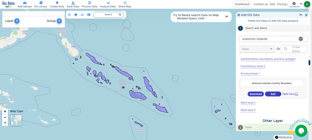
Download Solomon Islands National Boundary Shapefile
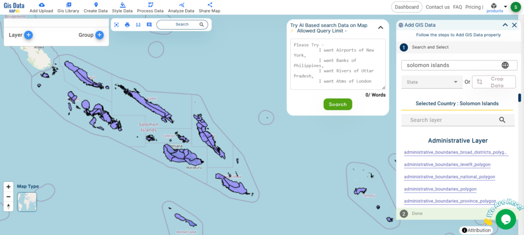
After successfully logging in with a legitimate email address, select the country you want to work with. Next, choose the specific layer you need and click on the download option. Once that’s done, pick the desired format to acquire the essential GIS data. Before proceeding with the data download, make sure to review the data table for any relevant information.
Download Solomon Islands Provinces Shapefile Data
Solomon Islands is divided into nine provinces. The national capital, Honiara, on the island of Guadalcanal, is separately governed as the country’s Capital Territory.
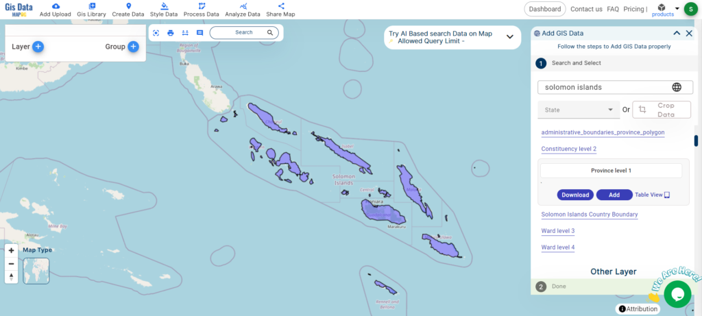
Download Solomon Islands Provinces Shapefile
The Solomon Islands is divided into nine provinces:
- Central Province
- Choiseul Province
- Guadalcanal Province
- Isabel Province
- Makira and Ulawa Province
- Malaita Province
- Rennell and Bellona Province
- Temotu Province
- Western Province
Download Solomon Islands Constituencies Shapefile Data
The Solomon Islands are divided into 50 constituencies for electing representatives to the National Parliament.
Download Solomon Islands Constituencies Shapefile
Other GIS Data:
- Download Solomon Islands Airport Point Shapefile
- Download Solomon Islands Highway Lines Shapefile
- Download Solomon Islands Road Lines Shapefile
- Download Solomon Islands Rivers Shapefile
Above all links are provided for GIS data of Solomon Islands if you are looking for any specific data please write us on support@mapog.com
Download Shapefile for the following:
- World Countries Shapefile
- Australia
- Argentina
- Austria
- Belgium
- Brazil
- Canada
- Denmark
- Fiji
- Finland
- Germany
- Greece
- India
- Indonesia
- Ireland
- Italy
- Japan
- Kenya
- Lebanon
- Madagascar
- Malaysia
- Mexico
- Mongolia
- Netherlands
- New Zealand
- Nigeria
- Papua New Guinea
- Philippines
- Poland
- Russia
- Singapore
- South Africa
- South Korea
- Spain
- Switzerland
- Tunisia
- United Kingdom Shapefile
- United States of America
- Vietnam
- Croatia
- Chile
- Norway
- Maldives
- Bhutan
- Colombia
- Libya
- Comoros
- Hungary
- Laos
- Estonia
- Iraq
- Portugal
- Azerbaijan
- Macedonia
- Romania
- Peru
- Marshall Islands
- Slovenia
- Nauru
- Guatemala
- El Salvador
- Afghanistan
- Cyprus
- Syria
- Slovakia
- Luxembourg
- Jordan
- Armenia
- Haiti And Dominican Republic
Disclaimer : If you find any shapefile data of country provided is incorrect do contact us or comment below, so that we will correct the same in our system as well we will try to correct the same in openstreetmap.