MAPOG offers a powerful tool to help you locate and download bank data. This information can be invaluable for creating maps, planning financial analyses, and exploring various banking locations. In this guide, we’ll walk you through the process of downloading bank data using MAPOG in multiple formats.
GIS Data is a specialized type of information that lets you visualize and analyze geographic locations on a map. With MAPOG, you can access GIS data that includes details about bank branches and their locations.
Download Bank GIS Data of any countries
Note:
- All data provided by MAPOG are in GCS datum EPSG:4326 WGS84 CRS (Coordinate Reference System).
- Access to shapefile downloads requires logging in to the platform.
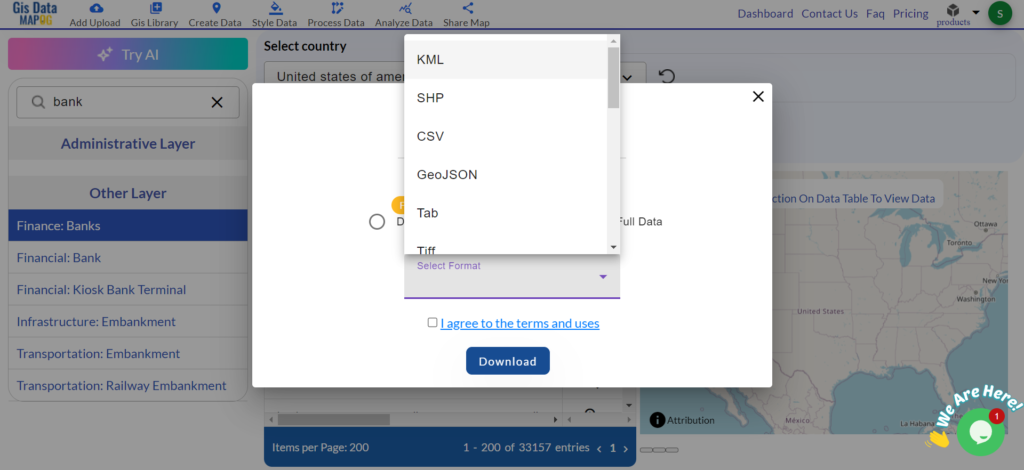
Bank data is crucial for several reasons. It helps individuals find nearby banking services and assists businesses in analyzing financial service distribution. With MAPOG GIS Data, you can download information about banks in multiple file formats, including KML, SHP, CSV, GeoJSON, Tab, SQL, Tiff, GML, KMZ, GPKZ, SQLITE, DXF, MIF, TOPOJSON, XLSX, GPX, ODS, MID, and GPS. This versatility allows you to use the data with various software and devices for diverse projects or analyses.
Step-by-step Process to Download Bank Data
Step 1: Open GIS Data
Log in to MAPOG using your email credentials. After logging in, navigate to the GIS Data tool. You can easily find this in the top navigation menu. Look for the bank GIS data category or use the search function. For example, you can search specifically for the bank networks of countries like USA, UK, Germany, and Egypt.
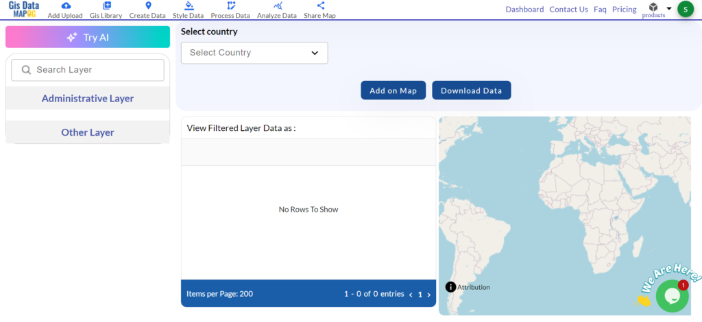
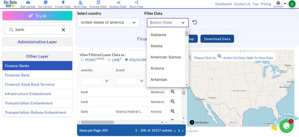
Step 2: Select the Country and Search for ‘Bank Data’
Start by selecting the country you’re interested in. Navigate through the available options and choose the specific country where you need hotel data. After selecting the country, search for the ‘Bank Data’ layer that contains the relevant information.
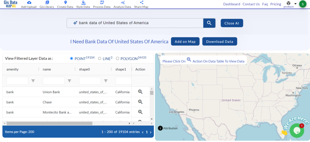
If you’re unsure which country or layer to choose, use the “Try AI” feature and It gives smart suggestions based on your needs and help you find the right data easily.
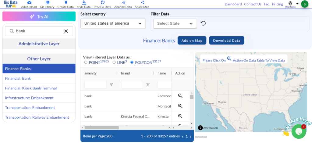
Step 3: Filter the Data
Apply the available filters to refine your search. You can select specific areas, types of banking institutions or other criteria to get the exact data you need.
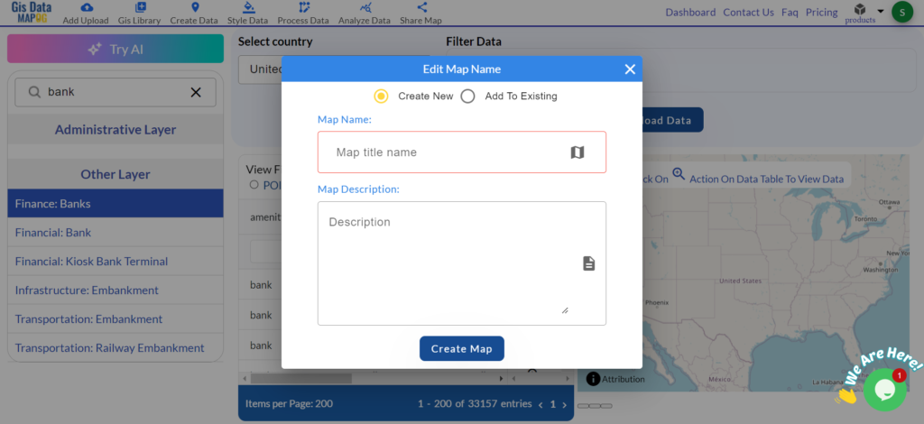
Step 4: Add to Map
After filtering the data, add it to your map and This step will show the locations of bank branches on your map, making it easier to visualize their placement.
Step 5: Download the Data
After reviewing the map, click the download button to download bank data. You can select from various file formats depending on your project needs.
Bank data consists of both point and polygon features because point data shows the exact location of each bank branch, while polygon data illustrates the boundaries or areas around banking facilities. These features provide a detailed view of bank locations and their surroundings and beneficial for creating comprehensive maps and conducting thorough analyses.
Discover the MAPOG’s Map Analysis tool, allowing you to effortlessly, Upload vector and raster files, Add WMS (Web Map Service) layers, Import Excel or CSV data, Merge and split polygons, Create new polygon and polyline data, Convert between various formats, Perform buffer analysis, Generate grids, Transform points to polygons, Calculate isochrones and support the geocoder for accurate location data.
For more information or assistance with downloading hotel data, please contact us at support@mapog.com.
Disclaimer:
The GIS data provided for download in this article was initially sourced from OpenStreetMap (OSM) and However, it has been further modified to enhance its usability. It’s important to note that the original data is licensed under the Open Database License (ODbL) by OpenStreetMap contributors. Although modifications have been made to improve the data, any use, redistribution, or further modification must still comply with the terms of the ODbL license. For additional details, please visit OpenStreetMap’s License Page.