In this guide, we’ll walk you through the simple steps to convert GPS files into the MIF format using the MAPOG‘s Converter Tool. Whether you’re new to this or have experience, this guide breaks down the process into straightforward steps, making it easy for anyone to follow.
Understanding File Conversion
The Converter Tool in MAPOG Map Analysis is a powerful feature that allows you to transform data from one format to another seamlessly. It’s as if you input data in one form, and it magically outputs it in another that suits your analysis needs. The beauty of GIS Data lies in its flexibility—once downloaded, it can be adapted for various uses.
Online GPS to MIF GIS Converter
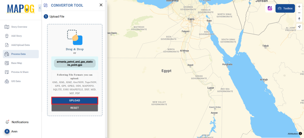
Step 1: Upload Your Data
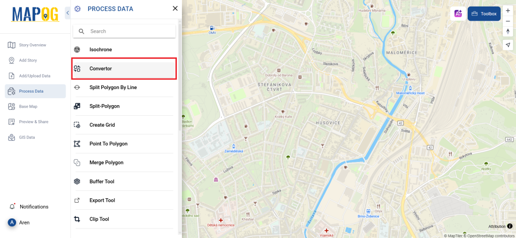
Begin by selecting your data through “Process Data” and navigating to the “Converter Tool.”
Here, you’ll upload your GPS file, which serves as the foundation for the conversion process.
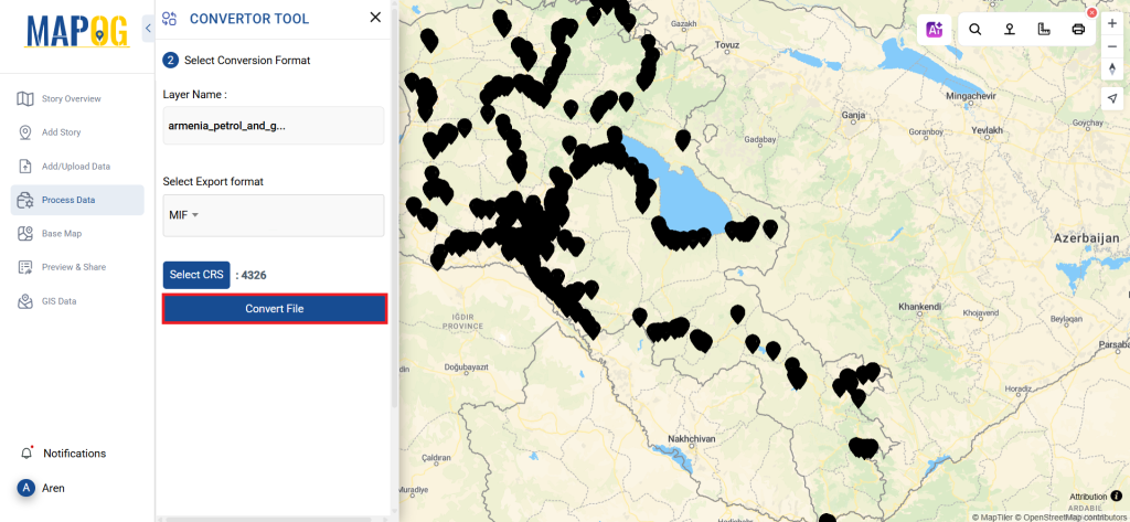
Step 2: Choose the Conversion Format
Next, select MIF as your output format. The tool offers multiple options, but for this guide, we’re focusing on converting your file to MIF.
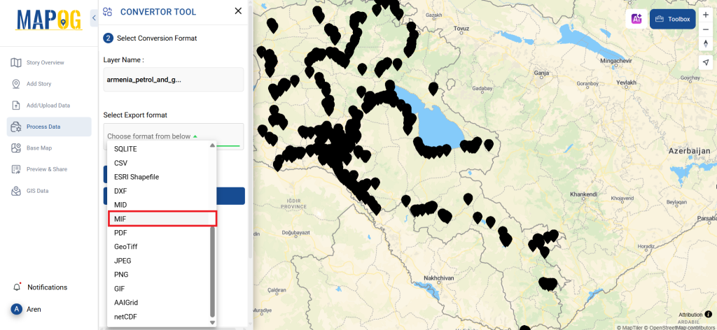
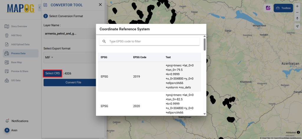
During this step, you can also adjust the CRS (Coordinate Reference System) to ensure that your data aligns precisely with your spatial analysis requirements.
Step 3: Execute the Conversion
Now, proceed to ‘Convert Files’ and let the tool work its magic. The Converter Tool will transform your GPS data into the MIF format, preparing it for your next analysis task.
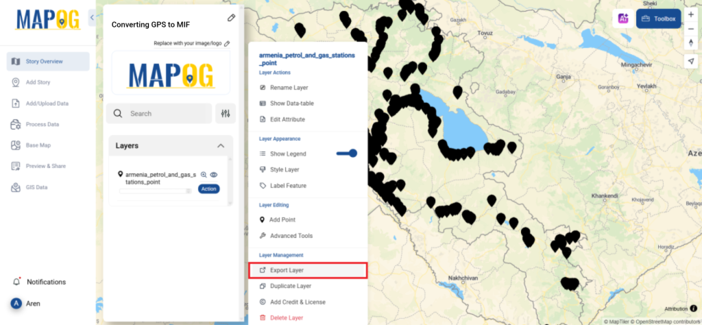
Step 4: Review and Download
After the conversion, take a moment to review your MIF file. This step is crucial to ensure everything has been converted correctly and that all your data remains intact. Once satisfied, download your converted file.
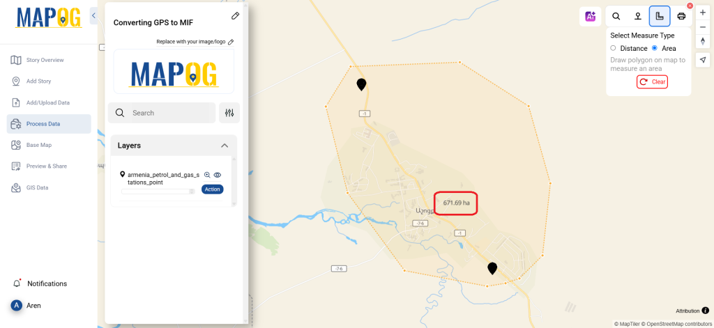
Step 5: Measure Area
You can easily measure the area by using the measurement tools available. To begin, in the upper right corner, you’ll find the toolbox. It offers two options for measuring distances and areas. Simply select the second option, and then draw area you wish to measure. As a result, the area will be displayed in the map interface.
With that, you’ve successfully used the Converter Tool in MAPOG to convert GPS files into MIF. This feature streamlines the process of handling various data formats, making your work both smoother and more efficient. Now, you’re ready to dive into your next analysis with your newly transformed data.
MAPOG has a lot of feature tool. These feature tools allow us to perform a variety of tasks. For example, you can create buffer zones using Buffer Tool, style your numeric data with the quantity style tool, create isochrones on your map using Isochrone tool, and more.
Here are some other blogs you might be interested in:
- Convert Online GIS data : KML to PDF file
- Converting KML to GeoTIFF , Online Gis Data Converter
- Converting KMZ to SHP : Online GIS Data Conversion
- Converting TopoJSON to SHP Online : GIS Data Converter
- Converting GeoJSON to TopoJSON with MAPOG
- Converting GeoJSON to CSV with MAPOG
- Converting KMZ to KML with MAPOG
- Converting GML to KML with MAPOG
- Convert KMZ to TopoJSON Online
- Converting KMZ to GeoJSON Online
- Convert KML to MID Online
- Online Conversion KML to MIF