This guide walks you through a straightforward process for converting MIF files to PNG format using the Converter Tool in MAPOG Map Analysis. Whether you’re a first-time user or have some prior experience with MAPOG, this tutorial will guide you through the conversion of MIF files into PNG with ease.
What is MIF Data Format:
MIF files are also known as MapInfo Interchange Format files, and often end in a .mif suffix. This format — developed and used by MapInfo for the export of maps and data — contains the data necessary for plotting map features (such as points, lines, or polygons) on a map. MIF files are often accompanied by MID files. MID files contain data attributes, but are not a mandatory addition to the MIF file format.
Converting MIF Data into PNG Format:
MAPOG’s Map Analysis features an advanced Converter Tool that allows users to effortlessly convert data between various formats according to their specific requirements. This tool streamlines the data transformation process for multiple GIS applications, providing both flexibility and efficiency in managing different file types. For example, MAPOG’s Converter Tool can convert MIF data into PNG format, optimizing file size while retaining critical geographic information. This conversion enhances the data’s compatibility with web-based mapping and interactive platforms, ultimately improving workflows and significantly boosting the usability of GIS data.
Steps to Convert MIF to PNG:
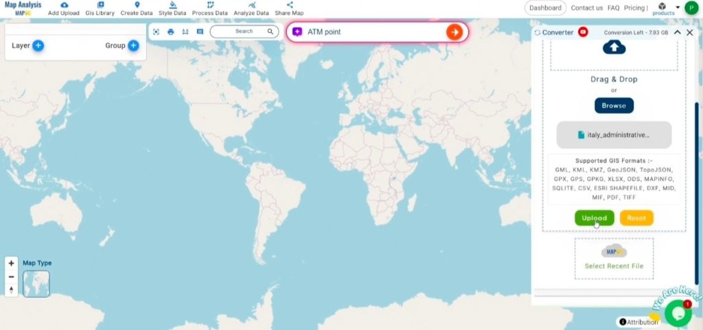
Step 1: Upload Your Data:
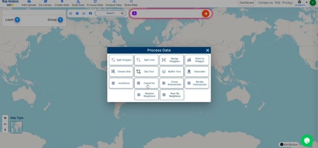
- Navigate to the top menu, click on “Process Data,” and choose the “Converter Tool” option to begin the conversion process.
2. To start the conversion, upload your MIF file by selecting the data you want to convert.
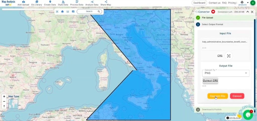
Step 2: Select the Output Format:
1.Choose PNG as your desired output format. Although the Converter Tool offers multiple export options, this guide specifically focuses on converting your MIF file to PNG format for optimal results.
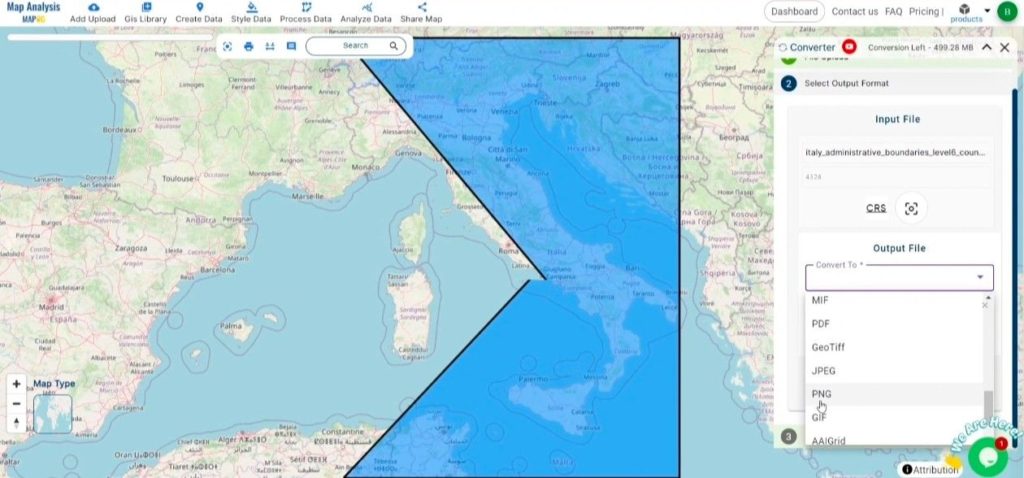
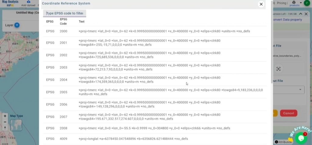
2. You can also Choose the Output Coordinate Reference System (CRS) according to your spatial analysis requirement.
Step 3: Run the Conversion:
Head to the “Convert Files” section and initiate the conversion. Upload your MIF file, and the Converter Tool will efficiently convert it to PNG format, ensuring a fast and seamless process.
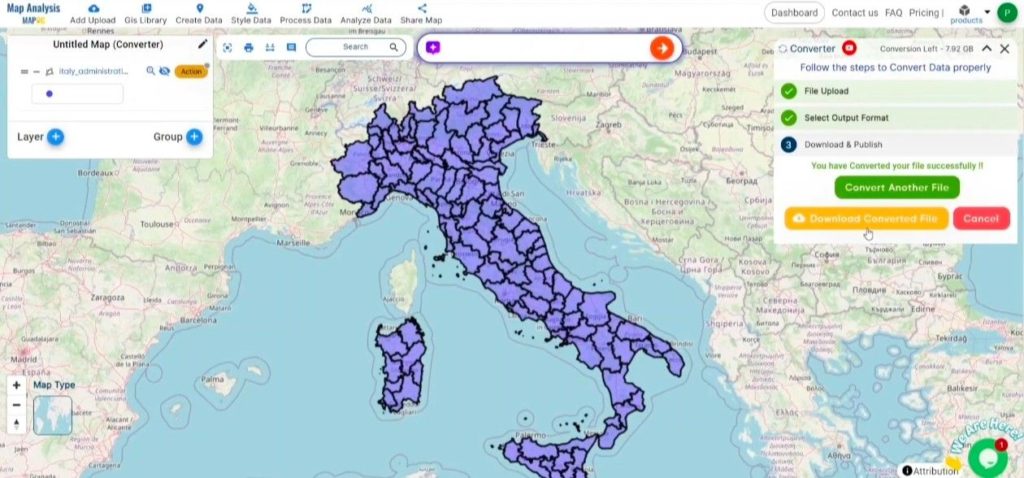
Step 4: Review and Download:
Check your converted PNG file to ensure it meets your expectations. After confirming that the conversion is correct and the data is accurately preserved, proceed to download the file. This step ensures the conversion was successful and that the file aligns with your requirements.
Conclusion:
MAPOG Map Analysis provides a variety of tools to improve your workflow, such as the Clip Tool for cutting down datasets, the Basic Style Tool for formatting numerical information, and the Create Point Tool for adding point features to your map. Furthermore, the Create Grid Tool enables you to create grids by uploading different types of data, among other functionalities.
Story by MAPOG:
Story by MAPOG feature allows users to build engaging, map-based stories by combining geospatial data with text, images, and multimedia elements. This versatile tool finds applications in various fields, such as urban planning, tourism, education, and environmental conservation. With its customizable and interactive features, Story by MAPOG offers valuable insights into specific locations or themes, simplifying the presentation of complex spatial information. Whether for professionals, educators, or students, this user-friendly platform provides an intuitive way to explore, present, and share geographic data in a visually compelling and accessible manner.
Other Feature Tools contain:
- Clip Tool
- Isochrones Tool
- Create Polygon Data
- Spatial Join
- Merge Polygon Tool
- Cross Intersection
- Nearest Neighbour
- Create Point Data
These blogs may also be useful for you:
- Converting MapInfo to GPS Online
- Converting TopoJSON to SHP Online : GIS Data Converter
- Converting GeoJSON to TopoJSON with MAPOG
- Converting GeoJSON to CSV with MAPOG
- Converting KMZ to KML with MAPOG
- Converting GML to KML with MAPOG
- Convert KMZ to TopoJSON Online
- Converting KMZ to GeoJSON Online
- Convert KML to MID Online