This guide provides an easy-to-follow method for converting MIF files to GPX format using the Converter Tool available in MAPOG Map Analysis. Whether you’re a novice or have some experience with the platform, this tutorial will guide you through the process of transforming MIF files into GPX with ease.
What is MIF Data Format:
MIF files are also known as MapInfo Interchange Format files, and often end in a .mif suffix. This format — developed and used by MapInfo for the export of maps and data — contains the data necessary for plotting map features (such as points, lines, or polygons) on a map. MIF files are often accompanied by MID files. MID files contain data attributes, but are not a mandatory addition to the MIF file format.
Converting MIF Data into GPX Format:
MAPOG’s Map Analysis features an advanced Converter Tool that allows users to effortlessly convert data between various formats according to their specific requirements. This tool streamlines the data transformation process for multiple GIS applications, providing both flexibility and efficiency in managing different file types. For example, MAPOG’s Converter Tool can convert MIF data into GPX format, optimizing file size while retaining critical geographic information. This conversion enhances the data’s compatibility with web-based mapping and interactive platforms, ultimately improving workflows and significantly boosting the usability of GIS data.
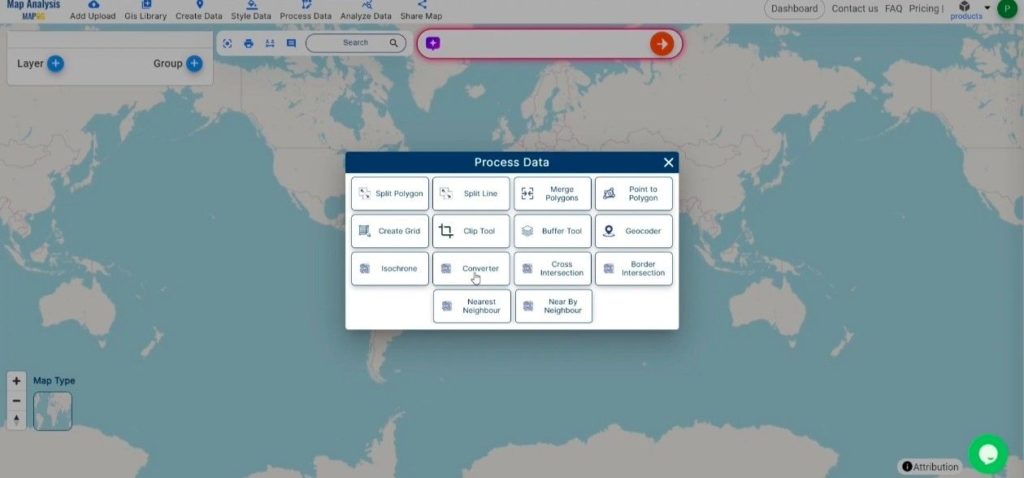
Steps to convert MIF to GPX:
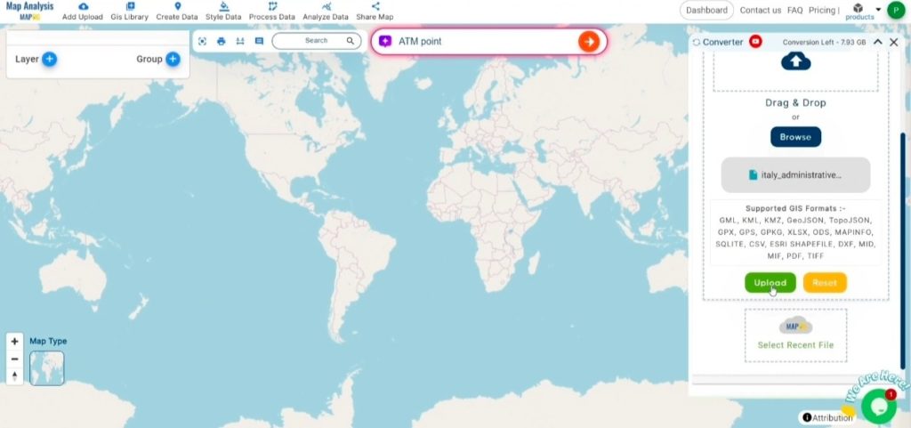
Step 1: Upload Your Data:
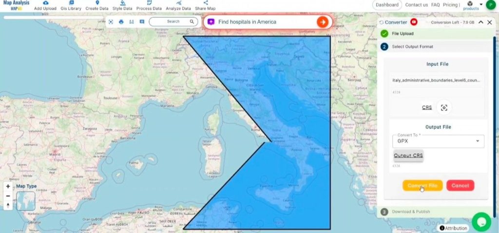
1. Begin by navigating to the top menu in MAPOG, selecting “Process Data,” and then clicking on the “Converter Tool” to start the process.
2. To start the conversion, upload your MIF file by selecting the data you want to convert.
Step 2: Select the Output Format:
- Choose GPX as the desired export format. Although the Converter Tool supports multiple output formats, this guide specifically directs you to select GPX for converting your data. The tool’s intuitive design ensures that choosing the correct format is quick and straightforward, allowing you to focus on creating the final product.
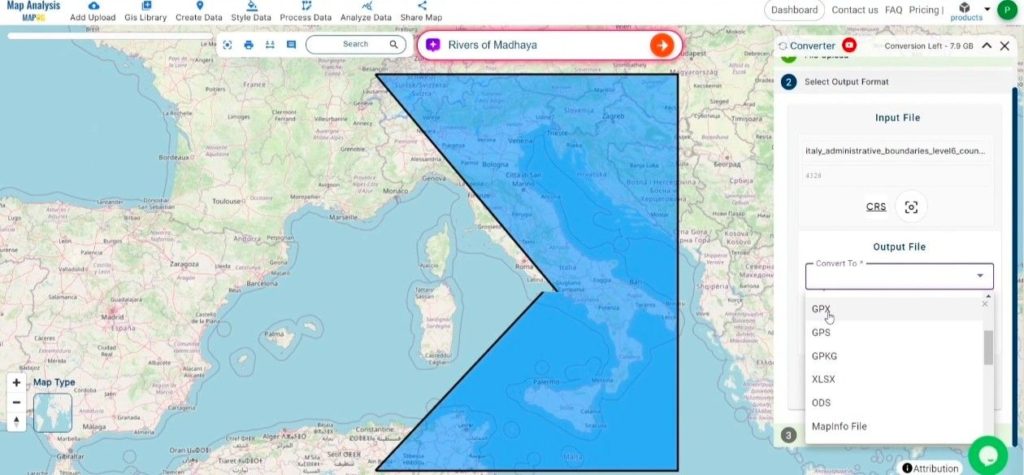
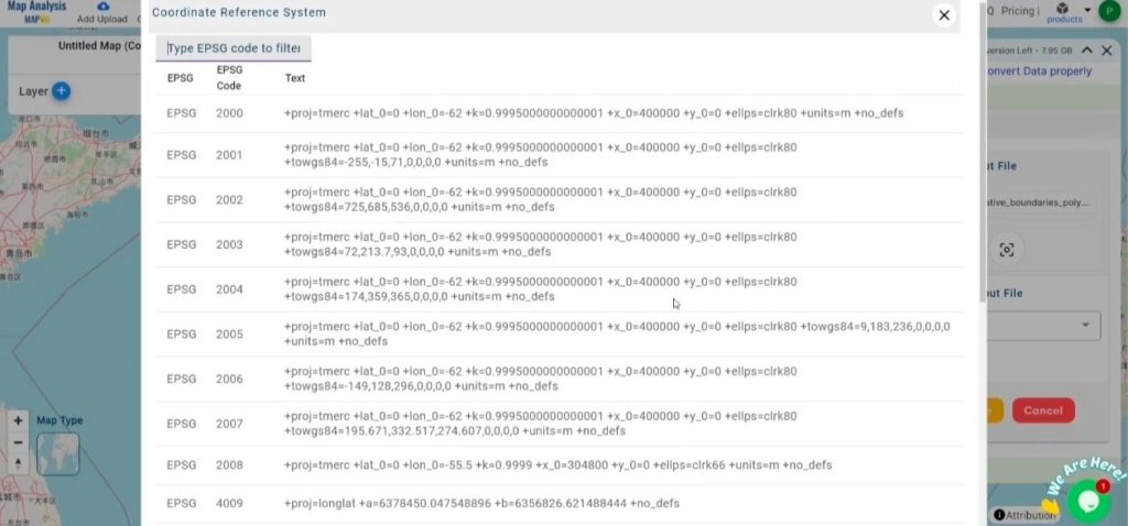
2. You can also Choose the Output Coordinate Reference System (CRS) according to your spatial analysis requirement.
Step 3: Execute the Conversion:
Navigate to the ‘Convert Files’ section and let the tool take care of the conversion process. Simply upload your MIF file, and the Converter Tool will efficiently convert it into GPX format, ensuring a smooth and hassle-free experience. The process is quick, allowing you to retrieve your GPX file in just a few clicks.
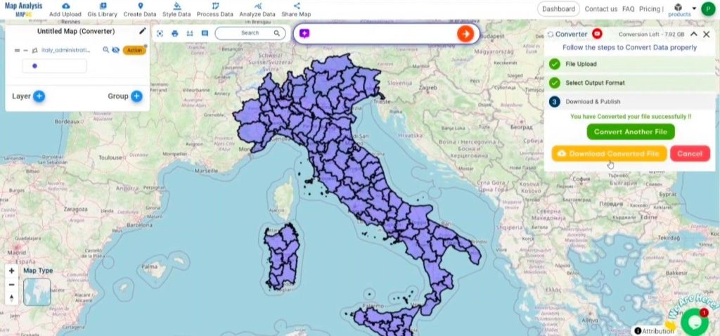
Step 4: Review and Download:
Carefully review your newly converted GPX file to verify that it meets your expectations and that the data has been accurately preserved. Once you’re satisfied with the conversion, proceed to download the file. This final step ensures the conversion was successful and the GPX file aligns with your project needs.
Conclusion:
MAPOG Map Analysis offers an array of powerful tools designed to enhance your workflow. Whether you’re using the Clip Tool to refine datasets, the Basic Style Tool to format numerical data, or the Create Point Tool to add point features to your map, the platform streamlines GIS tasks. Additionally, the Create Grid Tool allows you to generate grids by uploading various data types, among many other versatile functionalities. These tools make MAPOG a comprehensive solution for managing and analyzing spatial data efficiently.
Story by MAPOG:
Story by MAPOG is a dynamic tool designed to help users create immersive, map-based narratives by integrating geospatial data with multimedia elements like text, images, and videos. It offers an intuitive platform for turning complex geographical information into interactive, visually appealing stories. With its flexibility and customization options, Story by MAPOG is ideal for various fields such as tourism, urban development, education, and environmental research. Whether used by professionals, educators, or students, this tool simplifies the process of presenting and sharing geographic data in an engaging and accessible way.
Other Feature Tools contain:
- Clip Tool
- Isochrones Tool
- Create Polygon Data
- Spatial Join
- Merge Polygon Tool
- Cross Intersection
- Nearest Neighbour
- Create Point Data