This guide outlines a simple and clear process for converting GeoJSON files into GPS format using the Converter Tool within MAPOG. Whether you’re new to MAPOG or have prior experience, this tutorial will help you navigate the conversion process smoothly.
What is GIS Data?
Geographic Information System (GIS) data contains spatial information that helps map features and locations on the Earth’s surface. It combines geographic coordinates with descriptive attributes like names, categories, and measurements, making it crucial for mapping, analysis, and visualization. GIS data is widely used in areas such as urban planning, environmental monitoring, and transportation. To explore various GIS data formats like DXF, SHP, KML, KMZ, GeoJSON, and TopoJSON, visit GIS DATA, which offers over 900 data layers from 200+ countries.
Key Points for GeoJSON to GPS Conversion:
The Converter Tool in MAPOG Map Analysis provides an easy way to convert data between different formats. This allows users to upload files in one format and export them in another, such as converting GeoJSON to GPS, simplifying workflows and increasing GIS data accessibility for a wide range of projects.
Steps to Convert GeoJSON to GPS
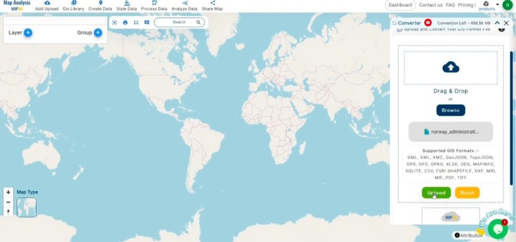
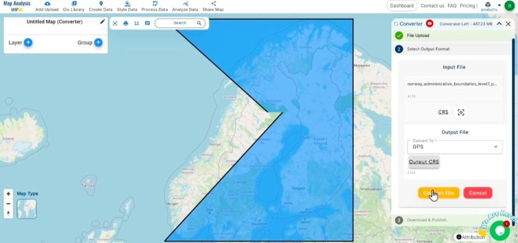
Step 1: Upload Your Data:
- From the top menu, click on “Process Data” and select “Converter Tool” to start the conversion process.
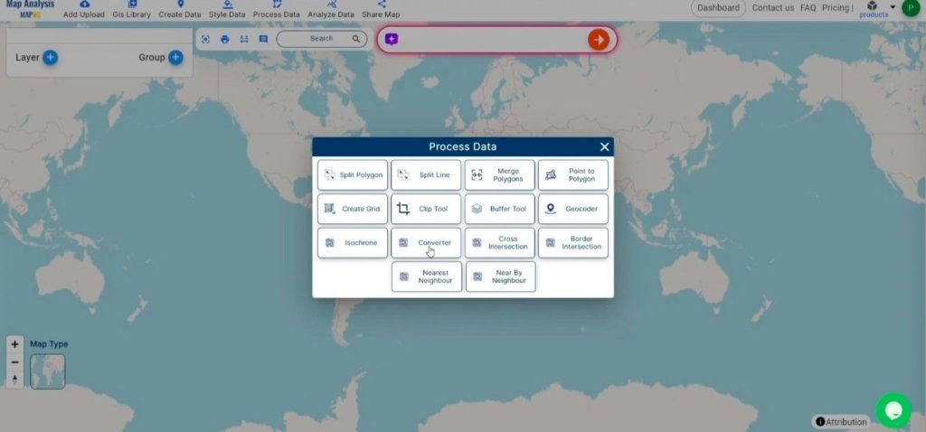
2. To start the conversion, upload your GeoJSON file by selecting the data you want to convert.
Step 2: Select the Output Format:
- In the Converter Tool, you’ll find several output format options. Choose GPS as the format for exporting your data. Although the tool supports multiple formats, this guide focuses specifically on converting your GeoJSON file to GPS format.
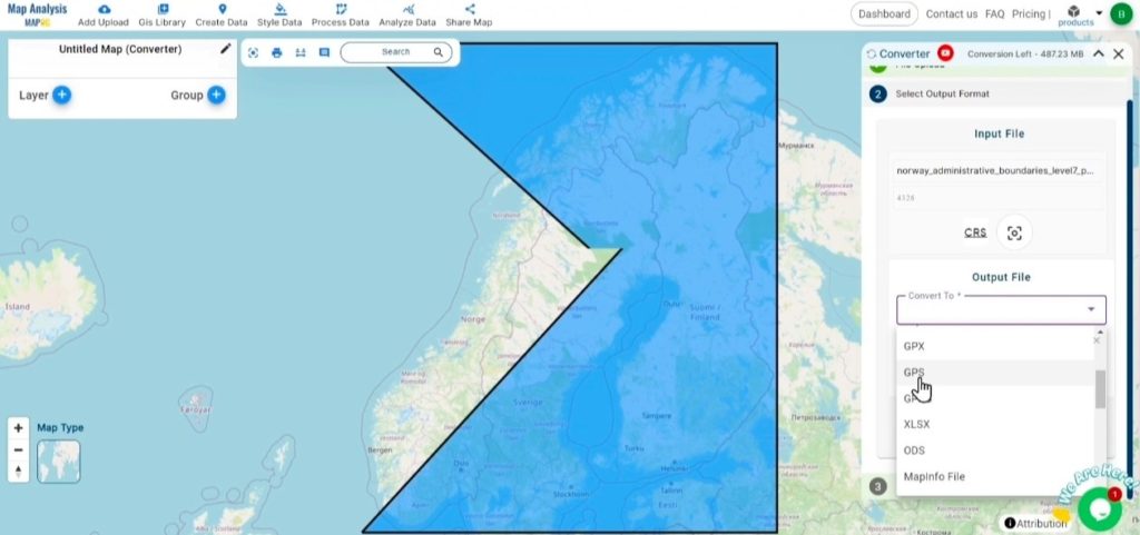
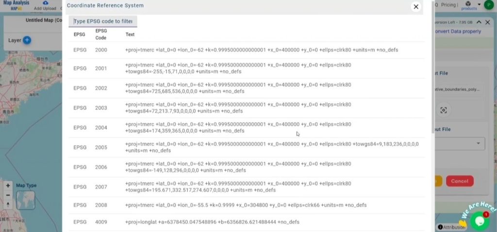
2. You can also Choose the Output Coordinate Reference System (CRS) according to your spatial analysis requirement.
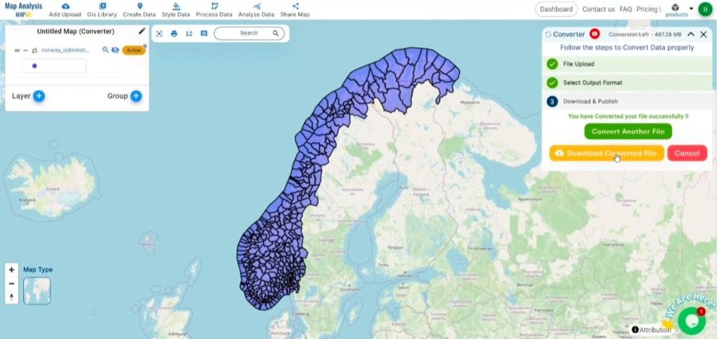
Step 3: Execute the Conversion:
Navigate to the “Convert Files” section within the Converter Tool. Upload your GeoJSON file, and the tool will automatically handle the conversion. It will efficiently convert your GeoJSON file to GPS format, ensuring a quick and seamless process.
Step 4: Review and Download:
Once the conversion is finished, review your GPS file to verify that the data has been accurately converted and preserved. Confirm that the spatial details and layout are correct and meet your expectations. After ensuring the output is satisfactory, download the file. This final step guarantees a successful conversion tailored to your project requirements.
Conclusion:
MAPOG Map Analysis offers a range of powerful tools to streamline your workflow. These include the Clip Tool for trimming datasets, the Basic Style Tool for formatting numerical data, and the Create Point Tool for adding point features to your maps. Additionally, the Create Grid Tool allows for the generation of grids using various data types, providing even more flexibility and functionality for your GIS projects.
Other Feature Tools contain:
These blogs may also be useful for you:
- Convert Online Gis data : KML to PDF file
- Converting KML to GeoTIFF , Online Gis Data Converter
- Converting KMZ to SHP : Online GIS Data Conversion
- Converting TopoJSON to SHP Online : GIS Data Converter
- Converting GeoJSON to TopoJSON with MAPOG
- Converting GeoJSON to CSV with MAPOG
- Converting KMZ to KML with MAPOG
- Converting GML to KML with MAPOG
- Convert KMZ to TopoJSON Online
- Converting KMZ to GeoJSON Online
- Convert KML to MID Online
- Online Conversion KML to MIF
- Convert KML to GML Online
- Convert KML to GPKG Online
- Convert KML to KMZ Online
- Convert GML to SHP Online
- Convert KML to GML Online
- Convert KML to GeoJSON file online
- Convert KML to TopoJSON Online
- GeoJSON to GeoTIFF – Vector to Raster Conversion
- KML to GeoTIFF – Vector to Raster Conversion
- SHP to GPX / GPS
- Convert GeoJSON to KML
- Convert Geojson to MIF MapInfo file
- GeoJSON to Shapefile
- Convert GML to CSV
- Convert KMZ to GPX