This tutorial offers a straightforward walkthrough for converting a DXF file into GPS format using the Converter Tool in MAPOG Map Analysis. Whether you’re new to MAPOG or have some experience, this guide will assist you in seamlessly converting your DXF files to GPS.
What is DXF Data Format:
DXF is short for Drawing Exchange Format or Drawing Interchange Format and is a type of vector file. Engineers, designers and architects often use the DXF format for 2D and 3D drawings during product design. This data format can be used in case of analyzing the maps. It can be of many types like point, line and polygon or any boundaries.
Converting DXF Data into GPS Format:
MAPOG’s Map Analysis includes an advanced Converter Tool that enables users to easily switch between various data formats to meet their specific needs. This tool simplifies the process of converting data for multiple GIS applications, offering both flexibility and efficiency in handling different formats. For instance, MAPOG’s Converter Tool can convert DXF data into the GPS format, reducing file size while preserving essential geographic details. This makes the data more suitable for web-based mapping and interactive platforms, ultimately enhancing workflows and significantly improving GIS data usability.
Steps to Convert DXF to GPS:
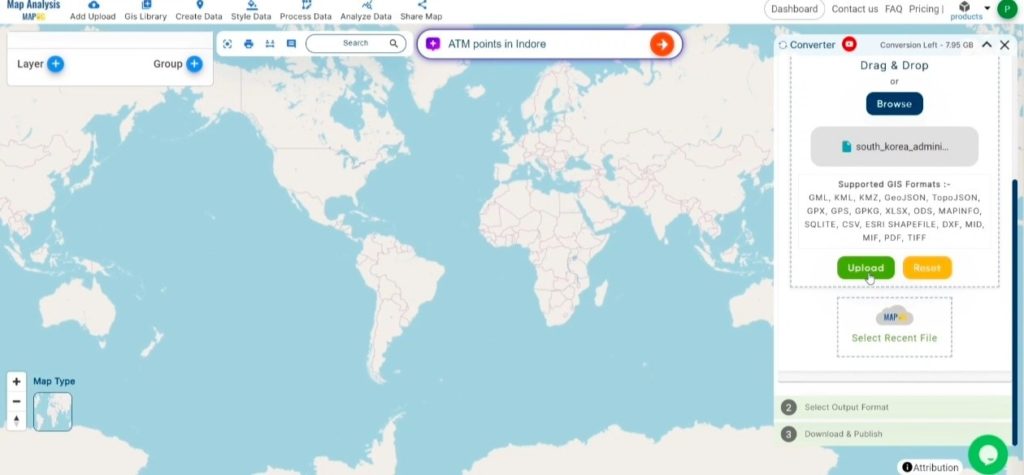
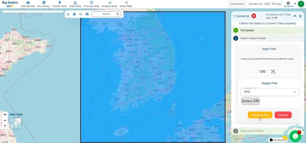
Step 1: Upload the Data:
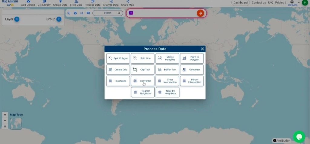
- Navigate to the header menu, click on “Process Data,” and select the “Converter Tool” option to get started.
- To start the conversion, upload your DXF file by selecting the data you want to convert.
Step 2: Select the Output Format:
- Choose GPS as the preferred output format for exporting your data. While the Converter Tool offers multiple format options, this guide focuses specifically on converting your file to GPS format.
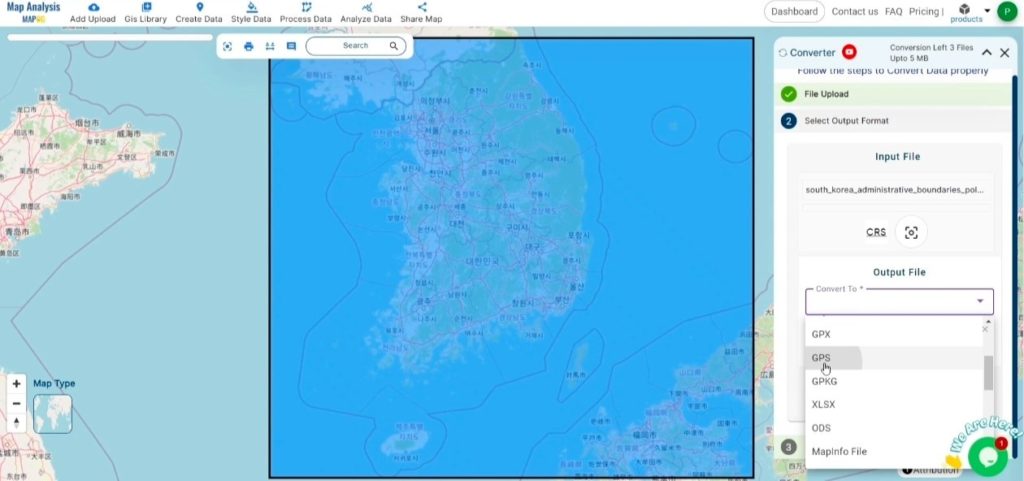
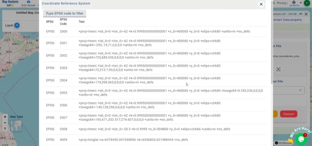
- You can also Choose the Output Coordinate Reference System (CRS) according to your spatial analysis requirement.
Step 3: Run the Conversion:
Go to the ‘Convert Files’ section and let the tool handle the conversion. Simply upload your DXF file, and the Converter Tool will efficiently convert it to GPS format, ensuring a smooth and fast process.
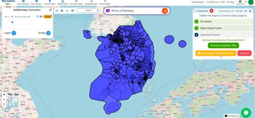
Step 4: Review and Download:
Review your converted GPS file to confirm its accuracy. After ensuring that the conversion is correct and meets your requirements, proceed to download the file. This step is crucial to validate that the conversion was successful and that your data has been accurately preserved.
Result :
MAPOG Map Analysis provides a variety of tools to improve your workflow, such as the Clip Tool for trimming datasets, the Basic Style Tool for formatting numeric data, and the Create Point Tool for adding point features to your map. Additionally, the Create Grid Tool allows you to generate grids by uploading different types of data, offering even more flexibility for your projects.
Story by MAPOG:
Story by MAPOG feature enables users to craft visually captivating, map-centered narratives by integrating geospatial data with text, images, feature attributes, location, address etc. It serves a wide range of applications, including urban planning, tourism, education, and environmental conservation. Offering interactive and customizable options, Story by MAPOG delivers dynamic perspectives on specific locations or themes, simplifying the presentation of intricate spatial data in an engaging and accessible manner. This tool is perfect for professionals, educators, and students, making the exploration and sharing of geographical information both intuitive and impactful.
Other Feature Tools contain:
- Clip Tool
- Isochrones Tool
- Create Polygon Data
- Spatial Join
- Merge Polygon Tool
- Cross Intersection
- Nearest Neighbour
- Create Point Data