Download Algeria Administrative Boundary Shapefiles – National, Districts, Municipalities and more

Algeria Shapefile Download Map – Free Polygon Administrative Download. Shapefiles showing Districts , Municipalities and Town and Cities.

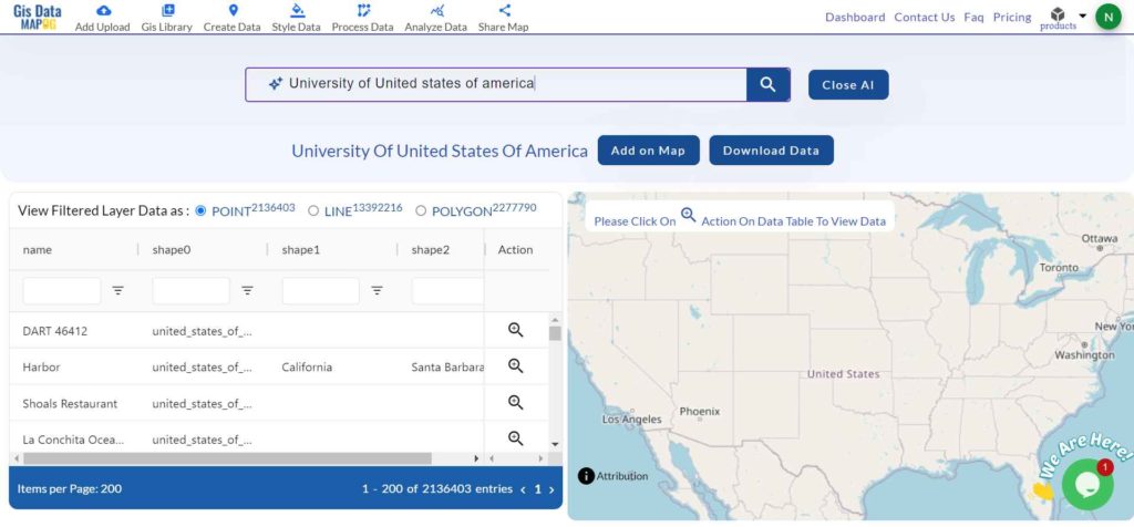
Have you been searching too long for accurate GIS data for your country of interest? Well the wait is over with MAPOG, your one-stop destination for comprehensive GIS data covering 150+ countries. You can find more than 150 GIS data for each nation in MAPOG GIS Data Collection. The distinctive feature of MAPOG GIS data collection lies in its commitment to providing highly accurate GIS data of the administrative divisions. Users can also find data of other natural and man made geographic features such as river, roads, railway lines, airport locations etc. that are represented in appropriate geometric structures (point, line and polygon). MAPOG provides two important tools for accessing these GIS datasets – Download GIS Data and Add GIS Data.

With MAPOG’s versatile toolkit, you can effortlessly upload vector and raster filesadd WMS (Web Map Service) layers, upload Excel or CSV data, incorporate existing files, perform polygon splitting and merging, generate new polygon and polyline data, use the converter for various formats, conduct buffer analysiscreate gridstransform points into polygons, calculate isochrones, and utilize the geocoder for precise location information.

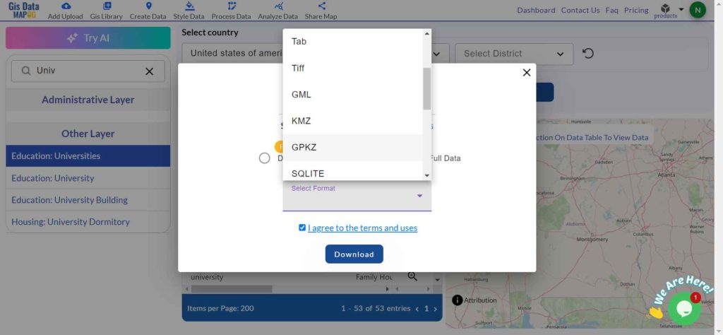
We offer an extensive array of data formats, including KML, SHP, CSV, GeoJSON, Tab, SQL, Tiff, GML, KMZ, GPKZ, SQLITE, Dxf, MIF, TOPOJSON, XLSX, GPX, ODS, MID, and GPS, ensuring compatibility and accessibility for various applications and analyses.

Note:

  • All data available are in GCS datum EPSG:4326 WGS84 CRS (Coordinate Reference System).
  • You need to login for downloading the shapefile.

Download Shapefile Data of Algeria

Algeria is bordered to the northeast by Tunisia; to the east by Libya; to the southeast by Niger; to the southwest by Mali, Mauritania, and Western Sahara; to the west by Morocco; and to the north by the Mediterranean Sea. It is considered part of the Maghreb region of North Africa. It has a semi-arid geography, with most of the population living in the fertile north and the Sahara dominating the geography of the south. Algeria covers an area of 2,381,741 square kilometres (919,595 sq mi), making it the world’s, tenth largest nation by area and the largest nation in Africa, more than 200 times as large as the continent’s smallest country, The Gambia. With a population of 44 million, Algeria is the tenth-most populous country in Africa, and the 32nd most populous country in the world. The capital and largest city is Algiers, located in the far north on the Mediterranean coast.

Algeria National Boundary

Download Algeria National Boundary Shapefile

Download Algeria Districts Shapefile Data

Algeria’s districts were created as arrondissements when Algeria was a colony of France and they had a status equal to those of mainland France. They were, like France’s arrondissements, part of departements, which are further part of a région (which was called a territory, territoire, in French Algeria). They were maintained 6 years after the country’s independence (until 1968) when they were renamed “daïras” and had their functions slightly changed.

Algeria Districts Boundaries

Download Algeria Districts Boundaries Shapefile

Download Algeria Municipalities Shapefile Data

The municipalities of Algeria form the third level of administrative subdivisions of Algeria. As of 2002, there were 1,541 municipalities in the country.

Algeria Municipalities Boundaries

Download Algeria Municipalities Boundaries Shapefile

Other Administrative Boundary Data:

Other GIS Data:

Download Shapefile for the following:

  1. World Countries Shapefile
  2. Australia
  3. Argentina
  4. Austria
  5. Belgium
  6. Brazil
  7. Canada
  8. Denmark
  9. Fiji
  10. Finland
  11. Germany
  12. Greece
  13. Greenland
  14. India
  15. Indonesia
  16. Ireland
  17. Italy
  18. Japan
  19. Kenya
  20. Lebanon
  21. Madagascar
  22. Malaysia
  23. Mexico
  24. Mongolia
  25. Netherlands
  26. New Zealand
  27. Nigeria
  28. Papua New Guinea
  29. Philippines
  30. Poland
  31. Russia
  32. Singapore
  33. South Africa
  34. South Korea
  35. Spain
  36. Switzerland
  37. Tunisia
  38. United Kingdom Shapefile
  39. United States of America
  40. Vietnam
  41. Norway
  42. Chile
  43. Crotia

Disclaimer : If you find any shapefile data of country provided is incorrect do contact us or comment below, so that we will correct the same in our system as well we will try to correct the same in openstreetmap.

Download Suriname Administrative Boundary GIS Data for – National, Districts and more

Access and download Suriname administrative boundary GIS data, including national and districts, for comprehensive geographic analysis and mapping.

Unleash the hidden depths of Suriname with MAPOG! Delve into a treasure trove of GIS data, unlocking the intricate details of its administrative regions. Chart the courses of Suriname’s mighty rivers and their winding tributaries. Map your exploration across the country’s vital transportation network – navigate the intricate web of roads and take flight with data on Suriname’s essential air gateways, its airports. Download this wealth of Suriname GIS data with ease in formats like Shapefile, KML, GeoJSON, and CSV using our user-friendly tools. Empower your analysis of Suriname’s geography – choose MAPOG for all your Suriname GIS data needs!.

With MAPOG’s versatile toolkit, you can effortlessly upload vector and raster filesadd WMS (Web Map Service) layers, upload Excel or CSV data, incorporate existing files, perform polygon splitting and merging, generate new polygon and polyline data, use the converter for various formats, conduct buffer analysiscreate gridstransform points into polygons, calculate isochrones, and utilize the geocoder for precise location information.

We offer an extensive array of data formats, including KML, SHP, CSV, GeoJSON, Tab, SQL, Tiff, GML, KMZ, GPKZ, SQLITE, Dxf, MIF, TOPOJSON, XLSX, GPX, ODS, MID, and GPS, ensuring compatibility and accessibility for various applications and analyses.

Note:

  • All data available are in GCS datum EPSG:4326 WGS84 CRS (Coordinate Reference System).
  • You need to login for downloading the shapefile.

Download Shapefile Data of Suriname

Suriname, officially the Republic of Suriname is a country in northern South America, sometimes considered part of the Caribbean and the West Indies. Located slightly north of the equator, over 90% of its territory is covered by rainforests, giving it the highest proportion of forest cover in the world. Suriname is bordered by the Atlantic Ocean to the north, French Guiana to the east, Guyana to the west, and Brazil to the south. It is the smallest country in South America by both population and area, with approximately 612,985 inhabitants and an area of about 163,820 square kilometers (63,251 square miles). The capital and largest city is Paramaribo, which is home to roughly half the population.

Tajikistan National Boundary
Suriname National Boundary

Download Suriname National Boundary Shapefile

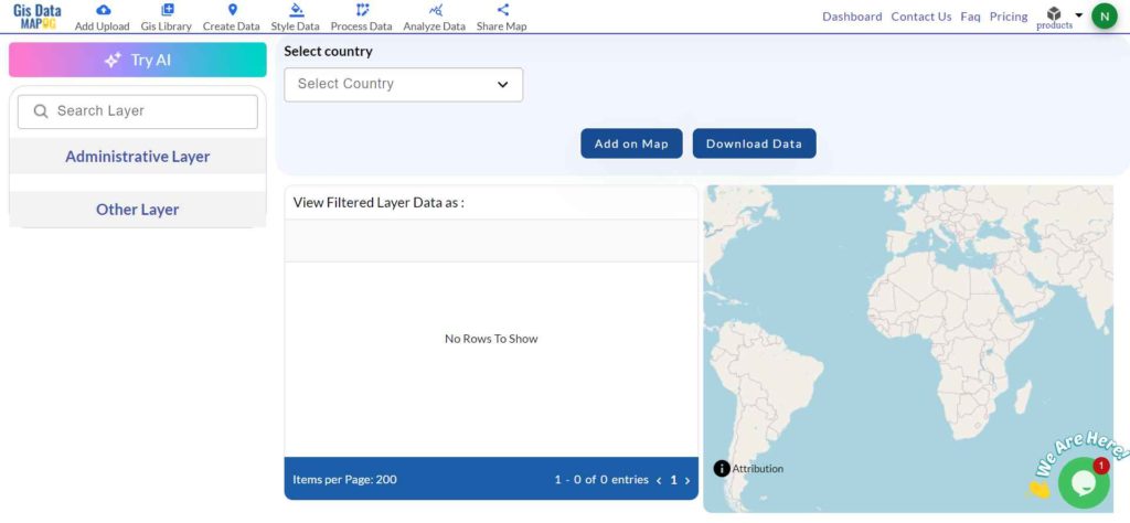
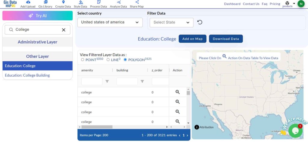
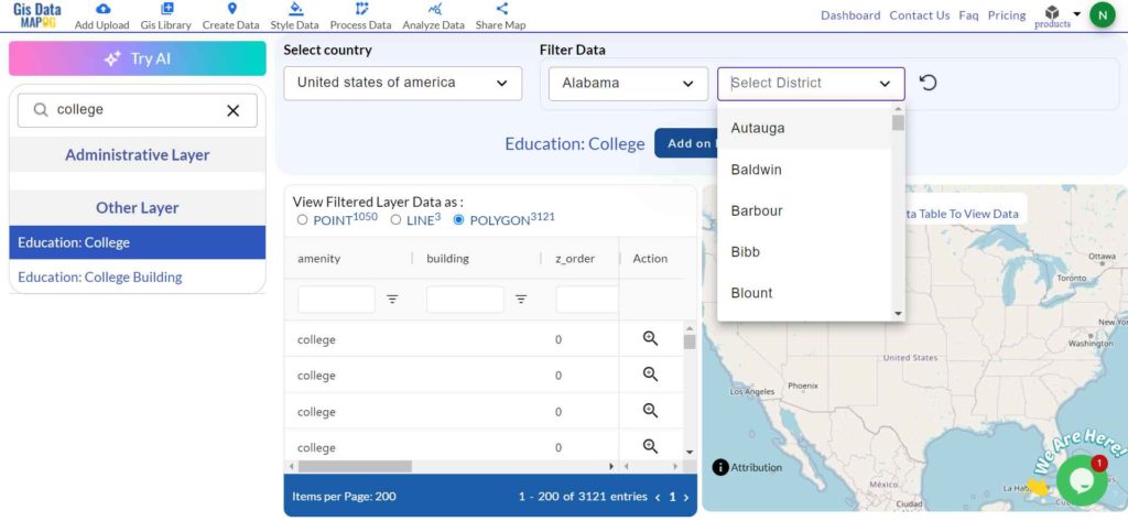
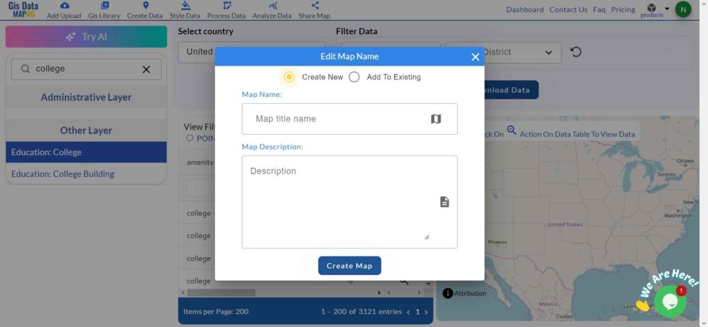
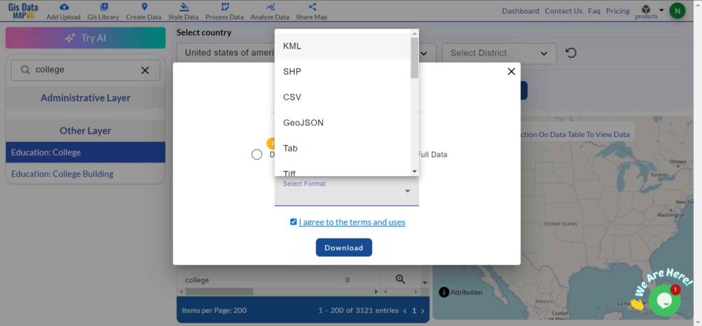
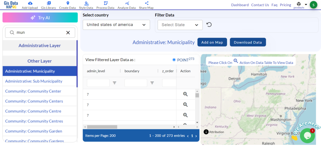
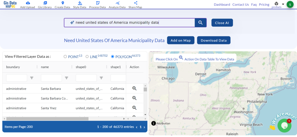
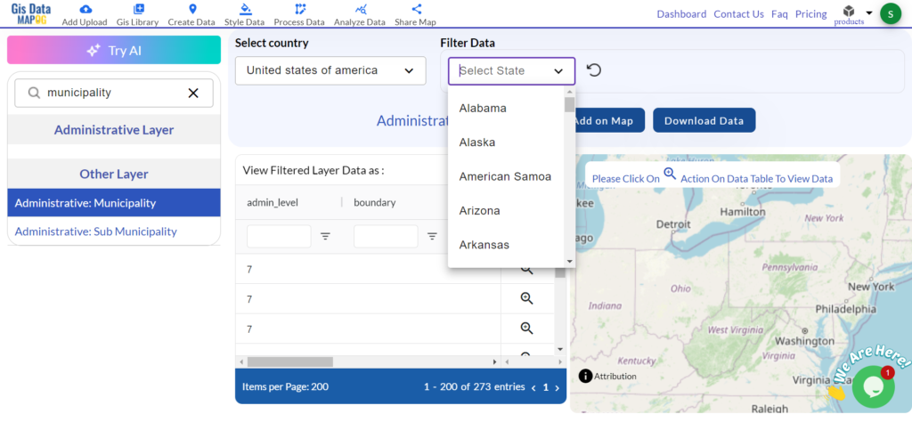
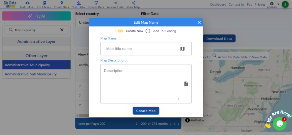
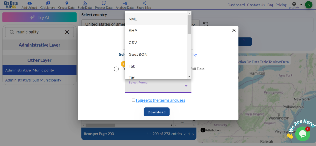
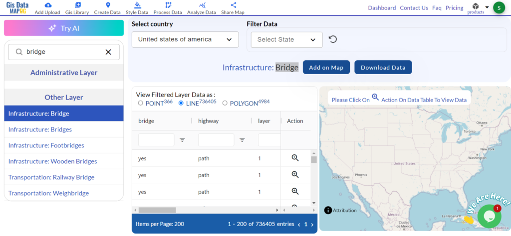
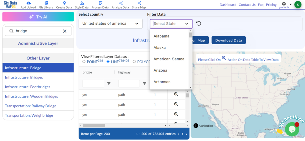
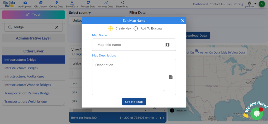
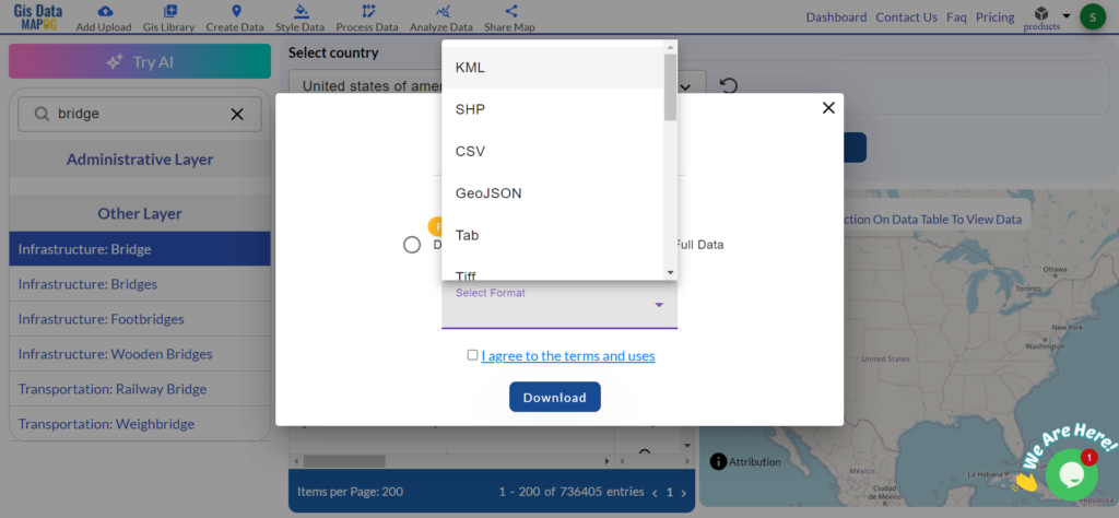
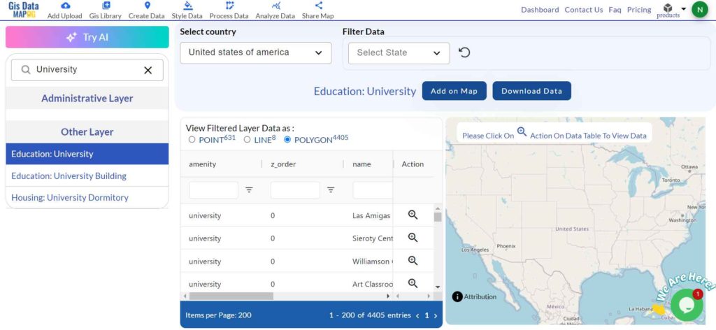
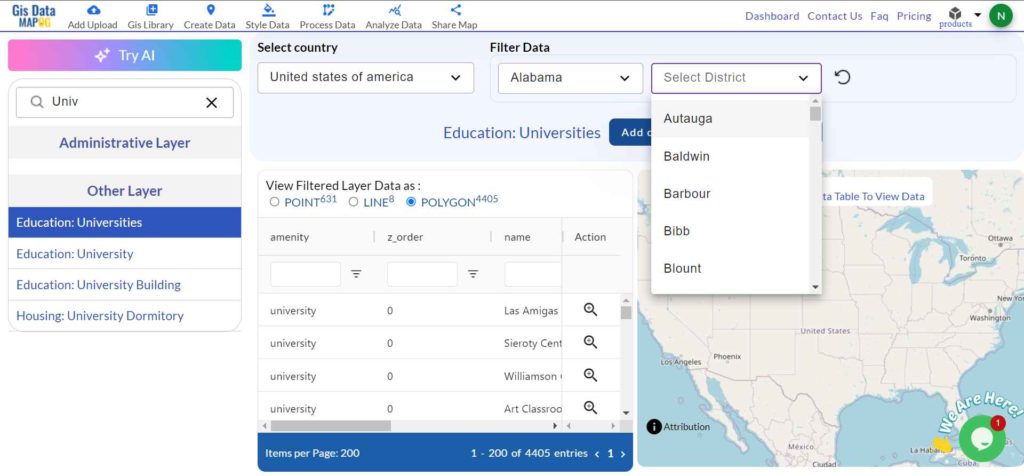
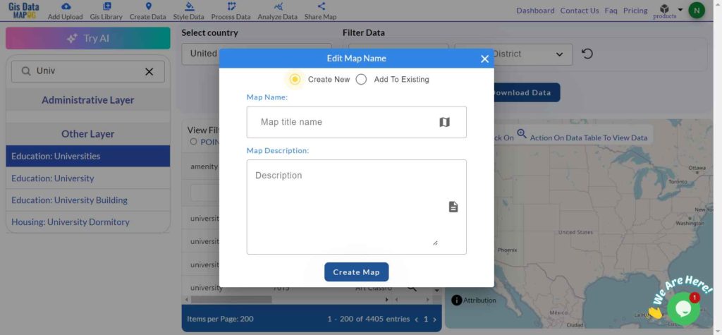
After successfully logging in with a legitimate email address, select the country you want to work with. Next, choose the specific layer you need and click on the download option. Once that’s done, pick the desired format to acquire the essential GIS data. Before proceeding with the data download, make sure to review the data table for any relevant information.

Download Suriname Districts Shapefile Data

Suriname is divided into ten administrative districts, each with its own unique characteristics and attractions.

Suriname Districts Shapefile

Download Suriname Districts Boundary Shapefile

Here are the districts of Suriname listed out:

  1. Brokopondo
  2. Commewijne
  3. Coronie
  4. Marowijne
  5. Nickerie
  6. Para
  7. Paramaribo
  8. Saramacca
  9. Sipaliwini
  10. Wanica

Download Suriname Municipalities Shapefile Data

Suriname is divided into districts, which are further subdivided into municipalities. However, the term “municipality” is not commonly used in Suriname’s administrative divisions. Instead, each district is divided into several resorts (ressorten).

Suriname Municipalities

Download Suriname Municipalities Boundary Shapefile

Other GIS Data:

Above all links are provided for GIS data of Suriname if you are looking for any specific data please write us on support@mapog.com

Download Shapefile for the following:

  1. World Countries Shapefile
  2. Australia
  3. Argentina
  4. Austria
  5. Belgium
  6. Brazil
  7. Canada
  8. Denmark
  9. Fiji
  10. Finland
  11. Germany
  12. Greece
  13. India
  14. Indonesia
  15. Ireland
  16. Italy
  17. Japan
  18. Kenya
  19. Lebanon
  20. Madagascar
  21. Malaysia
  22. Mexico
  23. Mongolia
  24. Netherlands
  25. New Zealand
  26. Nigeria
  27. Papua New Guinea
  28. Philippines
  29. Poland
  30. Russia
  31. Singapore
  32. South Africa
  33. South Korea
  34. Spain
  35. Switzerland
  36. Tunisia
  37. United Kingdom Shapefile
  38. United States of America
  39. Vietnam
  40. Croatia
  41. Chile
  42. Norway
  43. Maldives
  44. Bhutan
  45. Colombia
  46. Libya
  47. Comoros
  48. Hungary
  49. Laos
  50. Estonia
  51. Iraq
  52. Portugal
  53. Azerbaijan
  54. Macedonia
  55. Romania
  56. Peru
  57. Marshall Islands
  58. Slovenia
  59. Nauru
  60. Guatemala
  61. El Salvador
  62. Afghanistan
  63. Cyprus
  64. Syria
  65. Slovakia
  66. Luxembourg
  67. Jordan
  68. Armenia
  69. Haiti And Dominican Republic

Disclaimer : If you find any shapefile data of country provided is incorrect do contact us or comment below, so that we will correct the same in our system as well we will try to correct the same in openstreetmap.

Download Angola Administrative Boundary Shapefiles – National, Provinces and more

Download GIS data of Angola such as Angola National Boundary, Provinces, Municipalities and more. Download in Shapefile or CSV formats

Are you struggling to find accurate and up-to-date GIS data for your desired country? Worry no more, as MAPOG is here to be your ultimate solution! Our platform offers a comprehensive collection of GIS data covering more than 150 countries. You’ll find an impressive selection of over 150 GIS datasets available for each nation in the MAPOG GIS Data Collection. The hallmark of our GIS data lies in its exceptional accuracy, especially when representing administrative divisions. Moreover, our users can access a diverse range of data pertaining to natural and man-made geographic features, including rivers, roads, railway lines, airport locations, and much more, all meticulously represented in appropriate geometric structures (points, lines, and polygons). Facilitating seamless access to this invaluable data are two essential tools – Download GIS Data and Add GIS Data, thoughtfully integrated into the MAPOG platform. To delve deeper into the functionalities of the Add GIS Data tool, check out our enlightening article – “Add GIS data from IGISMap GIS data collection

With MAPOG’s versatile toolkit, you can effortlessly upload vector and raster filesadd WMS (Web Map Service) layers, upload Excel or CSV data, incorporate existing files, perform polygon splitting and merging, generate new polygon and polyline data, use the converter for various formats, conduct buffer analysiscreate gridstransform points into polygons, calculate isochrones, and utilize the geocoder for precise location information.

We offer an extensive array of data formats, including KML, SHP, CSV, GeoJSON, Tab, SQL, Tiff, GML, KMZ, GPKZ, SQLITE, Dxf, MIF, TOPOJSON, XLSX, GPX, ODS, MID, and GPS, ensuring compatibility and accessibility for various applications and analyses.

Note:

  • All data available are in GCS datum EPSG:4326 WGS84 CRS (Coordinate Reference System).
  • You need to login for downloading the shapefile.

Download Shapefile Data of Angola

Angola is located on the western Atlantic Coast of Southern Africa between Namibia and the Republic of the Congo. It also is bordered by the Democratic Republic of the Congo and Zambia to the east. The country consists of a sparsely watered and somewhat sterile coastal plain extending inland for a distance varying from 50 to 160 km (31 to 99 mi). Slightly inland and parallel to the coast is a belt of hills and mountains and behind those a large plateau. The total land size is 1,246,700 km2 (481,400 sq mi). It has an Exclusive Economic Zone of 518,433 km2 (200,168 sq mi).

Angola National Boundary

Download Angola National Boundary Shapefile

Download Angola Provinces Shapefile Data

Angola is divided into eighteen provinces, known in Portuguese as províncias:

  • Bengo
  • Caxito
  • Benguela
  • Bié
  • Cabinda
  • Cuando Cubango
  • Cuanza Norte
  • Cuanza Sul
  • Cunene
  • Huambo
  • Huíla
  • Luanda
  • Lunda Norte
  • Lunda Sul
  • Malanje
  • Moxico
  • Namibe
  • Uíge
  • Zaire
Angola Provinces Boundaries

Download Angola Provinces Boundaries Shapefiles

Other GIS Data:

Download Shapefile for the following:

  1. World Countries Shapefile
  2. Australia
  3. Argentina
  4. Austria
  5. Belgium
  6. Brazil
  7. Canada
  8. Denmark
  9. Fiji
  10. Finland
  11. Germany
  12. Greece
  13. India
  14. Indonesia
  15. Ireland
  16. Italy
  17. Japan
  18. Kenya
  19. Lebanon
  20. Madagascar
  21. Malaysia
  22. Mexico
  23. Mongolia
  24. Netherlands
  25. New Zealand
  26. Nigeria
  27. Papua New Guinea
  28. Philippines
  29. Poland
  30. Russia
  31. Singapore
  32. South Africa
  33. South Korea
  34. Spain
  35. Switzerland
  36. Tunisia
  37. United Kingdom Shapefile
  38. United States of America
  39. Vietnam
  40. Norway
  41. Chile
  42. Crotia

Disclaimer : If you find any shapefile data of country provided is in correct do contact us or comment below, so that we will correct the same in our system as well we will try to correct the same in OpenStreetMap.

Download Cape Verde Administrative Boundary GIS Data –Shapefiles-National , Municipality and more

Cape Verde Shapefile Download Map – Free Polygon Administrative Download. Shapefiles showing National , Municipalities.

Are you struggling to find accurate and up-to-date GIS data for your desired country? Worry no more, as MAPOG is here to be your ultimate solution! Our platform offers a comprehensive collection of GIS data covering more than 150 countries. You’ll find an impressive selection of over 150 GIS datasets available for each nation in the MAPOG GIS Data Collection. The hallmark of our GIS data lies in its exceptional accuracy, especially when representing administrative divisions. Moreover, our users can access a diverse range of data pertaining to natural and man-made geographic features, including rivers, roads, railway lines, airport locations, and much more, all meticulously represented in appropriate geometric structures (points, lines, and polygons). Facilitating seamless access to this invaluable data are two essential tools – Download GIS Data and Add GIS Data, thoughtfully integrated into the MAPOG platform. To delve deeper into the functionalities of the Add GIS Data tool, check out our enlightening article – “Add GIS data from IGISMap GIS data collection

With MAPOG’s versatile toolkit, you can effortlessly upload vector and raster filesadd WMS (Web Map Service) layers, upload Excel or CSV data, incorporate existing files, perform polygon splitting and merging, generate new polygon and polyline data, use the converter for various formats, conduct buffer analysiscreate gridstransform points into polygons, calculate isochrones, and utilize the geocoder for precise location information.

We offer an extensive array of data formats, including KML, SHP, CSV, GeoJSON, Tab, SQL, Tiff, GML, KMZ, GPKZ, SQLITE, Dxf, MIF, TOPOJSON, XLSX, GPX, ODS, MID, and GPS, ensuring compatibility and accessibility for various applications and analyses.

Note:

  • All data available are in GCS datum EPSG:4326 WGS84 CRS (Coordinate Reference System).
  • You need to login for downloading the shapefile.

Download Shapefile Data of Cape Verde

The Cape Verde archipelago is in the Atlantic Ocean, approximately 570 kilometers (350 mi) off the western coast of the African continent, near Senegal, The Gambia, and Mauritania as well as part of the Macaronesia ecoregion. It lies between latitudes 14° and 18°N, and longitudes 22° and 26°W. The country is a horseshoe-shaped cluster of ten islands (nine inhabited) and eight islets, that constitute an area of 4033 km2 (1557 sq mi).

Cape Verde National Boundary

Download Cape Verde National Boundary Shapefile

Download Cape Verde Municipalities Shapefile Data

 Cape Verde is divided into 22 concelhos municipalities.

  • Tarrafal
  • São Miguel
  • São Salvador do Mundo
  • Santa Cruz
  • São Domingos
  • Praia
  • Ribeira Grande de Santiago
  • São Lourenço dos Órgãos
  • Santa Catarina
  • Brava
  • São Filipe
  • Santa Catarina do Fogo
  • Mosteiros
  • Maio
  • Boa Vista
  • Sal
  • Ribeira Brava
  • Tarrafal de São Nicolau
  • São Vicente
  • Porto Novo
  • Ribeira Grande
  • Paul
Cape Verde Municipalities Boundaries

Download Cape Verde Municipalities Boundaries Shapefile

Other GIS Data:

Download Shapefile for the following:

  1. World Countries Shapefile
  2. Australia
  3. Argentina
  4. Austria
  5. Belgium
  6. Brazil
  7. Canada
  8. Denmark
  9. Fiji
  10. Finland
  11. Germany
  12. Greece
  13. India
  14. Indonesia
  15. Ireland
  16. Italy
  17. Japan
  18. Kenya
  19. Lebanon
  20. Madagascar
  21. Malaysia
  22. Mexico
  23. Mongolia
  24. Netherlands
  25. New Zealand
  26. Nigeria
  27. Papua New Guinea
  28. Philippines
  29. Poland
  30. Russia
  31. Singapore
  32. South Africa
  33. South Korea
  34. Spain
  35. Switzerland
  36. Tunisia
  37. United Kingdom Shapefile
  38. United States of America
  39. Vietnam
  40. Norway
  41. Chile
  42. Crotia

Disclaimer : If you find any shapefile data of country provided is incorrect do contact us or comment below, so that we will correct the same in our system as well we will try to correct the same in OpenStreetMap.

Download Nicaragua Administrative Boundary GIS Data for – National, Municipalities, Regions and others layers

Unlock Nicaragua’s geography with MAPOG! Access 150+ GIS datasets on administrative boundaries, geographic features, and infrastructure in multiple formats.

with MAPOG unlock the hidden treasures of Nicaragua’s geography! Gain exclusive access to a wealth of GIS data, offering insights into Nicaragua Administrative Boundary GIS Data for – National, Municipalities, Regions and others .

Discovering Nicaragua’s GIS data is effortless with MAPOG. Dive into a diverse collection of over 150 datasets meticulously detailing administrative boundaries, geographic features such as rivers and lakes, and key infrastructure like roads and airports. Our platform offers intuitive tools for seamless navigation: Download Nicaragua Administrative Boundary GIS Data for – National, Municipalities, Regions and others layers. With the Download GIS Data tool, choose from a range of formats like Shapefile, KML, GeoJSON, or CSV to effortlessly acquire the precise data you need. For those seeking guidance, our comprehensive guide walks you through the process of obtaining administrative-level GIS data using the Download GIS Data tool. Let MAPOG be your trusted companion on an enriching geospatial journey through Nicaragua’s stunning landscapes.

Discover the versatility of MAPOG’s tool, empowering you to effortlessly, Upload vector and raster files, Add WMS (Web Map Service) layers, Import Excel or CSV data, Merge and split polygons, Create new polygon and polyline data, Convert between various formats, Perform buffer analysis, Generate grids, Transform points to polygons,Calculate isochrones and Leverage the geocoder for accurate location data.

Our platform supports an extensive range of data formats, including KML, SHP, CSV, GeoJSON, Tab, SQL, Tiff, GML, KMZ, GPKZ, SQLITE, Dxf, MIF, TOPOJSON, XLSX, GPX, ODS, MID, and GPS, ensuring seamless compatibility and accessibility across different analyses.

Note:
  • all data provided by MAPOG are in GCS datum EPSG:4326 WGS84 CRS (Coordinate Reference System). 
  • Additionally, access to shapefile downloads requires logging in to the platform.

Download Nicaragua National Boundary

Nicaragua, nestled in Central America between the Pacific Ocean and the Caribbean Sea, boasts pristine beaches, lush rainforests, and towering volcanoes. From the historic cities of Granada and León to the tranquil shores of San Juan del Sur, Nicaragua offers a rich tapestry of natural beauty and cultural heritage. 

Nicaragua National Boundary

Download Nicaragua National Boundary

Download Nicaragua Provinces Data

Nicaragua’s provinces offer a diverse tapestry of landscapes and cultures. From the lush forests of Jinotega to the volcanic terrain of Masaya, each province showcases unique natural beauty and heritage. Explore the colonial charm of Granada in Granada Province or immerse yourself in the indigenous traditions of the North Caribbean Coast Autonomous Region. Whether it’s the bustling urban center of Managua in Managua Province or the serene beaches of Rivas in Rivas Province, Nicaragua’s provinces promise unforgettable experiences for every traveler.

Nicaragua Provinces Data

Download Nicaragua Provinces Data

Download Nicaragua Municipalities Data

Nicaragua is divided into municipalities, each serving as an administrative region within the country. With a total of 153 municipalities, Nicaragua’s local governance structure plays a crucial role in community development and service delivery.

Nicaragua Municipalities Data

Download Nicaragua Municipalities Data

Download Nicaragua Administrative Boundary GIS Data for – others layers:

Above all links are provided for GIS data of Montenegro if you are looking for any specific data please write us on support@mapog.com

Download Data for the following:

  1. World Countries Shapefile
  2. Australia
  3. Argentina
  4. Austria
  5. Belgium
  6. Brazil
  7. Canada
  8. Denmark
  9. Fiji
  10. Finland
  11. Germany
  12. Greece
  13. India
  14. Indonesia
  15. Ireland
  16. Italy
  17. Japan
  18. Kenya
  19. Lebanon
  20. Madagascar
  21. Malaysia
  22. Mexico
  23. Mongolia
  24. Netherlands
  25. New Zealand
  26. Nigeria
  27. Papua New Guinea
  28. Philippines
  29. Poland
  30. Russia
  31. Singapore
  32. South Africa
  33. South Korea
  34. Spain
  35. Switzerland
  36. Tunisia
  37. United Kingdom Shapefile
  38. United States of America
  39. Vietnam
  40. Croatia
  41. Chile
  42. Norway
  43. Maldives
  44. Bhutan
  45. Colombia
  46. Libya
  47. Comoros
  48. Hungary
  49. Laos
  50. Estonia
  51. Iraq
  52. Portugal
  53. Azerbaijan
  54. Macedonia
  55. Romania
  56. Peru
  57. Marshall Islands
  58. Slovenia
  59. Nauru
  60. Guatemala
  61. El Salvador
  62. Afghanistan
  63. Cyprus
  64. Syria
  65. Slovakia
  66. Luxembourg
  67. Jordan
  68. Armenia
  69. Haiti And Dominican Republic
  70. Malta
  71. Djibouti
  72. East Timor
  73. Micronesia
  74. Morocco
  75. Liberia
  76. Kosovo
  77. Isle Of Man
  78. Paraguay
  79. Tokelau
  80. Palau
  81. Ile De Clipperton
  82. Mauritius
  83. Equatorial Guinea
  84. Tonga
  85. Myanmar
  86. Thailand
  87. New Caledonia
  88. Niger
  89. Nicaragua
  90. Pakistan
  91. Nepal
  92. Seychelles
  93. Democratic Republic of the Congo
  94. China
  95. Kenya
  96. Kyrgyzstan
  97. Bosnia Herzegovina
  98. Burkina Faso
  99. Canary Island
  100. Togo
  101. Israel And Palestine
  102. Algeria
  103. Suriname
  104. Angola
  105. Cape Verde
  106. Liechtenstein
  107. Taiwan
  108. Turkmenistan
  109. Tuvalu
  110. Ivory Coast
  111. Moldova
  112. Somalia
  113. Belize
  114. Montenegro

Disclaimer : If you find any shapefile data of country provided is incorrect do contact us or comment below, so that we will correct the same in our system as well we will try to correct the same in openstreetmap.

Download Liechtenstein Administrative Boundary GIS Data – National, Municipality and more

Unlock the potential of mapping! MAPOG introduces a unique opportunity: download Liechtenstein’s administrative boundary GIS data, encompassing national, municipalities, and more. Elevate your mapping projects with these comprehensive GIS datasets. Seize the opportunity for enriched exploration and mapping experiences!

0Hello GIS enthusiasts! Get ready for some exciting news from MAPOG. We’re thrilled to introduce our carefully curated GIS data designed specifically for Liechtenstein. This data will give you detailed geographical insights and complete administrative boundaries. Whether you’re working on local or national mapping projects, our top-notch resource can take your work to the next level. You can easily access this data in various formats like ESRI Shapefile, KML, GeoJSON, and CSV, making integration a breeze. Don’t miss out on this fantastic opportunity to enhance your mapping endeavors with the latest Liechtenstein GIS data. Start exploring today!

With MAPOG’s versatile toolkit, you can effortlessly upload vector and raster filesadd WMS (Web Map Service) layers, upload Excel or CSV data, incorporate existing files, perform polygon splitting and merging, generate new polygon and polyline data, use the converter for various formats, conduct buffer analysiscreate gridstransform points into polygons, calculate isochrones, and utilize the geocoder for precise location information.

We offer an extensive array of data formats, including KML, SHP, CSV, GeoJSON, Tab, SQL, Tiff, GML, KMZ, GPKZ, SQLITE, Dxf, MIF, TOPOJSON, XLSX, GPX, ODS, MID, and GPS, ensuring compatibility and accessibility for various applications and analyses.

Note:

  • All data available are in GCS datum EPSG:4326 WGS84 CRS (Coordinate Reference System).
  • You need to login for downloading the shapefile.

Download Shapefile Data of Liechtenstein

Liechtenstein, known as Fürstentum Liechtenstein in German, is a nation nestled within the Alpine region, positioned between Austria and Switzerland. This doubly landlocked microstate is recognized for its German-speaking populace. Despite its small size, Liechtenstein holds the distinction of being the sixth smallest country globally. Governed by a semi-constitutional monarchy, the country is led by its reigning prince.

Liechtenstein National Boundary

Download Liechtenstein National Boundary Shapefile

After successfully logging in with a legitimate email address, select the country you want to work with. Next, choose the specific layer you need and click on the download option. Once that’s done, pick the desired format to acquire the essential GIS data. Before proceeding with the data download, make sure to review the data table for any relevant information.

Download Liechtenstein Municipality Shapefile Data

Liechtenstein is organized into eleven municipalities, with many of them comprising a single town. Among these, five municipalities are situated in the Unterland (lower country) electoral district, while the remaining six are located in the Oberland (upper country).

Liechtenstein Municipality Boundaries

Download Liechtenstein Municipalities Shapefile

This shapefile covers following Municipalities of Liechtenstein listed below:

  1. Balzers
  2. Eschen
  3. Gamprin
  4. Mauren
  5. Planken
  6. Ruggell
  7. Schaan
  8. Schellenberg
  9. Triesen
  10. Triesenberg
  11. Vaduz

Download Liechtenstein National, municipalities Combined Shapefile Data

Liechtenstein’s administrative divisions are organized into eleven municipalities, each contributing to the country’s local governance and management.

Liechtenstein National, Municipalities Boundaries

Download Liechtenstein National, Municipality Shapefile

Other GIS Data:

Above all links are provided for GIS data of Liechtenstein if you are looking for any specific data please write us on support@mapog.com

Download Shapefile for the following:

  1. World Countries Shapefile
  2. Australia
  3. Argentina
  4. Austria
  5. Belgium
  6. Brazil
  7. Canada
  8. Denmark
  9. Fiji
  10. Finland
  11. Germany
  12. Greece
  13. India
  14. Indonesia
  15. Ireland
  16. Italy
  17. Japan
  18. Kenya
  19. Lebanon
  20. Madagascar
  21. Malaysia
  22. Mexico
  23. Mongolia
  24. Netherlands
  25. New Zealand
  26. Nigeria
  27. Papua New Guinea
  28. Philippines
  29. Poland
  30. Russia
  31. Singapore
  32. South Africa
  33. South Korea
  34. Spain
  35. Switzerland
  36. Tunisia
  37. United Kingdom Shapefile
  38. United States of America
  39. Vietnam
  40. Croatia
  41. Chile
  42. Norway
  43. Maldives
  44. Bhutan
  45. Colombia
  46. Libya
  47. Comoros
  48. Hungary
  49. Libya
  50. Estonia

Disclaimer : If you find any shapefile data of country provided is incorrect do contact us or comment below, so that we will correct the same in our system as well we will try to correct the same in openstreetmap.

Download Taiwan Administrative Boundary GIS Data for – National, County, Townships and more

Access and download Taiwan administrative boundary GIS data, including national, county, and townships, for comprehensive geographic analysis and mapping.

Dive into the dynamic island of Taiwan with MAPOG! Unearth a treasure trove of GIS data, revealing the intricate details of its administrative districts. Trace the winding paths of Taiwan’s majestic rivers and their tributaries. Map your journey along the island’s vital transportation network – navigate the intricate web of roads and soar over the skies with data on essential air gateways, its airports. Download this wealth of Taiwan GIS data with ease in formats like Shapefile, KML, GeoJSON, and CSV using our user-friendly tools. Empower your analysis of Taiwan’s geography – choose MAPOG for all your Taiwan GIS data needs!

With MAPOG’s versatile toolkit, you can effortlessly upload vector and raster filesadd WMS (Web Map Service) layers, upload Excel or CSV data, incorporate existing files, perform polygon splitting and merging, generate new polygon and polyline data, use the converter for various formats, conduct buffer analysiscreate gridstransform points into polygons, calculate isochrones, and utilize the geocoder for precise location information.

We offer an extensive array of data formats, including KML, SHP, CSV, GeoJSON, Tab, SQL, Tiff, GML, KMZ, GPKZ, SQLITE, Dxf, MIF, TOPOJSON, XLSX, GPX, ODS, MID, and GPS, ensuring compatibility and accessibility for various applications and analyses.

Note:

  • All data available are in GCS datum EPSG:4326 WGS84 CRS (Coordinate Reference System).
  • You need to login for downloading the shapefile.

Download Shapefile Data of Taiwan


Taiwan, officially the Republic of China (ROC), is a country in East Asia. It is located at the junction of the East and South China Seas in the northwestern Pacific Ocean, with the People’s Republic of China (PRC) to the northwest, Japan to the northeast, and the Philippines to the south. The ROC controls 168 islands with a combined area of 36,193 square kilometers (13,974 square miles). The main island of Taiwan, also known as Formosa, has an area of 35,808 square kilometers (13,826 square miles). Mountain ranges dominate the eastern two-thirds of the island, while plains in the western third host its highly urbanized population. The capital, Taipei, together with New Taipei City and Keelung, forms the largest metropolitan area. With around 23.9 million inhabitants, Taiwan is among the most densely populated countries.

Taiwan National Boundary

Download Taiwan National Boundary Shapefile

After successfully logging in with a legitimate email address, select the country you want to work with. Next, choose the specific layer you need and click on the download option. Once that’s done, pick the desired format to acquire the essential GIS data. Before proceeding with the data download, make sure to review the data table for any relevant information.

Download Taiwan Counties Shapefile Data

Taiwan boasts 13 counties scattered across the island. From the agricultural heartland of Changhua County to the natural beauty of Hualien County with its stunning Taroko Gorge, each county offers unique experiences.

Taiwan Counties Boundary

Download Taiwan Counties Boundary Shapefile

Here’s a list of the 13 counties in Taiwan:

  • Changhua County
  • Chiayi County
  • Hsinchu County
  • Hualien County
  • Kaohsiung County
  • Miaoli County
  • Nantou County
  • Penghu County
  • Pingtung County
  • Taichung County
  • Tainan County
  • Taipei County
  • Taitung County

Download Taiwan Townships Shapefile Data

Taiwan’s administrative divisions include counties, some of which have been merged with cities. There are no townships that govern the entire island, but there are 184 townships spread across the counties.

Taiwan Townships
Taiwan Townships

Download Taiwan Townships Boundary Shapefile

Other GIS Data:

Above all links are provided for GIS data of Taiwan if you are looking for any specific data please write us on support@mapog.com

Download Shapefile for the following:

  1. World Countries Shapefile
  2. Australia
  3. Argentina
  4. Austria
  5. Belgium
  6. Brazil
  7. Canada
  8. Denmark
  9. Fiji
  10. Finland
  11. Germany
  12. Greece
  13. India
  14. Indonesia
  15. Ireland
  16. Italy
  17. Japan
  18. Kenya
  19. Lebanon
  20. Madagascar
  21. Malaysia
  22. Mexico
  23. Mongolia
  24. Netherlands
  25. New Zealand
  26. Nigeria
  27. Papua New Guinea
  28. Philippines
  29. Poland
  30. Russia
  31. Singapore
  32. South Africa
  33. South Korea
  34. Spain
  35. Switzerland
  36. Tunisia
  37. United Kingdom Shapefile
  38. United States of America
  39. Vietnam
  40. Croatia
  41. Chile
  42. Norway
  43. Maldives
  44. Bhutan
  45. Colombia
  46. Libya
  47. Comoros
  48. Hungary
  49. Laos
  50. Estonia
  51. Iraq
  52. Portugal
  53. Azerbaijan
  54. Macedonia
  55. Romania
  56. Peru
  57. Marshall Islands
  58. Slovenia
  59. Nauru
  60. Guatemala
  61. El Salvador
  62. Afghanistan
  63. Cyprus
  64. Syria
  65. Slovakia
  66. Luxembourg
  67. Jordan
  68. Armenia
  69. Haiti And Dominican Republic

Disclaimer : If you find any shapefile data of country provided is incorrect do contact us or comment below, so that we will correct the same in our system as well we will try to correct the same in openstreetmap.

Download Turkmenistan Administrative Boundary GIS Data for – National, Regions, Districts and more

Access and download Turkmenistan administrative boundary GIS data, including national, regions, and districts, for comprehensive geographic analysis and mapping.

Unleash the rich tapestry of Turkmenistan with MAPOG! Delve into a treasure trove of GIS data, unlocking the intricate details of its administrative regions. Chart the courses of Turkmenistan’s mighty rivers and their winding tributaries. Map your exploration across the country’s vital transportation network – navigate the intricate web of roads and take flight with data on Turkmenistan’s essential air gateways, its airports. Download this wealth of Turkmenistan GIS data with ease in formats like Shapefile, KML, GeoJSON, and CSV using our user-friendly tools. Empower your analysis of Turkmenistan’s geography – choose MAPOG for all your Turkmenistan GIS data needs!

With MAPOG’s versatile toolkit, you can effortlessly upload vector and raster filesadd WMS (Web Map Service) layers, upload Excel or CSV data, incorporate existing files, perform polygon splitting and merging, generate new polygon and polyline data, use the converter for various formats, conduct buffer analysiscreate gridstransform points into polygons, calculate isochrones, and utilize the geocoder for precise location information.

We offer an extensive array of data formats, including KML, SHP, CSV, GeoJSON, Tab, SQL, Tiff, GML, KMZ, GPKZ, SQLITE, Dxf, MIF, TOPOJSON, XLSX, GPX, ODS, MID, and GPS, ensuring compatibility and accessibility for various applications and analyses.

Note:

  • All data available are in GCS datum EPSG:4326 WGS84 CRS (Coordinate Reference System).
  • You need to login for downloading the shapefile.

Download Shapefile Data of Turkmenistan

Turkmenistan is a country in Central Asia bordered by Kazakhstan to the northwest, Uzbekistan to the north and east, Afghanistan to the southeast, Iran to the south and southwest, and the Caspian Sea to the west. Ashgabat is the capital and largest city. It is one of the six independent Turkic states. With a population of 6.5 million, Turkmenistan is the 35th most populous country in Asia and the least populous of the Central Asian republics, making it one of the most sparsely populated nations on the Asian continent.

Turkmenistan National Boundary

Download Turkmenistan National Boundary Shapefile

After successfully logging in with a legitimate email address, select the country you want to work with. Next, choose the specific layer you need and click on the download option. Once that’s done, pick the desired format to acquire the essential GIS data. Before proceeding with the data download, make sure to review the data table for any relevant information.

Download Turkmenistan Regions Shapefile Data

Turkmenistan is divided into five regions (welaýatlar) and one capital city with the status of an administrative region. Here are the regions and the capital city:

  1. Ahal Region (Ahal welaýaty)
  2. Balkan Region (Balkan welaýaty)
  3. Dashoguz Region (Daşoguz welaýaty)
  4. Lebap Region (Lebap welaýaty)
  5. Mary Region (Mary welaýaty)
Turkmenistan Regions Boundary

Download Turkmenistan Regions Boundary Shapefile

Other Administrative Boundary Data:

Other GIS Data:

Above all links are provided for GIS data of Turkmenistan if you are looking for any specific data please write us on support@mapog.com

Download Shapefile for the following:

  1. World Countries Shapefile
  2. Australia
  3. Argentina
  4. Austria
  5. Belgium
  6. Brazil
  7. Canada
  8. Denmark
  9. Fiji
  10. Finland
  11. Germany
  12. Greece
  13. India
  14. Indonesia
  15. Ireland
  16. Italy
  17. Japan
  18. Kenya
  19. Lebanon
  20. Madagascar
  21. Malaysia
  22. Mexico
  23. Mongolia
  24. Netherlands
  25. New Zealand
  26. Nigeria
  27. Papua New Guinea
  28. Philippines
  29. Poland
  30. Russia
  31. Singapore
  32. South Africa
  33. South Korea
  34. Spain
  35. Switzerland
  36. Tunisia
  37. United Kingdom Shapefile
  38. United States of America
  39. Vietnam
  40. Croatia
  41. Chile
  42. Norway
  43. Maldives
  44. Bhutan
  45. Colombia
  46. Libya
  47. Comoros
  48. Hungary
  49. Laos
  50. Estonia
  51. Iraq
  52. Portugal
  53. Azerbaijan
  54. Macedonia
  55. Romania
  56. Peru
  57. Marshall Islands
  58. Slovenia
  59. Nauru
  60. Guatemala
  61. El Salvador
  62. Afghanistan
  63. Cyprus
  64. Syria
  65. Slovakia
  66. Luxembourg
  67. Jordan
  68. Armenia
  69. Haiti And Dominican Republic

Disclaimer : If you find any shapefile data of country provided is incorrect do contact us or comment below, so that we will correct the same in our system as well we will try to correct the same in openstreetmap.

Download Tuvalu Administrative Boundary GIS Data for – National, Regions, Villages and more

Access and download Tuvalu administrative boundary GIS data, including national, regions, and villages, for detailed geographic analysis and mapping.

Unleash the captivating charm of Tuvalu with MAPOG! Dive deep into a treasure trove of GIS data, unveiling the intricate details of its island havens. Trace the courses of Tuvalu’s turquoise lagoons and map your exploration across its coral reefs teeming with life. Navigate the turquoise expanse with data on Tuvalu’s vital transportation network – chart a course across the intricate web of island connections and explore the skies with information on Tuvalu’s essential air gateways. Download this wealth of Tuvalu GIS data with ease in formats like Shapefile, KML, GeoJSON, and CSV using our user-friendly tools. Empower your exploration of Tuvalu’s unique geography – choose MAPOG for all your Tuvalu GIS data needs!

With MAPOG’s versatile toolkit, you can effortlessly upload vector and raster files, add WMS (Web Map Service) layers, upload Excel or CSV data, incorporate existing files, perform polygon splitting and merging, generate new polygon and polyline data, use the converter for various formats, conduct buffer analysiscreate gridstransform points into polygons, calculate isochrones, and utilize the geocoder for precise location information.

We offer an extensive array of data formats, including KML, SHP, CSV, GeoJSON, Tab, SQL, Tiff, GML, KMZ, GPKZ, SQLITE, Dxf, MIF, TOPOJSON, XLSX, GPX, ODS, MID, and GPS, ensuring compatibility and accessibility for various applications and analyses.

Note:

  • All data available are in GCS datum EPSG:4326 WGS84 CRS (Coordinate Reference System).
  • You need to login for downloading the shapefile.

Download Shapefile Data of Tuvalu

Tuvalu, formerly known as the Ellice Islands, is an island country in the Polynesian subregion of Oceania in the Pacific Ocean. It is situated about midway between Hawaii and Australia. Tuvalu lies east-northeast of the Santa Cruz Islands (part of the Solomon Islands), northeast of Vanuatu, southeast of Nauru, south of Kiribati, west of Tokelau, northwest of Samoa and Wallis and Futuna, and north of Fiji.

Tuvalu National Boundary

Download Tuvalu National Boundary Shapefile

After successfully logging in with a legitimate email address, select the country you want to work with. Next, choose the specific layer you need and click on the download option. Once that’s done, pick the desired format to acquire the essential GIS data. Before proceeding with the data download, make sure to review the data table for any relevant information.

Download Tuvalu Regions Shapefile Data

Tuvalu is divided into nine islands, which function as administrative regions. These islands are:

  1. Funafuti
  2. Nanumanga
  3. Nanumea
  4. Niulakita
  5. Niutao
  6. Nui
  7. Nukufetau
  8. Nukulaelae
  9. Vaitupu
Tuvalu Regions Boundary

Download Tuvalu Regions Boundary Shapefile

Other Administrative Boundary Data:

Other GIS Data:

Above all links are provided for GIS data of Tuvalu if you are looking for any specific data please write us on support@mapog.com

Download Shapefile for the following:

  1. World Countries Shapefile
  2. Australia
  3. Argentina
  4. Austria
  5. Belgium
  6. Brazil
  7. Canada
  8. Denmark
  9. Fiji
  10. Finland
  11. Germany
  12. Greece
  13. India
  14. Indonesia
  15. Ireland
  16. Italy
  17. Japan
  18. Kenya
  19. Lebanon
  20. Madagascar
  21. Malaysia
  22. Mexico
  23. Mongolia
  24. Netherlands
  25. New Zealand
  26. Nigeria
  27. Papua New Guinea
  28. Philippines
  29. Poland
  30. Russia
  31. Singapore
  32. South Africa
  33. South Korea
  34. Spain
  35. Switzerland
  36. Tunisia
  37. United Kingdom Shapefile
  38. United States of America
  39. Vietnam
  40. Croatia
  41. Chile
  42. Norway
  43. Maldives
  44. Bhutan
  45. Colombia
  46. Libya
  47. Comoros
  48. Hungary
  49. Laos
  50. Estonia
  51. Iraq
  52. Portugal
  53. Azerbaijan
  54. Macedonia
  55. Romania
  56. Peru
  57. Marshall Islands
  58. Slovenia
  59. Nauru
  60. Guatemala
  61. El Salvador
  62. Afghanistan
  63. Cyprus
  64. Syria
  65. Slovakia
  66. Luxembourg
  67. Jordan
  68. Armenia
  69. Haiti And Dominican Republic

Disclaimer : If you find any shapefile data of country provided is incorrect do contact us or comment below, so that we will correct the same in our system as well we will try to correct the same in openstreetmap.

Download Ivory Coast Administrative Boundary GIS Data for – National, province and more

Explore geography of China seamlessly with MAPOG. Access a diverse range of datasets, including boundaries, rivers, vegetation, and airports. Take advantage of user-friendly tools like Download GIS Data, providing formats such as Shapefile, KML, GeoJSON, and CSV. Delve into China GIS Data confidently with MAPOG.

With MAPOG’s versatile toolkit, you can effortlessly upload vector and raster filesadd WMS (Web Map Service) layers, upload Excel or CSV data, incorporate existing files, perform polygon splitting and merging, generate new polygon and polyline data, use the converter for various formats, conduct buffer analysiscreate gridstransform points into polygons, calculate isochrones, and utilize the geocoder for precise location information.

We offer an extensive array of data formats, including KML, SHP, CSV, GeoJSON, Tab, SQL, Tiff, GML, KMZ, GPKZ, SQLITE, Dxf, MIF, TOPOJSON, XLSX, GPX, ODS, MID, and GPS, ensuring compatibility and accessibility for various applications and analyses.

Note:

  • All data available are in GCS datum EPSG:4326 WGS84 CRS (Coordinate Reference System).
  • You need to login for downloading the shapefile.

Download Shapefile Data of Ivory Coast

The Ivory Coast, officially known as Côte d’Ivoire, is a West African country renowned for its vibrant culture and diverse landscapes. Covering an area of approximately 322,463 square kilometers, it boasts lush rainforests, savannahs, and sandy beaches along the Gulf of Guinea. Its capital, Yamoussoukro, stands as a testament to its rich history and serves as the political center of the nation.

Ivory Coast Administrative Boundary GIS Data

Download China National Boundary Shapefile

After successfully logging in with a legitimate email address, select the country you want to work with. Next, choose the specific layer you need and click on the download option. Once that’s done, pick the desired format to acquire the essential GIS data. Before proceeding with the data download, make sure to review the data table for any relevant information.

Download Ivory Coast District Shapefile Data

Districts in Ivory Coast are administrative regions, aiding local governance and services. They facilitate direct interaction between the government and communities, contributing to efficient development efforts. Please verify for recent changes.

Ivory Coast Administrative Boundary GIS Data

Download Ivory Coast District Boundary Shapefile

here is a list of the 14 District of Ivory Coast:

  1. Bas-Sassandra
  2. Denguele
  3. District Autonome D’Abidjan
  4. District Autonome De Yamoussoukro
  5. Goh-Djiboua
  6. Lacs
  7. Montagnes
  8. Sassandra
  9. Savanes
  10. Valle Du Bandama
  11. Woroba
  12. Zanzan
  13. Lagunes
  14. Comoe

Other GIS Data:

Above all links are provided for GIS data of Belize if you are looking for any specific data, please write us on support@mapog.com

Download Shapefile for the following:

  1. World Countries Shapefile
  2. Australia
  3. Argentina
  4. Austria
  5. Belgium
  6. Brazil
  7. Canada
  8. Denmark
  9. Fiji
  10. Finland
  11. Germany
  12. Greece
  13. India
  14. Indonesia
  15. Ireland
  16. Italy
  17. Japan
  18. Kenya
  19. Lebanon
  20. Madagascar
  21. Malaysia
  22. Mexico
  23. Mongolia
  24. Netherlands
  25. New Zealand
  26. Nigeria
  27. Papua New Guinea
  28. Philippines
  29. Poland
  30. Russia
  31. Singapore
  32. South Africa
  33. South Korea
  34. Spain
  35. Switzerland
  36. Tunisia
  37. United Kingdom Shapefile
  38. United States of America
  39. Vietnam
  40. Croatia
  41. Chile
  42. Norway
  43. Maldives
  44. Bhutan
  45. Colombia
  46. Libya
  47. Comoros
  48. Hungary
  49. Laos
  50. Estonia
  51. Iraq
  52. Portugal
  53. Azerbaijan
  54. Macedonia
  55. Romania
  56. Peru
  57. Marshall Islands
  58. Slovenia
  59. Nauru
  60. Guatemala
  61. El Salvador
  62. Afghanistan
  63. Cyprus
  64. Syria
  65. Slovakia
  66. Luxembourg
  67. Jordan
  68. Armenia
  69. Haiti And Dominican Republic
  70. Kiribati
  71. Swaziland
  72. Solomon Islands
  73. North Korea
  74. Sao Tome And Principe
  75. Guyana
  76. Serbia
  77. Senegal And Gambia
  78. Faroe Islands
  79. Guernsey Jersey
  80. Monaco
  81. Tajikistan
  82. Pitcairn

Disclaimer: If you find any shapefile data of country provided is incorrect do contact us or comment below, so that we will correct the same in our system as well we will try to correct the same in OpenStreetMap.