Geographic Information System is a system intends to capture, Store, manage, manipulate, analyze the data.
 Consider you are an operations manager at a bank. And you want to create a map of the bank locations in South India for managing and directing the operations and policies of your bank. Creating a map of the bank locations can help them expand their customer base and study market analysis. And without a doubt, GIS is the technology for this objective.
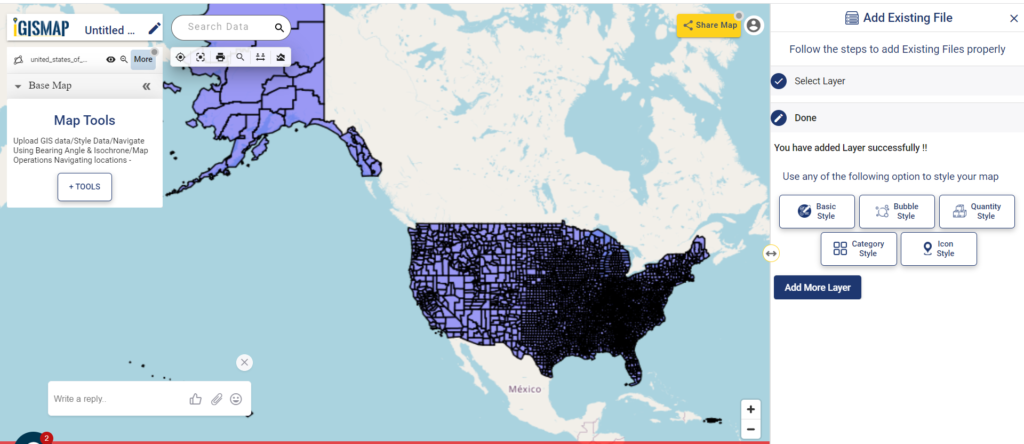
The applications of GIS are advancing in the field of information and computer science. The demand for mapping and geospatial analysis became important for almost all industrial sectors. Limited GIS software and online tools are available where you can do this job. Most GIS software are limited to the service of creating a map or hosting the map in a website, but IGISMap allows you to do both
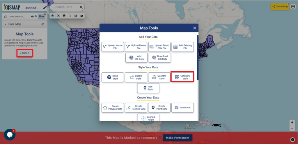
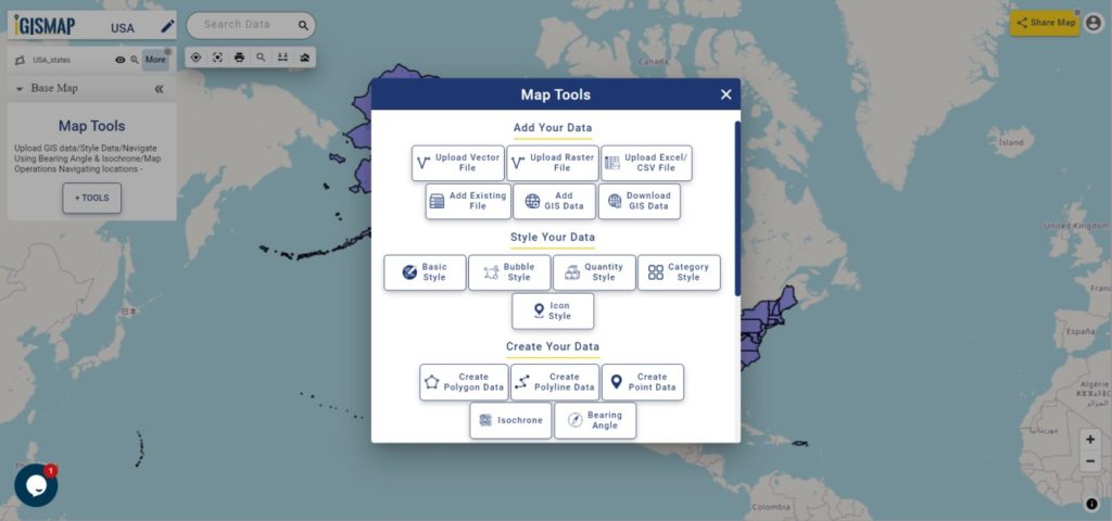
MAPOG is a GIS based web platform providing multiple GIS applications that are most important in the field of geospatial analytics. The peculiarity of IGISMAP in the GIS Industry is its UI/UX that helps the user to perform effortless geospatial operations. GIS tools of IGISMap allows you to Add Your Data, Create Your Data, Map Your Data, Style Your Data, Process Your Data, Analyze Your Data and also help you to Share your map privately or publicly.
IGISMap GIS Data Collection
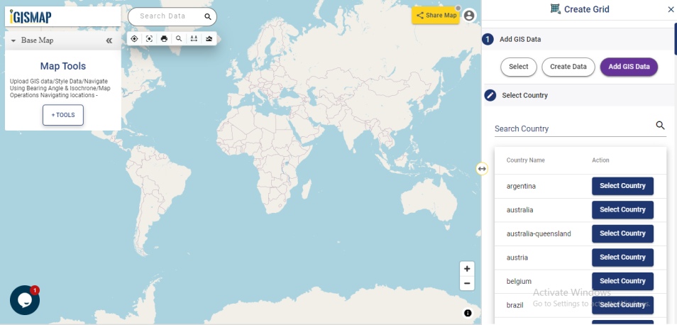
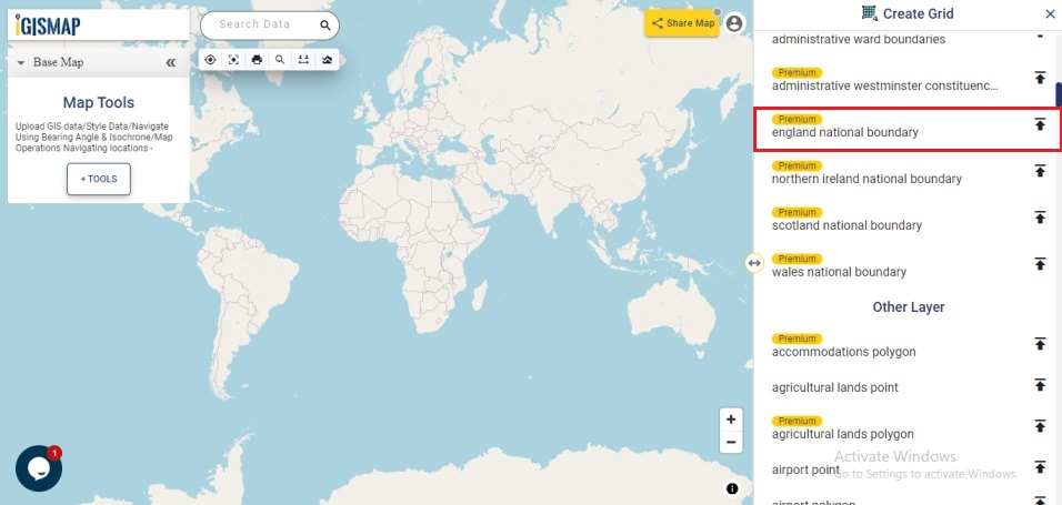
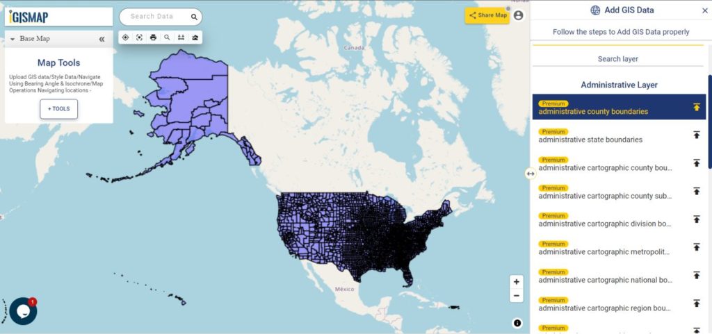
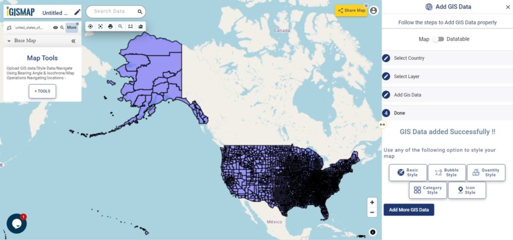
IGISMap provides GIS data based on countries level. These data are made available for more than 30 countries, 51 US states and few spatial data of globally distributed features. These data can be accessed by using Add GIS Data tool and Download GIS Data tools.
Click https://story.mapog.com/app/gisdata to access Add GIS Data tool
Click https://story.mapog.com/app/gisdata to access Download GIS Data tool
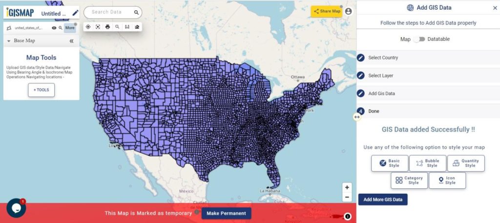
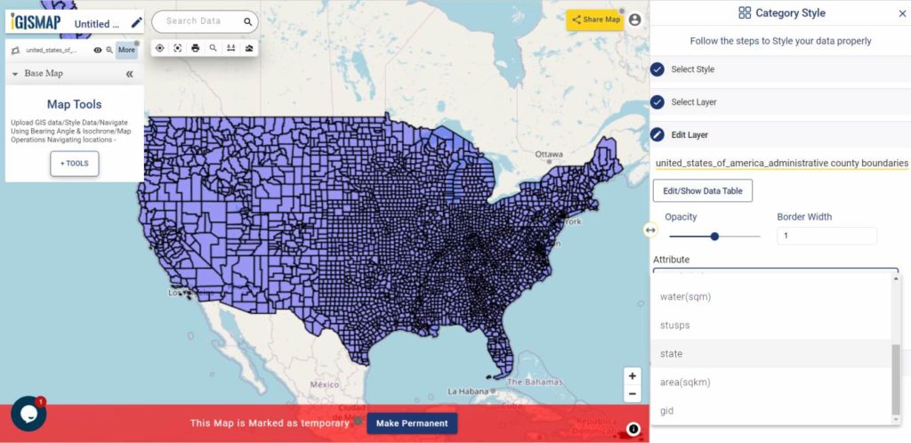
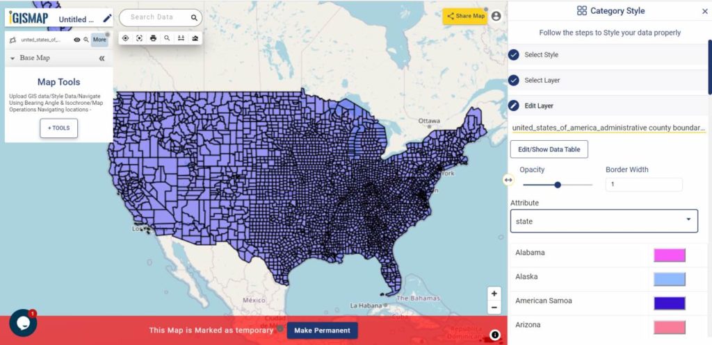
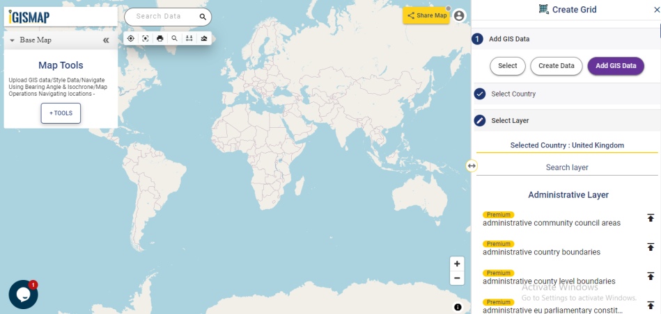
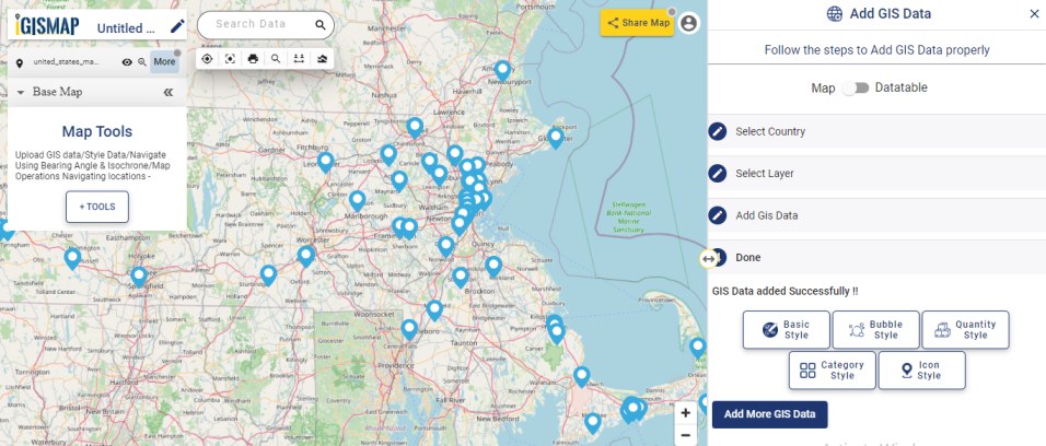
Using Add GIS Data tool, you can these data in your map in IGISMap application iteslf and apply IGISMap tool to perform various geospatial operations. Data are provided in two lists for each country or US states. They are Administrative Layer and Other Layer.
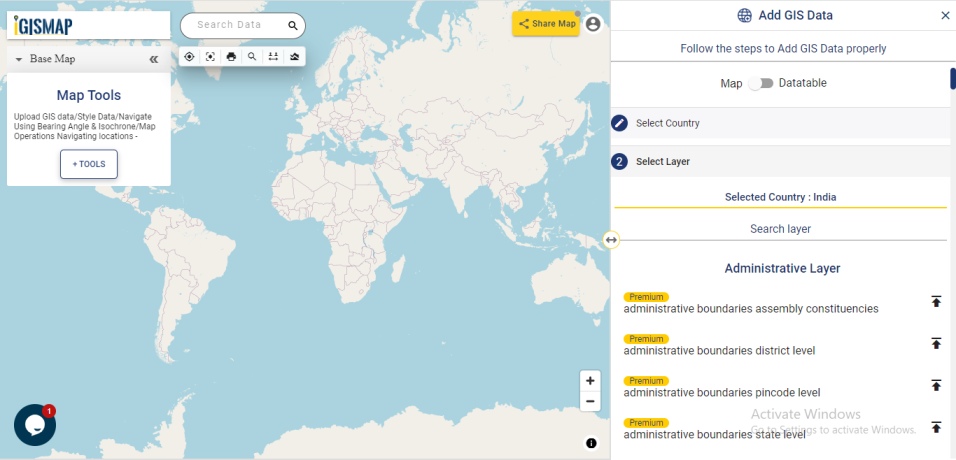
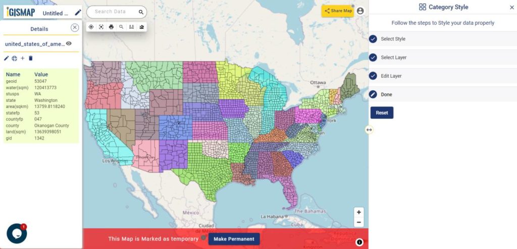
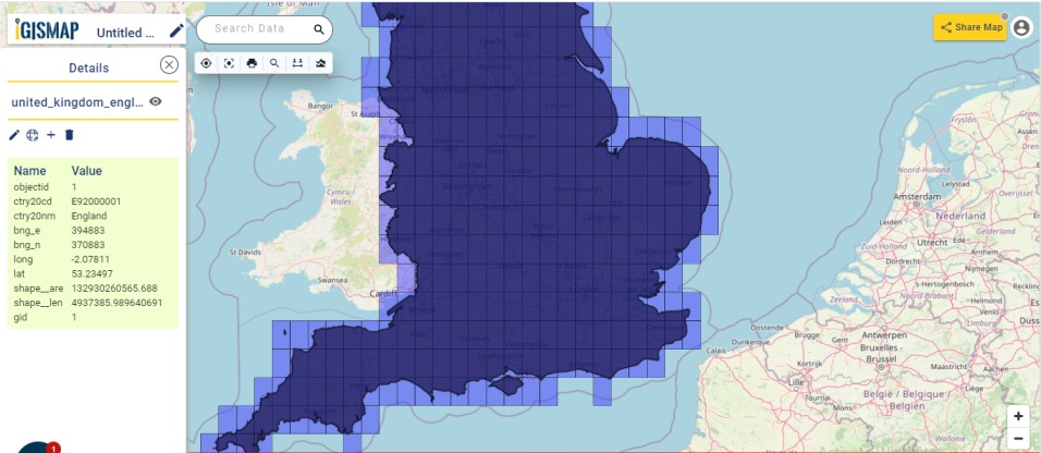
Administrative GIS data are polygon vector data of administrative boundaries such as national outline boundary, state boundaries, province boundaries, district boundaries, counties, postcode boundaries etc. Most of the data in IGISMap GIS data are from Open Street Maps. Administrative level data are collected from various government websites and other authentic online sources such as US Census Bureau, Humanitarian Data Exchange, Census India etc.
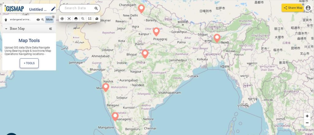
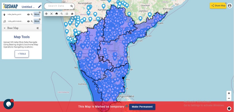
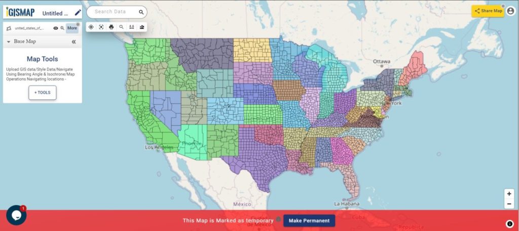
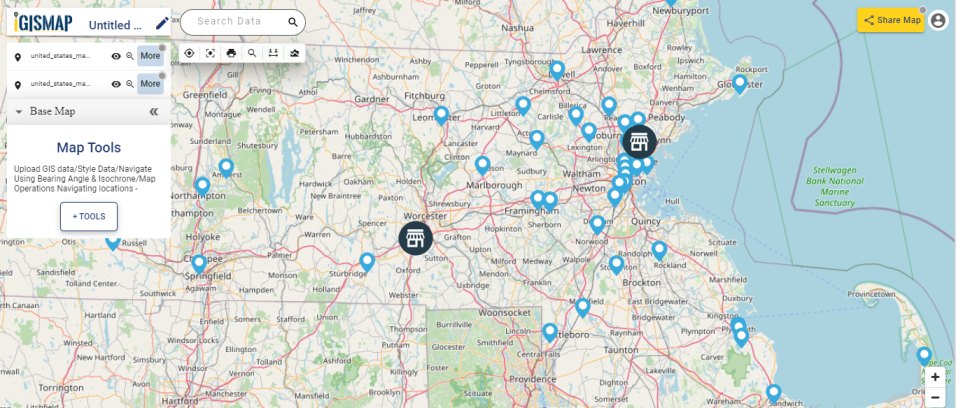
In this article we will Add GIS Data and Proximity Analysis tools of IGISMap to plot the locations of bank in south Indian states, like the following.
Adding data from Add GIS Data tool
For the requirement of mapping bank locations in south India, let us use the point data of bank locations and polygon data of state level boundaries of India from the IGISMap GIS database of India.

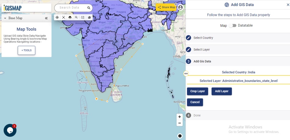
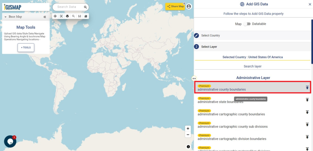
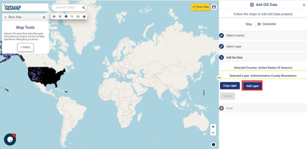
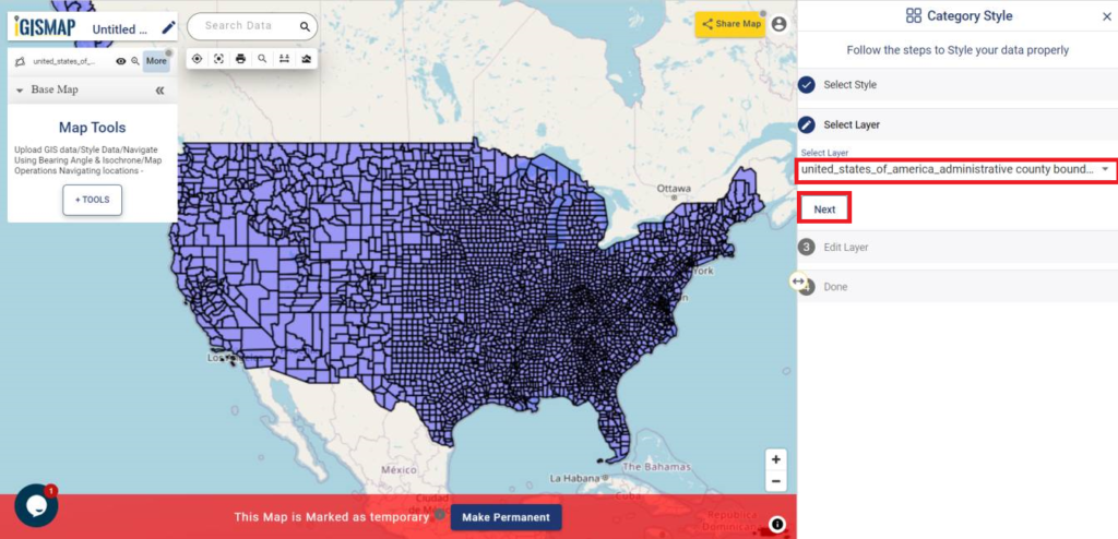
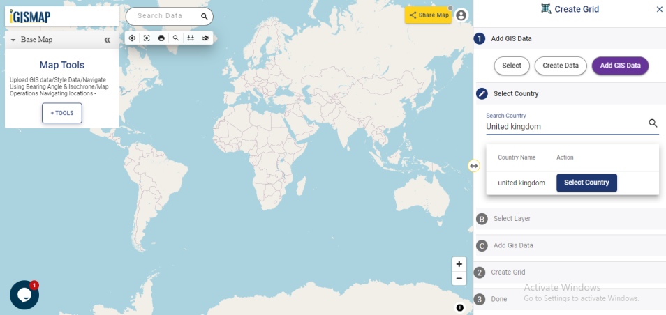
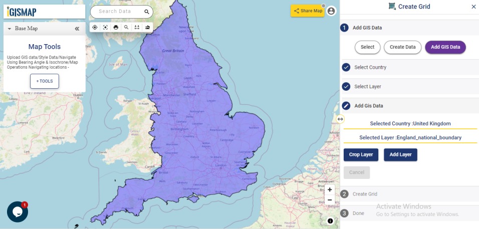
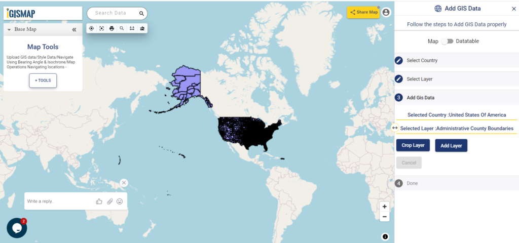
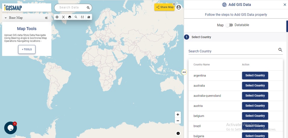
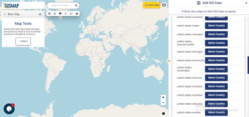
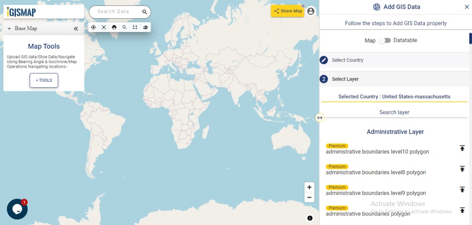
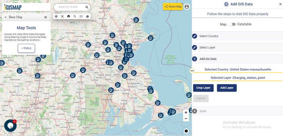
When Add GIS Data is opened, select the country from the list. You can search the name in the search box. Here we will select India and the list of GIS data associated with India will be opened
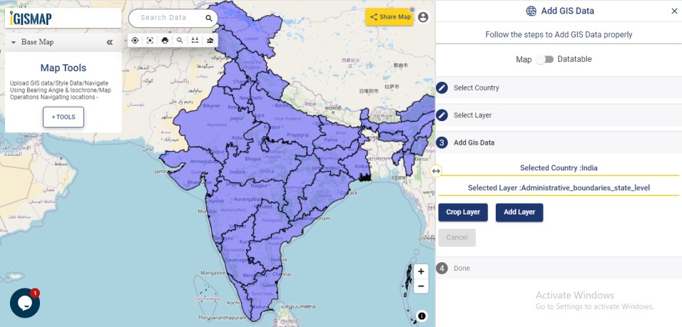
Adding state level GIS data of India
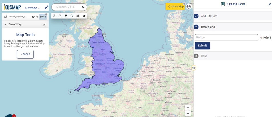
From the list opened, select administrative boundaries state level to preview the data. After confirming the data, click Add Layer icon. This will open the options to Crop Layer and Add Layer.
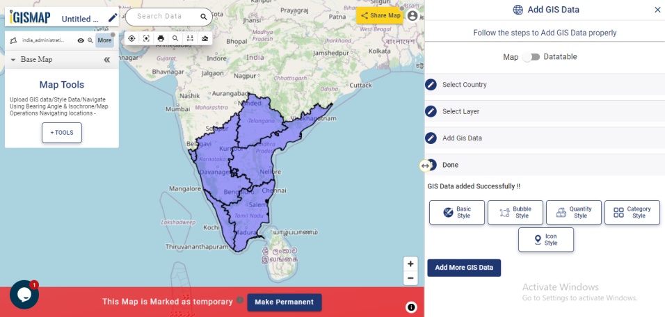
Based on our requirement, we only need to map the bank locations of south Indian states. Even though there is no official South India or North India division for the Republic of India, cetain states are commonly considered as south Indian states, north Indian, north east Indian states etc based on their geographical position. Kerala, Tamil Nadu, Karnataka, Telungana, Andhra Pradesh and Goa are considered to be south Indian states.
Thus lets use the Crop Layer functionality to select these states from the data we added. For this, select Crop Layer tool and draw a polygon intersecting all the south Indian states, as shown below.
After the polygon is completed, click Add Layer button to publish the polygon GIS map of south Indian states to the map.
Click the below link to download the GIS data of India state level boundaries
Download India State Level Boundaries
Adding GIS data of bank locations in India
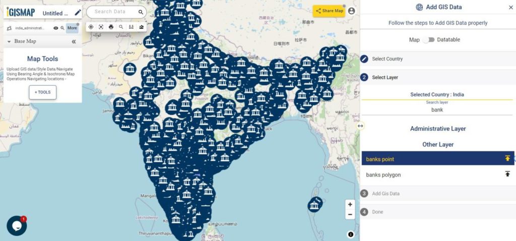
So, the GIS data of south Indian state is added from Add GIS Data tool. Now lets hunt for the GIS data of bank locations of India.
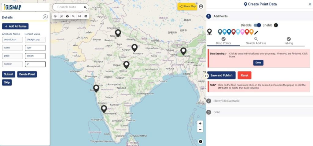
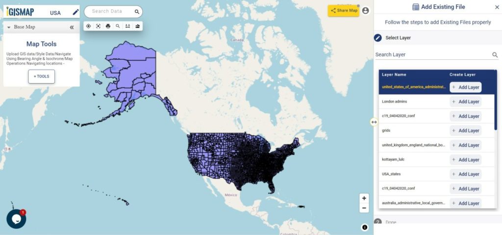
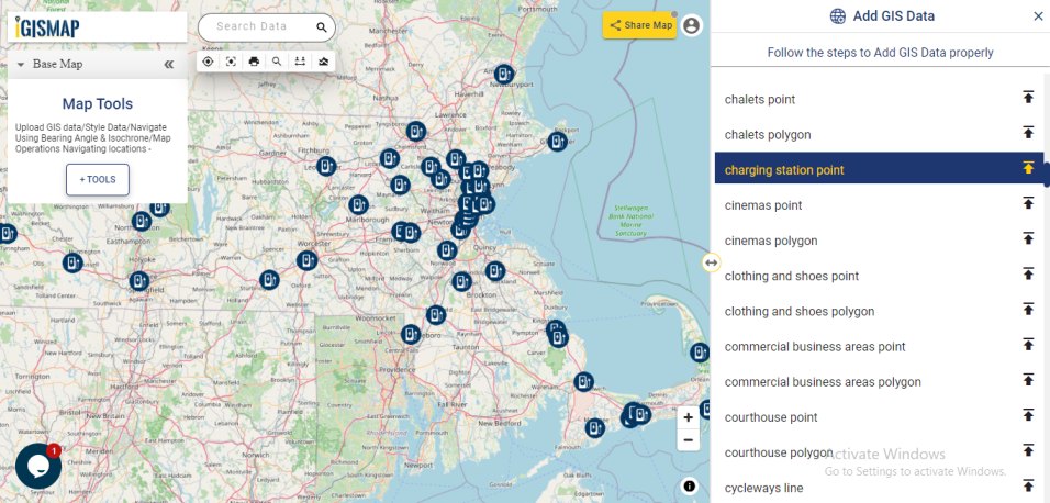
Follow the same steps to add another layer in the existing base map. Select the country from the list and search bank in the Search Layer bar to filter the data list. When you see the data bank point, select the data – preview the map – select Add Layer icon.
Use Crop Layer tool to select bank points in the southern part of India and click Add layer to add the selected bank points.
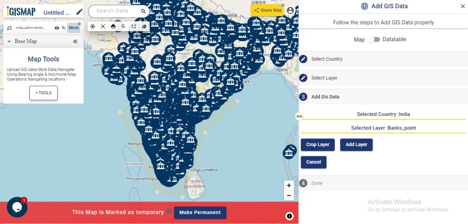
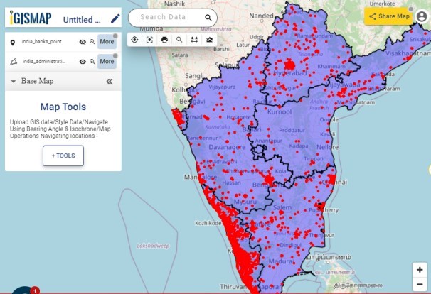
Now we got both GIS data of the administrative boundaries of southern states and location points of bank added in the map.
Click the below link to download the GIS data of bank locations in India
Download GIS Data of Bank Locations in India
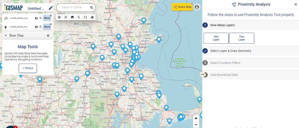
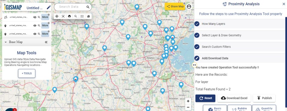
Proximity Analysis
Cropping the point GIS data by drawing polygon may not filter the data points accurately. Some points outside the area of interest may still remain. Thus let’s make use of Proximity Analysis tool of IGISMap.
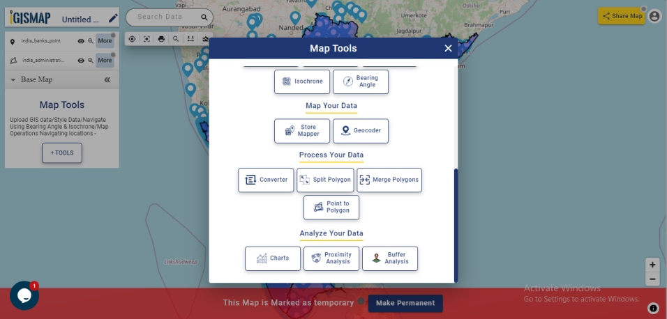
Proximity Analysis can be accessed only from a map. Click on from Map Tools to get the list of IGISMap tools from which you need to select Proximity Analysis tool.
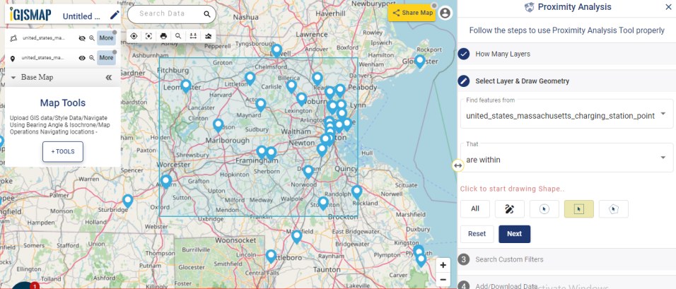
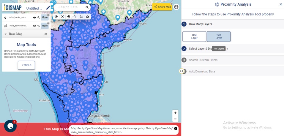
In the tool, the user needs to select layers for performing proximity analysis. Here we need to click the Two Layer option as we want to select the bank locations within the polygon boundaries of south Indian states.
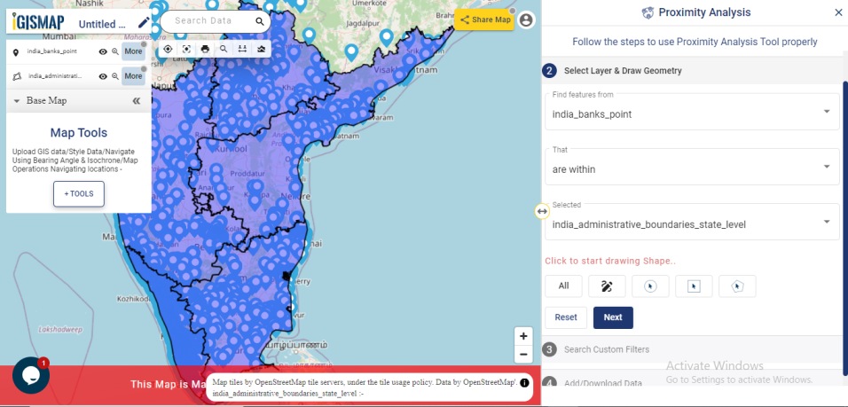
In Step 2, first select the input layer, which is the layer you want the features selected from – india_banks_points. Then select the mode of spatial intersection – are within and intersect. Here we want all bank locations that are within the south Indian states polygon boundaries. Thus select within as the mode of spatial intersection. In the next box, select the india_administrative_boundaries_state_level from the dropdown.
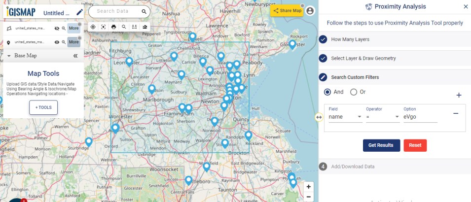
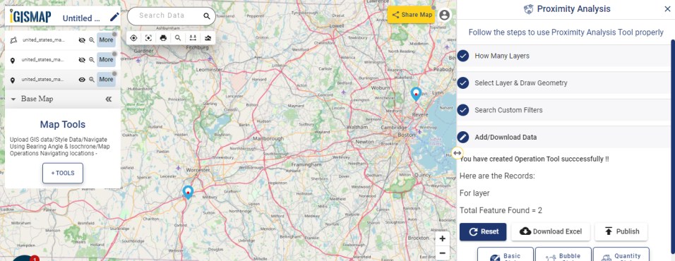
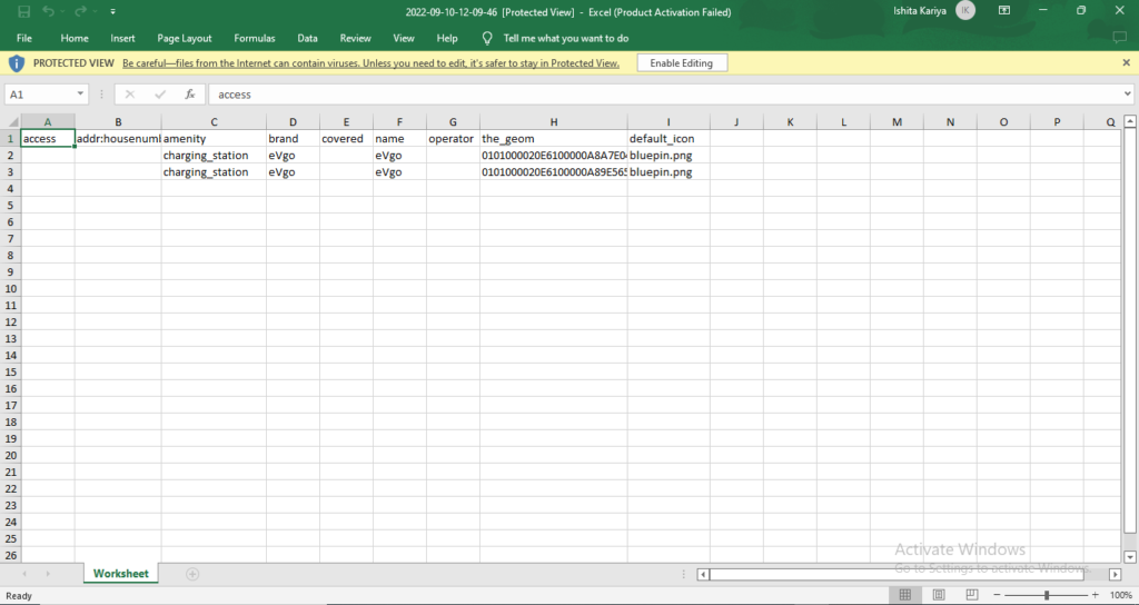
Click Next. Search Custom Filters step opens next, but we done need any further filter requirements. So click Get Result button and see the resulting points highlighted on the map
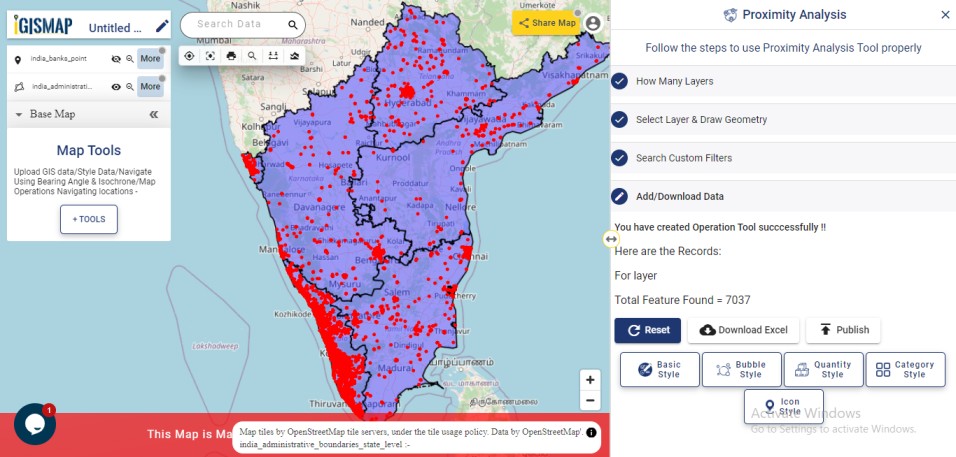
Click Publish which will publish the GIS data of bank locations only in the added south Indian states.
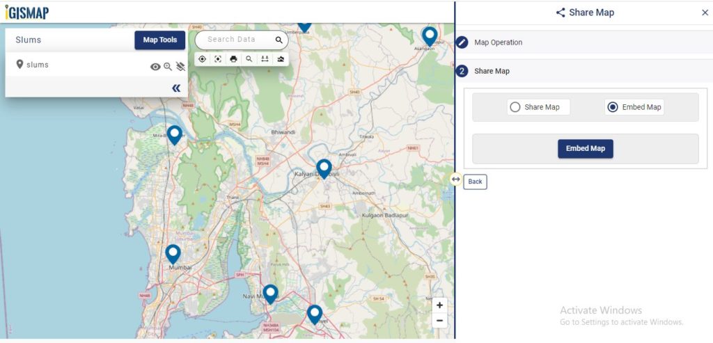
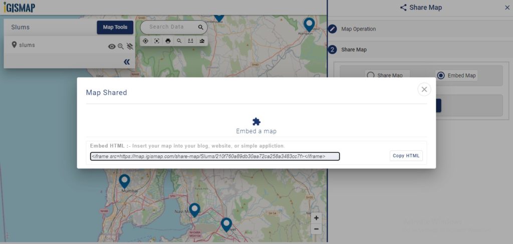
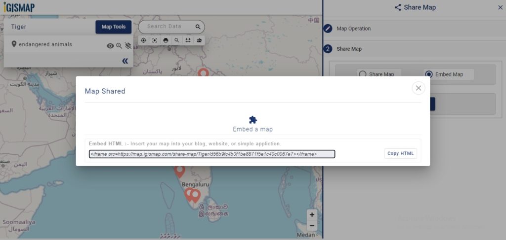
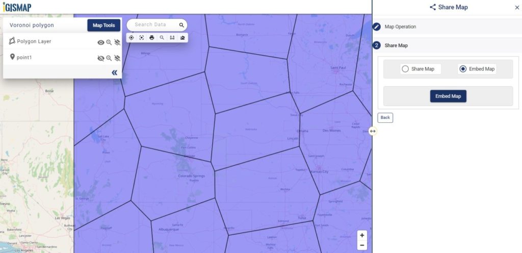
Check the article Share your Map to understand how to share this map with your team.
Also check the article Perform Proximity Analysis over data from Add GIS Data
Check other articles:
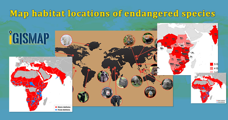
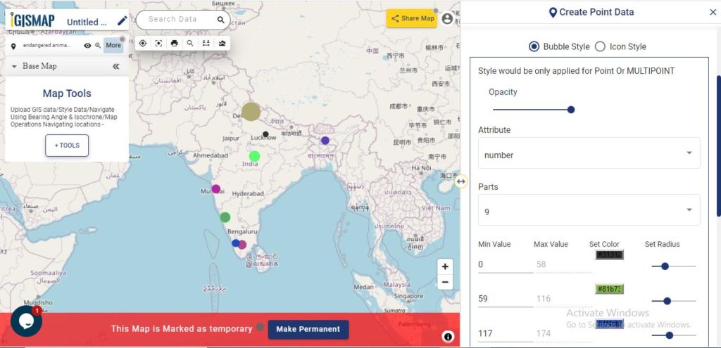
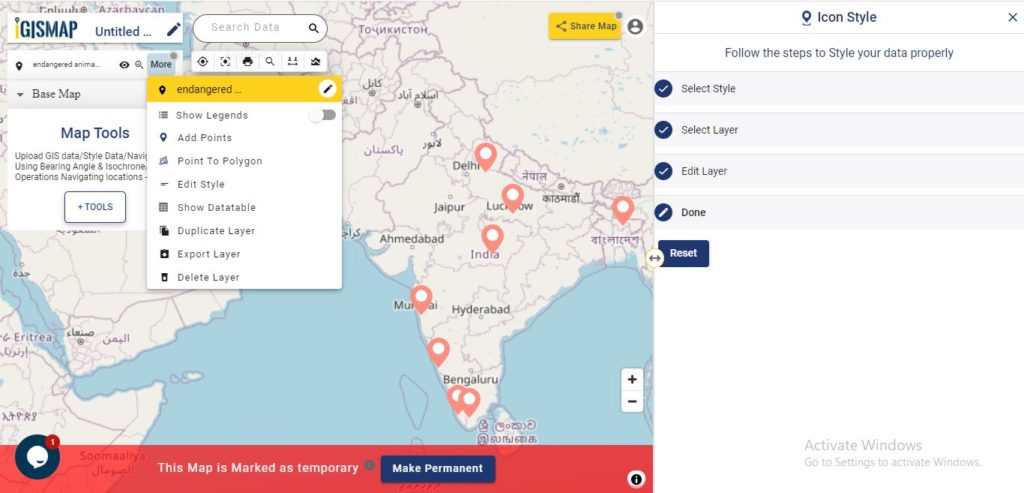
- Map habitat locations of endangered animals & keep track of their living
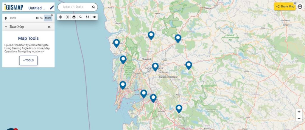
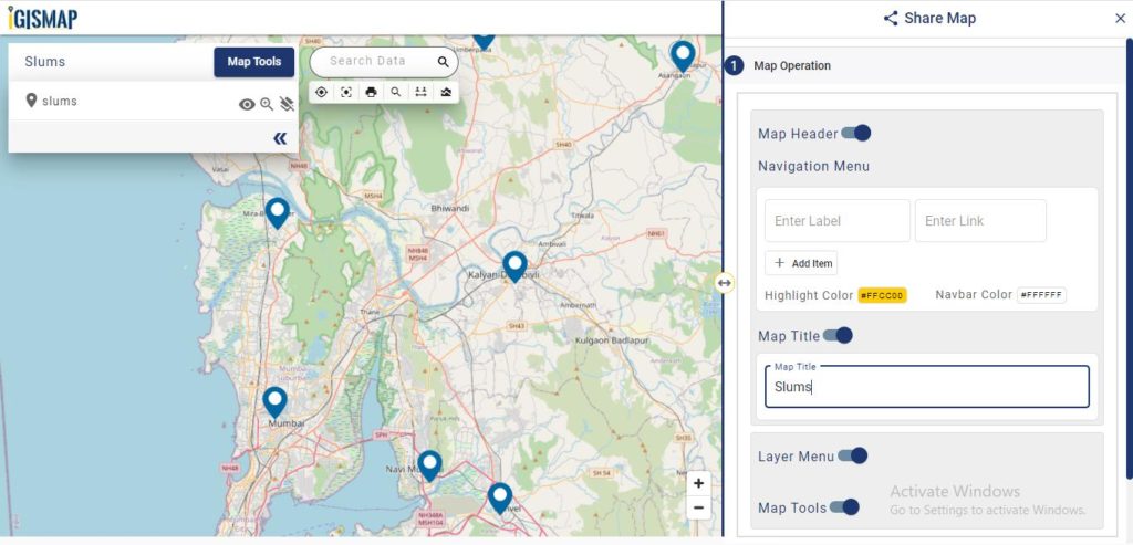
- Map the locations of slums and embed the map on your website
- Create GIS Bubble Map – IGIS Map Tool
- Charts with Map – Create Bar Chart, Histogram, Number Chart, Table
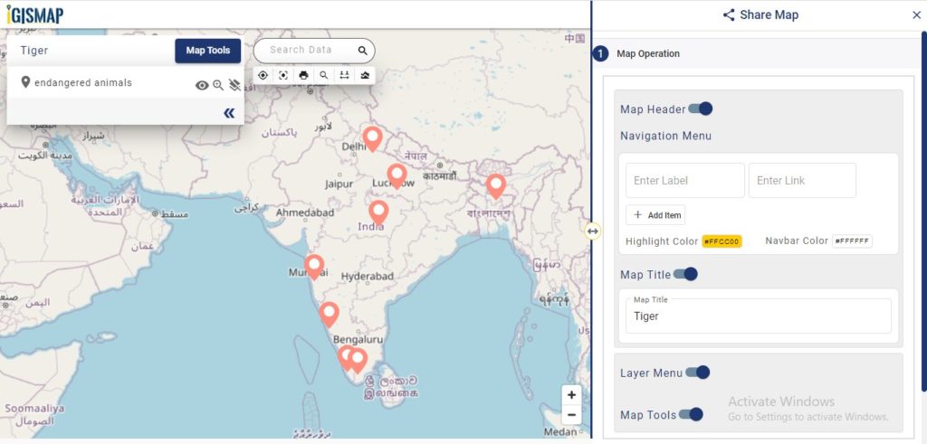
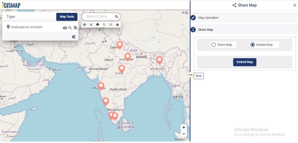
- How to Share Map – Publicly
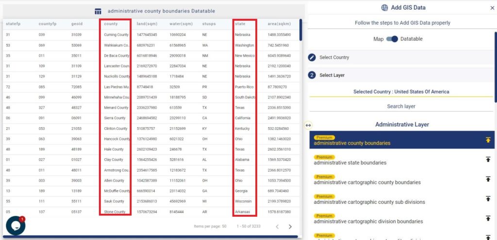
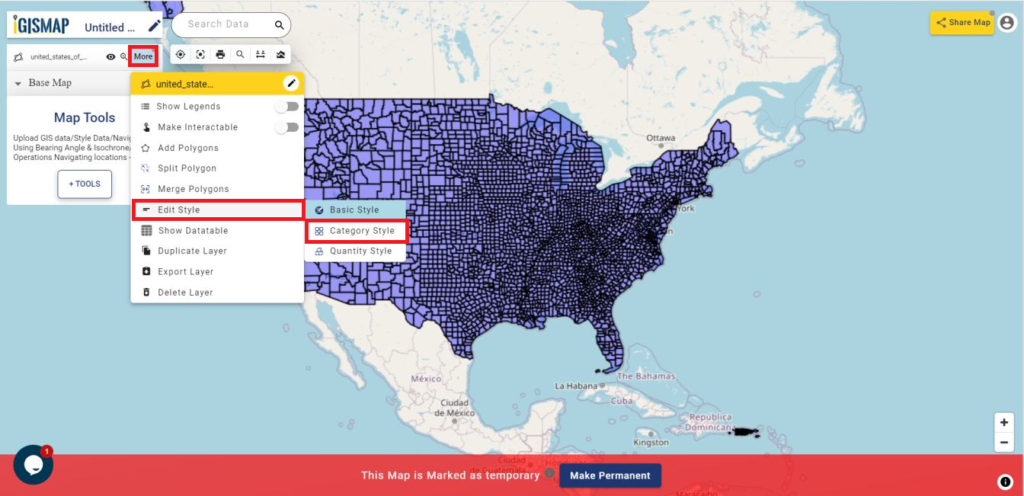
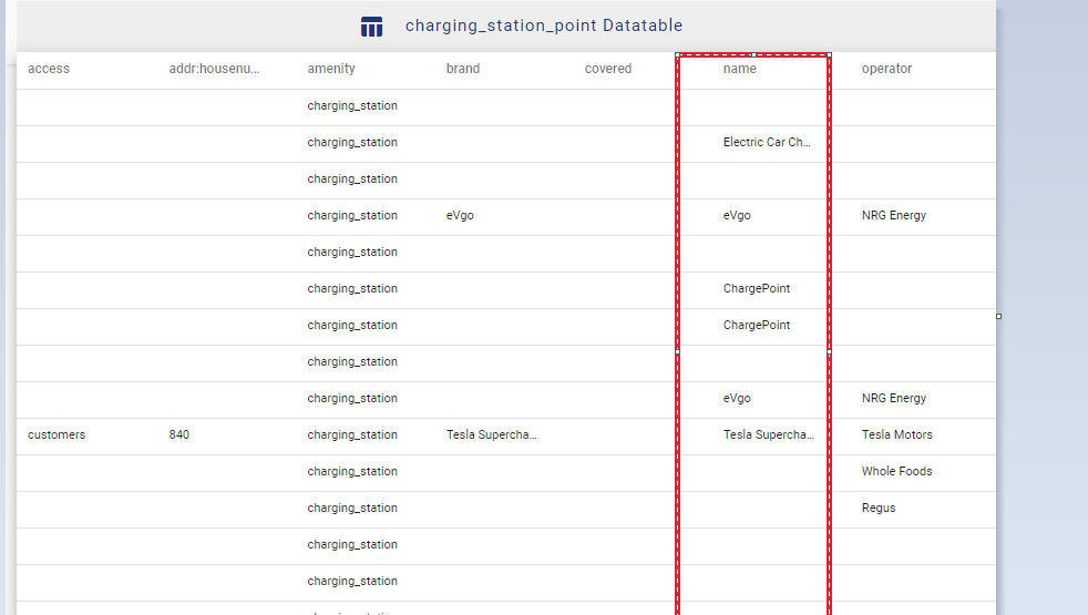
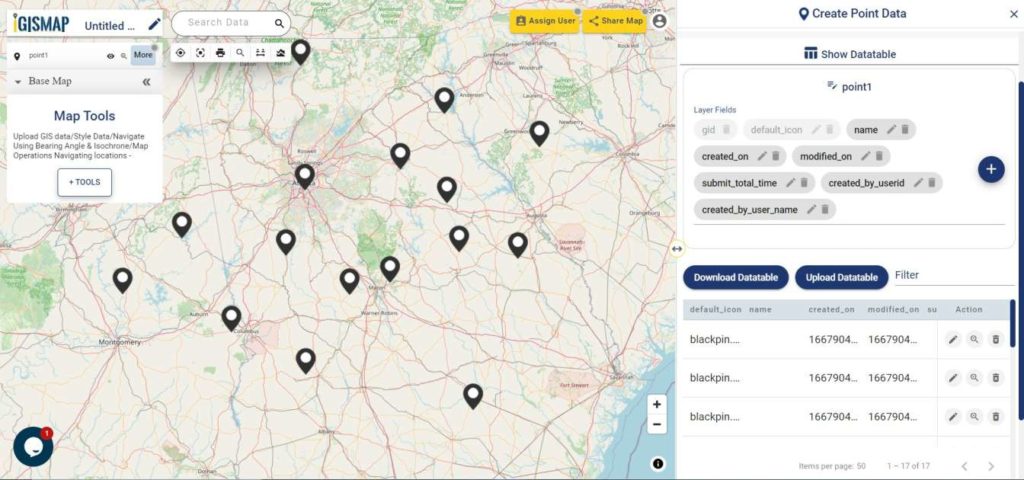
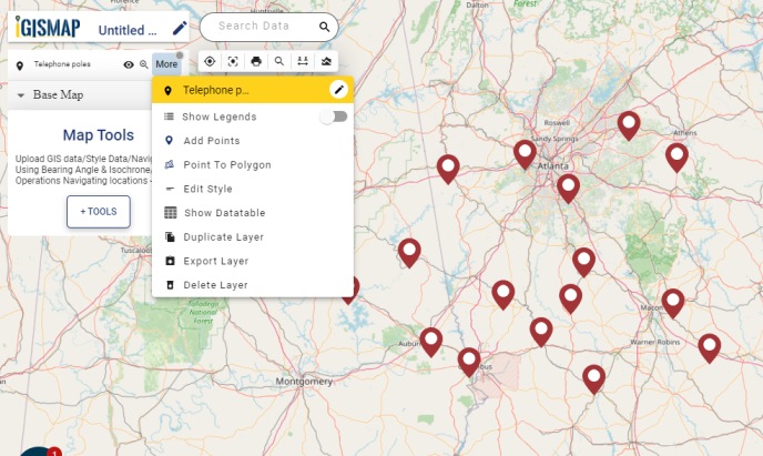
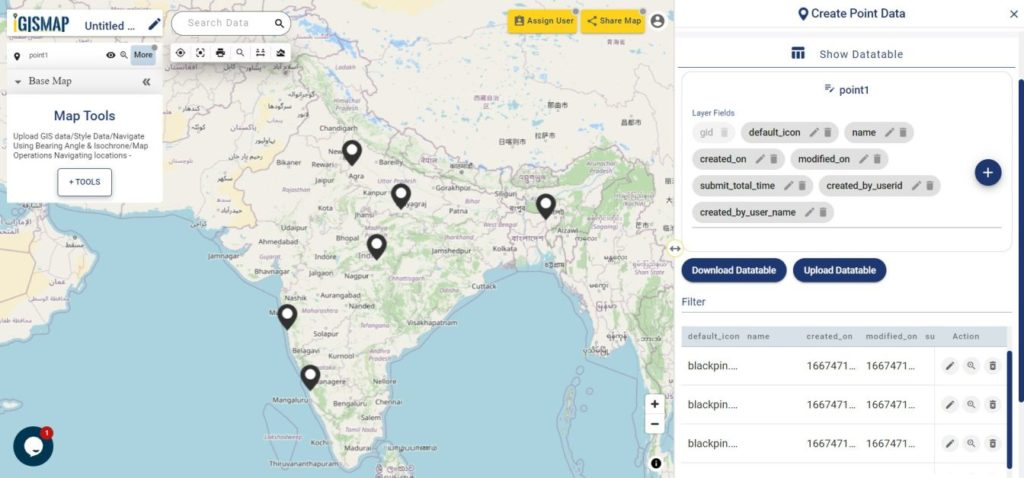
 can be used to switch the view from Map to Datatable. If the information about the datatable present in the add layer can be viewed by the user by switching the mode towards the datatable option.
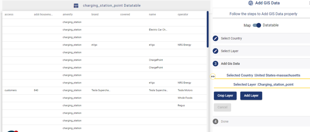
 from Map Tools, you can observe a lot of options to map, process, visualize and analyze your GIS data. Under Analyze Your Data title, select Proximity Analysis tool.