Download United States – Arkansas Shapefiles- Administrative, Kml – Boundary, County, highway, rail line

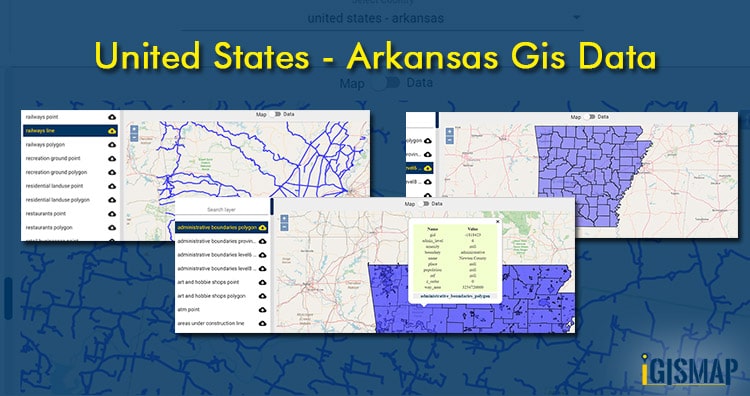
GIS Data and Maps of Arkansas State is used by planners and surveyors for visualizing and identifying the patterns that are difficult to examine when data is in table form. Here you can download the GIS data of the state boundary, county division, rail and highway maps in just a few clicks. You can use these data for analysis in IGISMAP itself or download them in any suitable GIS format. You can download these data in KML, GeoJSON, CSV or Shapefile formats.

With MAPOG’s versatile toolkit, you can effortlessly upload vector and raster filesadd WMS (Web Map Service) layers, upload Excel or CSV data, incorporate existing files, perform polygon splitting and merging, generate new polygon and polyline data, use the converter for various formats, conduct buffer analysiscreate gridstransform points into polygons, calculate isochrones, and utilize the geocoder for precise location information.

We offer an extensive array of data formats, including KML, SHP, CSV, GeoJSON, Tab, SQL, Tiff, GML, KMZ, GPKZ, SQLITE, Dxf, MIF, TOPOJSON, XLSX, GPX, ODS, MID, and GPS, ensuring compatibility and accessibility for various applications and analyses.

Note:

  • All data available are in GCS datum EPSG:4326 WGS84 CRS (Coordinate Reference System).
  • You need to login for downloading the shapefile.

Download County Shapefile of Arkansas State

Arkansas GIS data can be used for spatial analysis of data in social, corporate, and agricultural research & development. Links are provided down in the blog where a multiple layer list is given to choose the one you want. The download button is located near to layer name. Tap the on button select the GIS format from the drop down list. For more specificGISs format use GIS Converter Tool. Click on the link for Arkansas state boundary. For editing, analysis and share use Analysis & Share Tool.

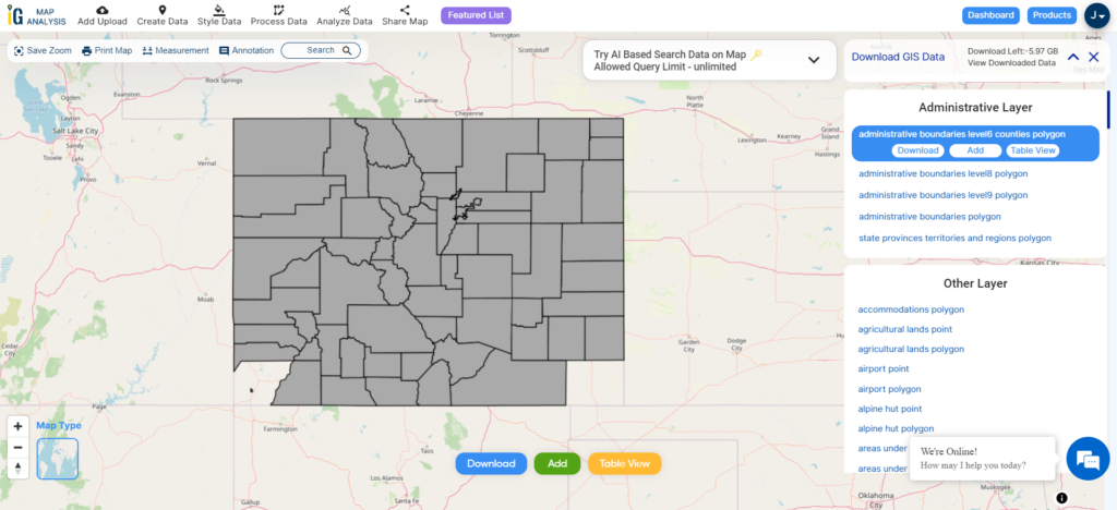
Arkansas State Boundary

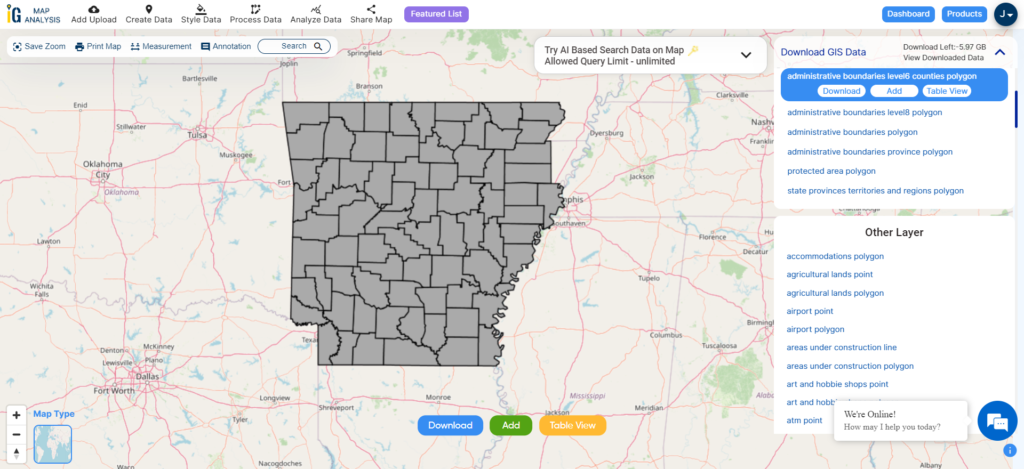
Download Arkansas County Boundary Shapefile

For information or data table regarding specific location click on the map area where you want to view.

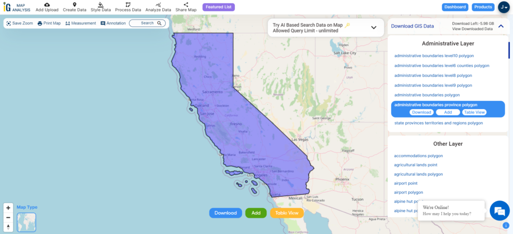
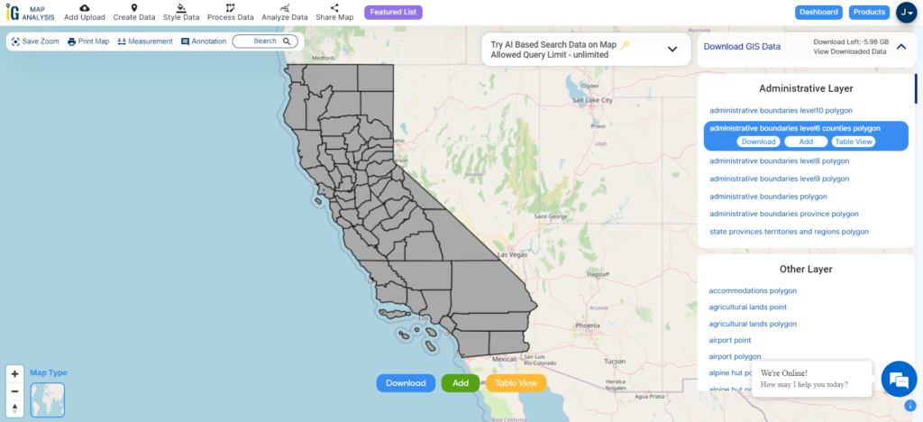
Arkansas polygon shapefile covers all the county. There are 75 counties in Arkansas. Name of Counties –

  • Arkansas
  • Ashley
  • Baxter
  • Benton
  • Boone
  • Bradley
  • Calhoun
  • Carroll
  • Chicot
  • Clark
  • Clay
  • Cleburne
  • Cleveland
  • Columbia
  • Conway
  • Craighead
  • Crawford
  • Crittenden
  • Cross
  • Dallas
  • Desha
  • Drew
  • Faulkner
  • Franklin
  • Fulton
  • Garland
  • Grant
  • Greene
  • Hempstead
  • Hot Spring
  • Howard
  • Independence
  • Izard
  • Jackson
  • Jefferson
  • Johnson
  • Lafayette
  • Lawrence
  • Lee
  • Lincoln
  • Little River
  • Logan
  • Lonoke
  • Madison
  • Marion
  • Miller
  • Mississippi
  • Monroe
  • Montgomery
  • Nevada
  • Newton
  • Ouachita
  • Perry
  • Phillips
  • Pike
  • Poinsett
  • Polk
  • Pope
  • Prairie
  • Pulaski
  • Randolph
  • St. Francis
  • Saline
  • Scott
  • Searcy
  • Sebastian
  • Sevier
  • Sharp
  • Stone
  • Union
  • Van Buren
  • Washington
  • White
  • Woodruff
  • Yell

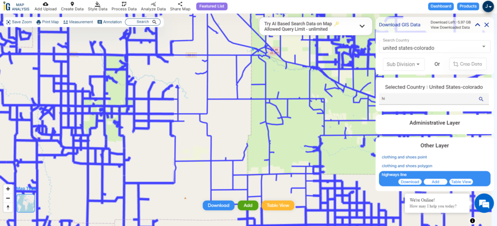
Highway Line Shapefile of Arkansas state

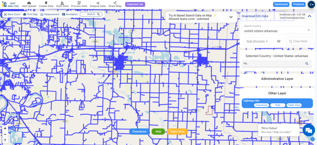
Arkansas Highway Line

Download Arkansas Highway Line Shapefile

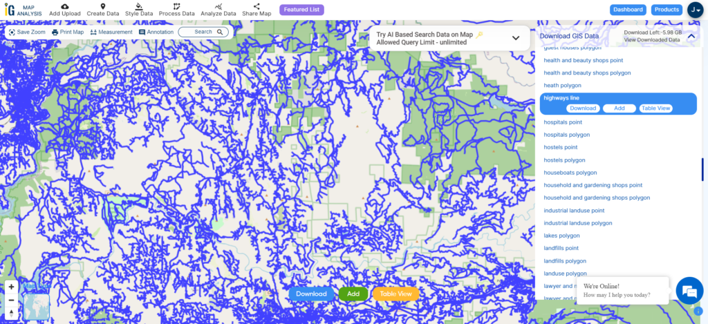
Zoom in view of highway line map is shown shown above. Similarly, you can easily download point based GIS data of airport point, ATM point, parking area, hospital location, etc.

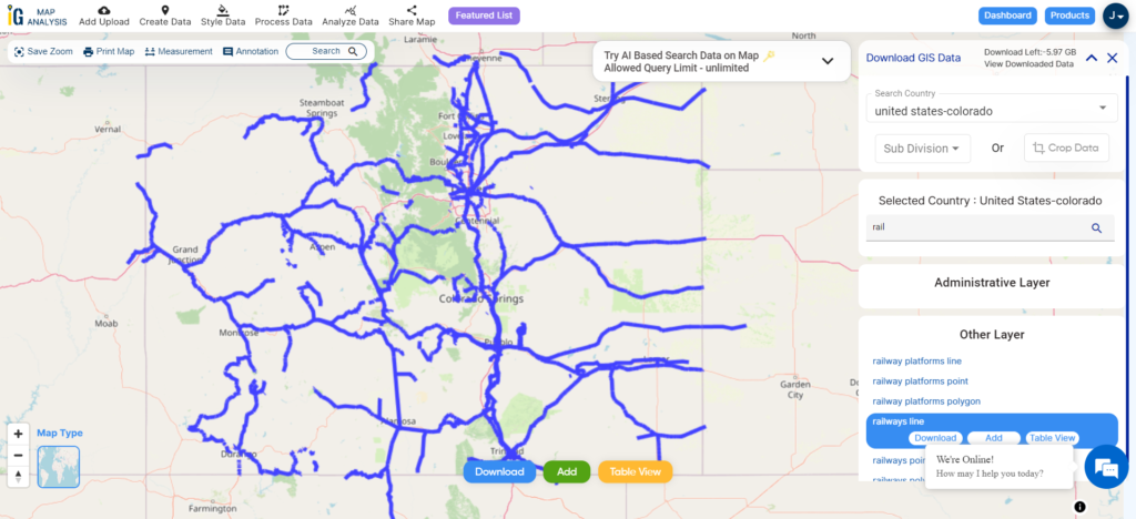
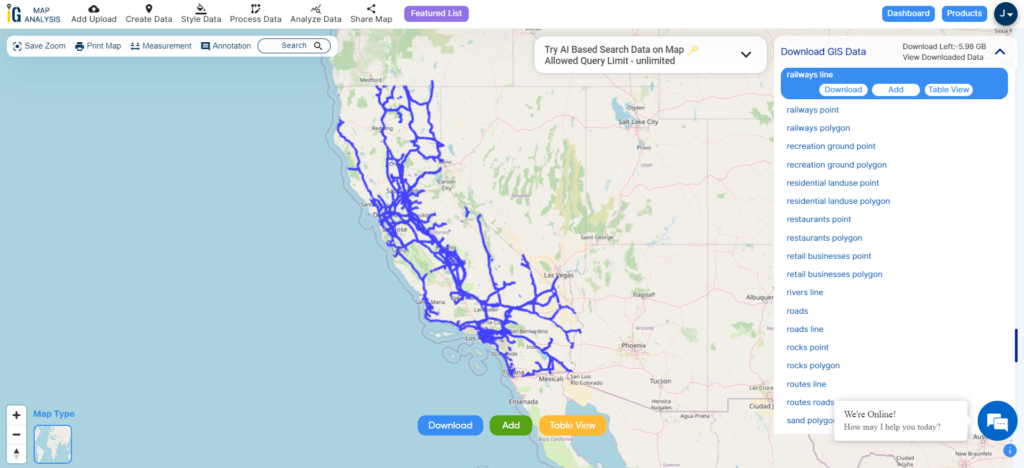
Download Arkansas Railway line GIS data

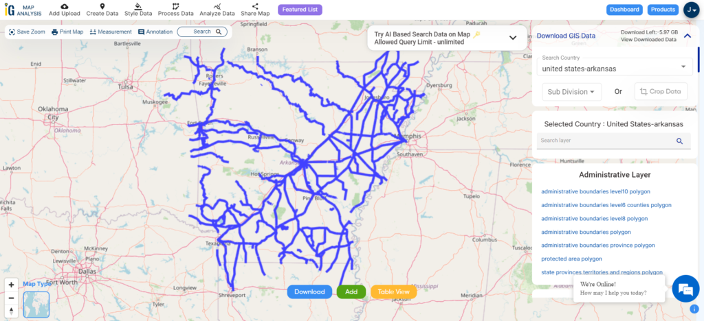
Arkansas Railway Line

Download Arkansas Railway Line Shapefile

Other GIS Data:

Above all links are provided for GIS data of Arkansas if you are looking for any specific data please write us on support@igismap.com

Download GIS Data of other states of USA

  1. Alabama
  2. Alaska
  3. Arizona
  4. Arkansas
  5. California
  6. Colorado
  7. Connecticut
  8. Florida
  9. Georgia
  10. Hawaii
  11. Idaho
  12. Illinois
  13. Indiana
  14. Iowa
  15. Kansas
  16. Massachusetts
  17. Maryland
  18. Michigan
  19. Minnesota
  20. Mississipi
  21. Missouri
  22. Montana
  23. Nevada
  24. Nebraska
  25. Ohio
  26. Oklahoma
  27. Pennsylvania
  28. Utah
  29. Vermont
  30. Washington
  31. Wisconsin
  32. Wyoming
  33. Tennessee
  34. Texas
  35. Kentucky
  36. Louisiana
  37. Maine
  38. North Carolina
  39. Oregon
  40. Virginia
  41. West Virginia

Download Shapefile for the following:

  1. World Countries Shapefile
  2. Australia
  3. Argentina
  4. Austria
  5. Belgium
  6. Brazil
  7. Canada
  8. Denmark
  9. Fiji
  10. Finland
  11. Germany
  12. Greece
  13. India
  14. Indonesia
  15. Ireland
  16. Italy
  17. Japan
  18. Kenya
  19. Lebanon
  20. Madagascar
  21. Malaysia
  22. Mexico
  23. Mongolia
  24. Netherlands
  25. New Zealand
  26. Nigeria
  27. Papua New Guinea
  28. Philippines
  29. Poland
  30. Russia
  31. Singapore
  32. South Africa
  33. South Korea
  34. Spain
  35. Switzerland
  36. Tunisia
  37. United Kingdom Shapefile
  38. United States of America
  39. Vietnam
  40. Croatia
  41. Chile
  42. Norway
  43. Maldives
  44. Bhutan
  45. Colombia
  46. Libya
  47. Comoros
  48. Hungary
  49. Laos
  50. Estonia
  51. Iraq
  52. Portugal
  53. Azerbaijan
  54. Macedonia
  55. Romania
  56. Peru
  57. Marshall Islands
  58. Slovenia
  59. Nauru
  60. Guatemala
  61. El Salvador
  62. Afghanistan
  63. Cyprus
  64. Syria
  65. Slovakia
  66. Luxembourg
  67. Jordan
  68. Armenia
  69. Haiti And Dominican Republic

Disclaimer : If you find any shapefile data of country provided is incorrect do contact us or comment below, so that we will correct the same in our system as well we will try to correct the same in openstreetmap.
Download Austria Shapefiles – Administrative Boundaries, Highway and Railway lines, Ferry, Airport and Aerodrome Points

Hello GIS enthusiasts, IGISMAP has now published the latest GIS vector data of Austria administrative levels. Links for downloading the shapefiles of the important administrative divisions of Austria are provided in the following. You can also download these data in KML, GeoJSON or CSV formats.

Note:

  • All data available are in GCS datum EPSG:4326 WGS84 CRS (Coordinate Reference System).
  • You need to login for downloading the shapefile.

Download Free Shapefile Data of Austria

Austria officially the Republic of Austria, is a country in the southern part of Central Europe. It is a federation of nine states, one of which is the capital Vienna, the largest city and state by population. The country is bordered by Germany to the northwest, the Czech Republic to the north, Slovakia to the northeast, Hungary to the east, Slovenia and Italy to the south, and Switzerland and Liechtenstein to the west. It occupies a landlocked area of 83,879 km2 (32,386 sq mi) and has a population of 9 million people.

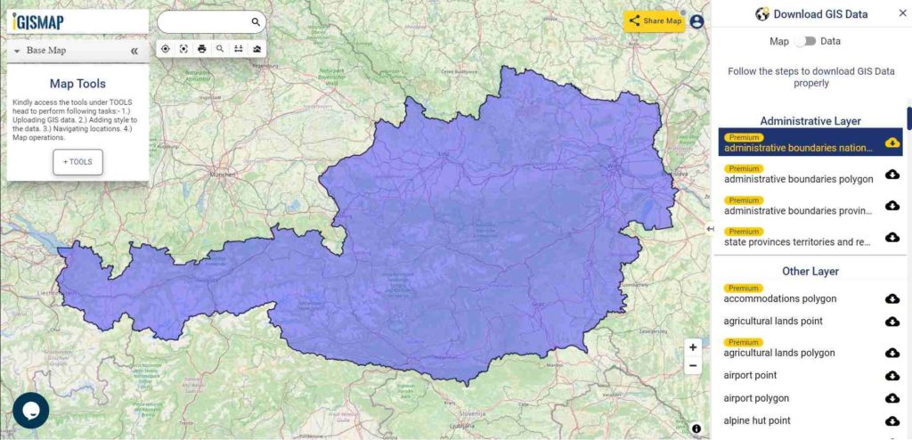
Austria GIS Data - National Boundary
Austria National Boundary

Download Austria National Outline Boundary Shapefile

If you are looking for any other GIS formats then use GIS File Converter.

Download Austria States Shapefile Data

Austria is a federal republic made up of nine states

Burgenland – Burgenland
Kärnten – Carinthia
Niederösterreich – Lower Austria
Oberösterreich – Upper Austria
Salzburg – Salzburg
Steiermark – Styria
Tirol – Tyrol
Vorarlberg – Vorarlberg
Wien – Vienna

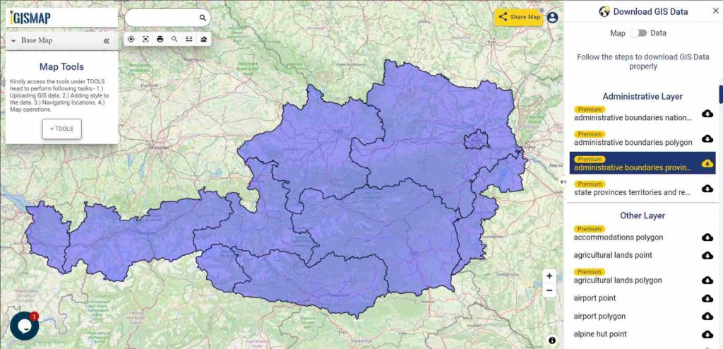
Austria GIS Data - State Boundaries
Austria State Boundaries

Download Austria State Boundaries Shapefile

Highway Line GIS Data of Austria

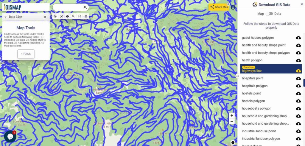
Austria GIS Data - Highway Lines
Austria Highway Lines

Download Austria Highway Lines Shapefile

In the above map, zoom in view of highway line map is shown. Similarly, you can easily download point based GIS data of airport locations, ATM locations, parking locations, hospital location, etc.

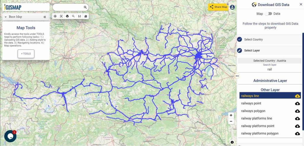
Railways Line GIS Data of Austria

Austria GIS Data - Railway Lines
Austria Railway Lines

Download Austria Railway Lines Shapefile

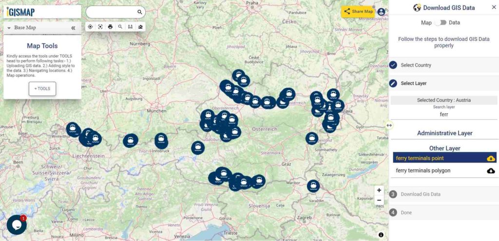
Download Ferry Point Shapefile of Austria

Austria GIS Data - Ferry Points
Austria Ferry Points

Download Austria Ferry Points Shapefile

You can view and download the ferry points of Austria from above link.

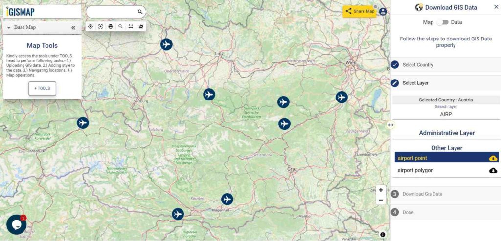
Download Austria Airport/Aerodrome Point Shapefile

Airport location points of the following airports are available:

  • Flugfeld Mariazell
  • Flugplatz Lanzen-Turnau
  • Zivilflugplatz Micheldorf
  • Flugplatz Schärding-Suben
  • Wiener Neustadt West Airport
  • Flugplatz Nötsch
  • Flugplatz Kufstein-Langkampfen
  • Flugplatz Sankt Donat Mairist
Austria GIS Data - Airport Points
Austria Airport Points

Download Austria Airport Points Shapefile

For more GIS data visit – MAPOG GIS Data

For more specific data contact us at support@igismap.com

Download Free Shapefile for the following:

  1. World Countries Shapefile
  2. Australia
  3. Argentina
  4. Austria
  5. Belgium
  6. Brazil
  7. Canada
  8. Denmark
  9. Fiji
  10. Finland
  11. Germany
  12. Greece
  13. India
  14. Indonesia
  15. Ireland
  16. Italy
  17. Japan
  18. Kenya
  19. Lebanon
  20. Madagascar
  21. Malaysia
  22. Mexico
  23. Mongolia
  24. Netherlands
  25. New Zealand
  26. Nigeria
  27. Papua New Guinea
  28. Philippines
  29. Poland
  30. Russia
  31. Singapore
  32. South Africa
  33. South Korea
  34. Spain
  35. Switzerland
  36. Tunisia
  37. United Kingdom Shapefile
  38. United States of America
  39. Vietnam
  40. Croatia
  41. Chile
  42. Norway

Disclaimer : If you find any shapefile data of country provided is in correct do contact us or comment below, so that we will correct the same in our system as well we will try to correct the same in OSM.

Download Russia Shapefiles – Administrative Boundaries, Highway and Railway lines, Ferry, Airport and Aerodrome Points

Hello GIS enthusiasts, IGISMAP has now published the latest GIS vector data of Russia administrative levels. Links for downloading the shapefiles of the important administrative divisions of Russia are provided in the following. You can also download these data in KML, GeoJSON or CSV formats.

Note:

  • All data available are in GCS datum EPSG:4326 WGS84 CRS (Coordinate Reference System).
  • You need to login for downloading the shapefile.

Download Free Shapefile Data of Russia

Russia or the Russian Federation (RF), is a transcontinental country spanning Eastern Europe and Northern Asia. It is the largest country in the world by area, covering over 17,125,191 square kilometers (6,612,073 sq mi), and encompassing one-eighth of Earth’s inhabitable landmass. Russia extends across eleven time zones and borders sixteen sovereign nations, the most of any country in the world.[d] It is the ninth-most populous country and the most populous country in Europe, with a population of 145.5 million. The country’s capital and largest city is Moscow, the largest city entirely within Europe. Saint Petersburg is Russia’s cultural center and second-largest city. Other major urban areas include Novosibirsk, Yekaterinburg, Nizhny Novgorod and Kazan.

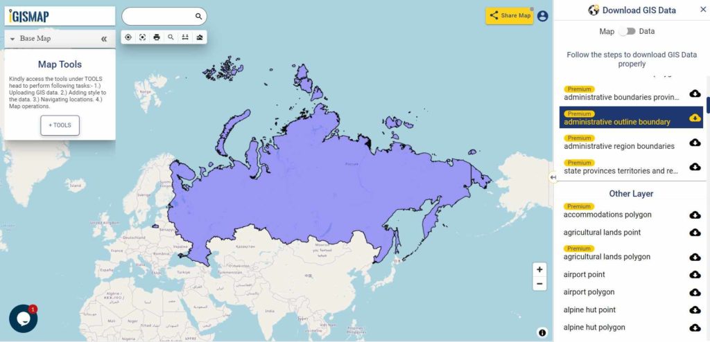
Russia GIS Data - National Boundary
Russia National Boundary

Download Russia National Outline Boundary Shapefile

If you are looking for any other GIS formats then use GIS File Converter.

Download Russia Regions Shapefile Data

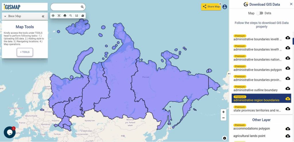
Russia is geographically divided into two parts: European Russia and Asian Russia. We will categorize Central, European North, North-West, European South (Northern Caucasus), the Volga region and the Ural region as part of European Russia. Asian Russia consists of Western Siberia, Eastern Siberia and the Far East.

Russia GIS Data - Region Boundaries
Russia National Boundary

Download Russia Regions Boundaries Shapefile

Highway Line GIS Data of Russia

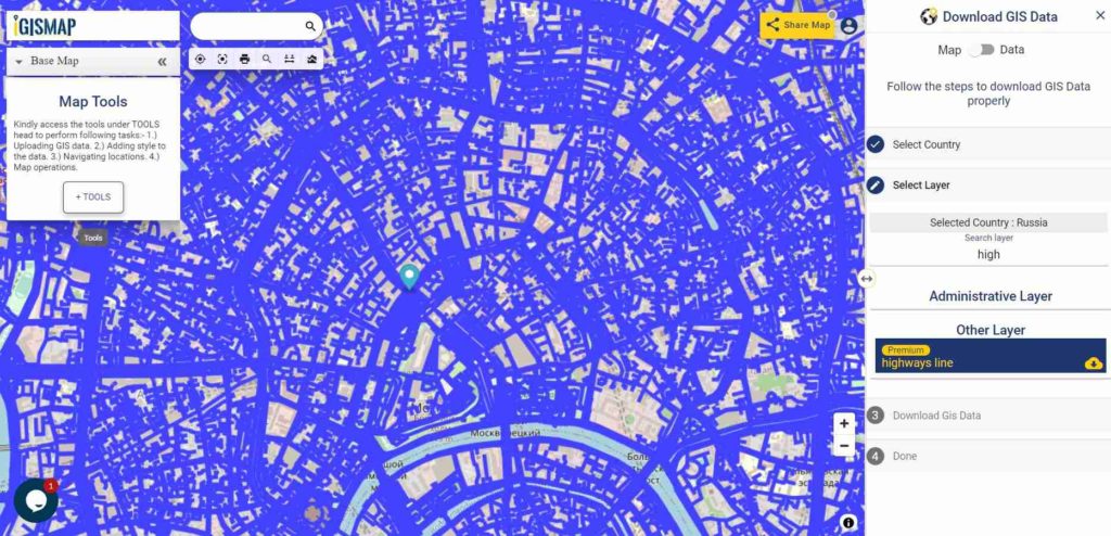
Russia GIS Data - Highway Lines
Russia Highway Lines

Download Russia Highway Lines Shapefile

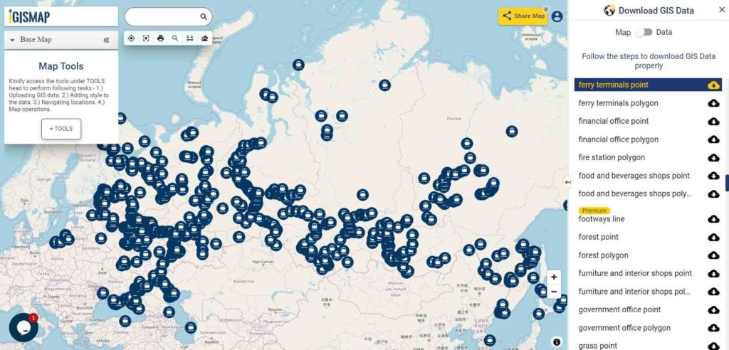
In the above map, zoom in view of highway lines of Moscow is shown. Similarly, you can easily download point based GIS data of airport locations, ATM locations, parking locations, hospital location, etc.

Railways Line GIS Data of Russia

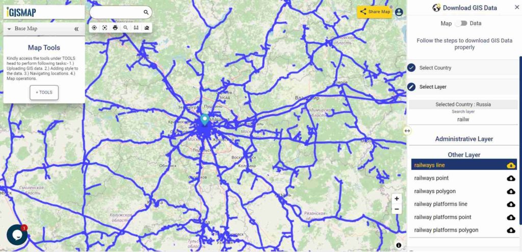
Russia GIS Data - Railway Lines
Russia Railway Lines

Download Russia Railway Lines Shapefile

In the above map, zoom in view of railway lines in Moscow is shown.

Download Ferry Point Shapefile of Russia

Russia GIS Data - Ferry Points
Austria Ferry Points

Download Russia Ferry Points Shapefile

You can view and download the ferry points of Austria from above link.

Other Data:

For more GIS data visit – MAPOG GIS Data

If you any problem in downloading shapefile please comment below or mail us at support@igismap.com

Download Free Shapefile for the following:

  1. World Countries Shapefile
  2. Australia
  3. Argentina
  4. Austria
  5. Belgium
  6. Brazil
  7. Canada
  8. Denmark
  9. Fiji
  10. Finland
  11. Germany
  12. Greece
  13. India
  14. Indonesia
  15. Ireland
  16. Italy
  17. Japan
  18. Kenya
  19. Lebanon
  20. Madagascar
  21. Malaysia
  22. Mexico
  23. Mongolia
  24. Netherlands
  25. New Zealand
  26. Nigeria
  27. Papua New Guinea
  28. Philippines
  29. Poland
  30. Russia
  31. Singapore
  32. South Africa
  33. South Korea
  34. Spain
  35. Switzerland
  36. Tunisia
  37. United Kingdom Shapefile
  38. United States of America
  39. Vietnam
  40. Croatia
  41. Chile
  42. Norway

Disclaimer : If you find any shapefile data of country provided is in correct do contact us or comment below, so that we will correct the same in our system as well we will try to correct the same in OSM.

Download Fiji Shapefile free – City, polygon, boundary

Hello GIS enthusiasts, IGISMAP has now published the latest GIS vector data of Austria administrative levels. Links for downloading the shapefiles of the important administrative divisions of Austria are provided in the following. You can also download these data in KML, GeoJSON or CSV formats.

Download Fiji Shapefile

Download link for both shapefile is provided. Before download fill your email id if you are not registered users. For registered user you can export Fiji datasets directly.

Boundary Shapefile of Fiji

All data available are in EPSG:4326 WGS84 CRS (Coordinate Reference System). Using following link you will be redirected to the boundary map of Fiji.

Download Boundary Fiji Map Shapefile

Polygon Shapefile of Fiji

Download Province State Polygon Shapefile of Fiji

Fiji polygon shapefile covers Central, Eastern, Northern, Rotuma and western.

Clarification – GIS datasets of Fiji provided here is license under Open Data Commons Open Database License (ODbL) .

Download shapefile of other countries –

In the following list if your requirement is not fulfilled then please comment below so that we can add it.

  1. World Countries Shapefile
  2. Australia
  3. Argentina
  4. Austria
  5. Belgium
  6. Brazil
  7. Canada
  8. Denmark
  9. Fiji
  10. Finland
  11. Germany
  12. Greece
  13. India
  14. Indonesia
  15. Ireland
  16. Italy
  17. Japan
  18. Kenya
  19. Lebanon
  20. Madagascar
  21. Malaysia
  22. Mexico
  23. Mongolia
  24. Netherlands
  25. New Zealand
  26. Nigeria
  27. Papua New Guinea
  28. Philippines
  29. Poland
  30. Russia
  31. Singapore
  32. South Africa
  33. South Korea
  34. Spain
  35. Switzerland
  36. Tunisia
  37. United Kingdom Shapefile
  38. United States of America
  39. Vietnam
  40. Croatia
  41. Chile
  42. Norway

Disclaimer : If you find any shapefile data of country provided is in correct do contact us or comment below, so that we will correct the same in our system as well we will try to correct the same in openstreetmap

Download Denmark Administrative Boundary Shapefiles – Regions, Municipalities, Postal Areas and More

Hello GIS enthusiasts, IGISMAP has now published the latest GIS vector data of Denmark administrative levels. Links for downloading the shapefiles of the important administrative divisions of Denmark are provided in the following. You can also download these data in KML, GeoJSON or CSV formats. 

Note:

  • All data available are in GCS datum EPSG:4326 WGS84 CRS (Coordinate Reference System).
  • You need to login for downloading the shapefile.

Download Free Shapefile Data of Denmark

Denmark is a Nordic country in Northern Europe. It is the most populous and politically central constituent of the Kingdom of Denmark, a constitutionally unitary state that includes the autonomous territories of the Faroe Islands and Greenland in the North Atlantic Ocean. European Denmark is the southernmost of the Scandinavian countries, lying southwest of Sweden, south of Norway, and north of Germany. Spanning a total area of 42,943 km2 (16,580 sq mi), it consists of the peninsula of Jutland and an archipelago of 443 named islands, of which the largest are Zealand, Funen and the North Jutlandic Island. Denmark’s geography is characterized by flat, arable land, sandy coasts, low elevation, and a temperate climate. As of 2022, it had a population of 5.88 million (1 March 2022), of which 800,000 live in the capital and largest city, Copenhagen.

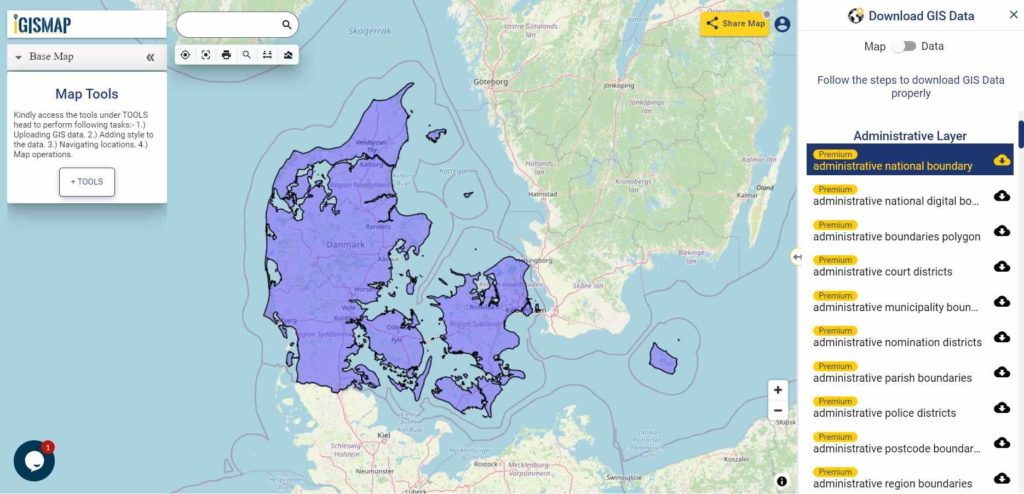
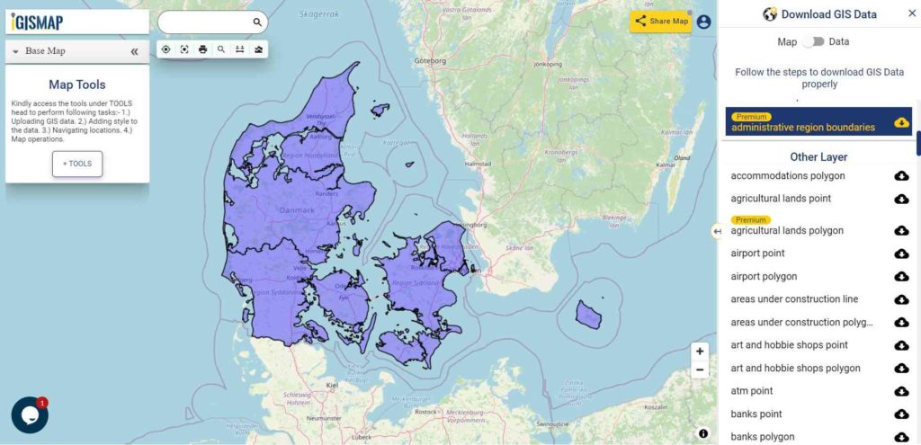
Denmark National Boundary

Download Denmark National Outline Boundary Shapefile

Download Denmark Regions Shapefile Data

Denmark is divided into 5 regions. The governing bodies of the regions are the regional councils, each with forty-one councillors elected for four-year terms.

Following are the list of regions:

  1. Hovedstaden – Capital Region of Denmark
  2. Midtjylland – Central Denmark Region
  3. Nordjylland – North Denmark Region
  4. Sjælland – Region Zealand
  5. Syddanmark – Region of Southern Denmark
Denmark Region Boundaries

Download Denmark Region Boundaries Shapefile

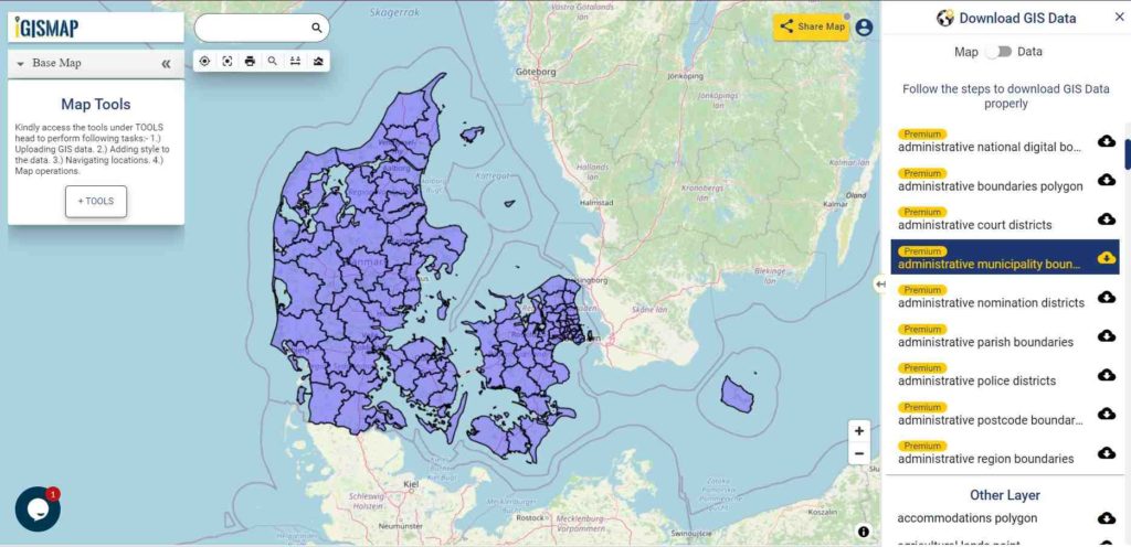
Download Denmark Municipalities Shapefile Data

Denmark Municipality Boundaries

Download Denmark Municipality Boundaries Shapefile

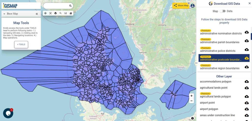
Download Denmark Postal Areas Shapefile Data

Denmark Postal Area Boundaries

Download Denmark Postal Area Boundaries Shapefile

Other Administrative Boundary Data:

Other GIS Data:

Please note that the Papua New Guinea data provided here is license under Open Data Commons Open Database License (ODbL). Please review the same before using it. If you want data under different license you can also look over to the post : Download Free Shapefile Maps – Country Boundary Polygon, Rail-Road, Water polyline etc

Download Free Shapefile for the following:

  1. World Countries Shapefile
  2. Australia
  3. Argentina
  4. Austria
  5. Belgium
  6. Brazil
  7. Canada
  8. Denmark
  9. Fiji
  10. Finland
  11. Germany
  12. Greece
  13. India
  14. Indonesia
  15. Ireland
  16. Italy
  17. Japan
  18. Kenya
  19. Lebanon
  20. Madagascar
  21. Malaysia
  22. Mexico
  23. Mongolia
  24. Netherlands
  25. New Zealand
  26. Nigeria
  27. Papua New Guinea
  28. Philippines
  29. Poland
  30. Russia
  31. Singapore
  32. South Africa
  33. South Korea
  34. Spain
  35. Switzerland
  36. Tunisia
  37. United Kingdom Shapefile
  38. United States of America
  39. Vietnam
  40. Croatia
  41. Chile
  42. Norway

Disclaimer : If you find any shapefile data of country provided is in correct do contact us or comment below, so that we will correct the same in our system as well we will try to correct the same in openstreetmap.
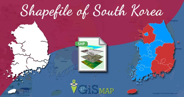
Download South Korea GIS Data – Provinces, Highway Lines, Airport Locations and More

Hello GIS enthusiasts, IGISMAP has now published the latest GIS vector data of South Korea administrative levels. Links for downloading the shapefiles of the important administrative divisions of South Korea are provided in the following. You can also download these data in KML, GeoJSON or CSV formats. 

Note:

  • All data available are in GCS datum EPSG:4326 WGS84 CRS (Coordinate Reference System).
  • You need to login for downloading the shapefile.

Download Free Shapefile Data of South Korea

South Korea, officially the Republic of Korea (ROK), is a country in East Asia, constituting the southern part of the Korean Peninsula and sharing a land border with North Korea. Its western border is formed by the Yellow Sea, while its eastern border is defined by the Sea of Japan. South Korea claims to be the sole legitimate government of the entire peninsula and adjacent islands. It has a population of 51.75 million, of which roughly half live in the Seoul Capital Area, the fifth largest metropolis in the world. Other major cities include Incheon, Busan, and Daegu.

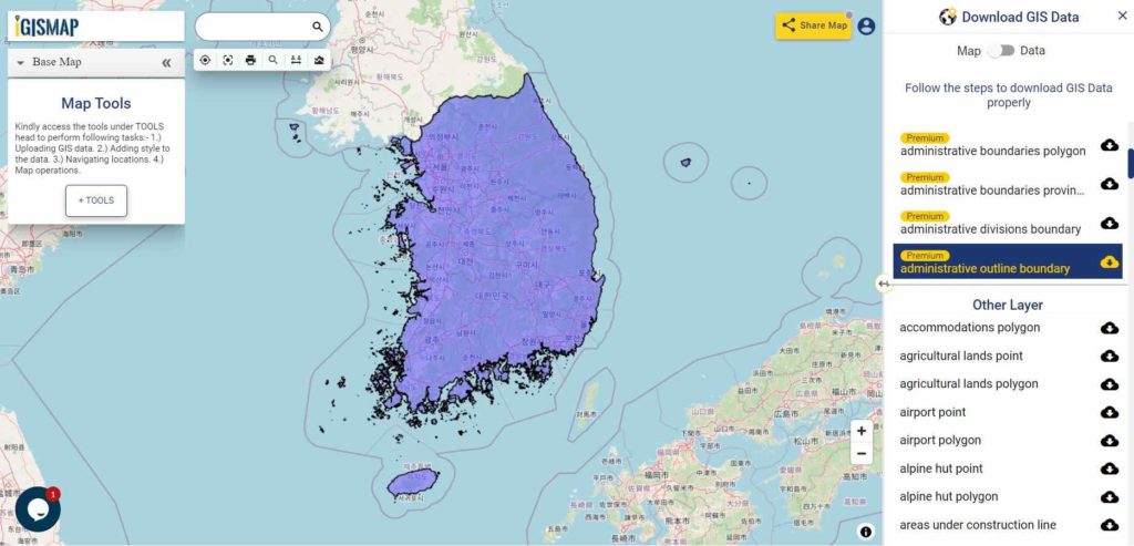
South Korea National Boundary

Download South Korea National Outline Boundary Shapefile

Download South Korea First Level Divisions Shapefile Data

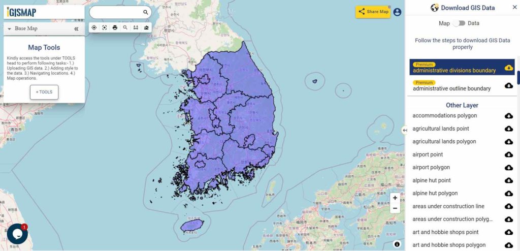
South Korea is divided into 8 provinces (do), 1 special autonomous province (teukbyeol jachido), 6 metropolitan cities (gwangyeoksi), and 1 special city (teukbyeolsi).

South Korea First Level Divisions Boundary

Download South Korea First Level Division Boundaries Shapefile

Other GIS Data:

Please note that the South Korea data provided here is license under Open Data Commons Open Database License (ODbL). Please review the same before using it. If you want data under different license you can also look over to the post : Download Free Shapefile Maps – Country Boundary Polygon, Rail-Road, Water polyline etc

Download Free Shapefile for the following:

  1. World Countries Shapefile
  2. Australia
  3. Argentina
  4. Austria
  5. Belgium
  6. Brazil
  7. Canada
  8. Denmark
  9. Fiji
  10. Finland
  11. Germany
  12. Greece
  13. India
  14. Indonesia
  15. Ireland
  16. Italy
  17. Japan
  18. Kenya
  19. Lebanon
  20. Madagascar
  21. Malaysia
  22. Mexico
  23. Mongolia
  24. Netherlands
  25. New Zealand
  26. Nigeria
  27. Papua New Guinea
  28. Philippines
  29. Poland
  30. Russia
  31. Singapore
  32. South Africa
  33. South Korea
  34. Spain
  35. Switzerland
  36. Tunisia
  37. United Kingdom Shapefile
  38. United States of America
  39. Vietnam
  40. Croatia
  41. Chile
  42. Norway

Disclaimer : If you find any shapefile data of country provided is in correct do contact us or comment below, so that we will correct the same in our system as well we will try to correct the same in openstreetmap.
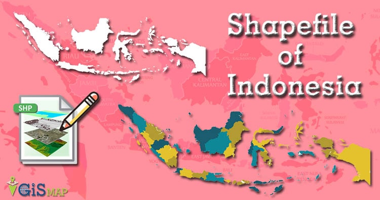
Download Indonesia Administrative Boundary Shapefiles – Provinces, Districts, Sub Districts and more

Hello GIS enthusiasts, IGISMAP has now published the latest GIS vector data of Indonesia administrative levels. Links for downloading the shapefiles of the important administrative divisions of Indonesia are provided in the following. You can also download these data in KML, GeoJSON or CSV formats. 

Note:

  • All data available are in GCS datum EPSG:4326 WGS84 CRS (Coordinate Reference System).
  • You need to login for downloading the shapefile.

Download Free Shapefile Data of Indonesia

Indonesia, officially the Republic of Indonesia, is a country in Southeast Asia and Oceania between the Indian and Pacific oceans. It consists of over 17,000 islands, including Sumatra, Java, Sulawesi, and parts of Borneo and New Guinea. Indonesia is the world’s largest island country and the 14th-largest country by area, at 1,904,569 square kilometres (735,358 square miles).

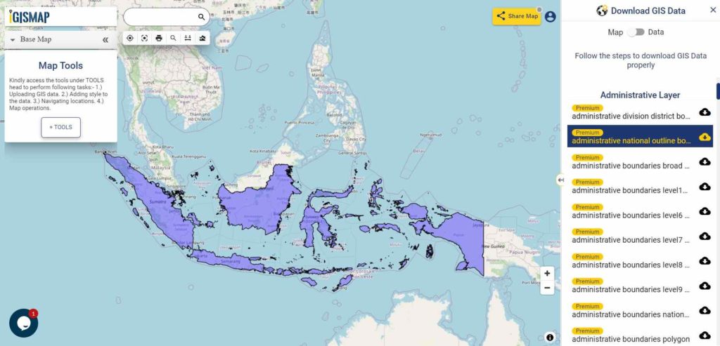
Indonesia National Boundary

Download Indonesia National Outline Boundary Shapefile

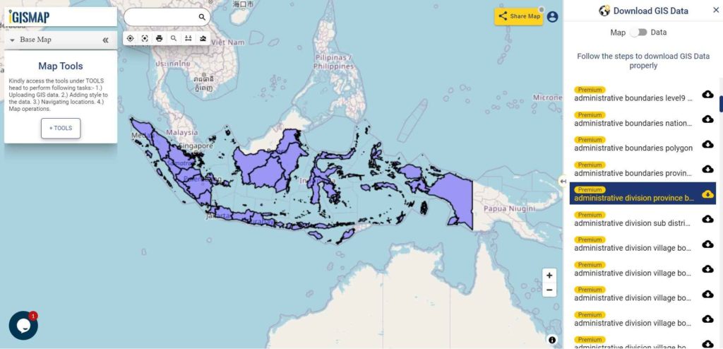
Download Indonesia Province Shapefile Data

Below Polygon of Indonesia shapefile covers 34 provinces –

  1. Aceh
  2. North Sumatra
  3. West Sumatra
  4. Riau
  5. Riau Archipelago/Islands
  6. Jambi
  7. Bengkulu
  8. South Sumatra
  9. Bangka Belitung Islands
  10. Lampung
  11. Banten
  12. Jakarta
  13. West Java
  14. Central Java
  15. Yogyakarta
  16. East Java
  17. Bali
  18. West Nusa Tenggara
  19. East Nusa Tenggara
  20. West Kalimantan
  21. Central Kalimantan
  22. South Kalimantan
  23. East Kalimantan
  24. North Kalimantan
  25. North Sulawesi
  26. Gorontalo
  27. Central Sulawesi
  28. West Sulawesi
  29. South Sulawesi
  30. Southeast Sulawesi
  31. North Maluku
  32. Maluku (The Moluccas)
  33. West Papua
  34. Papua
Indonesia Province Boundaries

Download Indonesia Province Boundaries Shapefile

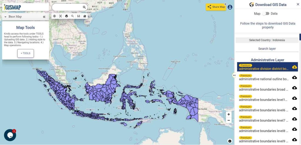
Download Indonesia District Shapefile Data

Indonesia District Boundaries

Download Indonesia District Boundaries Shapefile

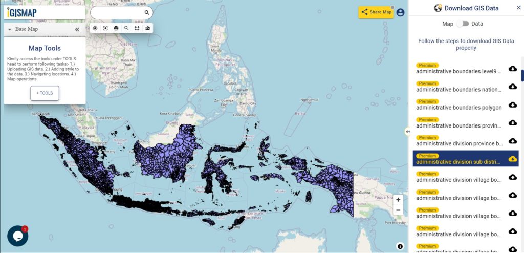
Download Indonesia Sub District Shapefile Data

Indonesia Sub District Boundaries

Download Indonesia Sub District Boundaries Shapefile

Other GIS Data:

Convert Indonesia Shapefile SHP to KML

For Indonesia SHP to KML conversion go to MAPOG Tool and follow the steps for Indonesia Shapefile SHP to KML file conversion.

Convert Indonesia KML to Indonesia Shapefile

For Indonesia KML conversion login at mapanalysis.mapog.com and follow the steps for KML to Shapefile SHP.

Download Free Shapefile for the following:

  1. World Countries Shapefile
  2. Australia
  3. Argentina
  4. Austria
  5. Belgium
  6. Brazil
  7. Canada
  8. Denmark
  9. Fiji
  10. Finland
  11. Germany
  12. Greece
  13. India
  14. Indonesia
  15. Ireland
  16. Italy
  17. Japan
  18. Kenya
  19. Lebanon
  20. Madagascar
  21. Malaysia
  22. Mexico
  23. Mongolia
  24. Netherlands
  25. New Zealand
  26. Nigeria
  27. Papua New Guinea
  28. Philippines
  29. Poland
  30. Russia
  31. Singapore
  32. South Africa
  33. South Korea
  34. Spain
  35. Switzerland
  36. Tunisia
  37. United Kingdom Shapefile
  38. United States of America
  39. Vietnam
  40. Croatia
  41. Chile
  42. Norway

Disclaimer : If you find any shapefile data of country provided is in correct do contact us or comment below, so that we will correct the same in our system.

Download Argentina Administrative Boundary Shapefiles – Provinces, Departmentos, Municipalities and more

Hello GIS enthusiasts, IGISMAP has now published the latest GIS vector data of Argentina administrative levels. Links for downloading the shapefiles of the important administrative divisions of Argentina are provided in the following. You can also download these data in KML, GeoJSON or CSV formats. 

Note:

  • All data available are in GCS datum EPSG:4326 WGS84 CRS (Coordinate Reference System).
  • You need to login for downloading the shapefile.

Download Free Shapefile Data of Argentina

Argentina, officially the Argentine Republic, is a country in the southern half of South America. Argentina covers an area of 2,780,400 km2 (1,073,500 sq mi), making it the largest Spanish-speaking nation in the world by area. It is the second-largest country in South America after Brazil, the fourth-largest country in the Americas, and the eighth-largest country in the world. It shares the bulk of the Southern Cone with Chile to the west, and is also bordered by Bolivia and Paraguay to the north, Brazil to the northeast, Uruguay and the South Atlantic Ocean to the east, and the Drake Passage to the south. Argentina is a federal state subdivided into twenty-three provinces, and one autonomous city, which is the federal capital and largest city of the nation, Buenos Aires. The provinces and the capital have their own constitutions, but exist under a federal system. Argentina claims sovereignty over a part of Antarctica, the Falkland Islands and South Georgia and the South Sandwich Islands.

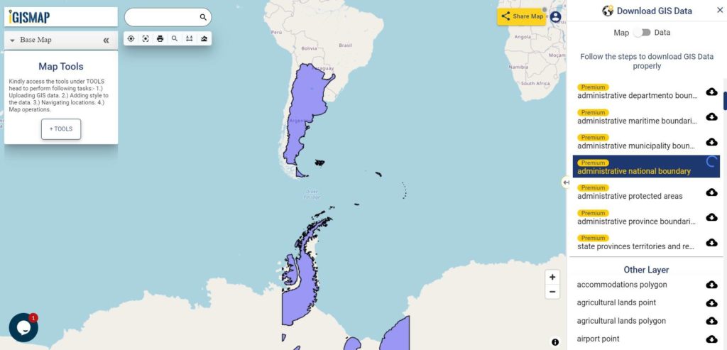
Argentina National Boundary

Download Argentina National Outline Boundary Shapefile

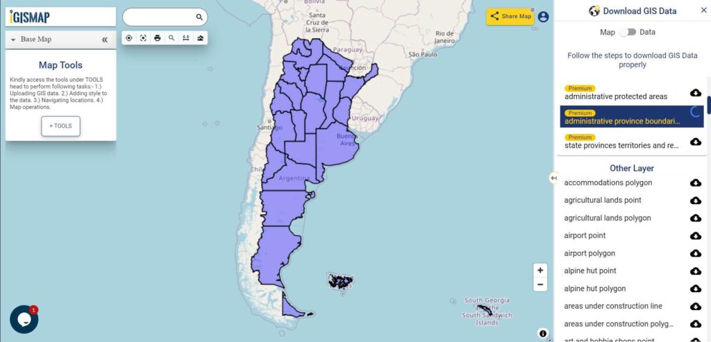
Download Argentina Province Shapefile Data

Polygon Shapefile of Argentina Covers – Autonomous City of Buenos Aires, Buenos Aires, Buenos Aires, Santa Fe, Mendoza, Tucumán, Salta, Entre Ríos, Misiones, Chaco, Corrientes, Santiago del Estero, San Juan, Jujuy, Río Negro, Neuquén, Formosa, Chubut, San Luis, Catamarca, La Rioja, La Pampa, Santa Cruz, Tierra del Fuego.

Argentina Province Boundaries

Download Argentina Province Boundaries Shapefile

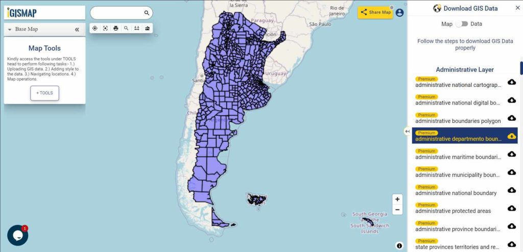
Download Argentina Departmentos Shapefile Data

Argentina Departmento Boundaries

Download Argentina Departmento Boundaries Shapefile

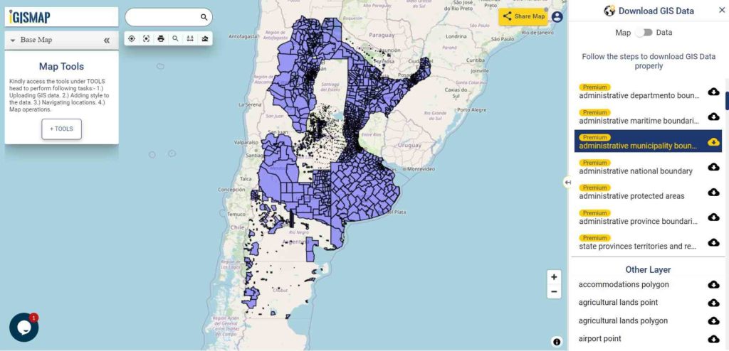
Download Argentina Municipality Shapefile Data

Argentina Municipality Boundaries

Download Argentina Municipality Boundaries Shapefile

Please note that the Argentina data provided here is license under Open Data Commons Open Database License (ODbL). Please review the same before using it. If you want data under different license you can also look over to the post : Download Free Shapefile Maps – Country Boundary Polygon, Rail-Road, Water polyline etc.

Download GIS Data for other countries From Here

Other GIS Data:

Download Free Shapefile for the following:

  1. World Countries Shapefile
  2. Australia
  3. Argentina
  4. Austria
  5. Belgium
  6. Brazil
  7. Canada
  8. Denmark
  9. Fiji
  10. Finland
  11. Germany
  12. Greece
  13. India
  14. Indonesia
  15. Ireland
  16. Italy
  17. Japan
  18. Kenya
  19. Lebanon
  20. Madagascar
  21. Malaysia
  22. Mexico
  23. Mongolia
  24. Netherlands
  25. New Zealand
  26. Nigeria
  27. Papua New Guinea
  28. Philippines
  29. Poland
  30. Russia
  31. Singapore
  32. South Africa
  33. South Korea
  34. Spain
  35. Switzerland
  36. Tunisia
  37. United Kingdom Shapefile
  38. United States of America
  39. Vietnam
  40. Croatia
  41. Chile
  42. Norway

Disclaimer : If you find any shapefile data of country provided is in correct do contact us or comment below, so that we will correct the same in our system.

Download Tunisia GIS Data – Provinces, Highway Lines, Airport Locations and More

Hello GIS enthusiasts, IGISMAP has now published the latest GIS vector data of Tunisia administrative levels. Links for downloading the shapefiles of the important administrative divisions of Tunisia are provided in the following. You can also download these data in KML, GeoJSON or CSV formats. 

Note:

  • All data available are in GCS datum EPSG:4326 WGS84 CRS (Coordinate Reference System).
  • You need to login for downloading the shapefile.

Download Free Shapefile Data of Tunisia

Tunisia, officially the Republic of Tunisia, is the northernmost country in Africa. It is a part of the Maghreb region of North Africa, and is bordered by Algeria to the west and southwest, Libya to the southeast, and the Mediterranean Sea to the north and east, covering 163,610 km2 (63,170 sq mi), with a population of 11 million. It contains the eastern end of the Atlas Mountains and the northern reaches of the Sahara desert, with much of its remaining territory being arable land. Its 1,300 km (810 mi) of coastline include the African conjunction of the western and eastern parts of the Mediterranean Basin. Tunisia is home to Africa’s northernmost point, Cape Angela; and its capital and largest city is Tunis, located on its northeastern coast, which lends the country its name.

Tunisia National Boundary

Download Tunisia National Outline Boundary Shapefile

Download Tunisia Province Shapefile Data

It Covers Ariana, Beja, Ben Arous, Bizerte, El Kef, Gabes, Gafsa, Jendouba, Kairouan, Kasserine, Kebili, Mahdia, Manouba, Medenine, Monastir, Nabeul, Sfax, Sidi Bouzid, Siliana, Sousse, Tataouine, Tozeur, Tunis and Zaghouan.

Tunisia Province Boundaries

Download Tunisia Province Boundaries Shapefile

Download Tunisia Highway Lines Shapefile Data

Tunisia Highway Lines

Download Tunisia Highway Line Shapefile

Above shown image is the zoomed in image of the highway line vector data of Tunisia

Download Tunisia Airport Points Shapefile Data

Tunisia Airport Locations

Download Tunisia Airport Locations Shapefile

Please note that the Tunisia data provided here is license under Open Data Commons Open Database License (ODbL). Please review the same before using it. If you want data under different license you can also look over to the post : Download Free Shapefile Maps – Country Boundary Polygon, Rail-Road, Water polyline etc

Download Free Shapefile for the following:

  1. World Countries Shapefile
  2. Australia
  3. Argentina
  4. Austria
  5. Belgium
  6. Brazil
  7. Canada
  8. Denmark
  9. Fiji
  10. Finland
  11. Germany
  12. Greece
  13. India
  14. Indonesia
  15. Ireland
  16. Italy
  17. Japan
  18. Kenya
  19. Lebanon
  20. Madagascar
  21. Malaysia
  22. Mexico
  23. Mongolia
  24. Netherlands
  25. New Zealand
  26. Nigeria
  27. Papua New Guinea
  28. Philippines
  29. Poland
  30. Russia
  31. Singapore
  32. South Africa
  33. South Korea
  34. Spain
  35. Switzerland
  36. Tunisia
  37. United Kingdom Shapefile
  38. United States of America
  39. Vietnam
  40. Croatia
  41. Chile
  42. Norway

Disclaimer : If you find any shapefile data of country provided is in correct do contact us or comment below, so that we will correct the same in our system as well we will try to correct the same in openstreetmap.
Download Lebanon Administrative Boundary Shapefiles – Governorates, Districts, Municipalities and more

Hello GIS enthusiasts, IGISMAP has now published the latest GIS vector data of Lebanon administrative levels. Links for downloading the shapefiles of the important administrative divisions of Lebanon are provided in the following. You can also download these data in KML, GeoJSON or CSV formats. 
Note:

  • All data available are in GCS datum EPSG:4326 WGS84 CRS (Coordinate Reference System).
  • You need to login for downloading the shapefile.

Download Free Shapefile Data of Lebanon

Lebanon, officially the Republic of Lebanon or the Lebanese Republic, is a country in Western Asia. It is located between Syria to the north and east and Israel to the south, while Cyprus lies to its west across the Mediterranean Sea; its location at the crossroads of the Mediterranean Basin and the Arabian hinterland has contributed to its rich history and shaped a cultural identity of religious diversity. It is part of the Levant region of the Middle East. Lebanon is home to roughly six million people and covers an area of 10,452 square kilometres (4,036 sq mi), making it one of the smallest countries in the world.

Lebanon National Boundary

Download Lebanon National Outline Boundary Shapefile

Download Lebanon Governorates Shapefile Data

Lebanon is divided into 8 Governorates; Akkar, Baalbeck-Hermel, Beirut, Bekaa, Mount Lebanon, North Lebanon, Nabatiyeh, and South Lebanon. The Governorate (Muhafazah) is considered an administrative division of the country.

Lebanon Governorates Boundaries

Download Lebanon Governorates Boundaries Shapefile

Download Lebanon Districts Shapefile Data

Lebanon District Boundaries

Download Lebanon District Boundaries Shapefile

Download Lebanon Sub Districts Shapefile Data

Lebanon Sub Districts

Download Lebanon Sub District Boundaries Shapefile

Please note that the Lebanon data provided here is license under Open Data Commons Open Database License (ODbL). Please review the same before using it. If you want data under different license you can also look over to the post : Download Free Shapefile Maps – Country Boundary Polygon, Rail-Road, Water polyline etc

Other GIS Data:

Download Free Shapefile for the following:

  1. World Countries Shapefile
  2. Australia
  3. Argentina
  4. Austria
  5. Belgium
  6. Brazil
  7. Canada
  8. Denmark
  9. Fiji
  10. Finland
  11. Germany
  12. Greece
  13. India
  14. Indonesia
  15. Ireland
  16. Italy
  17. Japan
  18. Kenya
  19. Lebanon
  20. Madagascar
  21. Malaysia
  22. Mexico
  23. Mongolia
  24. Netherlands
  25. New Zealand
  26. Nigeria
  27. Papua New Guinea
  28. Philippines
  29. Poland
  30. Russia
  31. Singapore
  32. South Africa
  33. South Korea
  34. Spain
  35. Switzerland
  36. Tunisia
  37. United Kingdom Shapefile
  38. United States of America
  39. Vietnam
  40. Croatia
  41. Chile
  42. Norway

Disclaimer : If you find any shapefile data of country provided is in correct do contact us or comment below, so that we will correct the same in our system.