Convert GIS Data Online : KML to CSV Step by Step Guide
Easily transform your KML data into CSV format using MAPOG, simplifying your geographic data processing for improved spatial analysis.

Converting KML data to CSV offers a straightforward approach to analyze, share, and integrate geographical information across various platforms. Whether you’re new to the process or experienced, this guide will walk you through the steps seamlessly.

Converting KML to CSV with MAPOG

Converting KML to CSV with MAPOG

Key Concept of File Conversion MAPOG’s Converter Tool facilitates effortless transformation between different data formats. By inputting data in one format, the tool converts it into the required format for analysis, enhancing flexibility and adaptability across applications.

Steps to Convert KML to CSV with MAPOG

Step 1: Upload the Data
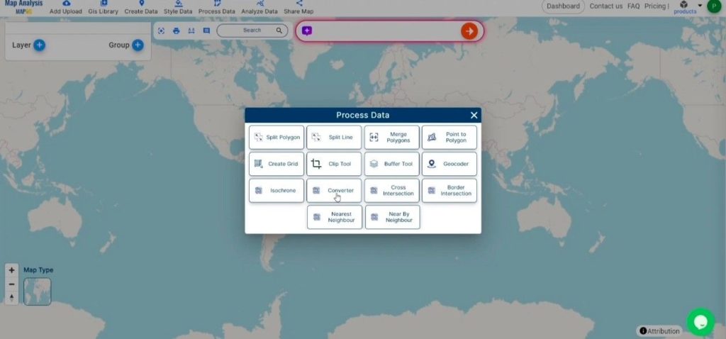
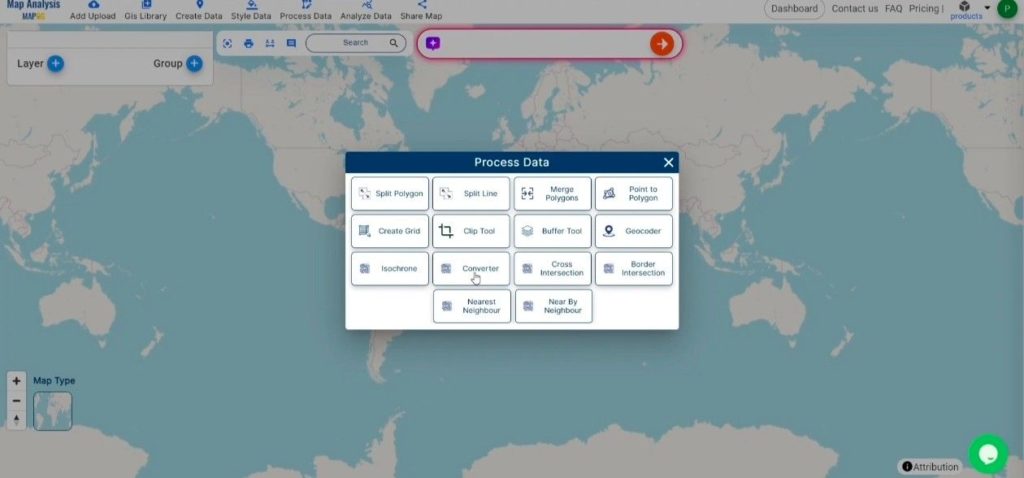
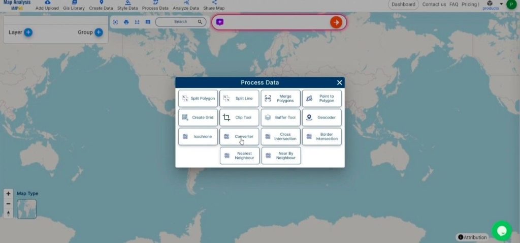
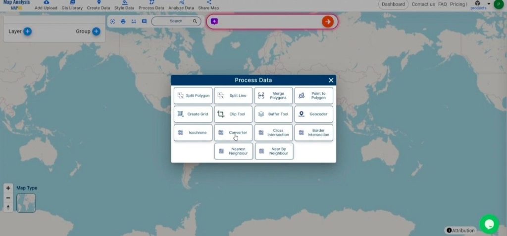
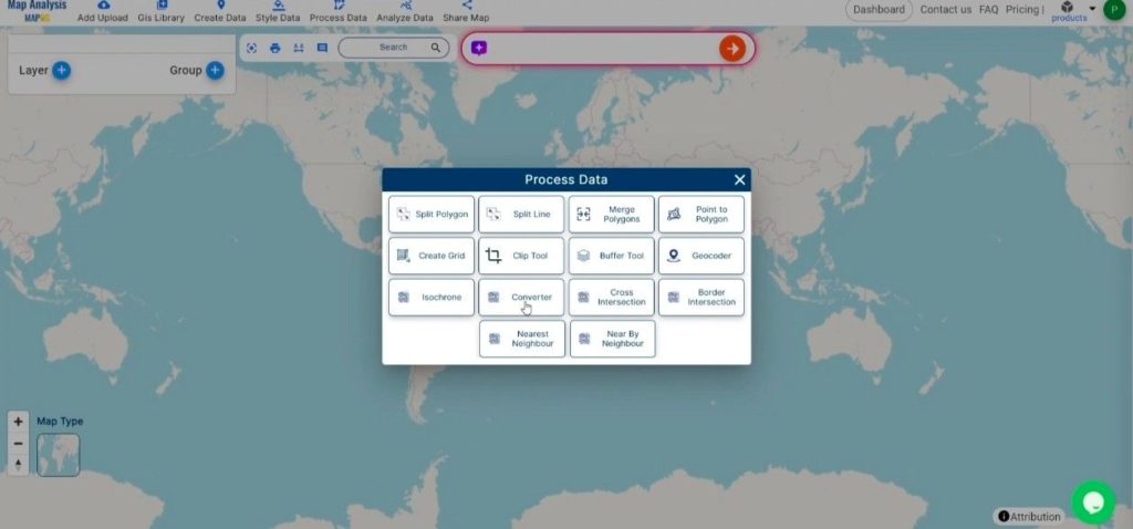
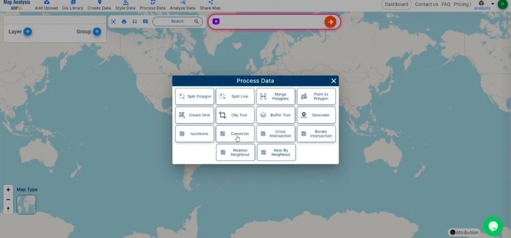
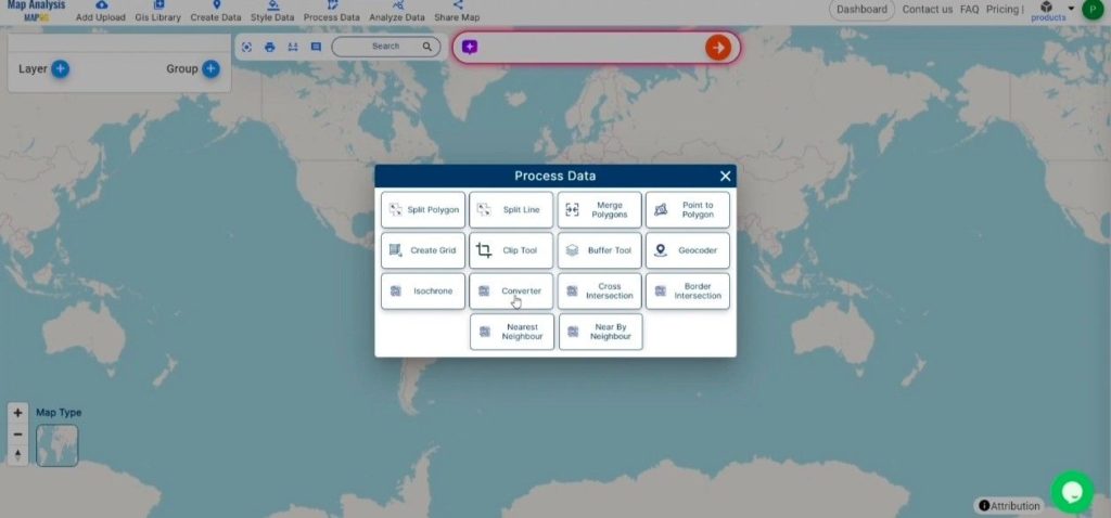
Access the Converter Tool: Navigate to the “Process Data” menu and select “Converter Tool.”

Upload the Data
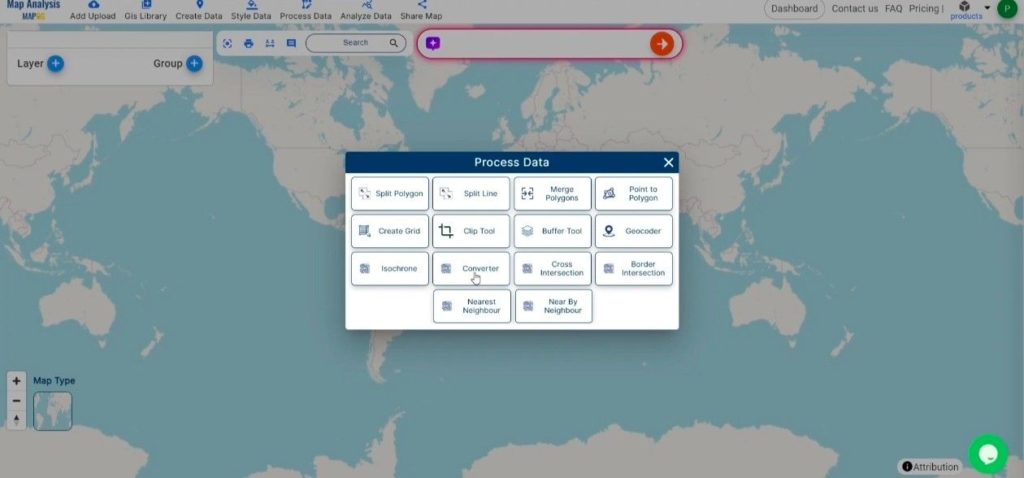
Upload the Data
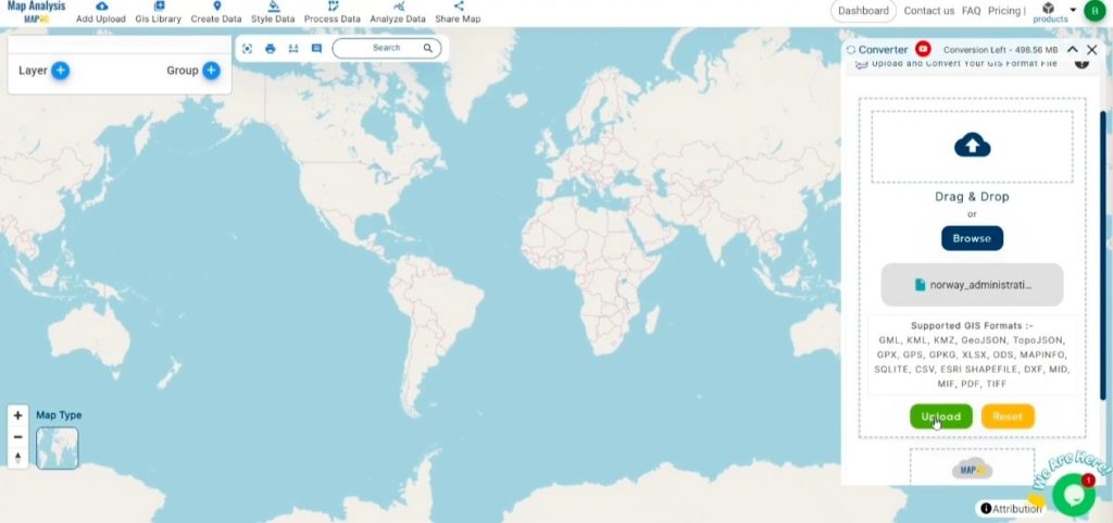

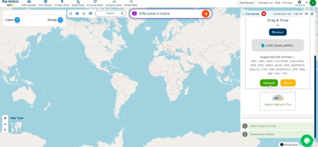
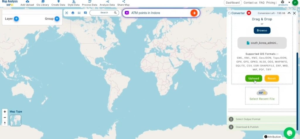
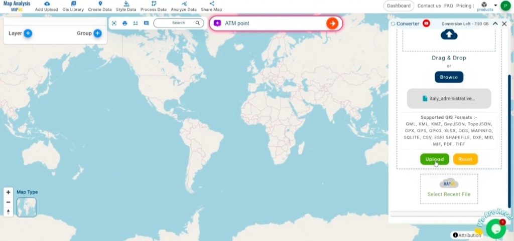
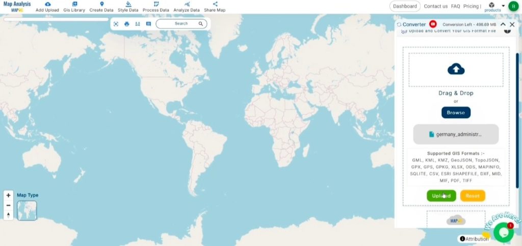
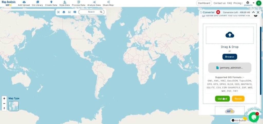
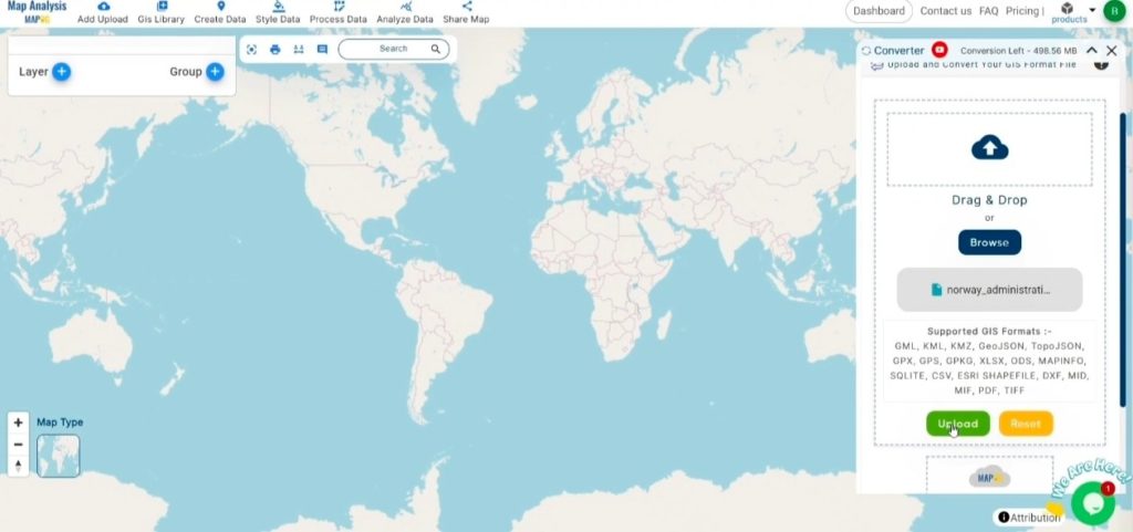
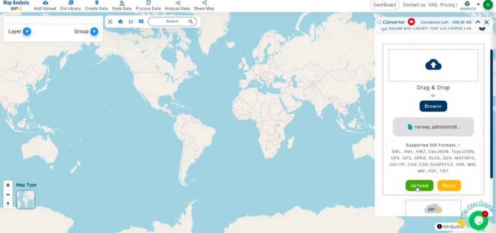
Upload KML File: Begin by uploading the KML file you wish to convert.

Upload KML File
Upload KML File

Step 2: Select the Output Format

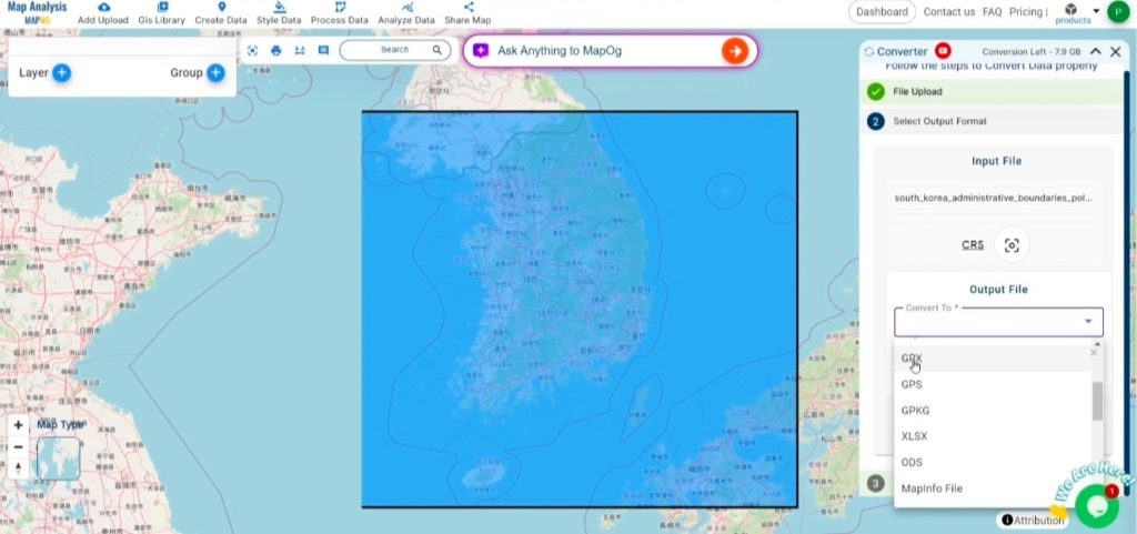
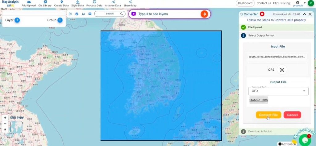
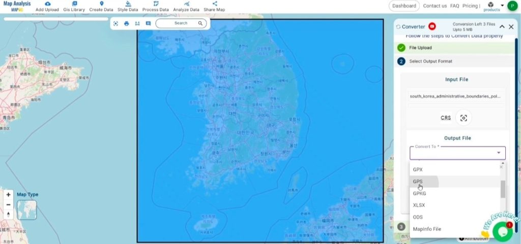
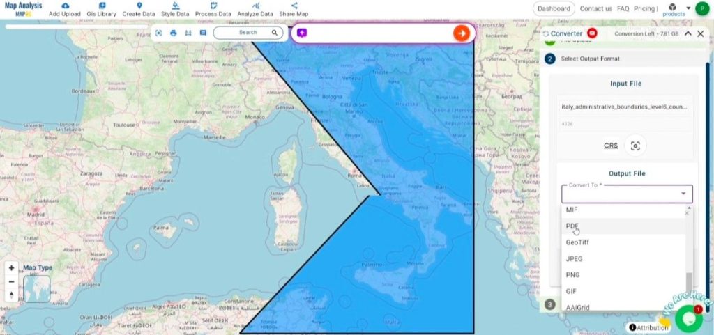
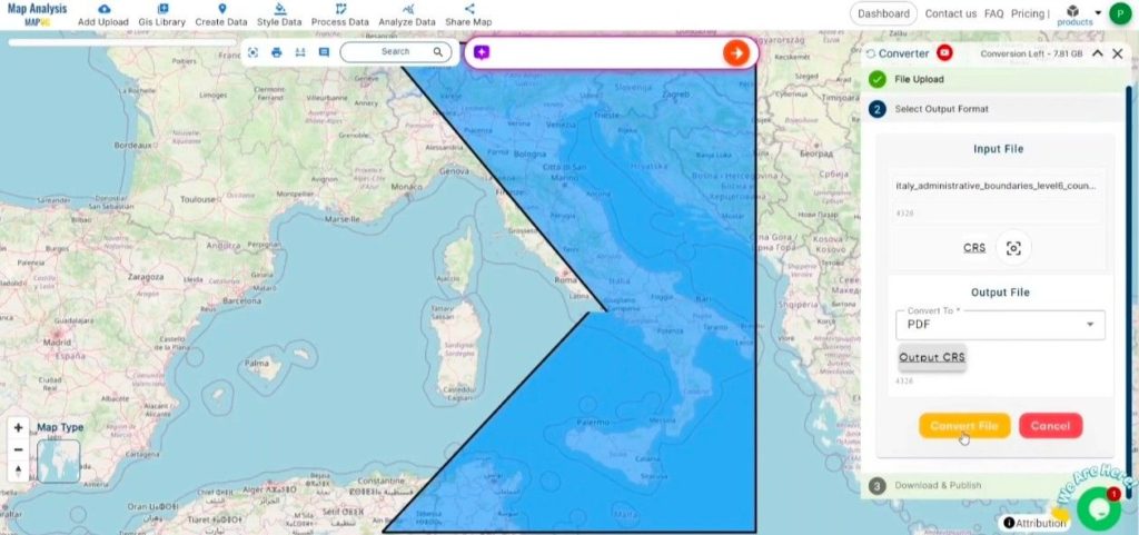
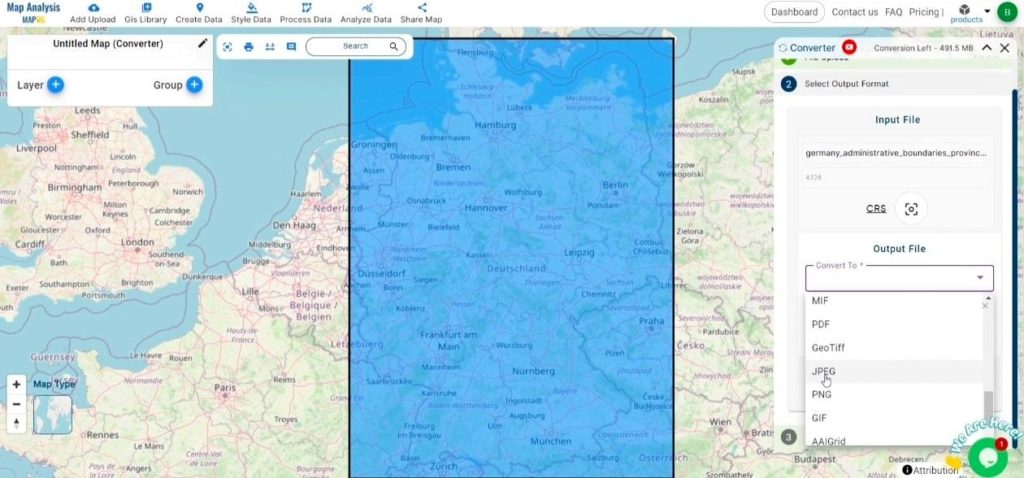
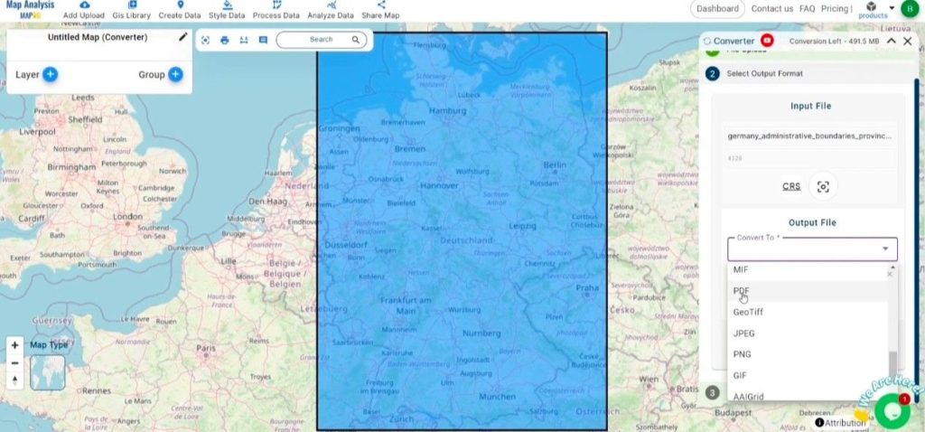
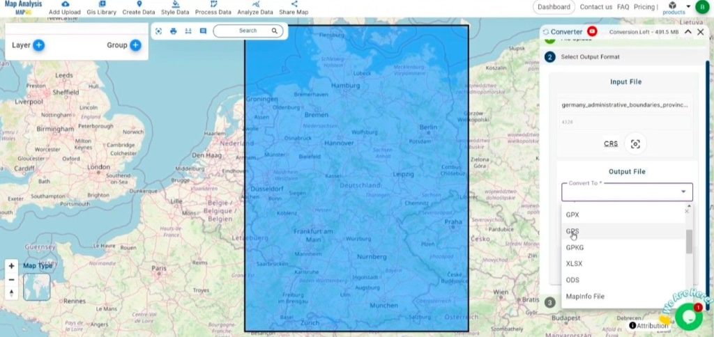
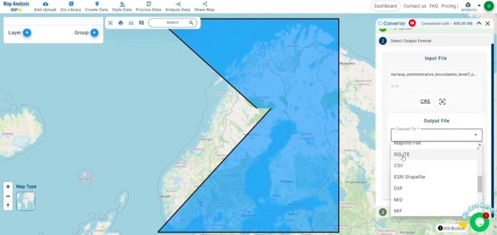
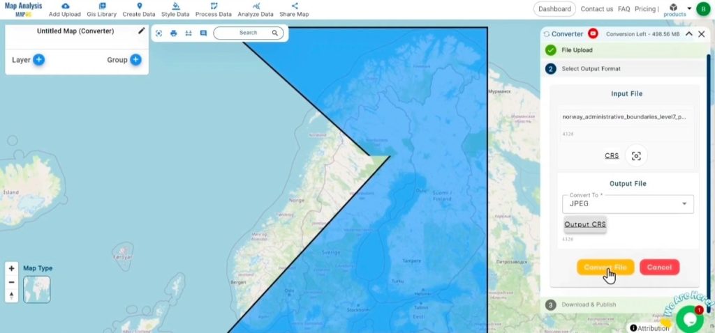
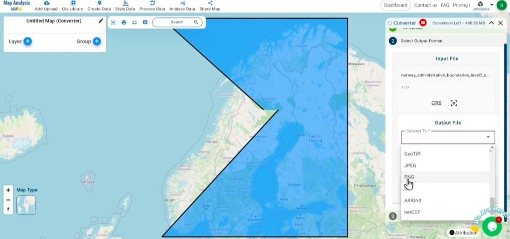
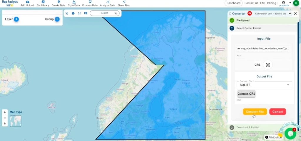
Choose the Output File Format: Opt for CSV as the output format.

Select the Output Format-Converting KML to CSV with MAPOG
Select the Output Format


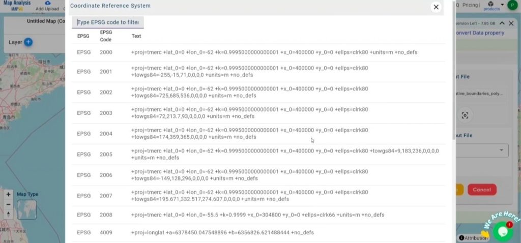
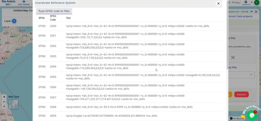
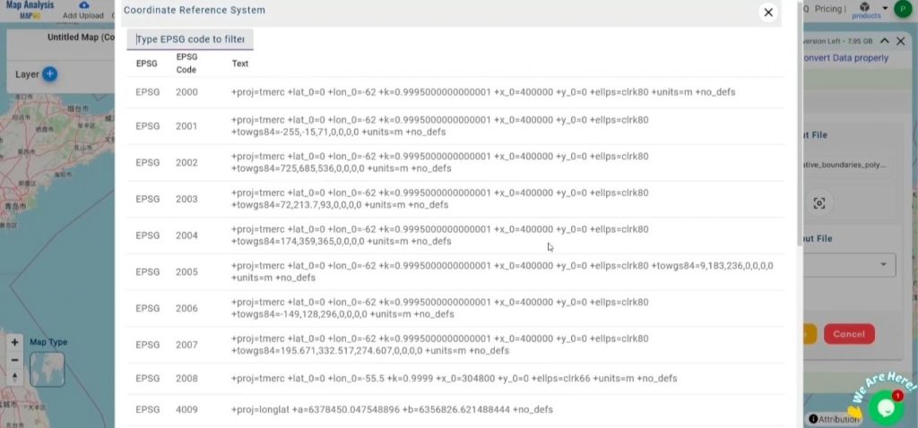
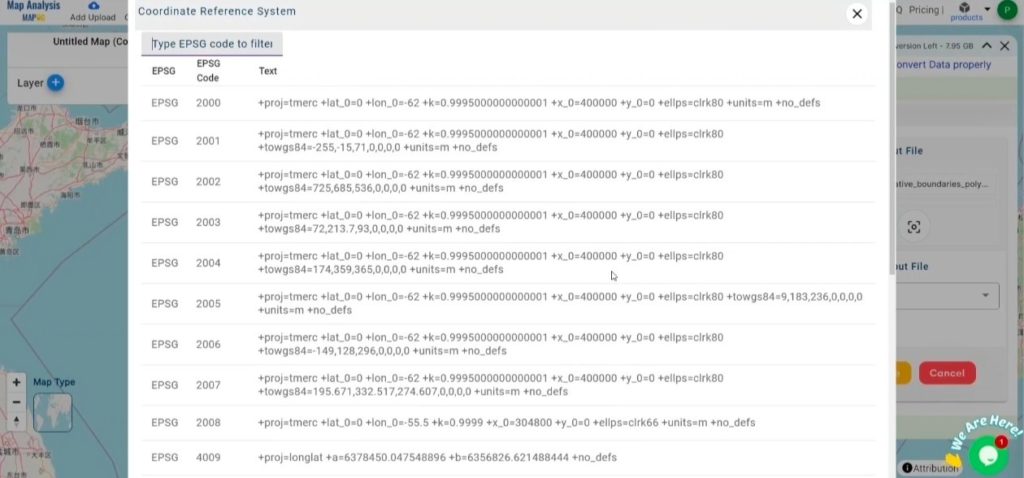
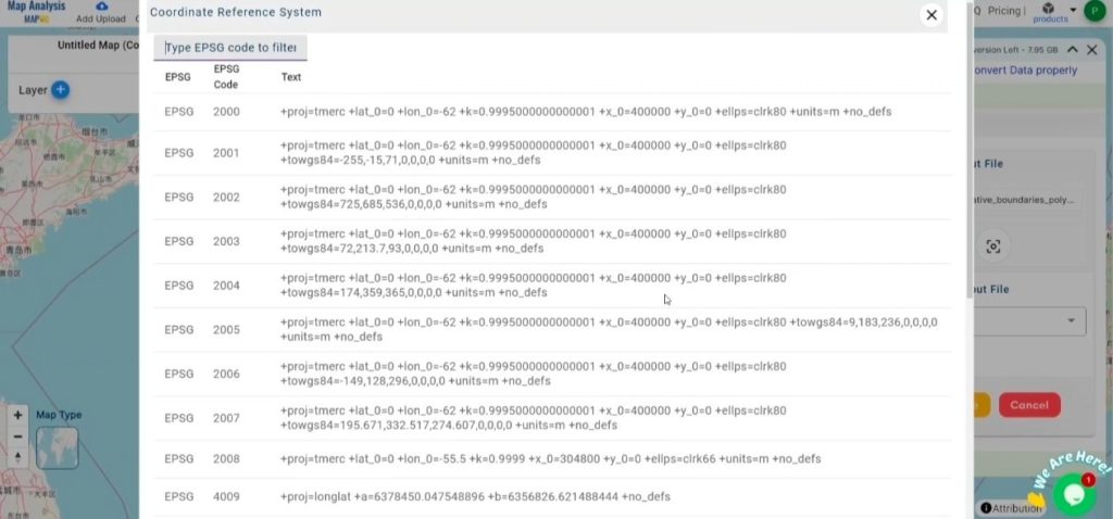
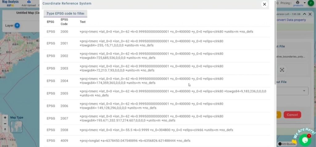
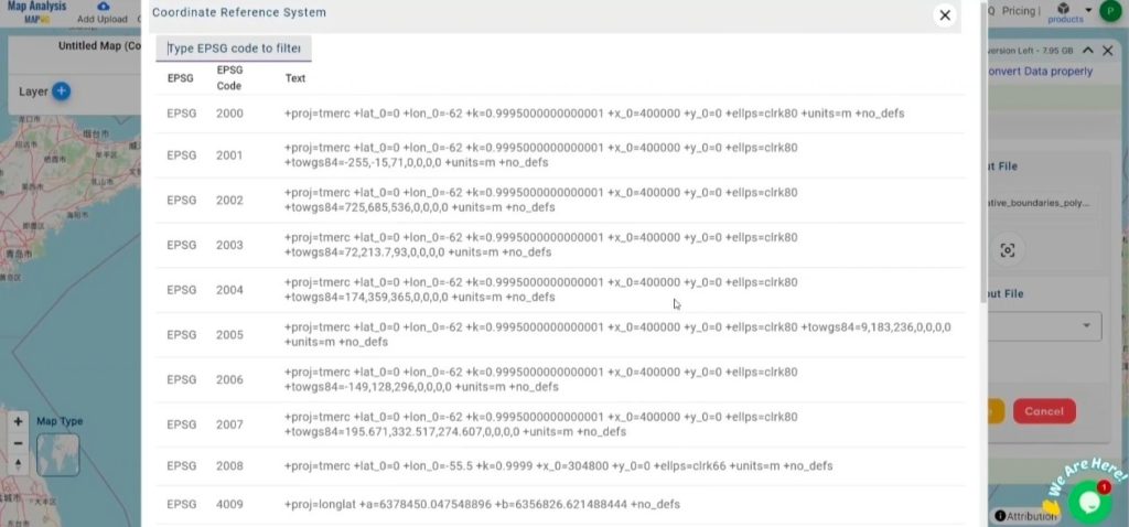
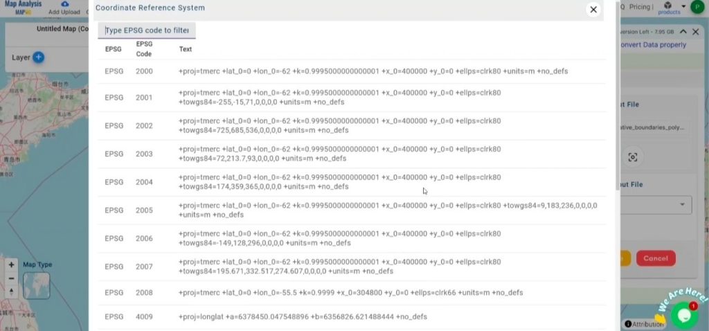
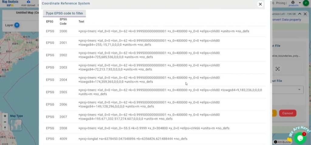
Set the CRS (Coordinate Reference System): Optionally, set the CRS to align data accurately with spatial analysis requirements.
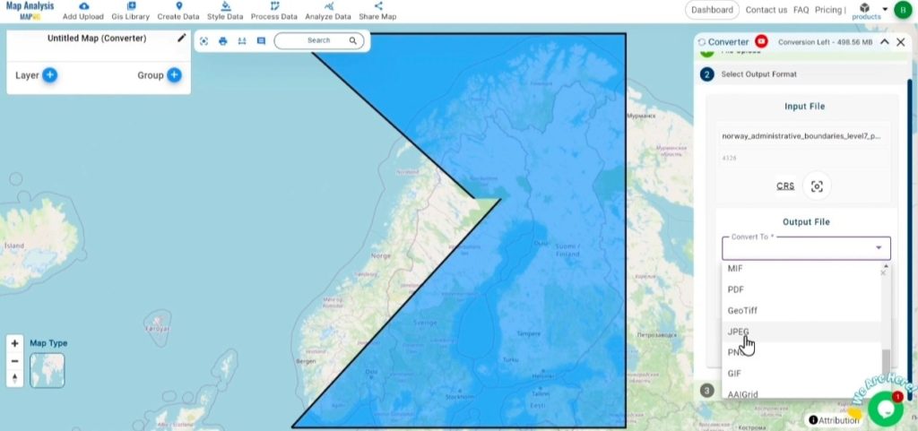
Set the CRS (Coordinate Reference System)

Step 3: Run the Conversion

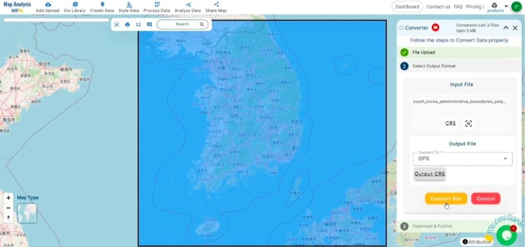
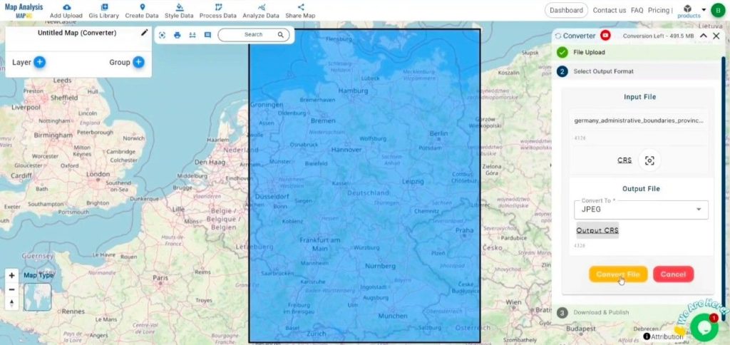
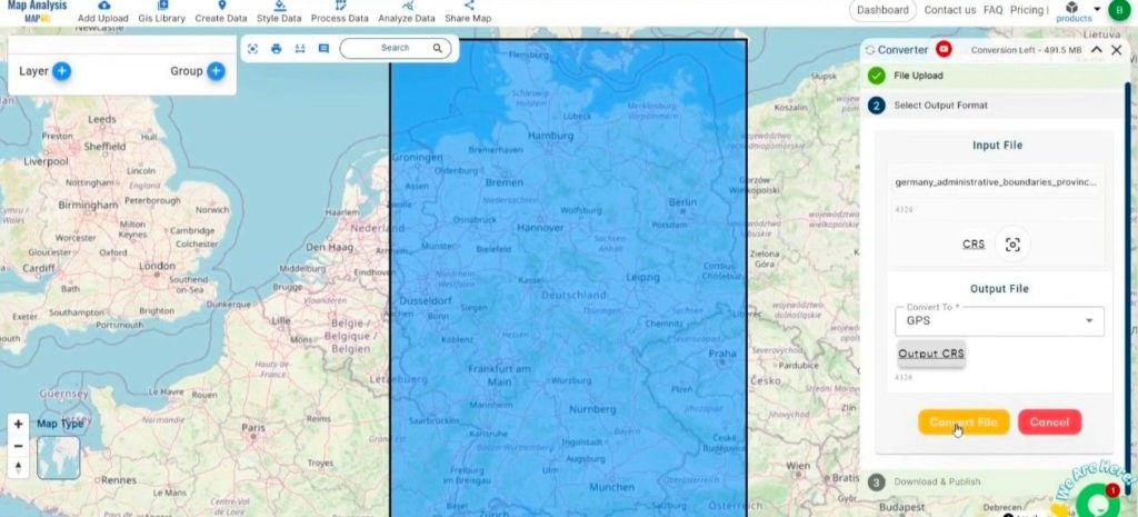
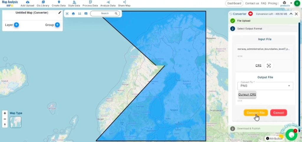
Initiate the Conversion Process: Click on ‘Convert‘ to start the conversion process.

 Run the Conversion-Converting KML to CSV with MAPOG
Run the Conversion

Step 4: Review and Download

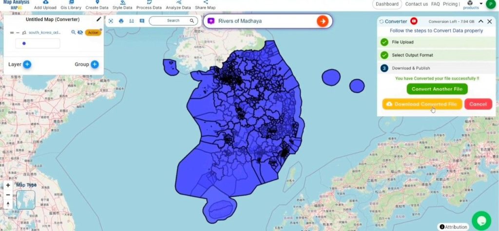
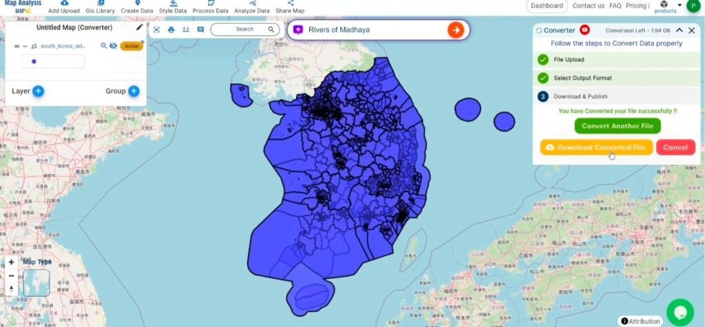
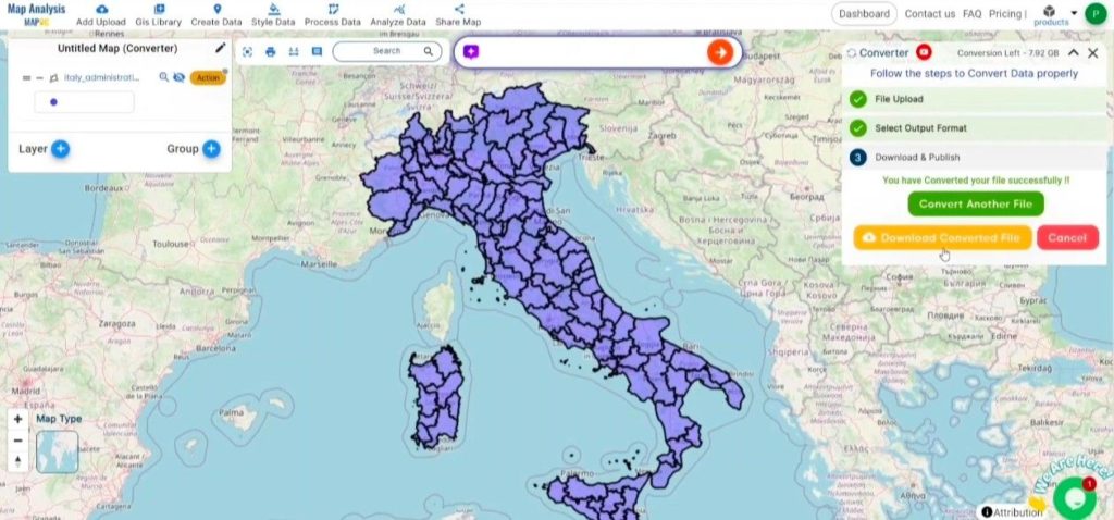
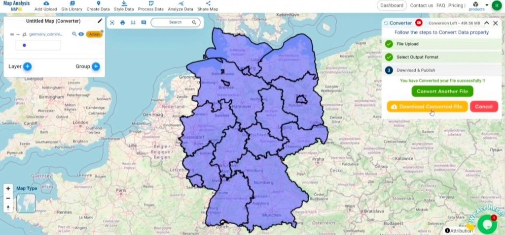
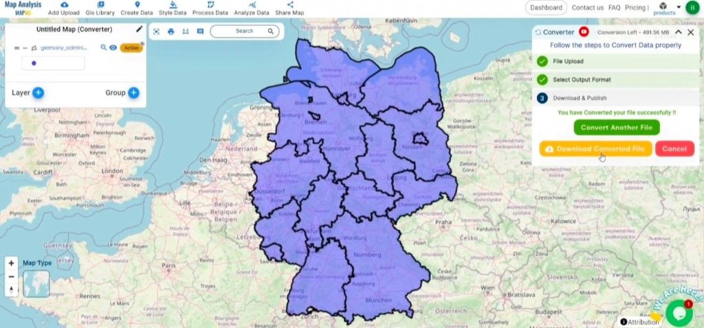
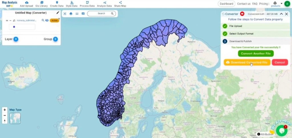
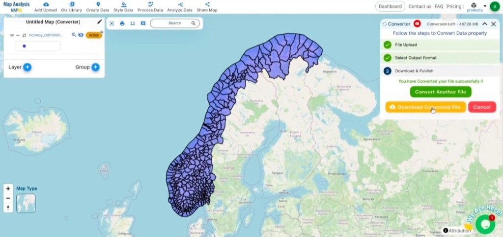
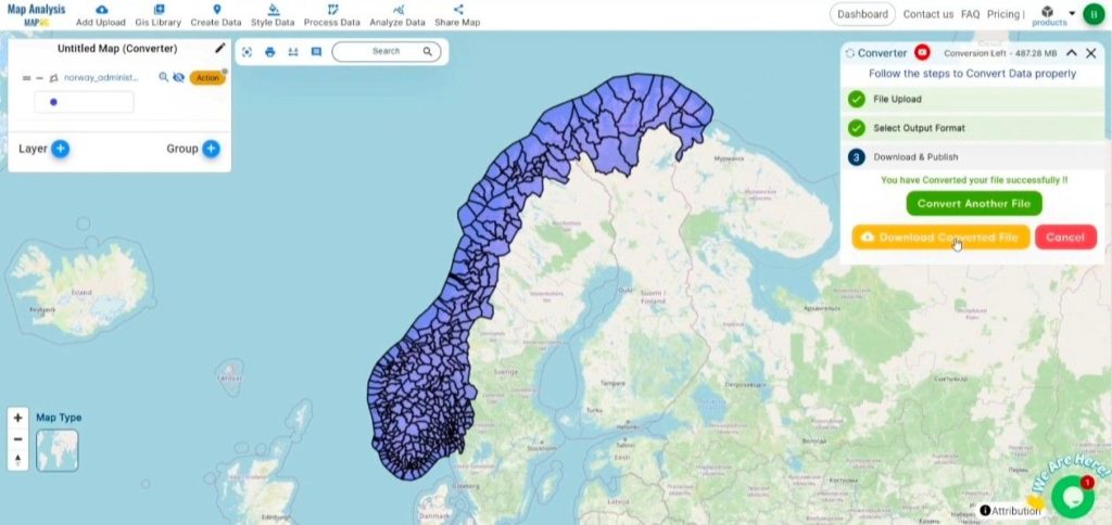
Review the Converted Data: Verify the converted CSV data for accuracy.

Review and Download
Review and Download

Download the Converted File: Upon satisfaction, download the converted CSV file.

Conclusion

By utilizing MAPOG’s Converter Tool, you’ve efficiently converted your KML files to CSV, streamlining your workflow and enhancing data interoperability. For further assistance, feel free to reach out to us at support@mapog.com.

Convert KML to GPKG Online

Convert KML to GPKG effortlessly with MAPOG. Streamline your geographic data transformation for enhanced spatial analysis and interoperability.

Transforming your GIS data by converting KML to GPKG can simplify analysis, sharing, and integration into various GIS applications. Whether you’re a beginner or an experienced user, this tutorial will help you understand the process in easy steps.

Converting KML to GPKG with MAPOG

Key Concept of Converting GIS Data Files

The Converter Tool in MAPOG Map Analysis allows you to change your data from one format to another effortlessly. You input your data in one form, and it transforms it into the required format for your analysis. This versatility enables you to download and use data in various formats, making it adaptable for different applications.

Steps to Convert KML to GPKG with MAPOG

Step 1: Upload the Data

Access the Converter Tool: Click on the “Process Data” menu and choose the “Converter Tool” option.

Access the Converter Tool

Upload Your KML File: This is your starting point where you provide the data that needs conversion.

Upload Your KML File

Step 2: Select the Format for Conversion

Choose the Output File Format: Select GPKG as the output file format. The tool offers various formats, but for this guide, we focus on converting to GPKG.

Choose the Output File Format

Set the CRS (Coordinate Reference System): You can also set the CRS at this stage to ensure your data aligns correctly with your spatial analysis requirements.

Set the CRS (Coordinate Reference System)

Step 3: Run the Conversion

Start the Conversion Process: Click ‘Convert’ and let the tool work its magic. The Converter Tool processes your data, transforming it from KML to GPKG format.

Start the Conversion Process-Converting KML to GPKG with MAPOG
Start the Conversion Process

Step 4: Review and Download

Review the Converted Data: Check your converted GPKG data to ensure it looks correct. This step is crucial to verify that the conversion has been successful and the data integrity is maintained.

Converting KML to GPKG with MAPOG

Download the Converted File: Once satisfied, download the converted file.

Conclusion

And there you have it! You’ve successfully used the Converter Tool in MAPOG Map Analysis to convert your KML files to GPKG. This conversion simplifies the process of handling different data formats and makes your workflow more efficient and effective. For any queries, please contact us at support@mapog.com.

Here are some other blogs you might be interested in:

Online Conversion KML to MIF

Effortlessly convert KML to MIF with MAPOG to streamline your geographic data transformation for enhanced spatial analysis.

Transforming your GIS data by converting KML to MIF can simplify analysis, sharing, and integration into various GIS applications. Whether you’re a beginner or an experienced user, this tutorial will guide you through the process in easy steps.

Converting KML to MIF with MAPOG

Key Concept of Converting Files

The Converter Tool in MAPOG Map Analysis allows you to change your data from one format to another effortlessly. You input your data in one form, and it transforms it into the required format for your analysis. This versatility enables you to download and use data in various formats, making it adaptable for different applications.

Steps to Convert KML to MIF with MAPOG

Step 1: Upload the Data

Access the Converter Tool: Click on the “Process Data” menu and choose the “Converter Tool” option.

Access the Converter Tool

Upload KML File: This is your starting point where you provide the data that needs conversion.

Upload KML File - Converting KML to MIF with MAPOG

Step 2: Select the Format for Conversion

Choose the Output File Format: Select MIF as the output file format. The tool offers various formats, but for this guide, we focus on converting to MIF.

Choose the Output File Format-Converting KML to MIF with MAPOG
Choose the Output File Format

Set the CRS (Coordinate Reference System): You can also set the CRS at this stage to ensure your data aligns correctly with your spatial analysis requirements.

Set the CRS (Coordinate Reference System)

Step 3: Run the Conversion

Start the Conversion Process: Click ‘Convert’ and let the tool work its magic. The Converter Tool processes your data, transforming it from KML to MIF format.

Start the Conversion Process

Step 4: Review and Download

Review the Converted Data: Check your converted MIF data to ensure it looks correct. This step is crucial to verify that the conversion has been successful and the data integrity is maintained.

Converting KML to MIF with MAPOG

Download the Converted File: Once satisfied, download the converted file.

Conclusion

And there you have it! You’ve successfully used the Converter Tool in MAPOG Map Analysis to convert your KML files to MIF. This conversion simplifies the process of handling different data formats and makes your workflow more efficient and effective. For any queries, please contact us at support@mapog.com.

Here are some other blogs you might be interested in:

Convert Online Gis data : KML to PDF file

Effortlessly convert KML to PDF with MAPOG to streamline your geographic data presentation for enhanced spatial analysis.

Transforming your GIS data by converting KML to PDF can simplify analysis, sharing, and integration into various GIS applications. Whether you’re a beginner or an experienced user, this tutorial will guide you through the process in easy steps.

Converting KML to PDF with MAPOG

Key Concept of Converting Files

The Converter Tool in MAPOG Map Analysis allows you to change your data from one format to another effortlessly. You input your data in one form, and it transforms it into the required format for your analysis. This versatility enables you to download and use data in various formats, making it adaptable for different applications.

Steps to Convert KML to PDF with MAPOG

Step 1: Upload the Data

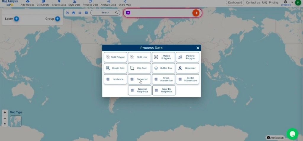
Access the Converter Tool: Click on the “Process Data” menu and choose the “Converter Tool” option.

Access the Converter Tool

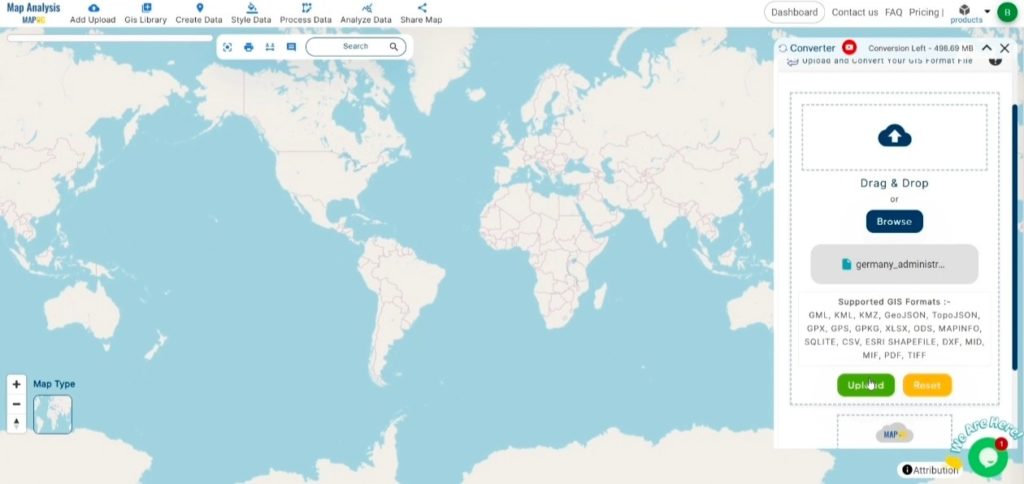
Upload KML File: This is your starting point where you provide the data that needs conversion.

Upload KML File
Upload KML File

Step 2: Select the Format for Conversion

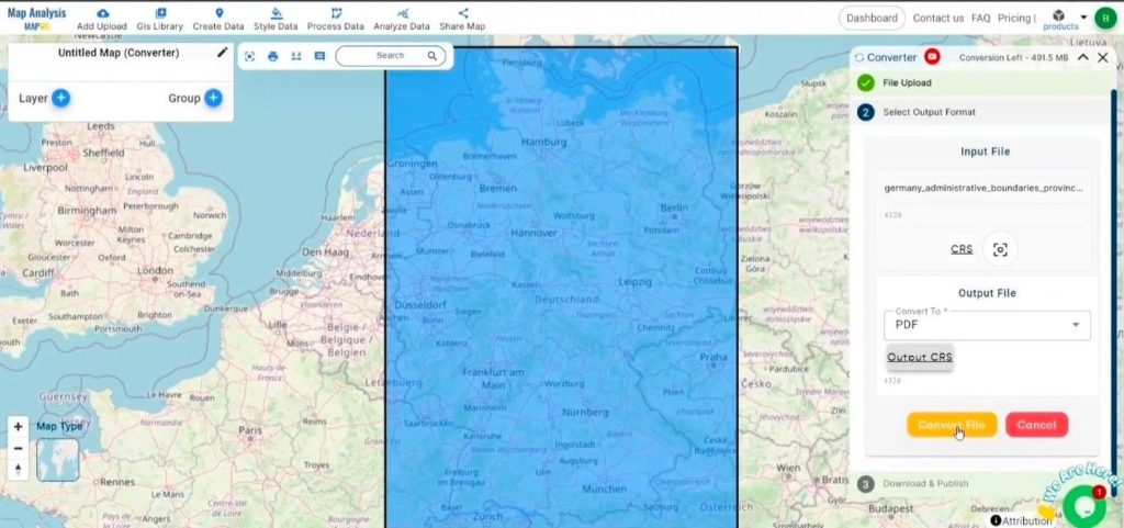
Choose the Output File Format: Select PDF as the output file format. The tool offers various formats, but for this guide, we focus on converting to PDF.

Choose the Output File Format

Set the CRS (Coordinate Reference System): You can also set the CRS at this stage to ensure your data aligns correctly with your spatial analysis requirements.

Set the CRS (Coordinate Reference System)

Step 3: Run the Conversion

Start the Conversion Process: Click ‘Convert’ and let the tool work its magic. The Converter Tool processes your data, transforming it from KML to PDF format.

Start the Conversion Process-Converting KML to PDF with MAPOG
Start the Conversion Process

Step 4: Review and Download

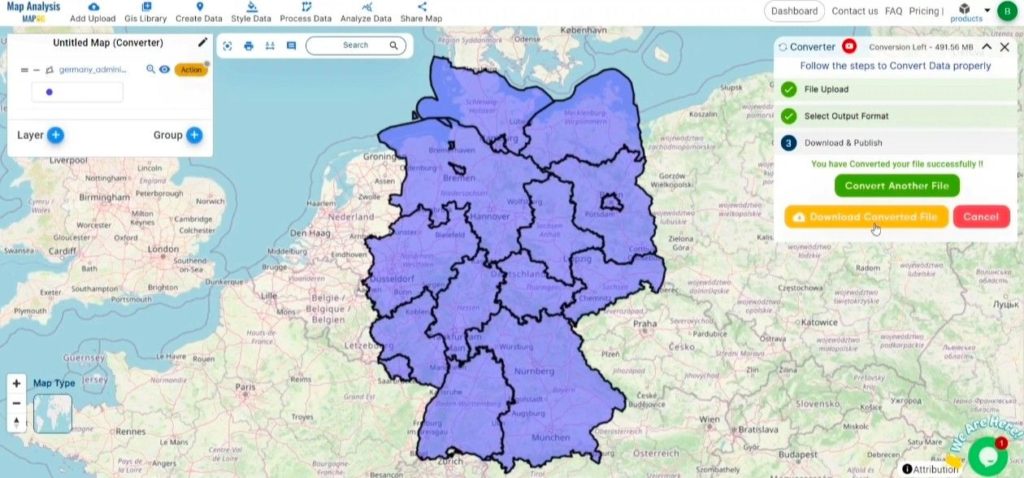
Review the Converted Data: Check your converted PDF data to ensure it looks correct. This step is crucial to verify that the conversion has been successful and the data integrity is maintained.

Converting KML to PDF with MAPOG

Download the Converted File: Once satisfied, download the converted file.

Conclusion

And there you have it! You’ve successfully used the Converter Tool in MAPOG Map Analysis to convert your KML files to PDF. This conversion simplifies the process of handling different data formats and makes your workflow more efficient and effective. For any queries, please contact us at support@mapog.com.

Here are some other blogs you might be interested in:

Converting KMZ to MIF Online : GIS Data Converter

In this guide, we’ll walk you through how to efficiently convert your KMZ files to MIF using the powerful Converter Tool in MAPOG Map Analysis. Whether you’re a beginner or an experienced user, Converting KMZ to MIF with MAPOG, this tutorial will help you understand the process in easy steps.

Key Concept of Converting files

The Converter Tool is a feature in MAPOG Map Analysis that helps you change your data from one format to another. It’s like magic! You give it your data in one form, and it transforms it into another form that you need for your analysis. Additionally, with GIS Data, you can download data in any format, making it versatile and adaptable for various applications.

Online KMZ to MID GIS Converter

Now, let’s walk through the simple steps of using the Converter Tool to Converting KMZ to MIF with MAPOG.

Step 1: Upload the Data

1. Click on the “Process Data” menu and choose the “Converter Tool” option.

2.Upload your KMZ file. This is your starting point where you provide the data that needs conversion.

Step 2: Select the Format for Conversion

1.Choose the output file format as MIF. The tool offers various formats, but for this guide, we are focusing on converting to MIF.

2.You can also set the CRS at this stage.

Step 3: Run the Conversion

Click ‘Convert’ and let the tool work its magic. The Converter Tool processes your data, transforming it from KMZ to MIF format.

Step 4: Review and Download

Finally, review your converted MIF data to ensure it looks right. Once satisfied, download the converted file. This step is crucial to verify that the conversion has been successful and the data integrity is maintained.

And there you have it! You’ve successfully used the Converter Tool in MAPOG Map Analysis to convert your KMZ files to MIF. Now you can easily convert your data for all your analysis needs. This feature simplifies the process of handling different data formats, making your workflow more efficient and effective.

Explore Our Other Blogs

  1. TopoJSON to KMZ
  2. GML to TopoJSON
  3. GML to GeoJSON
  4. KMZ to KML
  5. GML to KML
  6. GML to KMZ
  7. KMZ to GML
  8. TopoJSON to KML
  9. GeoJSON to CSV
  10. GeoJSON to TopoJSON
  11. TopoJSON to GML
  12. KMZ to MIF

Converting GeoJSON to CSV with MAPOG

In this guide, it will provide step by step of how the GeoJSON files can be easily and quickly converted to CSV format with the help of Converter Tool in MAPOG Map Analysis. So, both if you are a first-time user and a regular one, Converting GeoJSON to CSV with MAPOG, the entire process will be explained in simple steps for you.

Key Concept to Converting files

Converter Tool is a tool in the MAPOG Map Analysis used for the purpose of converting the information you have from one type to another. It’s like magic! You input data into it in one form, and you get it output in another form that you could use in your analysis. Moreover, GIS Data has a download in any format that means it is shift able in any kind of uses.

Online GeoJSON to CSV GIS Converter

Step 1: Upload the Data

1. Select the data through the “Process Data” and go to the “Converter Tool”.

GeoJSON to CSV

2. Upload your GeoJSON file. This is your entry point where you feed in the information that needs conversion.

GeoJSON to CSV
Step 2: Select the Format for Conversion

Select the output format as CSV or Comma-Separated Values if you want to expatriate only the data. The tool provides several options in arriving at the result but for this guide, we are using the option to convert the file to CSV.

GeoJSON to CSV

2. You can also set the Output CRS at this stage.

GeoJSON to CSV
Step 3: Run the Conversion

Go to ‘Convert Files’ and watch the tool at work. Working with the Converter Tool you input your data and then the tool converts it from the GeoJSON format to the CSV format.

GeoJSON to CSV
Step 4: Review and Download

Take a moment to review your converted CSV data to make sure everything looks correct. Once you’re happy with it, go ahead and download the file. This step is really important to ensure that the conversion worked properly and that all your data is intact.

GeoJSON to CSV
Step 5: Add Label Feature

1. We can add the Lebel on this map using the Label Feature in the map analysis interface. First, We need to go to the action button of the newly converted layer. Then select the Label feature from the drop down section.

GeoJSON to CSV

2. Next, we need to provide the newly converted file in layer selection and the desired attribute in the feature name section. Label feature has the option to select the font size and color. When you are happy with it, Click the save button.

GeoJSON to CSV

3. Now here you can see the newly converted data with all boundaries name mentioned into it.

GeoJSON to CSV

That’s it! You’ve mastered the Converter Tool in MAPOG Map Analysis to turn your GeoJSON files into CSVs. Now, transforming your data is easier than ever, ready for any analysis you need. This handy feature streamlines dealing with various data formats, making your work smoother and more productive.

Here are some other blogs you might be interested in:

Converting KMZ to GML Online

By converting KMZ to GML, you can transform your gis data, making it easier to analyze, share, and integrate into various GIS applications.

In this guide, we’ll walk you through how to efficiently convert your KMZ files to GML using the powerful Converter Tool in MAPOG Map Analysis. Whether you’re a beginner or an experienced user, Converting KMZ to GML with MAPOG, this tutorial will help you understand the process in easy steps.

Key Concept to Converting files

The Converter Tool is a feature in MAPOG Map Analysis that helps you change your data from one format to another. It’s like magic! You give it your data in one form, and it transforms it into another form that you need for your analysis. Additionally, with GIS Data, you can download data in any format, making it versatile and adaptable for various applications.

Online KMZ to GML Gis Converter

Now, let’s walk through the simple steps of using the Converter Tool to Converting KMZ to GML with MAPOG.

Step 1: Upload the Data

1. Click on the “Process Data” menu and choose the “Converter Tool” option.

Converting KMZ to GML with MAPOG: converter tool


2. Upload your KMZ file. This is your starting point where you provide the data that needs conversion.

Converting KMZ to GML with MAPOG: upload the kmz data

Step 2: Select the Format for Conversion

1. Choose the output file format as GML. The tool offers various formats, but for this guide, we are focusing on converting to GML.

Converting KMZ to GML with MAPOG: set the output format

2.You can also set the CRS at this stage.

Converting KMZ to GML with MAPOG: CRS

Step 3: Run the Conversion

Click ‘Convert’ and let the tool work its magic. The Converter Tool processes your data, transforming it from KMZ to GML format.

Converting KMZ to GML with MAPOG: run the convert file button

Step 4: Review and Download

Finally, review your converted GML data to ensure it looks right. Once satisfied, download the converted file. This step is crucial to verify that the conversion has been successful and the data integrity is maintained.

Converting KMZ to GML with MAPOG: final result

And there you have it! You’ve successfully used the Converter Tool in MAPOG Map Analysis to convert your KMZ files to GML. Now you can easily convert your data for all your analysis needs. This feature simplifies the process of handling different data formats, making your workflow more efficient and effective.

Explore Our Other Blogs

  1. TopoJSON to KMZ
  2. GML to TopoJSON
  3. GML to GeoJSON
  4. KMZ to KML
  5. GML to KML
  6. GML to KMZ
  7. KMZ to GML
  8. TopoJSON to KML
  9. GeoJSON to CSV
  10. GeoJSON to TopoJSON
  11. TopoJSON to GML
  12. KMZ to MIF

Converting TopoJSON to KMZ with MAPOG

Effortlessly convert TopoJSON to KMZ with MAPOG to streamline your geographic data presentation for enhanced spatial analysis.

Transforming your GIS data by converting TopoJSON to KMZ can simplify analysis, sharing, and integration into various GIS applications. Whether you’re a beginner or an experienced user, this tutorial will guide you through the process in easy steps.

Converting TopoJSON to KMZ with MAPOG

KEY CONCEPT OF CONVERTING FILES

The Converter Tool in MAPOG Map Analysis allows you to change your data from one format to another effortlessly. You input your data in one form, and it transforms it into the required format for your analysis. This versatility enables you to download and use data in various formats, making it adaptable for different applications.

STEPS TO CONVERT TOPOJSON TO KMZ WITH MAPOG

STEP 1: UPLOAD THE DATA

Access the Converter Tool: Click on the “Process Data” menu and choose the “Converter Tool” option.

Access the Converter Tool

Upload TopoJSON File: This is your starting point where you provide the data that needs conversion.

Upload TopoJSON File

STEP 2: SELECT THE FORMAT FOR CONVERSION

Choose the Output File Format: Select KMZ as the output file format. The tool offers various formats, but for this guide, we focus on converting to KMZ.

Choose the Output File Format

Set the CRS (Coordinate Reference System): You can also set the CRS at this stage to ensure your data aligns correctly with your spatial analysis requirements.

Set the CRS (Coordinate Reference System)

STEP 3: RUN THE CONVERSION

Start the Conversion Process: Click ‘Convert’ and let the tool work its magic. The Converter Tool processes your data, transforming it from TopoJSON to KMZ format.

Converting TopoJSON to KMZ with MAPOG
Start the Conversion Process

STEP 4: REVIEW AND DOWNLOAD

Review the Converted Data: Check your converted KMZ data to ensure it looks correct. This step is crucial to verify that the conversion has been successful and the data integrity is maintained.

Converting TopoJSON to KMZ with MAPOG

Download the Converted File: Once satisfied, download the converted file.

CONCLUSION

And there you have it! You’ve successfully used the Converter Tool in MAPOG Map Analysis to convert your TopoJSON files to KMZ. This conversion simplifies the process of handling different data formats and makes your workflow more efficient and effective. For any queries, please contact us at support@mapog.com.

Here are some other blogs you might be interested in:

Converting GML to KMZ with MAPOG

In this guide, we’ll walk you through how to efficiently convert your GML files to KMZ using the powerful Converter Tool in MAPOG Map Analysis. Whether you’re a beginner or an experienced user, Converting GML to KMZ with MAPOG, this tutorial will help you understand the process in easy steps.

Key Concept to Converting files

The Converter Tool is a feature in MAPOG Map Analysis that helps you change your data from one format to another. It’s like magic! You give it your data in one form, and it transforms it into another form that you need for your analysis. Additionally, with GIS Data, you can download data in any format, making it versatile and adaptable for various applications.

Convert GML to KMZ –

Now, let’s walk through the simple steps of using the Converter Tool to Converting GML to KMZ with MAPOG.

Step 1: Upload the Data

1. Click on the “Process Data” menu and choose the “Converter Tool” option.

GML to KMZ

2. Upload your GML file. This is your starting point where you provide the data that needs conversion.

GML to KMZ

Step 2: Select the Format for Conversion

1. Choose the output file format as KMZ. The tool offers various formats, but for this guide, we are focusing on converting to KMZ.

GML to KMZ

Step 3: Run the Conversion

Click ‘Convert Files’ and let the tool work its magic. The Converter Tool processes your data, transforming it from GML to KMZ format.

GML to KMZ

Step 4: Review and Download

Finally, review your converted KMZ data to ensure it looks right. Once satisfied, download the converted file. This step is crucial to verify that the conversion has been successful and the data integrity is maintained.

And there you have it! You’ve successfully used the Converter Tool in MAPOG Map Analysis to convert your GML files to KMZ. Now you can easily convert your data for all your analysis needs. This feature simplifies the process of handling different data formats, making your workflow more efficient and effective.

Here are some other blogs you might be interested in