This tutorial will walk you through the process of using MAPOG‘s Converter Tool to rapidly and simply convert GPS files to KML format. Thus, the entire process of Converting GPS to KML with MAPOG will be broken down into easy steps for you, regardless of whether you are a first-time user or not.
Key Concept to Converting files
Converter Tool is a tool in the MAPOG used for the purpose of converting the information you have from one type to another. It’s like magic! You input data into it in one form, and you get it output in another form that you could use in your analysis. Moreover, GIS Data has a download in any format that means it is shift able in any kind of uses.
Online Conversion from GPS to KML
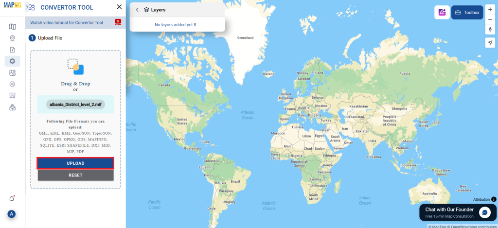
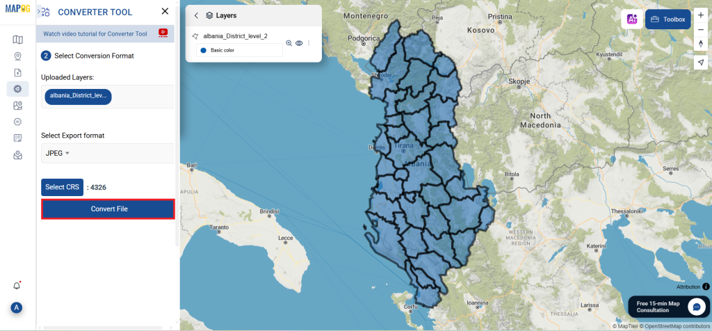
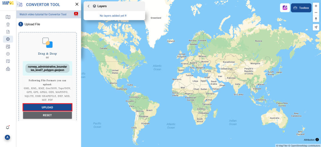
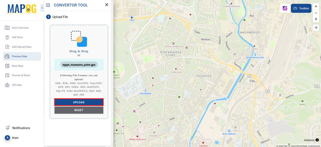
Step 1: Upload the Data
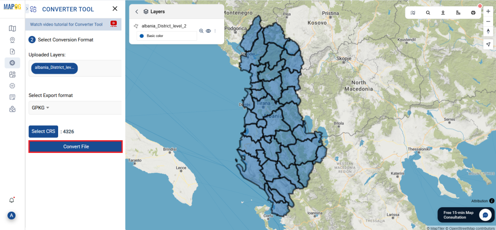
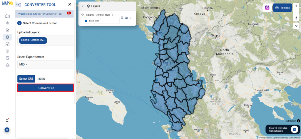
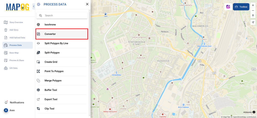
1. Choose the data by using the “Process Data” option, then select the “Converter Tool.”

2. Upload your GPS file. This is the entry point where you enter the data to be converted.
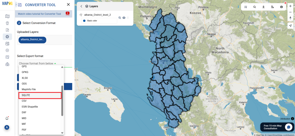
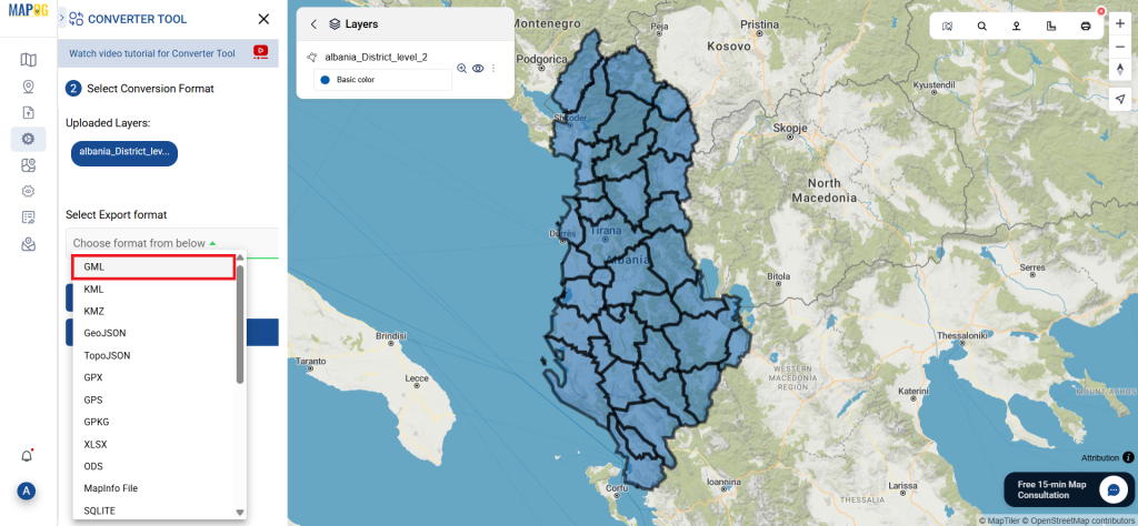
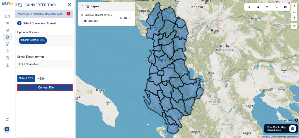
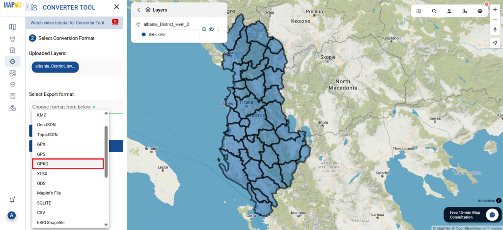
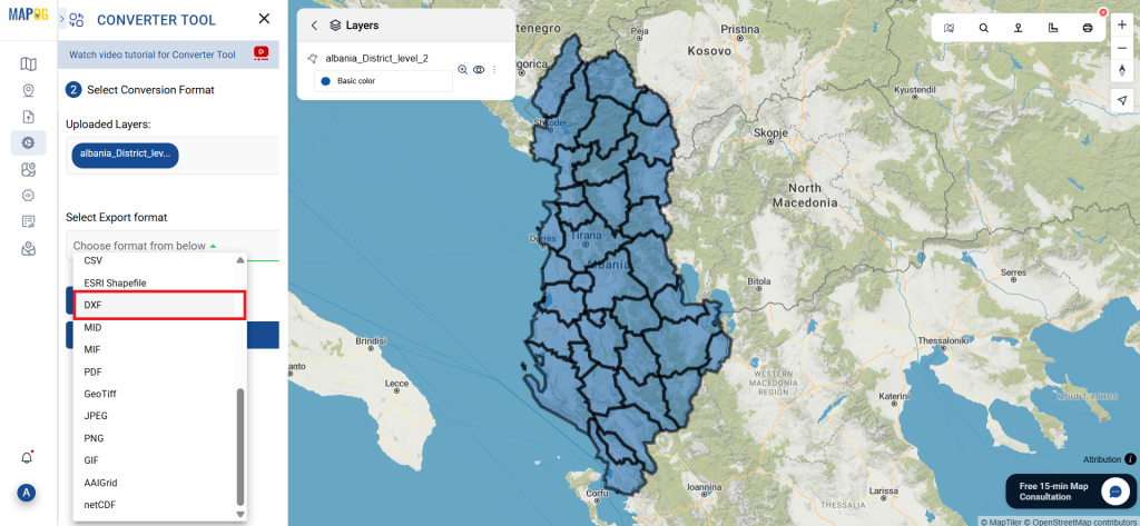
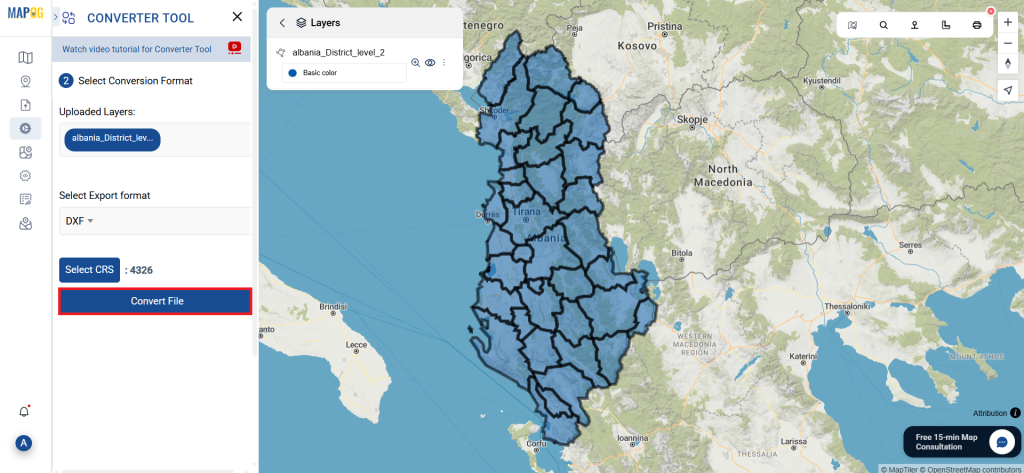
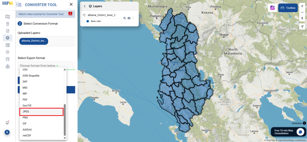
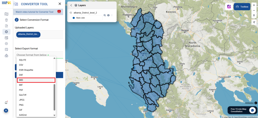
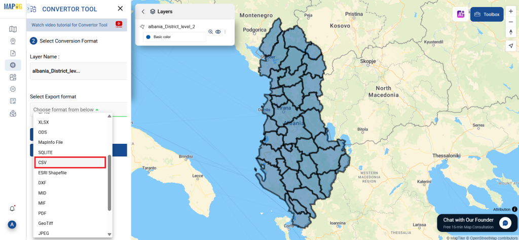
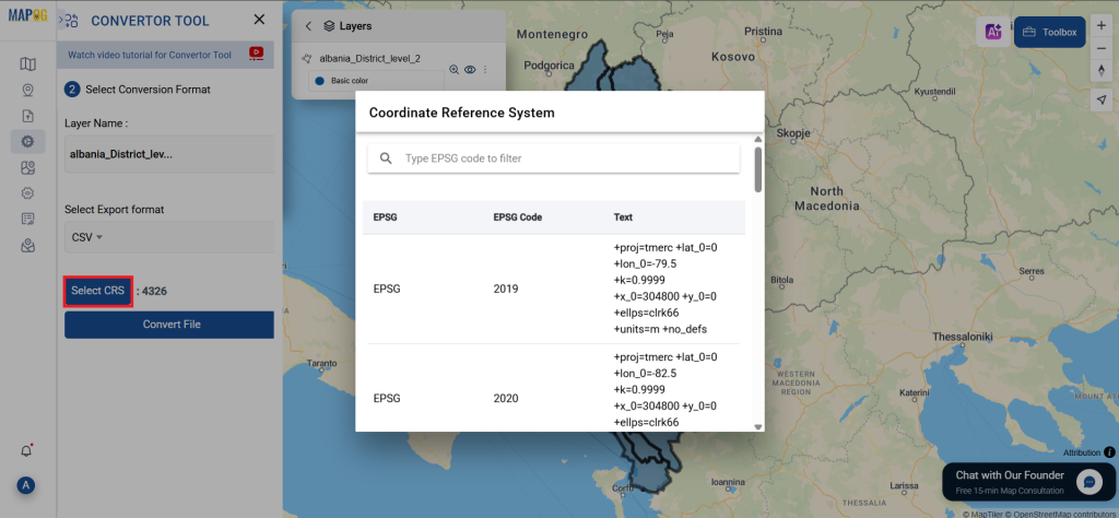
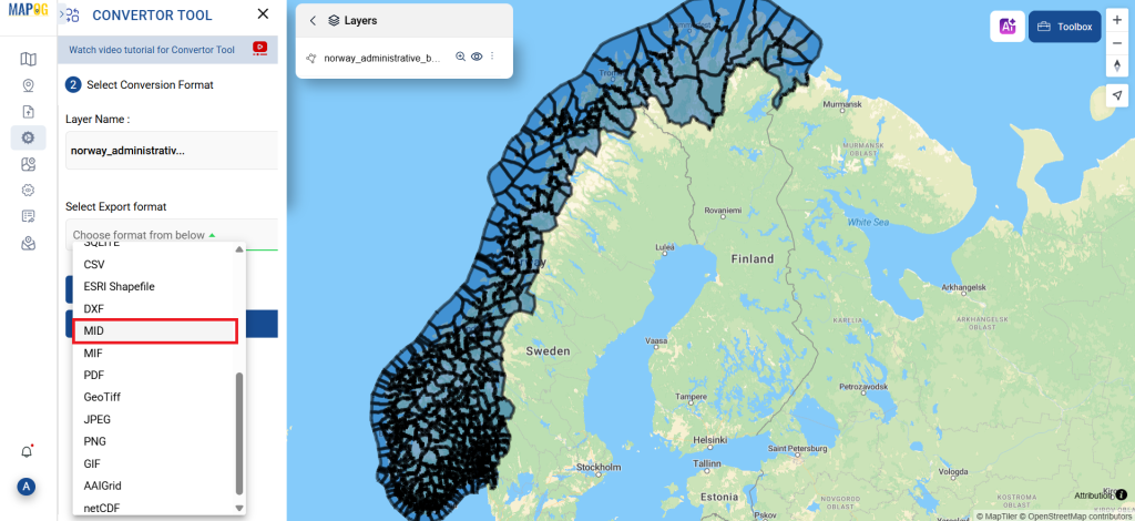
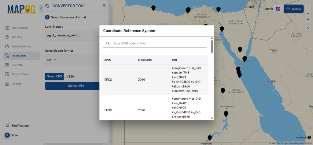
Step 2: Decide on the Conversion Format
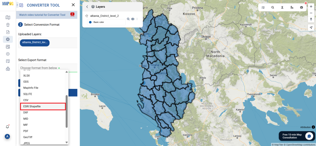
If you wish to export just the data, choose KML or Keyhole Markup Language as the output format. The application offers other ways to get the desired outcome, but in this tutorial, we’ll be using the option to convert the file to KML.
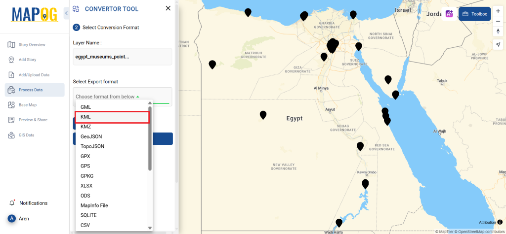
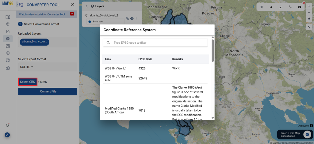
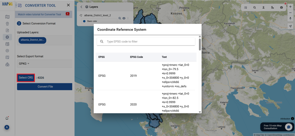
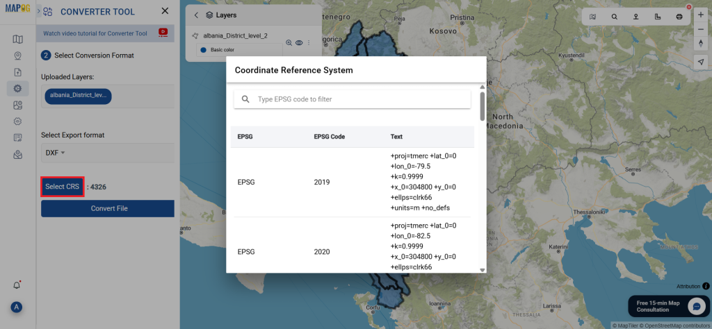
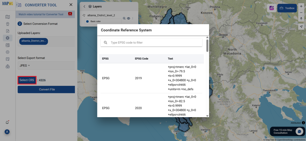
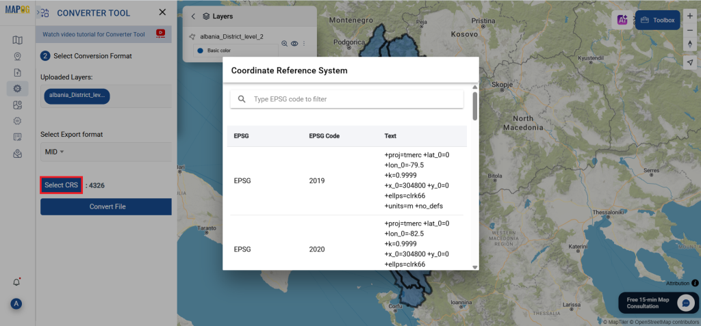
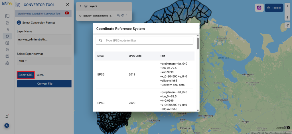
Additionally, this is a good time to set the CRS (Coordinate Reference System) to ensure your data aligns correctly with your spatial analysis requirements.
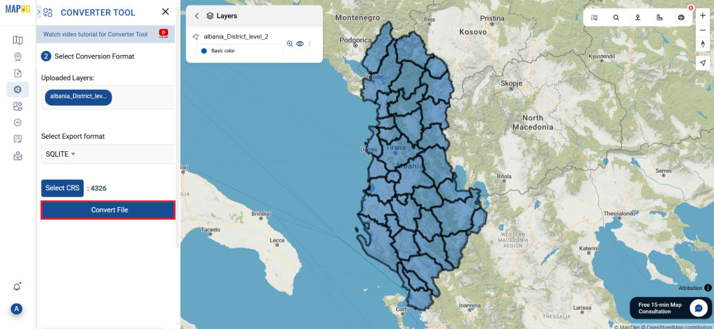
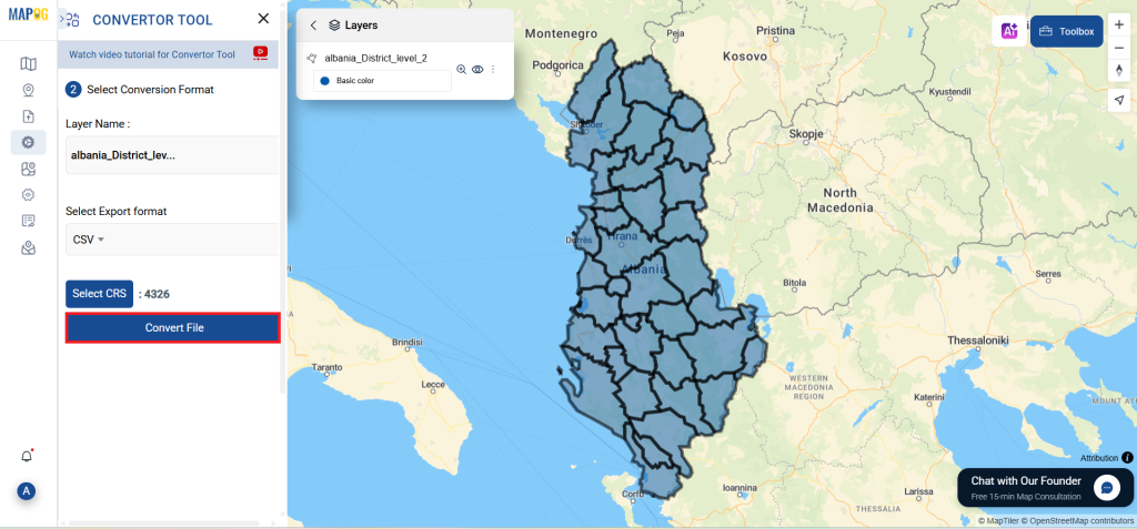
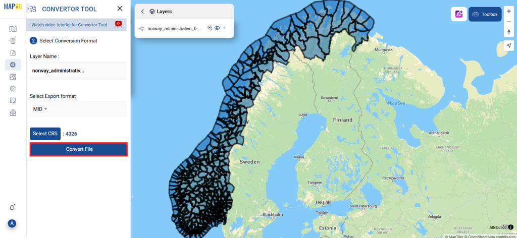
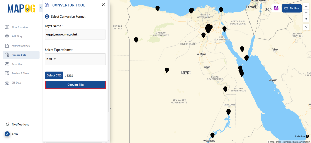
Step 3: Execute the Conversion
Navigate to “Convert Files” to observe the tool in action. When you use the Converter Tool, you enter your data and it transforms it from GPS to KML format.
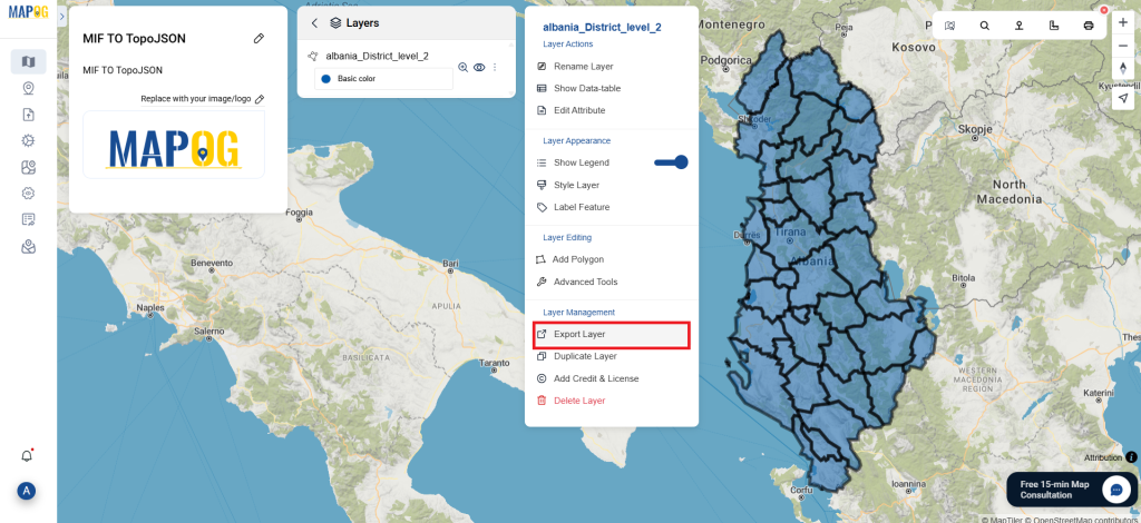
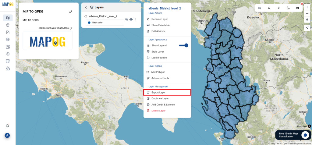
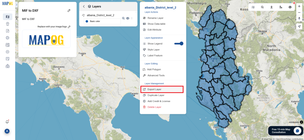
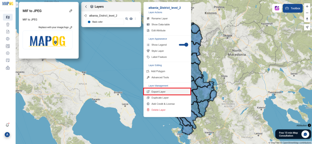
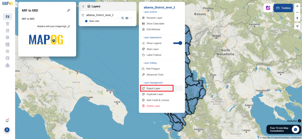
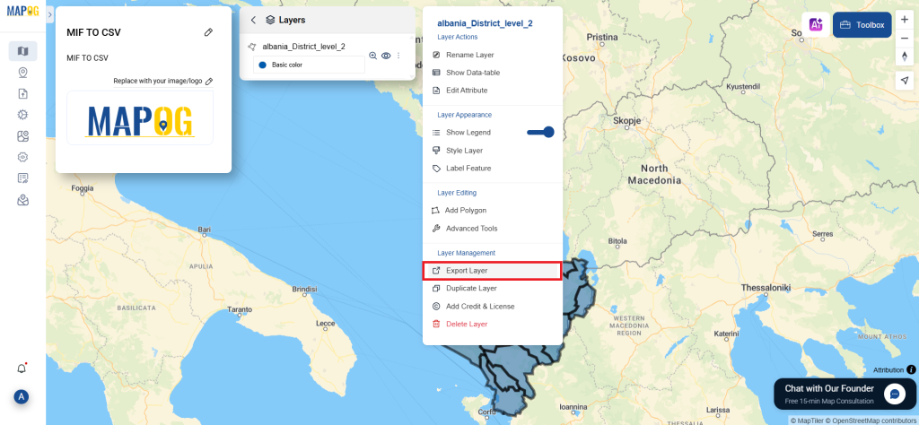
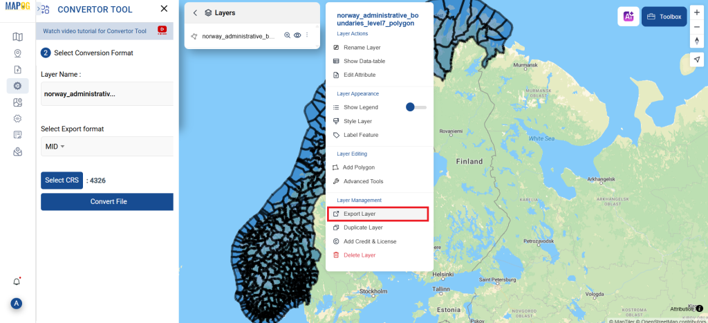
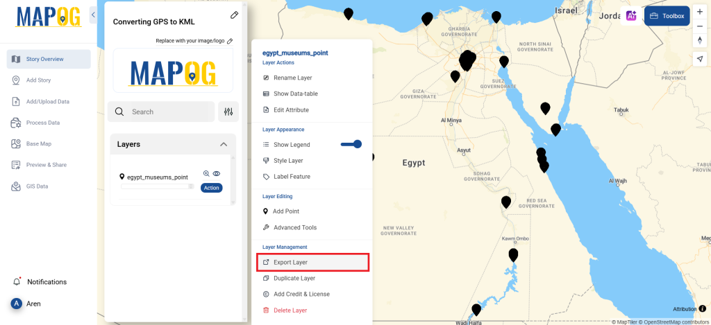
Step 4: Review and Download
Take a moment to review your converted KML data to make sure everything looks correct. Once you’re happy with it, go ahead and export the file. This step is really important to ensure that the conversion worked properly and that all your data is intact.
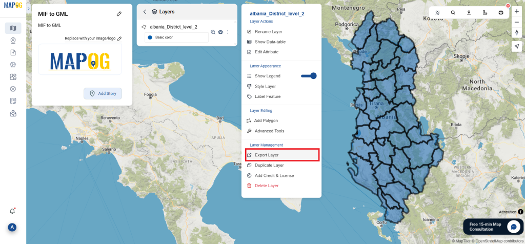
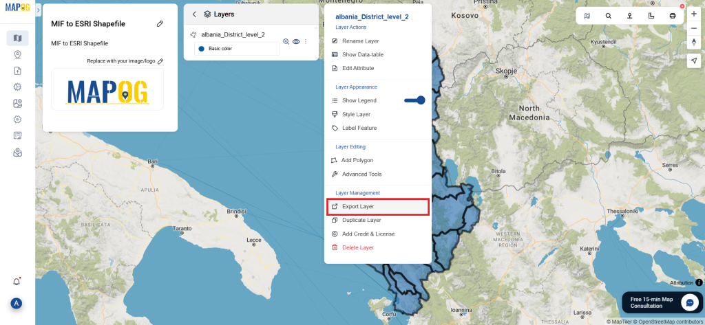
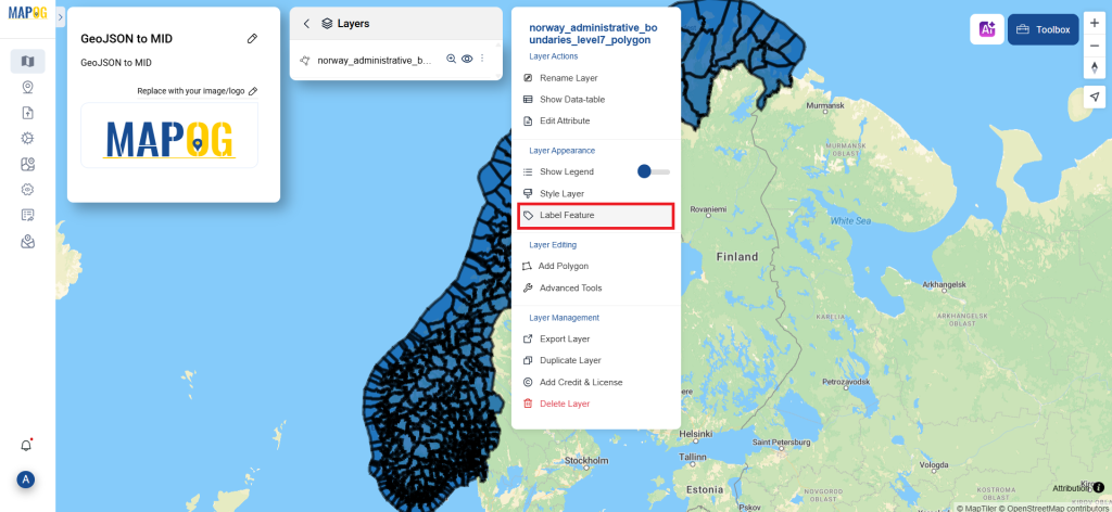
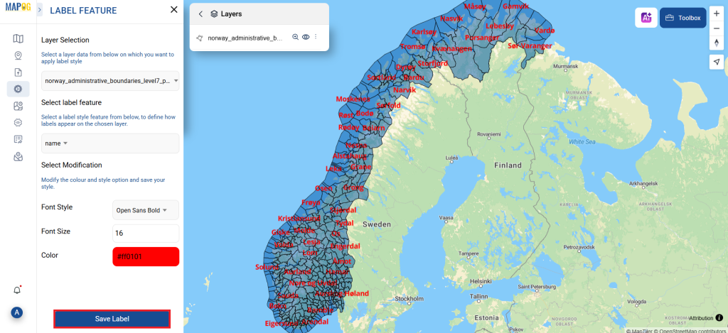
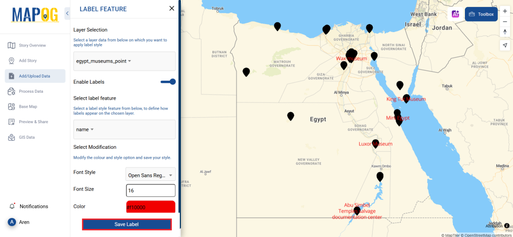
Step 5: Add Label Feature
To add a Lebel to a map, click the layer’s action button, select the Label Feature, enter the converted file, and adjust color and font size. Save the data, and the newly converted data with all museums names will be displayed.
And that’s it! You now know how to use MAPOG Converter Tool to convert GPS files to KMLs. It’s now simpler than ever to modify your data and get it ready for whatever analysis you require. This useful tool makes handling different data types easier, which improves the efficiency and productivity of your work.
With MAPOG’s versatile toolkit, you can effortlessly upload vector and upload Excel or CSV data, incorporate existing layers, perform polyline splitting, use the converter for various formats, calculate isochrones, and utilize the Export Tool.
Here are some other blogs you might be interested in: