Blog

Create Heat Map – IGISMap Tool Now MAPOG

Using Heat map is very effective way of visualizing points data. To create Heat map, first of all you must know what is heat map. When map visual of a location data is so dense and tightly packed that it does not make much sense a heat map is used. Heat maps are ordinarily used when mapping “points”. In this article we are providing pictorial tutorial of Create Heat Map using IGIS Map Tool

To create Heat map with IGIS Map Tool, you also need to  look over the GIS MapOG HeatMAP Tool.

Create Heat Map – GIS MapOG Tool

Heat Map allows user to display the density of the geographic points in a map. Heat map uses geographic points as a gradient color layer to style the map.

To create  Heat Map with IGIS Map Tool you need to follow some steps as follows:

  • Go To GIS MapOG Heat MAP Tool and login to your account or register if you are new user with name, email id, Organization name and role in examination.
  • Click on Create New Map and fill the tittle of map with its description.
  • Next screen will be redirected to the canvas where you can create, upload or use sample data for your heat map creation.
  • Upload a layer from data set.

Create Heat Map

  • Once the map is uploaded click on publish layer.
  • Select style layer by right click on the layer in side bar.

Create Heat Map

  • Now click on the Heat map section to create Heat map.

Create Heat Map

  • The distance between points for clustering is the merge radius here. The greater the number of points that fall within the radius, the greater the intensity of the heat map. While a radius set too small will generate isolated spots; a radius set to large will show no detail.
  • Now fill the opacity in the fill section to set the transparency of the heat map layer between 100% and 0%.

Create Heat Map

Heat map use red color to show high density of points and blue color for the low density of point area.

Below is the heat map of disaster management using sample data.

Create Heat Map

Use of Heat Map

This type of identification and visualization is useful for visualizing density of the geographic points and also used for business analysis and demographics mapping.

Heat Map serves in following industries:

For example, Heat Map can be used by Disaster Management Firm. As when a DM needs to calculate the flood  disaster data it uses the heat map.

While data and business analysis is the main reason to Create Heat Map, but it can also helps in understanding and comparing the data easily. It is also very common practice to use the Heat Map in Disaster and Risk management.

I hope this may help you in develop and Create Heat map with IGIS Map Tool. So if you find any problem in creating one such example do let us know by commenting below.

PHP connection with pgRouting for shortest path

Here in this post we do PHP connection with pgRouting for shortest path. Here we have explained how we can add source and destination point in table and how can we query for shortest route. In this demo we have made a connection between pgrouting and PHP using code igniter using code igniter framework.
Here we have uploaded shape file in postgis. For doing this you need to  install postgres and create a database. Everything is already explained in earlier tutorial.
You can also check Postgres with QGIS.
Now the same procedure is implemented using PHP in code igniter framework. As we have an idea about code igniter, which has three main component as view, model and controller.

VIEW-

In view section  we will be adding PHP code for presenting the shapefile and the output shortest route.

Model-

In model section will be writing query for getting two end points and shortest path.

Controller-

In controller section we will make function for registration, login and distance.

First of all you need to render your shape file on map. The map can be Google map, Open street map or any other map. For rendering the shape file using leaflet you need to add plugin in your script, which can be downloaded from https://github.com/calvinmetcalf/leaflet.shapefile link. Passing shapefile in L.Shapefile() method and calling addTo(map) method we can add the shapefile on map. After that we need to create input boxes for user to enter end points latitude and longitude. Using ajax we have send these latitude and longitude of both start and end point to model and got the result back in view.

$.ajax({
type: 'POST',
url: "<?php echo base_url('index.php/User_Authentication/distance');?>",
data:{dlat1:lat1,dlong1:long1,dlat2:lat2,dlong2:long2},
dataType: 'JSON',
success: function (response) {
var data= response;
var latitude= parseFloat(response['latitude']);
var longitude= parseFloat(response['longitude']);
var geodata= GeoJSON.parse(data, {Point: ['longitude','latitude']});
geojsonLayer = L.geoJson(geodata).addTo(map);
},
error: function (errorThrown){
check_status= 0;
console.log(errorThrown);
}
});

Write Query in Model

In model section we have written an insert function, which will help us to insert the obtained latitude longitude points from user in query. The query takes latitude longitude as input. As given

insertLatLong($dlat1,$dlat2,$dlong1,$dlong2){}

Then take out the id for given source and destination point and saved them as result in variable start and end.
$start = $this->db->query("SELECT source FROM network1 ORDER BY geom <-> ST_SetSRID(ST_Point ($dlong1,$dlat1),4326) LIMIT 1")->result();
$end= $this->db->query("SELECT source FROM network1 ORDER BY geom <->  ST_SetSRID(ST_Point ($dlong2,$dlat2),4326) LIMIT 1")->result();

After completing this wrote query using pgr_dijsktra method. This is an algorithm to find out the shortest path. This takes shape file table, start point , end point, boolean result for directed/undirected route and boolean result for having/not having route cost. To get the geometry column from network table applied join. Take this result in calculation variable.
After this check for the number of row i.e. the result of query is not empty and take result in distance variable and return is to controller.

public function insertLatLong($dlat1,$dlat2,$dlong1,$dlong2) {
$calculation= $this->db->query("select seq, id1, id2, cost, geom, ST_X(ST_AsText(ST_StartPoint((ST_AsText(ST_LineMerge(ST_GeomFromText(ST_AsText(geom)))))))) as latitude, ST_Y(ST_AsText(ST_StartPoint((ST_AsText(ST_LineMerge(ST_GeomFromText(ST_AsText(geom)))))))) as longitude
from pgr_dijkstra('Select gid as id, source, target, st_length(geom::geography)/1000 as cost from network1',
$start ,$end ,false, false) as di JOIN network1 pt ON (di.id2 = pt.gid)");

if($calculation->num_rows()>0) {
$distance= $try->result();

return $distance;

} else {

return false;
}
}

Call Function in Controller

In the controller, we can call the insert function and pass the required input to called function and also can load the view. Here for this article we have made login session and registration of user. This distance function takes the data in variable in sends to insertLatLong function in Login_Database model.

public function distance() {
$dlat1 = $this->input->post('dlat1');
$dlong1 = $this->input->post('dlong1');
$dlat2 = $this->input->post('dlat2');
$dlong2 = $this->input->post('dlong2');
$res= $this->Login_Database->insertLatLong($dlat1,$dlat2,$dlong1,$dlong2);
echo json_encode($res);
}

After writing everything properly you can run the project in browser. See the shortest path as given-

Export shapefile from postgreSQL - pgsql2shp
Export shapefile from postgreSQL – pgsql2shp

Hope you enjoyed the tutorial. If you face any problem in working with pgRouting please let us know.

GIS Data Conversion

In this post we are going to focus on one of the important topic of GIS world, which is the “DATA CONVERSION”. Data Conversion means converting computer data into another format. With huge amounts of GIS data available for use, it is more cost-efficient and effective to convert the GIS data from one format to another than recreating all of it.

We have an Online GIS Data Convert Tool Platform

GIS Data Conversion

There are many ways to convert GIS data and the conversion may use special conversion programs. Simply, it may involve complex data exporting or importing procedures. As we  know there are many data file formats used in GIS, this time we will be converting them from one format to another.

To get the list of the various data file formats you can visit our previous posts.

Vector data file formats in GIS and Raster data file formats in GIS.

To make datasets usable together in GIS, it is necessary to convert the both vector and raster geospatial file from one format to another. And for doing the Conversion we already have posts about the data conversion from GeoJSON to Shapefile and KML to shapefile and many more, but they all have a long way to convert the GIS data. The Alternative to that is some free and commercial converter  software or tools available on the web. There are a Lots’s of tools available on the web, but I recommend you to use  IGisMap converterMAPOG Converter is an online tool to convert GIS data from one format to another format.

MAPOG converter provides On-line conversion and transformation of both vector and raster geospatial data.  In this on-line converter tool the uploaded data file is allowed to convert into various GIS data format.

MAPOG converter can convert bulk amount of data into another format using any coordinates reference systems. And then you can download the converted data or store it into MyMapData.

This all about MAPOG Converter tool hope it will make your spatial study easy. If you face any problem in data conversion then please comment or chat with us.

Futhermore, You can also check :

Download Indonesia Administrative Boundary Shapefiles – Provinces, Districts, Sub Districts and more

Hello GIS enthusiasts, IGISMAP has now published the latest GIS vector data of Indonesia administrative levels. Links for downloading the shapefiles of the important administrative divisions of Indonesia are provided in the following. You can also download these data in KML, GeoJSON or CSV formats. 

Note:

  • All data available are in GCS datum EPSG:4326 WGS84 CRS (Coordinate Reference System).
  • You need to login for downloading the shapefile.

Download Free Shapefile Data of Indonesia

Indonesia, officially the Republic of Indonesia, is a country in Southeast Asia and Oceania between the Indian and Pacific oceans. It consists of over 17,000 islands, including Sumatra, Java, Sulawesi, and parts of Borneo and New Guinea. Indonesia is the world’s largest island country and the 14th-largest country by area, at 1,904,569 square kilometres (735,358 square miles).

Indonesia National Boundary

Download Indonesia National Outline Boundary Shapefile

Download Indonesia Province Shapefile Data

Below Polygon of Indonesia shapefile covers 34 provinces –

  1. Aceh
  2. North Sumatra
  3. West Sumatra
  4. Riau
  5. Riau Archipelago/Islands
  6. Jambi
  7. Bengkulu
  8. South Sumatra
  9. Bangka Belitung Islands
  10. Lampung
  11. Banten
  12. Jakarta
  13. West Java
  14. Central Java
  15. Yogyakarta
  16. East Java
  17. Bali
  18. West Nusa Tenggara
  19. East Nusa Tenggara
  20. West Kalimantan
  21. Central Kalimantan
  22. South Kalimantan
  23. East Kalimantan
  24. North Kalimantan
  25. North Sulawesi
  26. Gorontalo
  27. Central Sulawesi
  28. West Sulawesi
  29. South Sulawesi
  30. Southeast Sulawesi
  31. North Maluku
  32. Maluku (The Moluccas)
  33. West Papua
  34. Papua
Indonesia Province Boundaries

Download Indonesia Province Boundaries Shapefile

Download Indonesia District Shapefile Data

Indonesia District Boundaries

Download Indonesia District Boundaries Shapefile

Download Indonesia Sub District Shapefile Data

Indonesia Sub District Boundaries

Download Indonesia Sub District Boundaries Shapefile

Other GIS Data:

Convert Indonesia Shapefile SHP to KML

For Indonesia SHP to KML conversion go to MAPOG Tool and follow the steps for Indonesia Shapefile SHP to KML file conversion.

Convert Indonesia KML to Indonesia Shapefile

For Indonesia KML conversion login at mapanalysis.mapog.com and follow the steps for KML to Shapefile SHP.

Download Free Shapefile for the following:

  1. World Countries Shapefile
  2. Australia
  3. Argentina
  4. Austria
  5. Belgium
  6. Brazil
  7. Canada
  8. Denmark
  9. Fiji
  10. Finland
  11. Germany
  12. Greece
  13. India
  14. Indonesia
  15. Ireland
  16. Italy
  17. Japan
  18. Kenya
  19. Lebanon
  20. Madagascar
  21. Malaysia
  22. Mexico
  23. Mongolia
  24. Netherlands
  25. New Zealand
  26. Nigeria
  27. Papua New Guinea
  28. Philippines
  29. Poland
  30. Russia
  31. Singapore
  32. South Africa
  33. South Korea
  34. Spain
  35. Switzerland
  36. Tunisia
  37. United Kingdom Shapefile
  38. United States of America
  39. Vietnam
  40. Croatia
  41. Chile
  42. Norway

Disclaimer : If you find any shapefile data of country provided is in correct do contact us or comment below, so that we will correct the same in our system.

Download Argentina Administrative Boundary Shapefiles – Provinces, Departmentos, Municipalities and more

Hello GIS enthusiasts, IGISMAP has now published the latest GIS vector data of Argentina administrative levels. Links for downloading the shapefiles of the important administrative divisions of Argentina are provided in the following. You can also download these data in KML, GeoJSON or CSV formats. 

Note:

  • All data available are in GCS datum EPSG:4326 WGS84 CRS (Coordinate Reference System).
  • You need to login for downloading the shapefile.

Download Free Shapefile Data of Argentina

Argentina, officially the Argentine Republic, is a country in the southern half of South America. Argentina covers an area of 2,780,400 km2 (1,073,500 sq mi), making it the largest Spanish-speaking nation in the world by area. It is the second-largest country in South America after Brazil, the fourth-largest country in the Americas, and the eighth-largest country in the world. It shares the bulk of the Southern Cone with Chile to the west, and is also bordered by Bolivia and Paraguay to the north, Brazil to the northeast, Uruguay and the South Atlantic Ocean to the east, and the Drake Passage to the south. Argentina is a federal state subdivided into twenty-three provinces, and one autonomous city, which is the federal capital and largest city of the nation, Buenos Aires. The provinces and the capital have their own constitutions, but exist under a federal system. Argentina claims sovereignty over a part of Antarctica, the Falkland Islands and South Georgia and the South Sandwich Islands.

Argentina National Boundary

Download Argentina National Outline Boundary Shapefile

Download Argentina Province Shapefile Data

Polygon Shapefile of Argentina Covers – Autonomous City of Buenos Aires, Buenos Aires, Buenos Aires, Santa Fe, Mendoza, Tucumán, Salta, Entre Ríos, Misiones, Chaco, Corrientes, Santiago del Estero, San Juan, Jujuy, Río Negro, Neuquén, Formosa, Chubut, San Luis, Catamarca, La Rioja, La Pampa, Santa Cruz, Tierra del Fuego.

Argentina Province Boundaries

Download Argentina Province Boundaries Shapefile

Download Argentina Departmentos Shapefile Data

Argentina Departmento Boundaries

Download Argentina Departmento Boundaries Shapefile

Download Argentina Municipality Shapefile Data

Argentina Municipality Boundaries

Download Argentina Municipality Boundaries Shapefile

Please note that the Argentina data provided here is license under Open Data Commons Open Database License (ODbL). Please review the same before using it. If you want data under different license you can also look over to the post : Download Free Shapefile Maps – Country Boundary Polygon, Rail-Road, Water polyline etc.

Download GIS Data for other countries From Here

Other GIS Data:

Download Free Shapefile for the following:

  1. World Countries Shapefile
  2. Australia
  3. Argentina
  4. Austria
  5. Belgium
  6. Brazil
  7. Canada
  8. Denmark
  9. Fiji
  10. Finland
  11. Germany
  12. Greece
  13. India
  14. Indonesia
  15. Ireland
  16. Italy
  17. Japan
  18. Kenya
  19. Lebanon
  20. Madagascar
  21. Malaysia
  22. Mexico
  23. Mongolia
  24. Netherlands
  25. New Zealand
  26. Nigeria
  27. Papua New Guinea
  28. Philippines
  29. Poland
  30. Russia
  31. Singapore
  32. South Africa
  33. South Korea
  34. Spain
  35. Switzerland
  36. Tunisia
  37. United Kingdom Shapefile
  38. United States of America
  39. Vietnam
  40. Croatia
  41. Chile
  42. Norway

Disclaimer : If you find any shapefile data of country provided is in correct do contact us or comment below, so that we will correct the same in our system.

Download Tunisia GIS Data – Provinces, Highway Lines, Airport Locations and More

Hello GIS enthusiasts, IGISMAP has now published the latest GIS vector data of Tunisia administrative levels. Links for downloading the shapefiles of the important administrative divisions of Tunisia are provided in the following. You can also download these data in KML, GeoJSON or CSV formats. 

Note:

  • All data available are in GCS datum EPSG:4326 WGS84 CRS (Coordinate Reference System).
  • You need to login for downloading the shapefile.

Download Free Shapefile Data of Tunisia

Tunisia, officially the Republic of Tunisia, is the northernmost country in Africa. It is a part of the Maghreb region of North Africa, and is bordered by Algeria to the west and southwest, Libya to the southeast, and the Mediterranean Sea to the north and east, covering 163,610 km2 (63,170 sq mi), with a population of 11 million. It contains the eastern end of the Atlas Mountains and the northern reaches of the Sahara desert, with much of its remaining territory being arable land. Its 1,300 km (810 mi) of coastline include the African conjunction of the western and eastern parts of the Mediterranean Basin. Tunisia is home to Africa’s northernmost point, Cape Angela; and its capital and largest city is Tunis, located on its northeastern coast, which lends the country its name.

Tunisia National Boundary

Download Tunisia National Outline Boundary Shapefile

Download Tunisia Province Shapefile Data

It Covers Ariana, Beja, Ben Arous, Bizerte, El Kef, Gabes, Gafsa, Jendouba, Kairouan, Kasserine, Kebili, Mahdia, Manouba, Medenine, Monastir, Nabeul, Sfax, Sidi Bouzid, Siliana, Sousse, Tataouine, Tozeur, Tunis and Zaghouan.

Tunisia Province Boundaries

Download Tunisia Province Boundaries Shapefile

Download Tunisia Highway Lines Shapefile Data

Tunisia Highway Lines

Download Tunisia Highway Line Shapefile

Above shown image is the zoomed in image of the highway line vector data of Tunisia

Download Tunisia Airport Points Shapefile Data

Tunisia Airport Locations

Download Tunisia Airport Locations Shapefile

Please note that the Tunisia data provided here is license under Open Data Commons Open Database License (ODbL). Please review the same before using it. If you want data under different license you can also look over to the post : Download Free Shapefile Maps – Country Boundary Polygon, Rail-Road, Water polyline etc

Download Free Shapefile for the following:

  1. World Countries Shapefile
  2. Australia
  3. Argentina
  4. Austria
  5. Belgium
  6. Brazil
  7. Canada
  8. Denmark
  9. Fiji
  10. Finland
  11. Germany
  12. Greece
  13. India
  14. Indonesia
  15. Ireland
  16. Italy
  17. Japan
  18. Kenya
  19. Lebanon
  20. Madagascar
  21. Malaysia
  22. Mexico
  23. Mongolia
  24. Netherlands
  25. New Zealand
  26. Nigeria
  27. Papua New Guinea
  28. Philippines
  29. Poland
  30. Russia
  31. Singapore
  32. South Africa
  33. South Korea
  34. Spain
  35. Switzerland
  36. Tunisia
  37. United Kingdom Shapefile
  38. United States of America
  39. Vietnam
  40. Croatia
  41. Chile
  42. Norway

Disclaimer : If you find any shapefile data of country provided is in correct do contact us or comment below, so that we will correct the same in our system as well we will try to correct the same in openstreetmap.
Download Lebanon Administrative Boundary Shapefiles – Governorates, Districts, Municipalities and more

Hello GIS enthusiasts, IGISMAP has now published the latest GIS vector data of Lebanon administrative levels. Links for downloading the shapefiles of the important administrative divisions of Lebanon are provided in the following. You can also download these data in KML, GeoJSON or CSV formats. 

Note:

  • All data available are in GCS datum EPSG:4326 WGS84 CRS (Coordinate Reference System).
  • You need to login for downloading the shapefile.

Download Free Shapefile Data of Lebanon

Lebanon, officially the Republic of Lebanon or the Lebanese Republic, is a country in Western Asia. It is located between Syria to the north and east and Israel to the south, while Cyprus lies to its west across the Mediterranean Sea; its location at the crossroads of the Mediterranean Basin and the Arabian hinterland has contributed to its rich history and shaped a cultural identity of religious diversity. It is part of the Levant region of the Middle East. Lebanon is home to roughly six million people and covers an area of 10,452 square kilometres (4,036 sq mi), making it one of the smallest countries in the world.

Lebanon National Boundary

Download Lebanon National Outline Boundary Shapefile

Download Lebanon Governorates Shapefile Data

Lebanon is divided into 8 Governorates; Akkar, Baalbeck-Hermel, Beirut, Bekaa, Mount Lebanon, North Lebanon, Nabatiyeh, and South Lebanon. The Governorate (Muhafazah) is considered an administrative division of the country.

Lebanon Governorates Boundaries

Download Lebanon Governorates Boundaries Shapefile

Download Lebanon Districts Shapefile Data

Lebanon District Boundaries

Download Lebanon District Boundaries Shapefile

Download Lebanon Sub Districts Shapefile Data

Lebanon Sub Districts

Download Lebanon Sub District Boundaries Shapefile

Please note that the Lebanon data provided here is license under Open Data Commons Open Database License (ODbL). Please review the same before using it. If you want data under different license you can also look over to the post : Download Free Shapefile Maps – Country Boundary Polygon, Rail-Road, Water polyline etc

Other GIS Data:

Download Free Shapefile for the following:

  1. World Countries Shapefile
  2. Australia
  3. Argentina
  4. Austria
  5. Belgium
  6. Brazil
  7. Canada
  8. Denmark
  9. Fiji
  10. Finland
  11. Germany
  12. Greece
  13. India
  14. Indonesia
  15. Ireland
  16. Italy
  17. Japan
  18. Kenya
  19. Lebanon
  20. Madagascar
  21. Malaysia
  22. Mexico
  23. Mongolia
  24. Netherlands
  25. New Zealand
  26. Nigeria
  27. Papua New Guinea
  28. Philippines
  29. Poland
  30. Russia
  31. Singapore
  32. South Africa
  33. South Korea
  34. Spain
  35. Switzerland
  36. Tunisia
  37. United Kingdom Shapefile
  38. United States of America
  39. Vietnam
  40. Croatia
  41. Chile
  42. Norway

Disclaimer : If you find any shapefile data of country provided is in correct do contact us or comment below, so that we will correct the same in our system.

Download Mongolia Administrative Boundary GIS Data for- National, Regions, Provinces, Districts and more

Elevate your mapping pursuits! IGISMAP presents a special offer: download Mongolia’s administrative boundary GIS data, including national, regions, provinces, districts, and more.

Effortlessly explore Mongolia’s geographical data through MAPOG. Discover a wide range of datasets of Mongolia GIS Data including comprehensive information on borders, rivers, roads, and airports. Utilizing tools such as Download GIS Data and Add GIS Data is straightforward. You have the option to select formats like Shapefile, KML, GeoJSON, and CSV with the Download GIS Data tool. For a step-by-step guide on utilizing the Add GIS Data tool refer to ” Add GIS data from IGISMap GIS data collection..” This guide provides instructions for obtaining administrative GIS data using the Download GIS Data feature. Trust MAPOG to enhance your understanding of Mongolia’s geography.

With MAPOG’s versatile toolkit, you can effortlessly upload vector and raster filesadd WMS (Web Map Service) layers, upload Excel or CSV data, incorporate existing files, perform polygon splitting and merging, generate new polygon and polyline data, use the converter for various formats, conduct buffer analysiscreate gridstransform points into polygons, calculate isochrones, and utilize the geocoder for precise location information.

We offer an extensive array of data formats, including KML, SHP, CSV, GeoJSON, Tab, SQL, Tiff, GML, KMZ, GPKZ, SQLITE, Dxf, MIF, TOPOJSON, XLSX, GPX, ODS, MID, and GPS, ensuring compatibility and accessibility for various applications and analyses.

Note:

  • All data available are in GCS datum EPSG:4326 WGS84 CRS (Coordinate Reference System).
  • You need to login for downloading the shapefile.

Download Shapefile Data of Mongolia

Mongolia is a landlocked country in East Asia, bordered by Russia to the north and China to the south. It covers an area of 1,564,116 square kilometers (603,909 square miles), with a population of just 3.3 million, making it the world’s most sparsely populated sovereign nation. Mongolia is the world’s largest landlocked country that does not border a closed sea, and much of its area is covered by grassy steppe, with mountains to the north and west and the Gobi Desert to the south. Ulaanbaatar, the capital and largest city, is home to roughly half of the country’s population.

Mongolia National Boundary

Download Mongolia National Outline Boundary Shapefile

Download Mongolia Regions Shapefile Data

Mongolia is geographically divided into 4 regions:

  • Central Region
  • Eastern Region
  • Khangai Region
  • Western Region
Mongolia Region Boundaries

Download Mongolia Region Boundaries Shapefile

Download Mongolia Provinces Shapefile Data

Mongolia is divided into 21 provinces or aimags and one provincial municipality, whose boundaries are available in the following polygon GIS data provided by IGISMAP.

Mongolia Province Boundaries

Download Mongolia Province Boundaries Shapefile

Here is the list of the 21 provinces of Mongolia :

  1. Arkhangai Province
  2. Bayan-Ölgii Province
  3. Bayankhongor Province
  4. Bulgan Province
  5. Darkhan-Uul Province
  6. Dornod Province
  7. Dornogovi Province
  8. Dundgovi Province
  9. Govi-Altai Province
  10. Govisümber Province
  11. Khentii Province
  12. Khovd Province
  13. Khövsgöl Province
  14. Ömnögovi Province
  15. Orkhon Province
  16. Övörkhangai Province
  17. Selenge Province
  18. Sükhbaatar Province
  19. Töv Province
  20. Uvs Province
  21. Zavkhan Province

Download Mongolia Districts Shapefile Data

In Mongolia, a district (locally known as “сум” or “sum,” meaning “arrow” in Mongolian) is a secondary administrative division. Mongolia’s 21 provinces are further divided into a total of 331 districts, each serving as a second-level administrative subdivision.

Mongolia District Boundaries

Download Mongolia District Boundaries Shapefile

Other Administrative Boundary Data:

Other GIS Data:

Above all links are provided for GIS data of Mongolia if you are looking for any specific data please write us on support@igismap.com

Download Shapefile for the following:

  1. World Countries Shapefile
  2. Australia
  3. Argentina
  4. Austria
  5. Belgium
  6. Brazil
  7. Canada
  8. Denmark
  9. Fiji
  10. Finland
  11. Germany
  12. Greece
  13. India
  14. Indonesia
  15. Ireland
  16. Italy
  17. Japan
  18. Kenya
  19. Lebanon
  20. Madagascar
  21. Malaysia
  22. Mexico
  23. Mongolia
  24. Netherlands
  25. New Zealand
  26. Nigeria
  27. Papua New Guinea
  28. Philippines
  29. Poland
  30. Russia
  31. Singapore
  32. South Africa
  33. South Korea
  34. Spain
  35. Switzerland
  36. Tunisia
  37. United Kingdom Shapefile
  38. United States of America
  39. Vietnam
  40. Croatia
  41. Chile
  42. Norway
  43. Maldives
  44. Bhutan
  45. Colombia
  46. Libya
  47. Comoros
  48. Hungary
  49. Laos
  50. Estonia
  51. Iraq
  52. Portugal
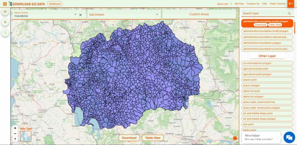
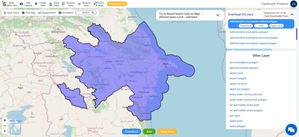
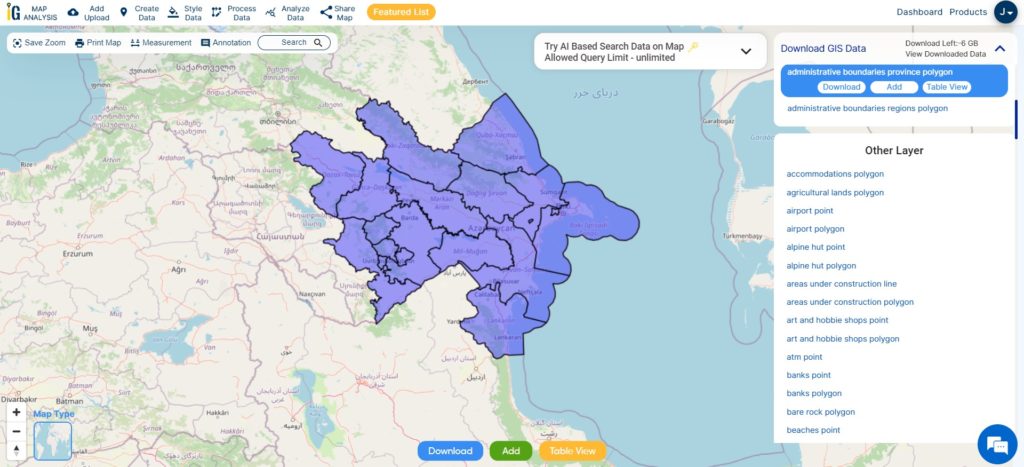
  53. Azerbaijan
  54. Macedonia
  55. Romania
  56. Peru
  57. Marshall Islands
  58. Slovenia
  59. Nauru
  60. Guatemala
  61. El Salvador
  62. Afghanistan
  63. Cyprus
  64. Syria
  65. Slovakia
  66. Luxembourg
  67. Jordan
  68. Armenia
  69. Haiti And Dominican Republic

Disclaimer : If you find any shapefile data of country provided is incorrect do contact us or comment below, so that we will correct the same in our system as well we will try to correct the same in openstreetmap.
Download Vietnam Administrative Boundary Shapefiles – National, Provinces and Districts

Hello GIS enthusiasts, IGISMAP has now published the latest GIS vector data of Vietnam administrative levels. Links for downloading the shapefiles of the important administrative divisions of Vietnam are provided in the following. You can also download these data in KML, GeoJSON or CSV formats. 
Note:

  • All data available are in GCS datum EPSG:4326 WGS84 CRS (Coordinate Reference System).
  • You need to login for downloading the shapefile.

Download Free Shapefile Data of Vietnam

Vietnam, officially the Socialist Republic of Vietnam, is a country in Southeast Asia. Located at the eastern edge of mainland Southeast Asia, it covers 311,699 square kilometers (120,348 sq mi). With a population of over 96 million, it is the world’s fifteenth-most populous country. Vietnam borders China to the north, Laos and Cambodia to the west, and shares maritime borders with Thailand through the Gulf of Thailand, and the Philippines, Indonesia, and Malaysia through the South China Sea. Its capital is Hanoi and its largest city is Ho Chi Minh City.

Vietnam National Boundary

Download Vietnam National Outline Boundary Shapefile

Download Vietnam Province Shapefile Data

Following GIS vector data of Vietnam Provinces contains 63 polygon boundaries

Vietnam Province Boundaries

Download Vietnam Provinces Boundaries Shapefile

Download Vietnam Districts Shapefile Data

Vietnam Districts Boundaries

Download Vietnam Districts Boundaries Shapefile

Please note that the Vietnam data provided here is license under Open Data Commons Open Database License (ODbL). Please review the same before using it. If you want data under different license you can also look over to the post : Download Free Shapefile Maps – Country Boundary Polygon, Rail-Road, Water polyline etc

Download Free Shapefile for the following:

  1. World Countries Shapefile
  2. Australia
  3. Argentina
  4. Austria
  5. Belgium
  6. Brazil
  7. Canada
  8. Denmark
  9. Fiji
  10. Finland
  11. Germany
  12. Greece
  13. India
  14. Indonesia
  15. Ireland
  16. Italy
  17. Japan
  18. Kenya
  19. Lebanon
  20. Madagascar
  21. Malaysia
  22. Mexico
  23. Mongolia
  24. Netherlands
  25. New Zealand
  26. Nigeria
  27. Papua New Guinea
  28. Philippines
  29. Poland
  30. Russia
  31. Singapore
  32. South Africa
  33. South Korea
  34. Spain
  35. Switzerland
  36. Tunisia
  37. United Kingdom Shapefile
  38. United States of America
  39. Vietnam
  40. Croatia
  41. Chile
  42. Norway

Disclaimer : If you find any shapefile data of country provided is in correct do contact us or comment below, so that we will correct the same in our system.

Convert Shapefile to SQLite

The shapefile format is a geospatial vector data format for geographic information system (GIS) software. It is developed and regulated by ESRI as a mostly open specification for data interoperability among ESRI and other GIS software products.

SQLite is an in-process library that implements a self-contained, serverless, zero-configuration, transactional SQL database engine. It provides Geo database functional like PostGIS, Oracle. For more information on SQLite, visit www.sqlite.org

Online Convert Shapefile to SQLite

In this article we will provide you the pictorial based tutorial of Shapefile to SQLite conversion using IGISMAP.

Shapefile to SQLite

IGISMAP to Convert Shapefile to SQLite

For Shapefile to SQLite conversion, go to GIS MapOG Converter Tool, after logging in with your registered email and password. If you are a new user, click the Sign Up button in the Login popup and register to IGISMAP by filling the details.

There are three main steps for using GIS Converter:

  • Upload the data
  • Choose the format to which it should be converted
  • Download the converted file

Step one is to upload your Shapefile which you want to convert. You can upload your file from system or select from the Recent Files.

Upload Shapefile
Upload Shapefile

Here we have uploaded the Shapefile of the US state ‘Texas’.

Step two is to select choose the output format of the converted file, in this case its SQLite. You can also set the Coordinate Reference System of your preference. As a default CRS will set to WGS 84 (World) [EPSG:4326]. Click on the Convert File.

Select SQLITE as Output Format

Your Shapefile will then gets converted to SQLite after a few seconds and will be available for downloading.

Download and Publish SQLite File

You can also choose to style the layer or continue with further conversion process by clicking the Convert Another File button.

You can also download the converted file or the uploaded file from the Converted Files section from the dashboard. This section contains the list of the details of all the conversion done in your account, providing both input and output data available for download their corresponding formats.

So, this is all about the Shapefile SHP to SQLITE conversion. We try our best with pictorial representation of steps of conversion. If still you are facing any problem then contact us or comment below.

Other GIS data Conversions

If you are facing any problem in conversion or login then please let us know by mailing at support@igismap.com or drop comment.