Convert CSV to TopoJSON Online: A Step-by-Step Guide

In the world of Geographic Information Systems (GIS), file conversion is essential for ensuring that geospatial data is compatible with different platforms and tools. Converting CSV to TopoJSON allows you to visualize your data.

What is CSV File?

A CSV file (Comma-Separated Values) is a simple text file that stores data in a table format. Each line represents a row, and the values in each row are separated by commas, making it easy to organize and share information like a spreadsheet.

                                         ONLINE GIS DATA CONVERTION

Key Concept for Conversion CSV to Topojson:

The MAPOG MapAnalysis Converter Tool is designed to make data conversion between various formats seamless and user-friendly. Below is a step-by-step guide on how to convert CSV files to TopoJSON format using MAPOG.

Step-by-Step Guide to Converting CSV to TopoJSON

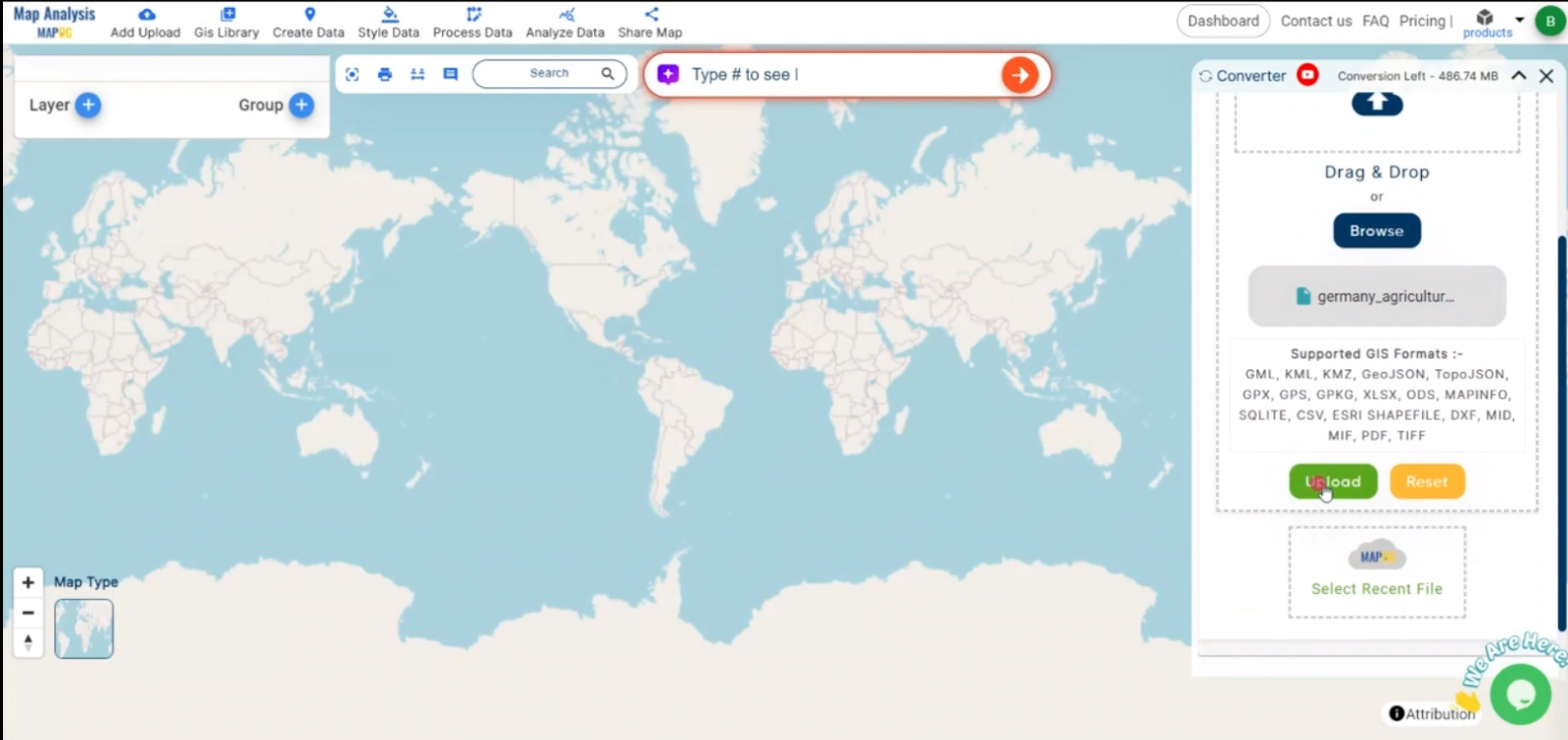
Step 1: Upload Your CSV Data

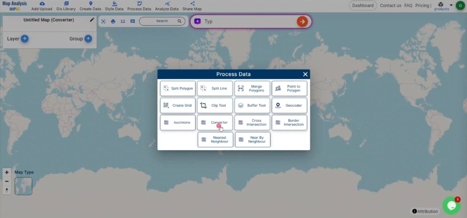
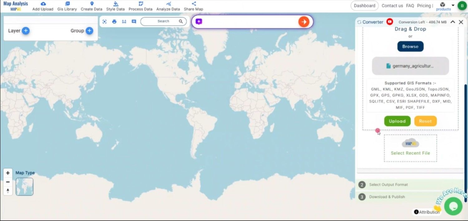
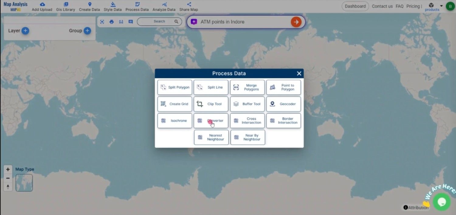
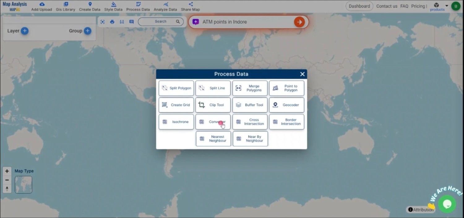
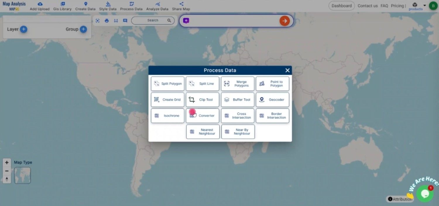
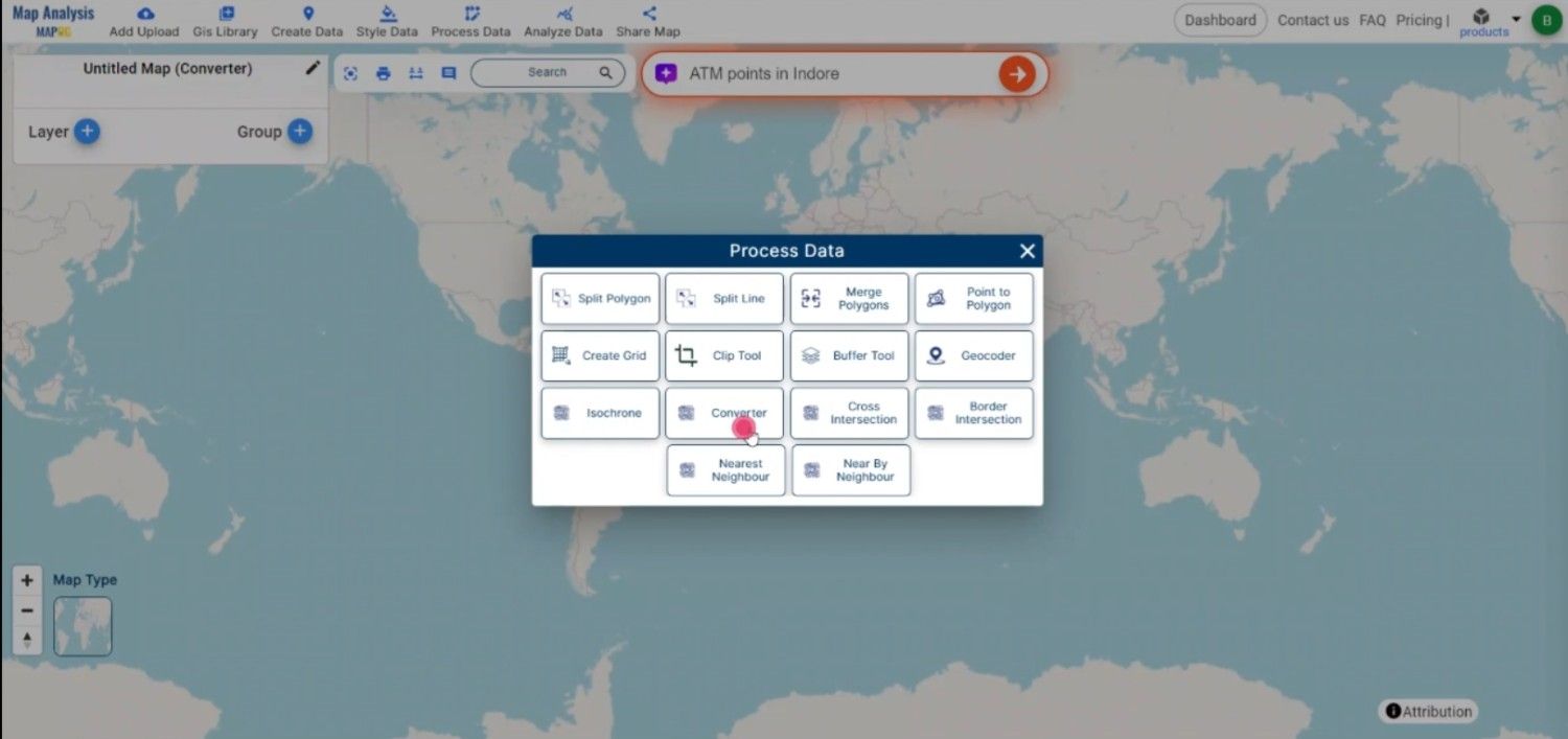
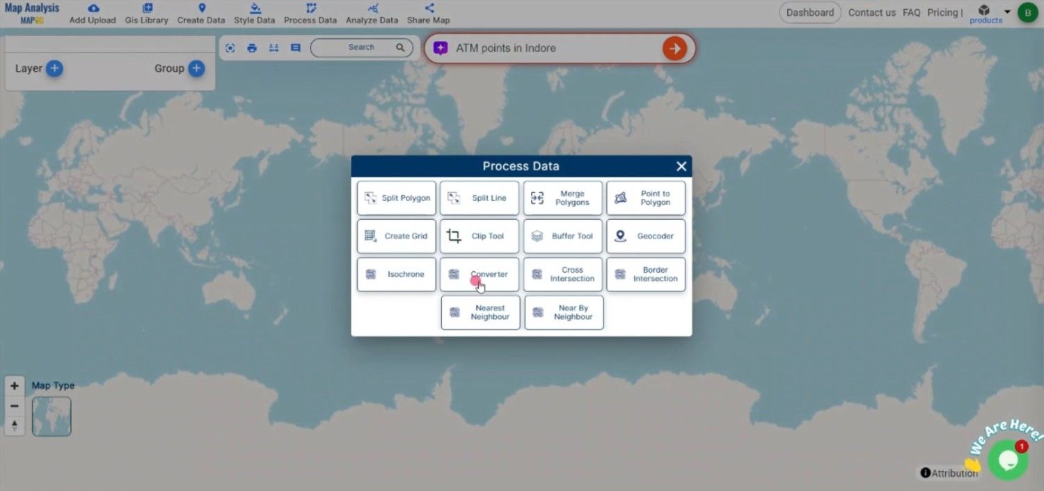
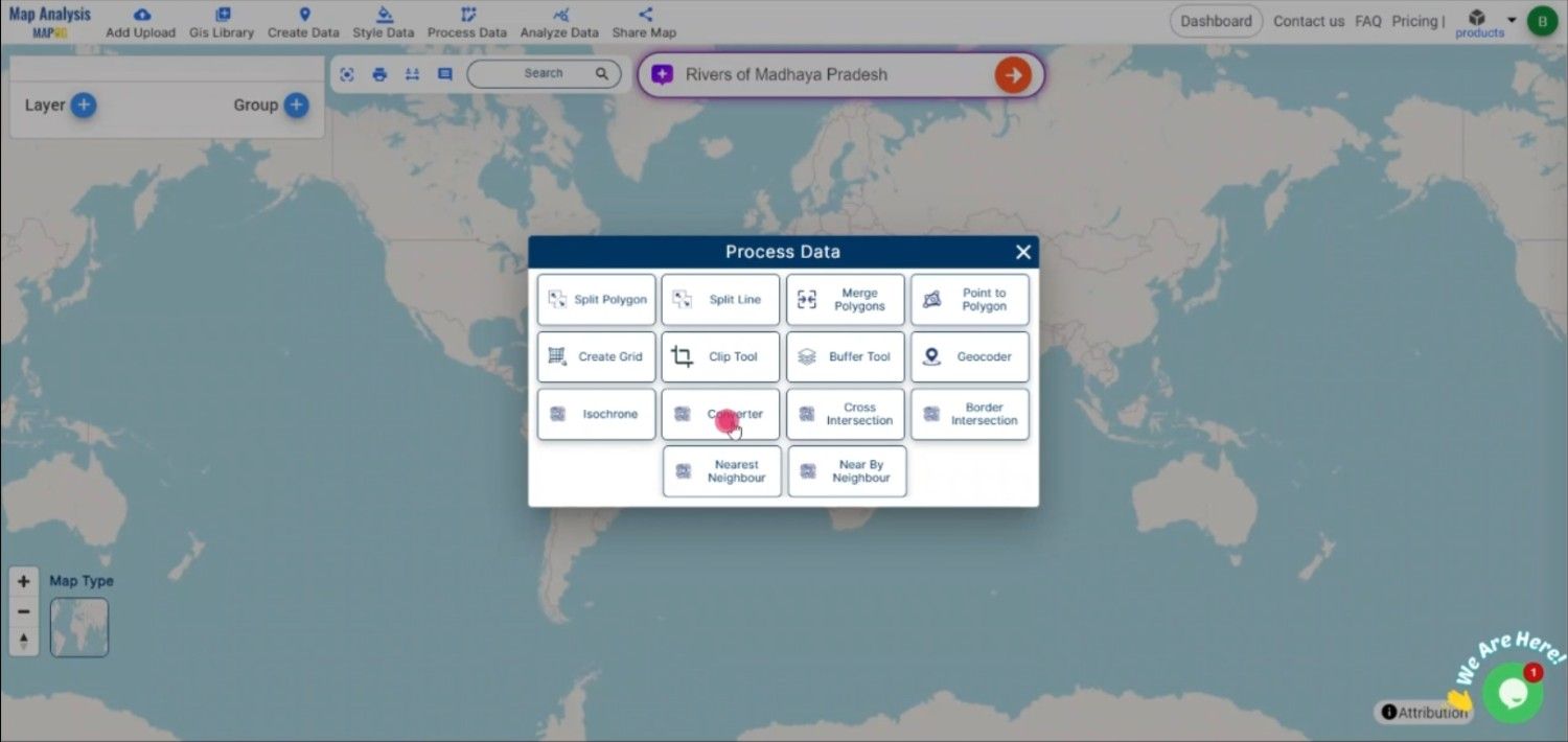
Begin by navigating to the “Process Data” section in MAPOG MapAnalysis and selecting the “Converter Tool” option. Before uploading, ensure your CSV file is well-organized, with columns representing necessary attributes like coordinates  and any other relevant data fields.

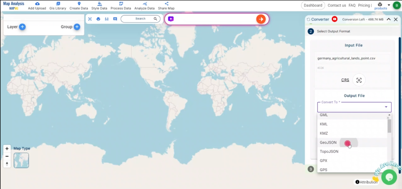
Step 2: Select TopoJSON as the Output Format

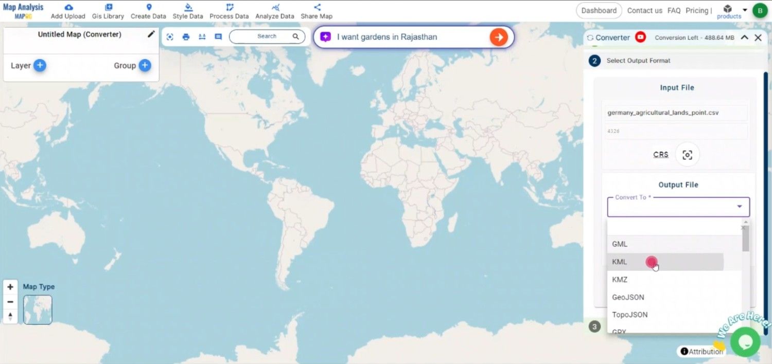
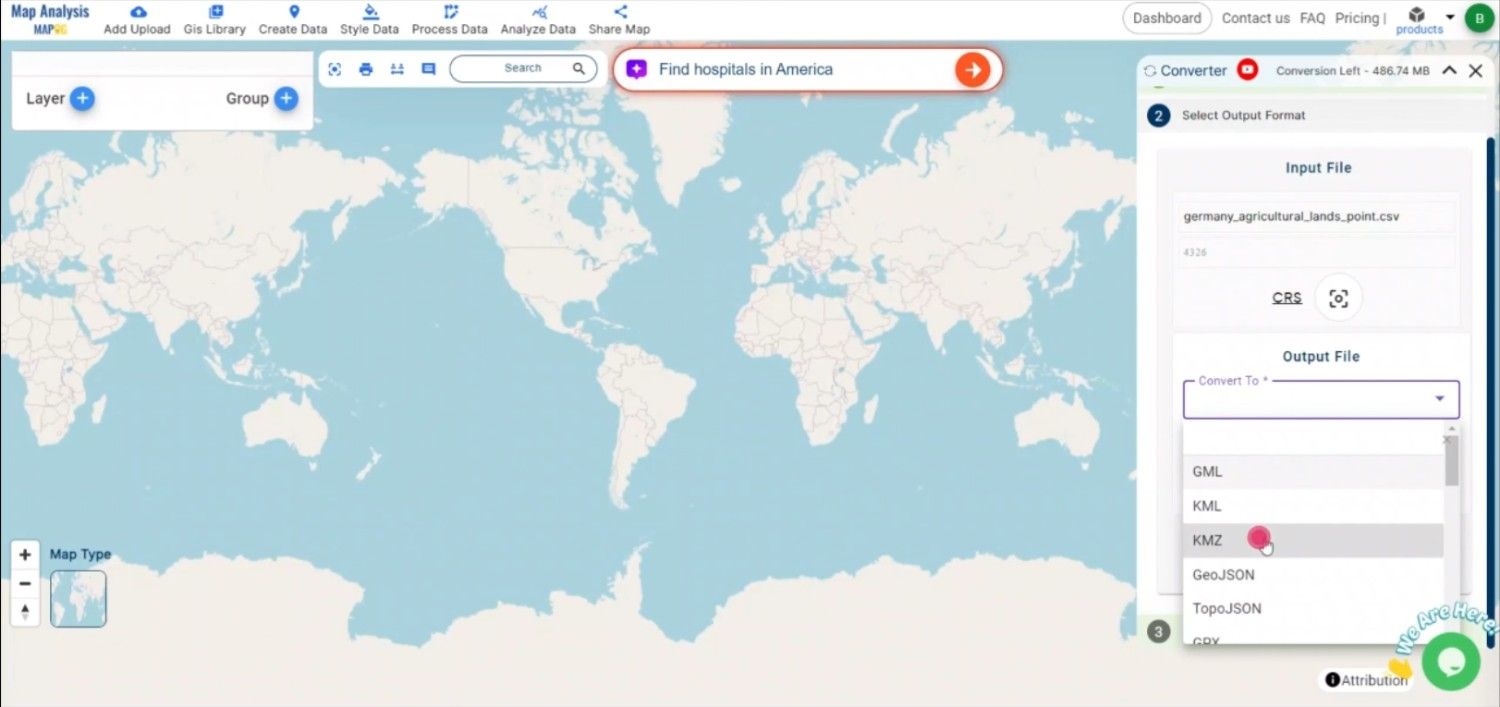
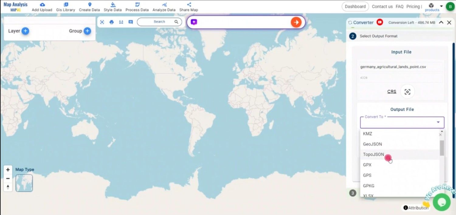
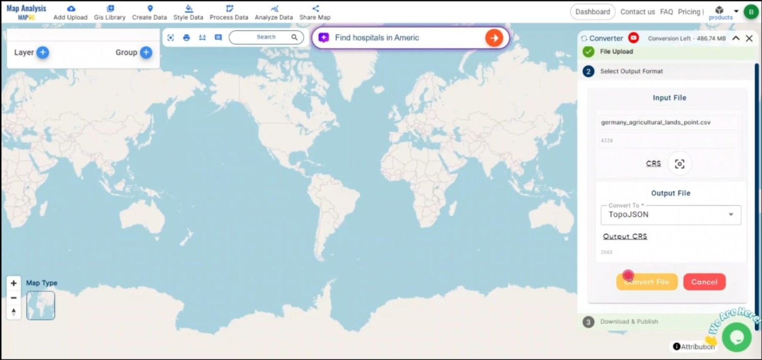
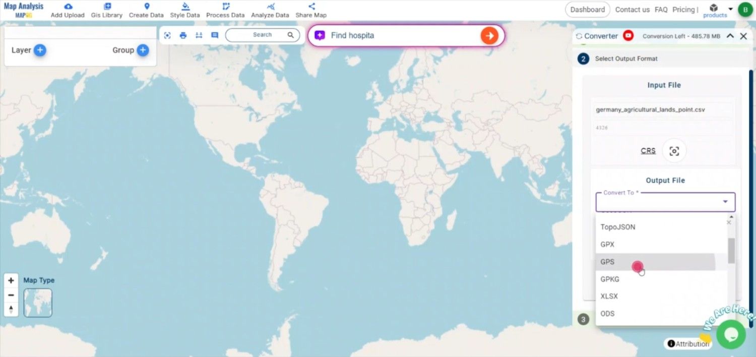
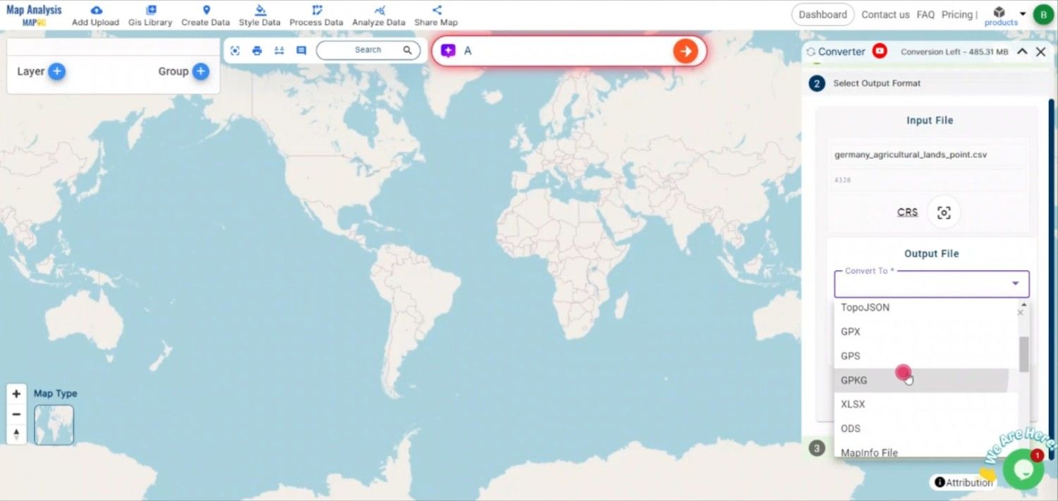
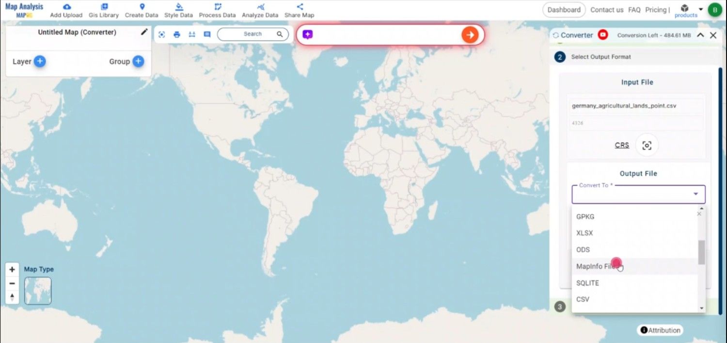
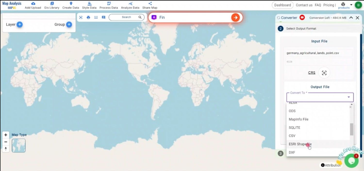
From the available list of formats, choose TopoJSON as the output. TopoJSON is particularly useful for web mapping due to its compact size and ability to encode topology, reducing redundancy in geometric data.

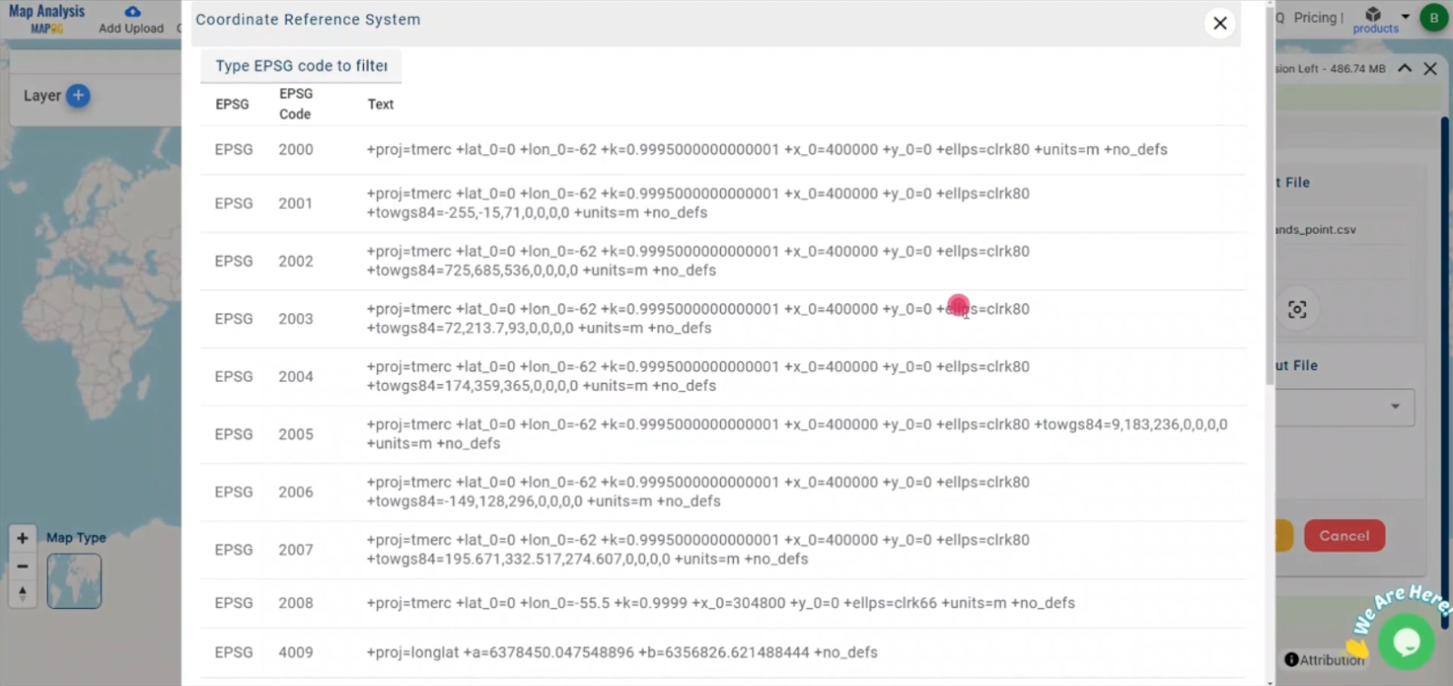
Step 3: Select the Output CRS

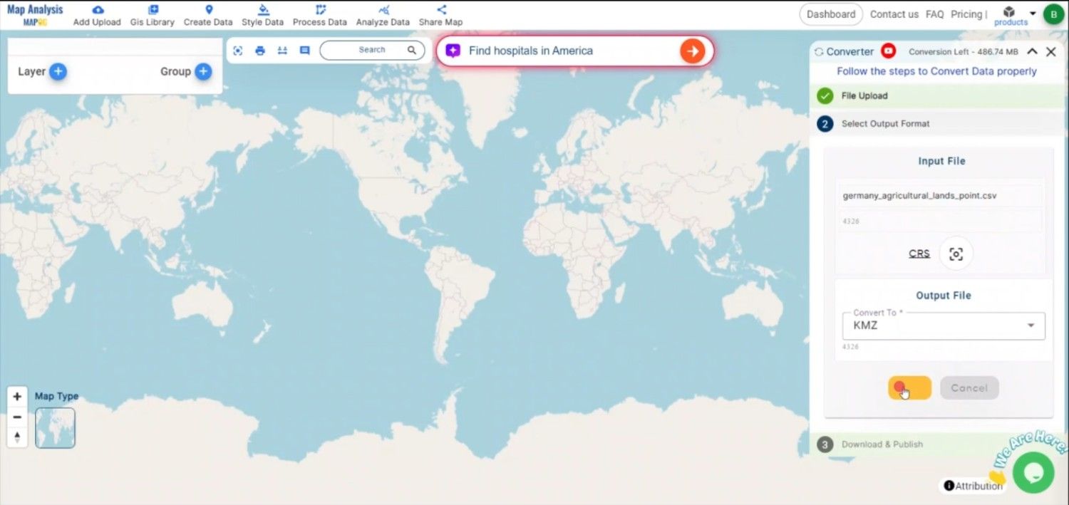
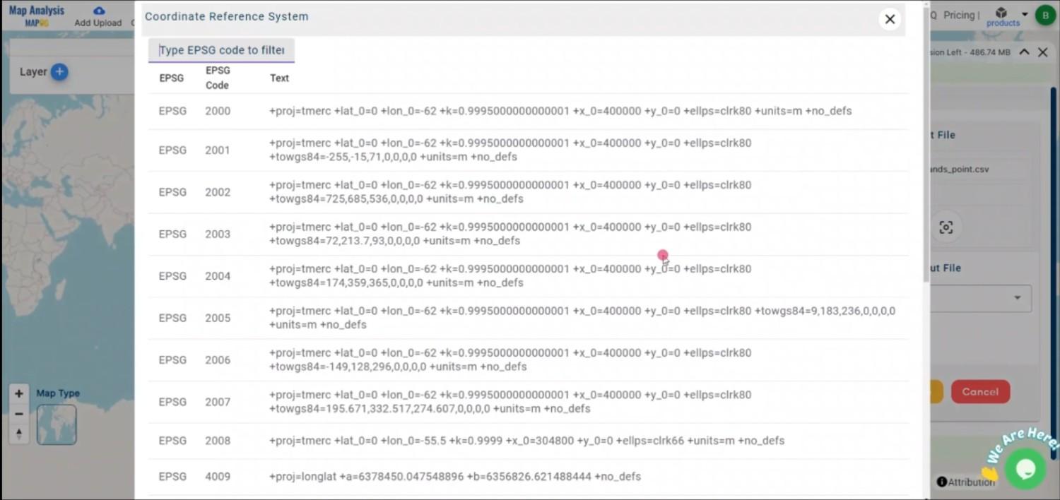
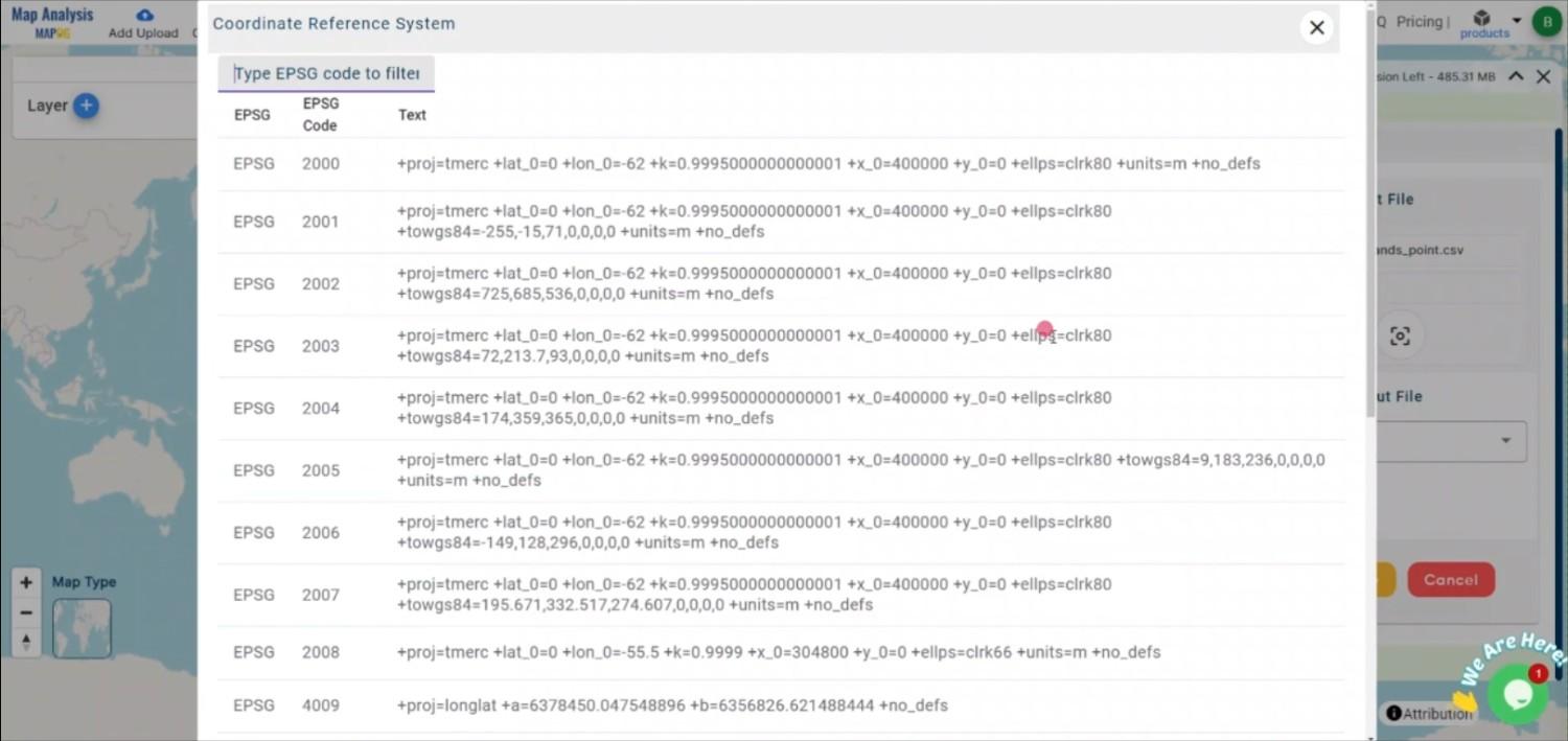
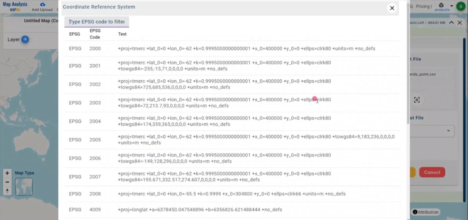
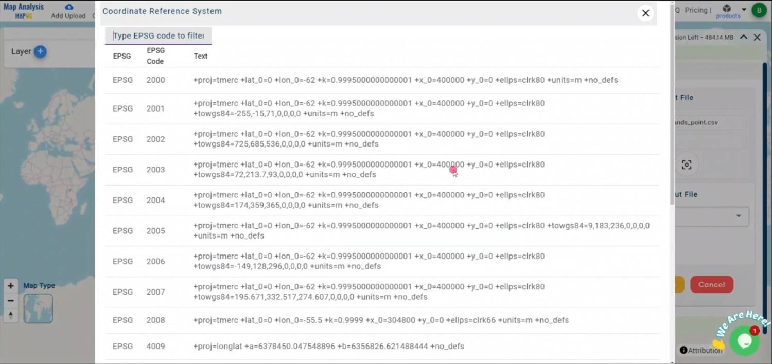
Choosing the appropriate CRS is crucial to ensure that your spatial data is accurately represented in the TOPOJSON file. 

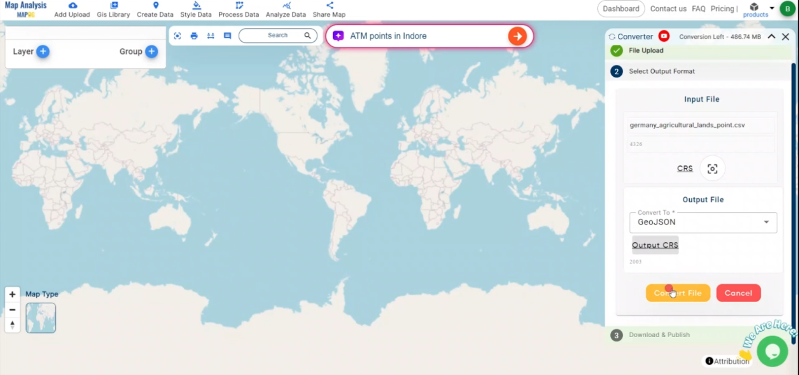
Step 4: Execute the Conversion

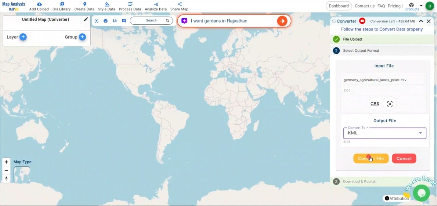
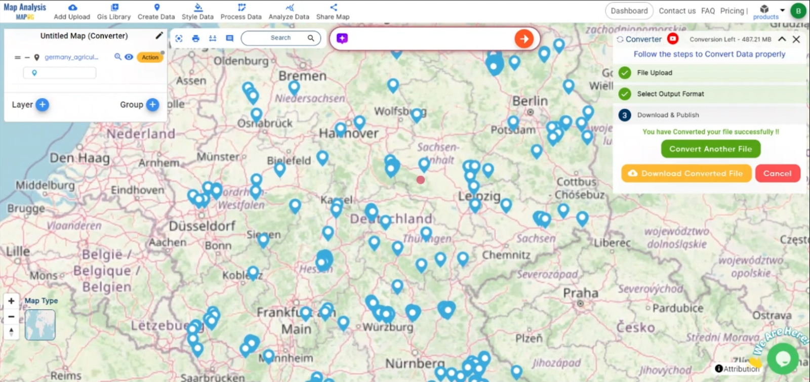
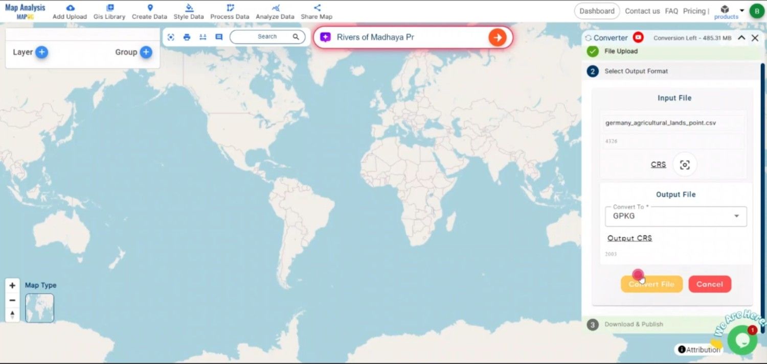
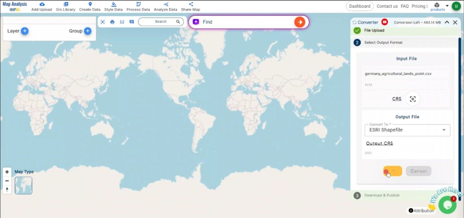
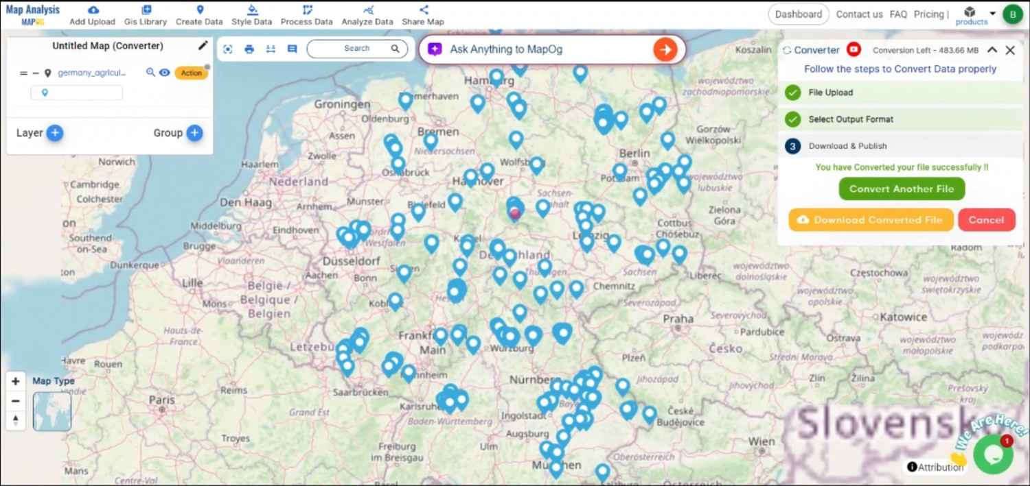
After configuring the necessary parameters, initiate the conversion by clicking the “Convert” button. The MAPOG tool will process the CSV file and generate a TopoJSON file that accurately reflects the geographic data.

Step 5: Review and Download the TopoJSON File

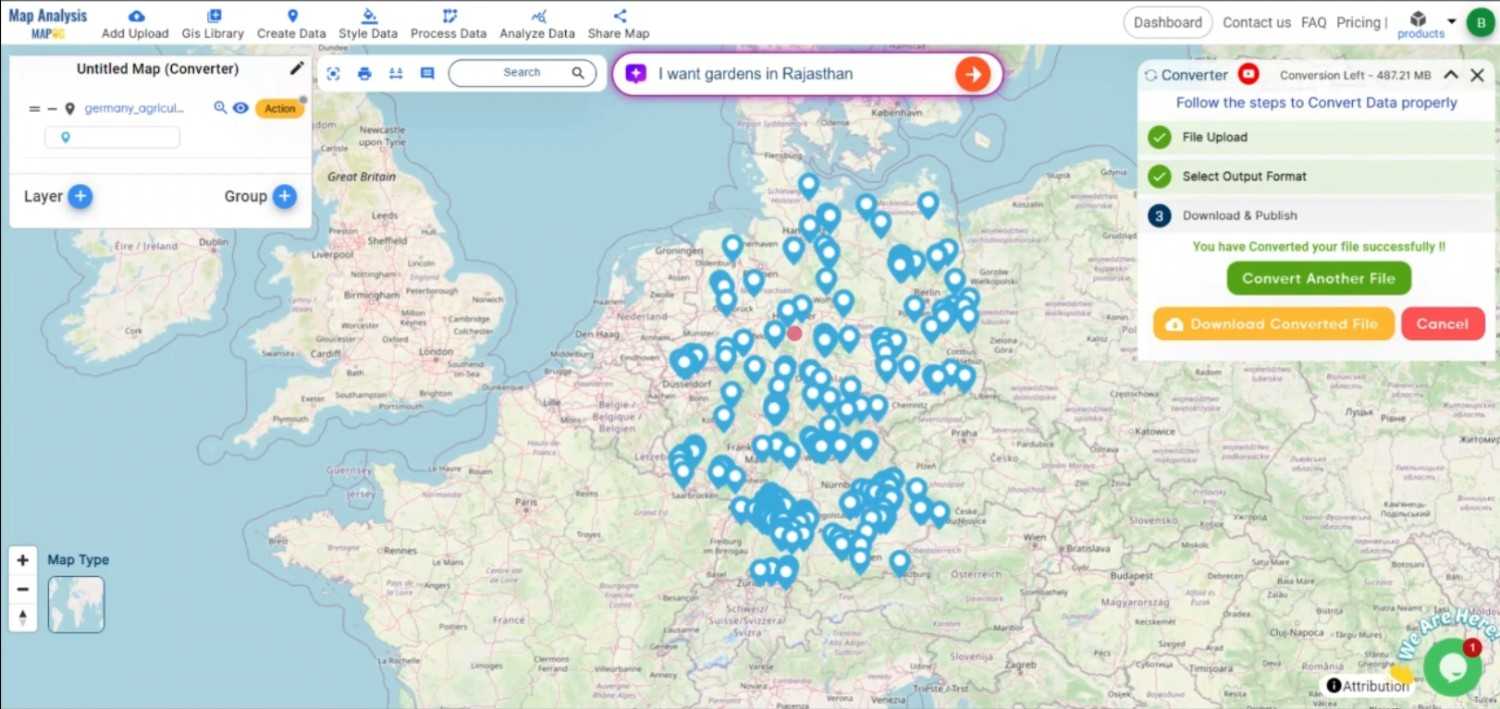
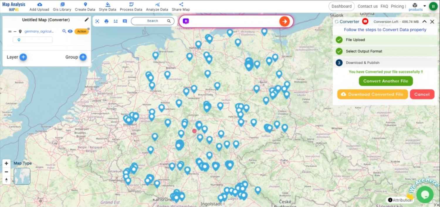
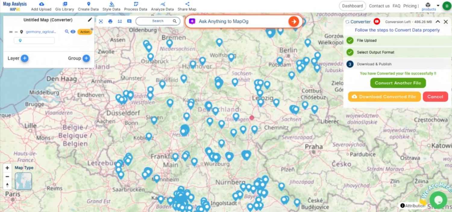
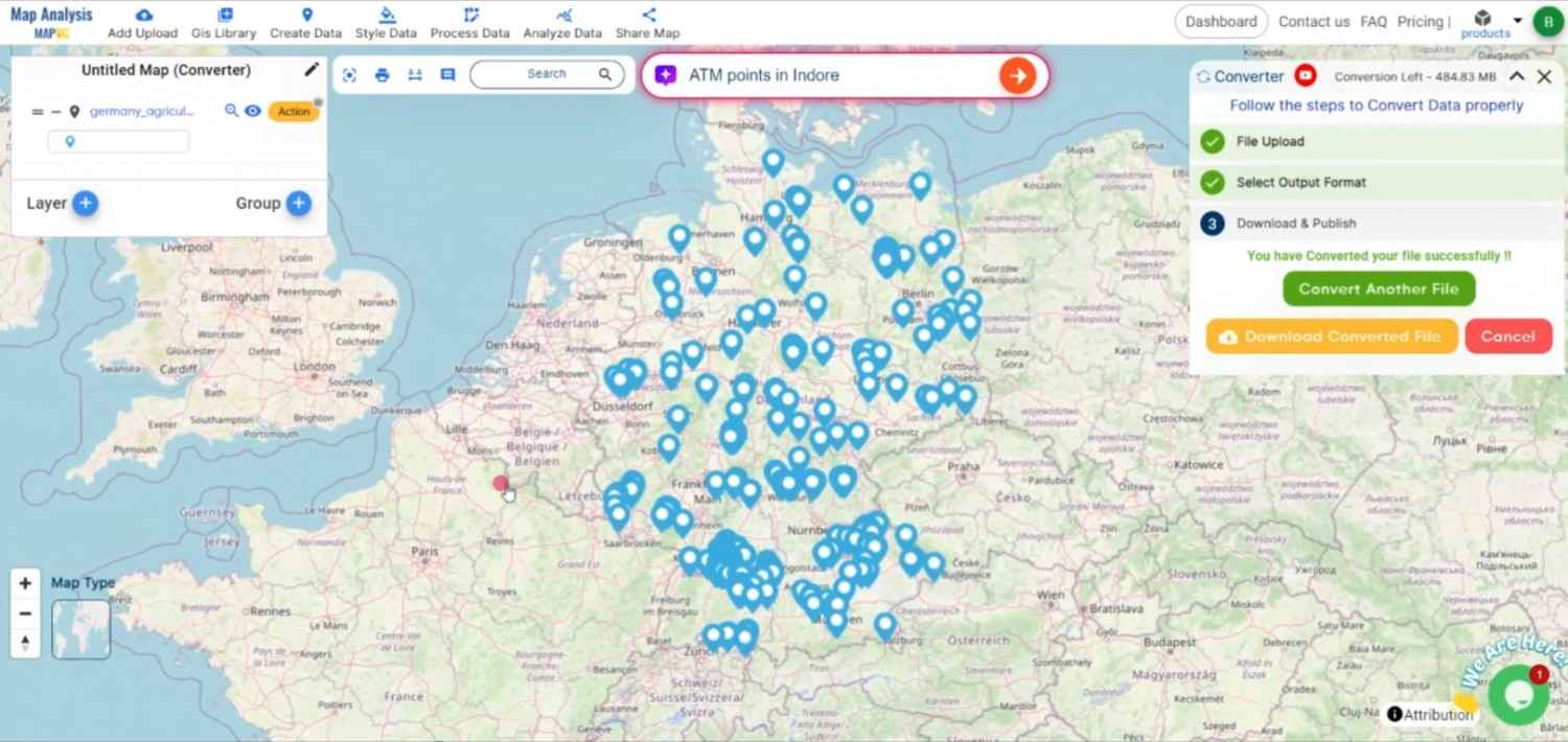
Once the conversion is complete, review the TopoJSON file to ensure that all data has been accurately transformed. If satisfied with the result, download the TopoJSON file, which is now ready for use in web applications or any other platform that supports TopoJSON.

Conclusion:

The MAPOG Converter Tool is an invaluable resource for GIS professionals and web developers, streamlining the process of converting data into efficient, web-optimized formats like TopoJSON. By following these steps, you can easily convert CSV files to TopoJSON, making your geospatial data ready for advanced web visualization and analysis. If you need to download any data file in CSV or in any other formats like KMZ, GML. visit GIS DATA. Here we have 900+ data layers for 200+ countries.

Feature Tool:
Story by MAPOG:

Story by MAPOG is an interactive application that uses storytelling and interactive maps to bring geographical data to life. Imagine creating engrossing narratives about locations, occasions, or trends by fusing in-depth maps with images, text, and videos. With Story by MAPOG, it’s simple to take visitors on a visual journey, be it for tracking environmental changes, presenting stunning landscapes, or visiting cultural sites.

Here are some other blogs you might be interested in:

Convert CSV to GPS Online: A Step-by-Step Guide

Geospatial data conversion is a fundamental aspect of GIS processes, allowing data to be easily utilized across different platforms and applications. CSV is a common format for storing tabular data, while GPS formats, is widely used for mapping and navigation purposes in GPS devices and software. Converting CSV to a GPS format, enables the data to be used directly in GPS units for navigation and tracking.

What is CSV File?

A CSV file (Comma-Separated Values) is a simple text file that stores data in a table format. Each line represents a row, and the values in each row are separated by commas, making it easy to organize and share information like a spreadsheet.

                                         ONLINE GIS DATA CONVERTION

Key Concept for Conversion CSV to GPS:

The MAPOG MapAnalysis Converter Tool provides an intuitive and user-friendly platform for converting data between various formats. Below is a step-by-step guide on how to convert CSV files to GPS-compatible format (e.g., GPX) using MAPOG.

Step-by-Step Guide to Converting CSV to GPS

Step 1: Upload CSV Data

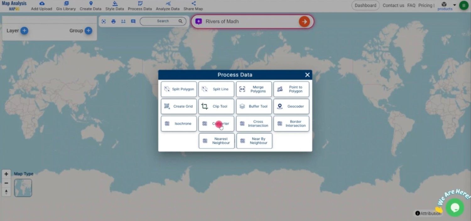
Start by navigating to the “Process Data” section in MAPOG MapAnalysis. Select the “Converter Tool” option. Before uploading your CSV file, ensure that it is well-organized, with columns representing the necessary attributes such as coordinates (latitude and longitude), waypoint names, and any additional data fields.

Convert CSV to GPS Online
Upload the Data

Step 2: Select the GPS Format

From the list of available formats, select GPS format as the output. Allowing for easy integration into GPS devices and software.

Convert CSV to GPS Online
Select the GPS Format

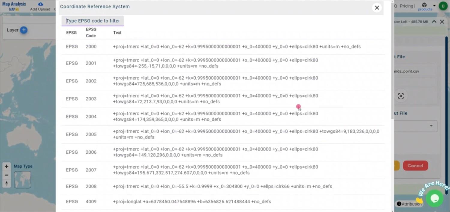
Step 3: Choose the Output CRS

Convert CSV to GPS Online
Choose the OutputCRS

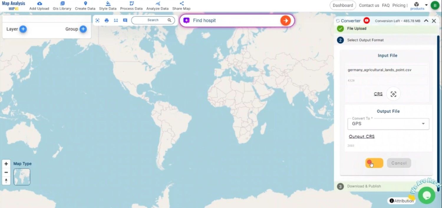
Step 4: Execute the Conversion

Once you’ve configured the necessary parameters and selected the GPS format, click the “Convert” button. The MAPOG tool will process the CSV file and generate a GPS-compatible file that accurately reflects the geographic data.

Convert CSV to GPS Online
Execute the Conversion

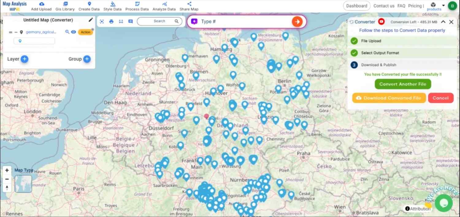
Step 5: Review and download the GPS File

After the conversion is complete, review the GPS file to ensure all data has been correctly transformed. Once satisfied, download the GPS file, which is now ready for use in GPS devices, navigation software, or mapping applications.

Convert CSV to GPS Online
Review the Data

Conclusion:

The MAPOG Converter Tool is an invaluable resource for GIS professionals and navigation enthusiasts, simplifying the process of converting data into GPS-compatible formats. By following these steps, you can efficiently convert CSV files to a GPS format, ensuring your data is ready for use in navigation, tracking, and mapping applications. If you need to download any data file in CSV or in any other formats like GML, TOPOJSON. visit GIS DATA. Here we have 900+ data layers for 200+ countries.

Feature Tool:
Story by MAPOG:

Using interactive maps and storytelling, Story by MAPOG is a powerful tool that makes geographic data come to life. Think of how interesting stories about locations, occasions, or trends could be told by fusing text, images, and videos with intricate maps. It’s simple to take visitors on a visual trip with Story by MAPOG, whether you’re exhibiting stunning vistas, monitoring environmental changes, or visiting cultural places.

Here are some other blogs you might be interested in:

Convert CSV to GPX Online: A Step-by-Step Guide
File conversion is necessary to make geospatial data in Geographic Information Systems (GIS) easily shared and used in a range of applications. Converting CSV to GPX allows users to visualize and upload geographic data to GPS devices for navigation.
What is CSV File?

A CSV file (Comma-Separated Values) is a simple text file that stores data in a table format. Each line represents a row, and the values in each row are separated by commas, making it easy to organize and share information like a spreadsheet.

                                    ONLINE GIS DATA CONVERSION

Key Concept for Conversion CSV to GPX:

MAPOG MapAnalysis‘s Converter Tool provides an intuitive, user-friendly platform for converting geospatial data between various formats. Below is a guide on converting CSV files to GPX format using MAPOG.
Step-by-Step Guide to Converting CSV to GPX
Step 1: Upload Your CSV Data

Start by navigating to the “Process Data” section in MAPOG MapAnalysis and selecting the “Converter Tool” option. Ensure your CSV file is organized, with columns representing latitude, longitude, and other relevant data.

Convert CSV to GPX Online
Upload the Data

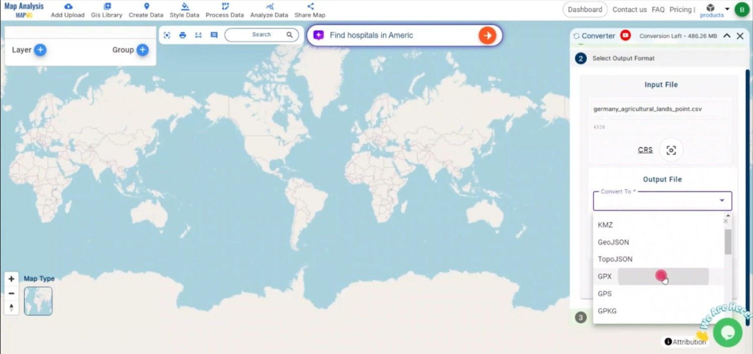
Step 2: Select GPX as the Output Format
Once your CSV file is uploaded, select GPX as the output format. GPX is widely used for GPS applications, making it the best choice for storing waypoints, tracks, and routes.
Convert CSV to GPX Online
Select the GPX format

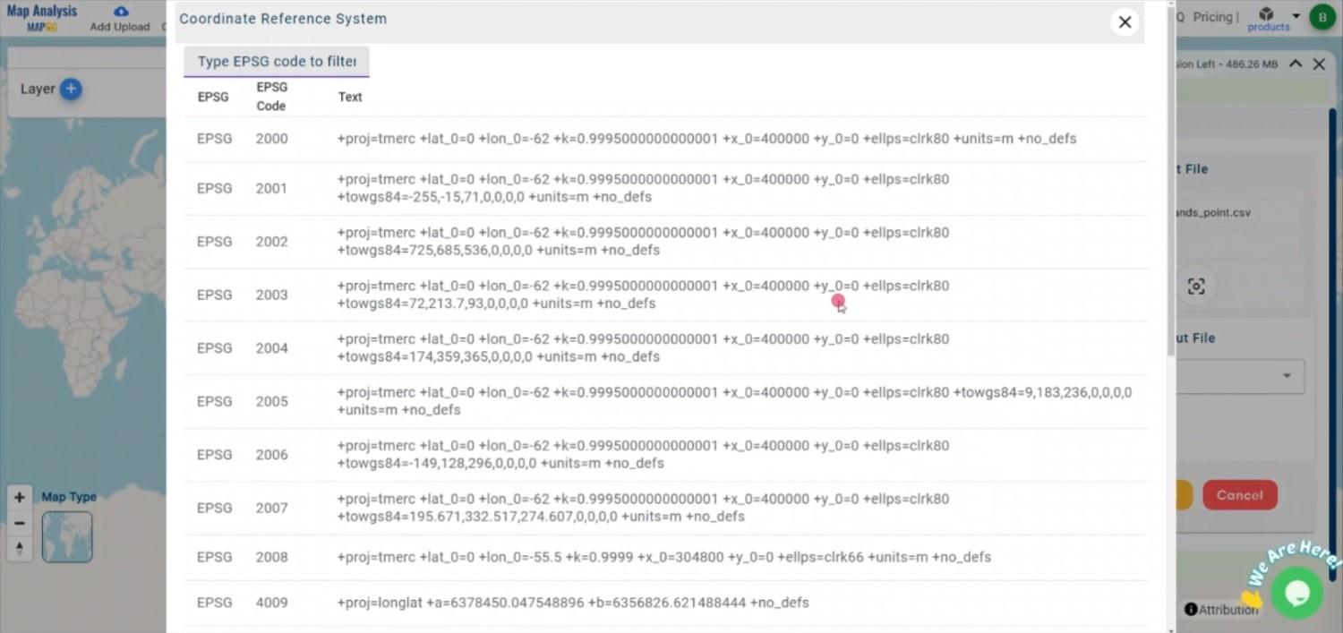
Step 3: Choose the Output CRS

Choosing the Output CRS is crucial to ensure that your spatial data is accurately represented in the GPX file. 

Convert CSV to GPX Online
Choose the Output CRS

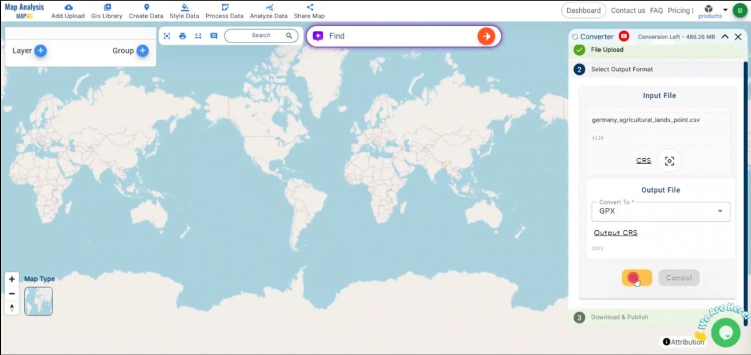
Step 4: Execute the Conversion

After mapping the necessary fields, click the “Convert” button to start the conversion process. MAPOG will transform your CSV data into a GPX file, ready for use with GPS devices or mapping software.

Convert CSV to GPX Online
Execute the Conversion

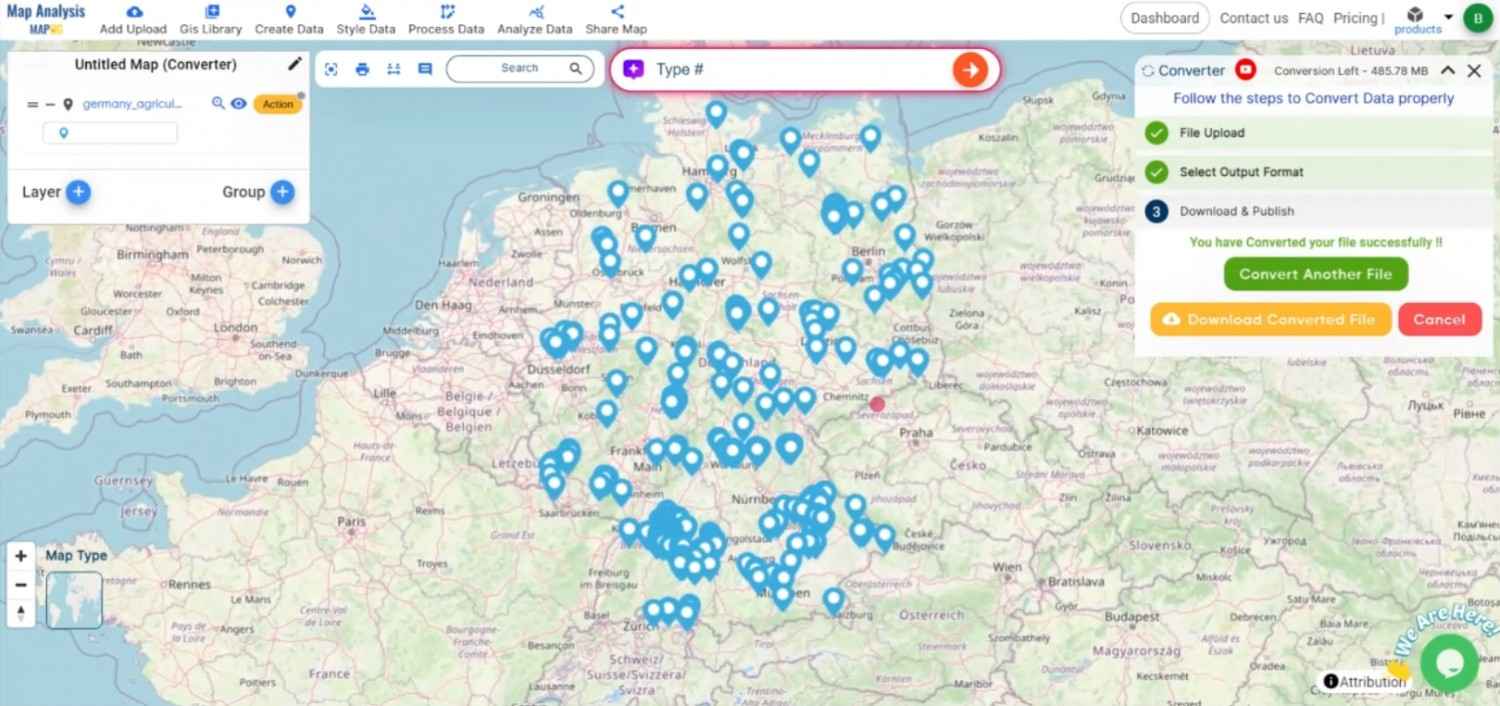
Step 5: Review and Download the GPX File

Once the conversion is complete, review the GPX file to ensure accuracy. After confirming that all data has been correctly converted, download the GPX file, which can now be uploaded to GPS devices or applications like Google Earth or Garmin.

Convert CSV to GPX Online
Review the Data

Conclusion:

The MAPOG Converter Tool simplifies converting CSV files to GPX, allowing for easy navigation and data sharing with GPS devices. By following these steps, you can efficiently transform your CSV data into GPX format, making it accessible for geographic visualization and GPS use. If you need to download any data file in CSV or in any other formats like KMZ, DXF, GML. visit GIS DATA. Here we have 900+ data layers for 200+ countries.

Feature Tool :

Story by MAPOG:

Story by MAPOG is perfect for users who want to bring their data to life through interactive and visually engaging maps. It allows you to tell powerful stories, blending maps with multimedia elements like images and text. Whether you’re showcasing a project, presenting research, or guiding a tour, Story by MAPOG makes it easy to create shareable content.

Here are some other blogs you might be interested in:

Convert CSV to GPKG Online: A Step-by-Step Guide

File conversion is crucial to Geographic Information Systems (GIS) in order to guarantee the seamless integration of geospatial data across various platforms and applications. Geospatial data can be efficiently stored and shared in a single file that can be used in a variety of GIS software programs by converting CSV to GPKG.

What is CSV File?

A CSV file (Comma-Separated Values) is a simple text file that stores data in a table format. Each line represents a row, and the values in each row are separated by commas, making it easy to organize and share information like a spreadsheet.

                                          ONLINE GIS DATA CONVERSION

Key Concept for Conversion CSV to GPKG:

MAPOG MapAnalysis‘s Converter Tool provides a simple, user-friendly interface for converting CSV files to GPKG. The following guide explains the step-by-step process for converting CSV to GPKG using the MAPOG platform.

Step-by-Step Guide to Converting CSV to GPKG

Step 1: Upload Your CSV Data

Begin by navigating to the “Process Data” section in MAPOG MapAnalysis and selecting the “Converter Tool“. Ensure your CSV file is well-structured, with clear headers for fields like latitude, longitude, and any other relevant data.

Convert CSV to GPKG Online
Upload the Data

Step 2: Select GPKG as the Output Format

Once your CSV file is uploaded, choose GPKG (GeoPackage) as the desired output format. GPKG is a versatile, efficient format that allows you to store multiple types of geographic data, including points, lines, and polygons, in one file.

Convert CSV to GPKG Online
Select the Format

Step 3: Choose the Coordinate Reference System (CRS)

Select the appropriate CRS for your data, ensuring that the geographic coordinates are accurately projected in the resulting GPKG file. This step is crucial for maintaining spatial integrity when using your data in different GIS platforms.

Convert CSV to GPKG Online
Choose the Output CRS

Step 4: Execute the Conversion

After mapping your data and selecting the CRS, initiate the conversion process. The MAPOG Converter Tool will transform your CSV data into a GPKG file, organizing the data into spatial layers and attributes.

Convert CSV to GPKG Online
Execute the Excursion

Step 5: Review and Download the GPKG File

Once the conversion is complete, review the resulting GPKG file to ensure all geographic and attribute data was accurately converted. If everything looks correct, download the GPKG file, which is now ready for use in various GIS applications.

Convert CSV to GPKG
Review the Data

Conclusion:

The MAPOG Converter Tool streamlines the process of converting CSV files to GPKG, making it easier to integrate and store geospatial data efficiently. By following these steps, you can transform your tabular CSV data into a robust, spatially-enabled GPKG file for use in a variety of GIS platforms. If you need to download any data file in CSV or in any other formats like SHP, TOPOJSON, GML. visit GIS DATA. Here we have 900+ data layers for 200+ countries.

Feature Tool: 
Story by MAPOG:

Story by MAPOG is perfect for users who wish to make their data come alive through interactive and visually appealing maps. It enables you to construct compelling stories by maps with multimedia elements such as text and images. Story by MAPOG makes it simple to create shareable content, whether you’re presenting research, exhibiting a project.

Here are some other blogs you might be interested in:

Convert CSV to MAPINFO Online: A Step-by-Step Guide

In the field of Geographic Information Systems (GIS), file conversion plays a vital role in ensuring data interoperability across multiple software platforms. CSV is a popular format for storing tabular data, while MapInfo uses MIF formats for handling spatial and attribute data. Converting CSV to MapInfo format allows you to integrate and visualize your data within MapInfo Professional seamlessly.

What is CSV File?

A CSV file (Comma-Separated Values) is a simple text file that stores data in a table format. Each line represents a row, and the values in each row are separated by commas, making it easy to organize and share information like a spreadsheet.

                                               ONLINE GIS DATA CONVERSION

Key Concept for Conversion CSV to Mapinfo:

MAPOG MapAnalysis‘s Converter Tool provides a straightforward solution for converting data between various GIS formats. Here is a detailed step-by-step guide on how to convert CSV files to MapInfo format using the MAPOG platform.

Step-by-Step Guide to Converting CSV to MapInfo Format

Step 1: Upload the CSV Data

Navigate to the “Process Data” section of MAPOG MapAnalysis and choose the “Converter Tool“. Upload your CSV file, ensuring it contains well-organized data with properly labeled columns, including geographic information like latitude and longitude.

Upload the Data

Step 2: Select the MapInfo Format (MIF)

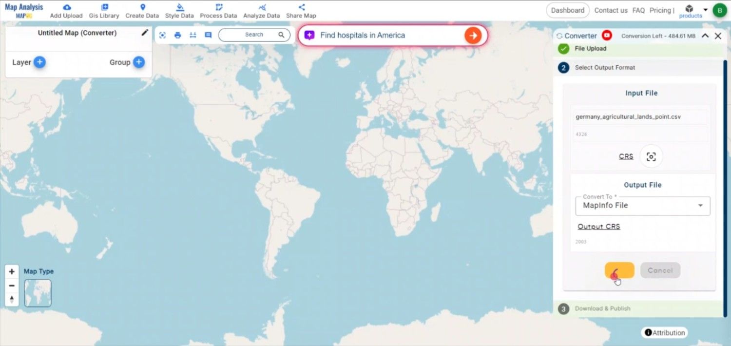
Once the file is uploaded, choose the desired MapInfo format for the output (MIF or TAB). MapInfo formats are well-suited for both the spatial and attribute data needed in MapInfo applications.

Convert CSV to MAPINFO Online
Select the Format

Step 3: Choose the Coordinate Reference System (CRS)

Selecting the correct Coordinate Reference System (CRS) is important for ensuring accurate spatial representation. Choose the CRS that best fits your data’s geographic context, such as WGS 84, which is commonly used for global latitude/longitude coordinates.

Convert CSV to MAPINFO Online
Choose the Output CRS

Step 4: Execute the Conversion

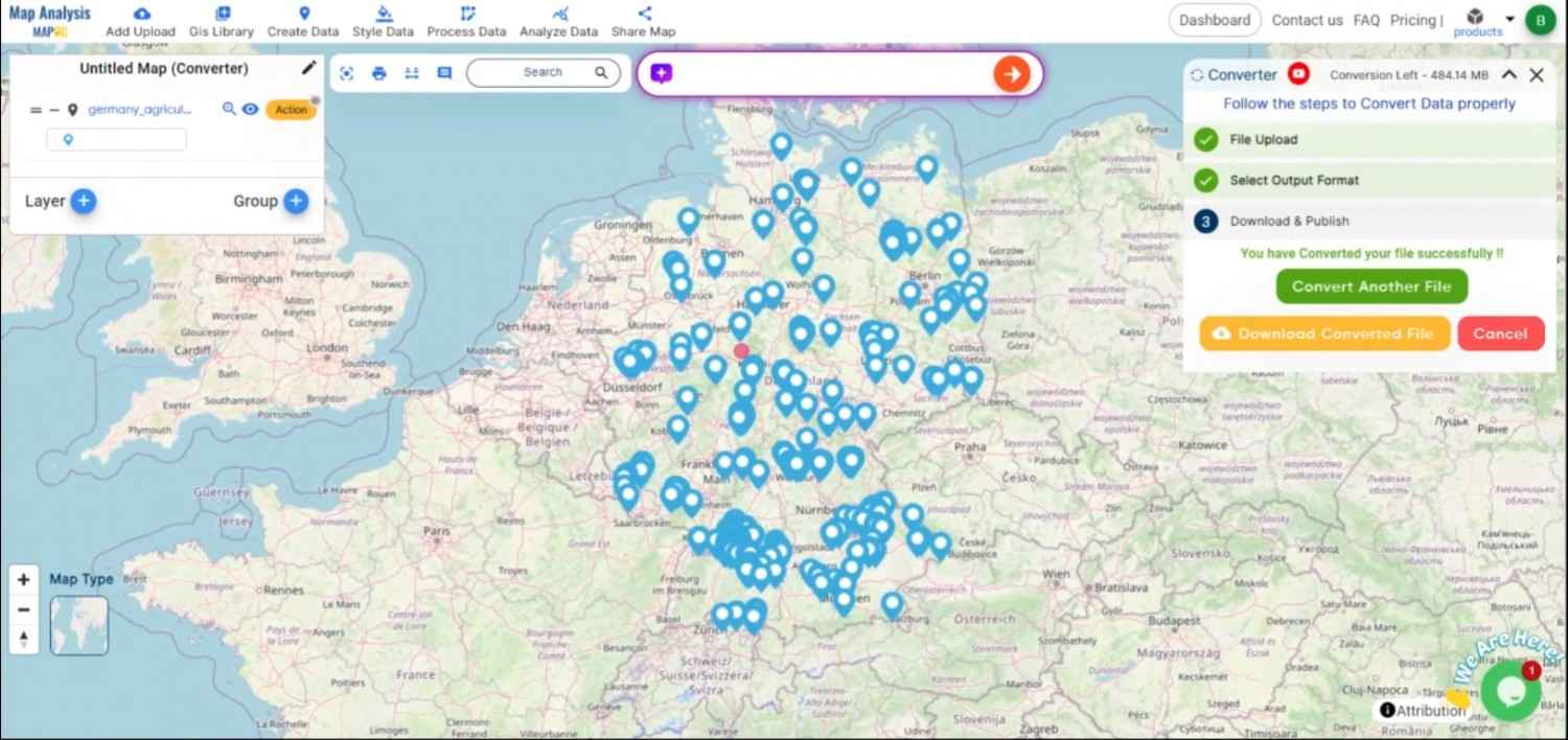
After configuring all the settings and choosing the output format, initiate the conversion by clicking the “Convert” button. The MAPOG Converter Tool will process the CSV file and generate a MapInfo-compatible file (MIF), accurately preserving both the spatial data and attributes.

Convert CSV to MAPINFO Online
Execute the Converrsion

Step5: Review and Download the MapInfo File

Once the conversion is completed, review the output to ensure all data was correctly converted. Finally, download the MapInfo file, which is now ready to be imported and used within MapInfo Professional or other compatible GIS software.

Convert CSV to MAPINFO Online
Review the Data

Conclusion:

The MAPOG Converter Tool makes it easier for GIS experts and MapInfo users to prepare, integrate, and use their geospatial data by streamlining the conversion process from CSV files to MapInfo formats. If you need to download any data file in CSV or in any other formats like KMZ, DXF, GEOJSON. visit GIS DATA. Here we have 900+ data layers for 200+ countries.

Feature Tool: 
Story by MAPOG:

For those looking to create dynamic and eye-catching maps that bring their data to life, MAPOG’s Story is ideal. Maps containing multimedia features, like text and images, allow you to create engaging stories. If you’re presenting research or showcasing a project, Story by MAPOG makes it easy to generate material that can be shared.

Here are some other blogs you might be interested in:

Convert CSV to SQLITE Online: A Step-by-Step Guide

In the field of Geographic Information Systems (GIS), efficient data management is crucial. CSV is widely used for storing tabular data, but when it comes to managing spatial databases, SQLite offers a more robust, lightweight database solution.

What is CSV File?

A CSV file (Comma-Separated Values) is a simple text file that stores data in a table format. Each line represents a row, and the values in each row are separated by commas, making it easy to organize and share information like a spreadsheet.

  ONLINE GIS DATA CONVERTION

Key Concept for Conversion CSV to SQLITE:

MAPOG MapAnalysis’s Converter Tool simplifies the process of converting data between various formats, including converting CSV files into SQLite databases. Below is a step-by-step guide to walk you through the process using the MAPOG platform.

Step-by-Step Guide to Converting CSV to SQLite

Step 1: Upload Your CSV Data

Begin by navigating to the “Process Data” section in the MAPOG MapAnalysis platform. Select the Converter Tool and upload your CSV file. Ensure your CSV file contains well-organized data with clear column headers, especially for geographic information such as coordinates.

Convert CSV to SQLITE Online
Upload the Data

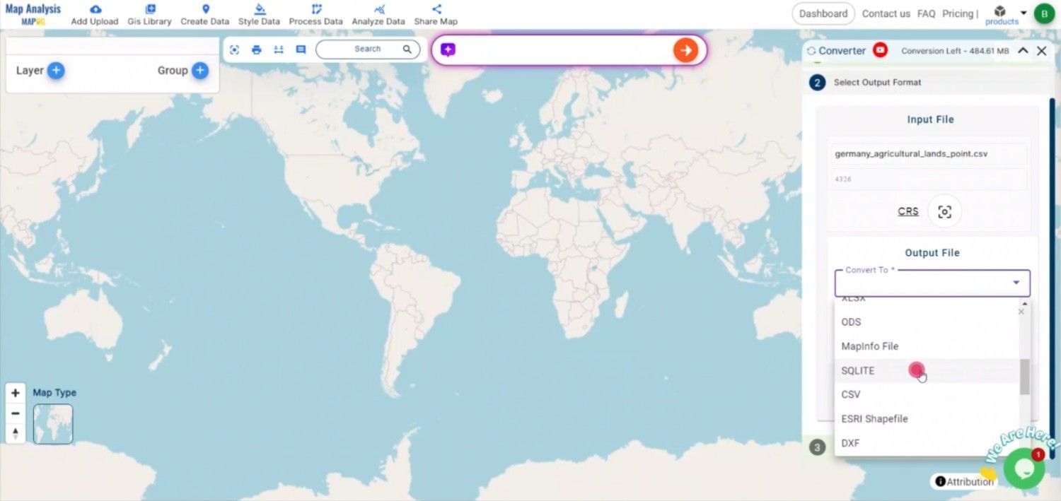
Step 2: Select SQLite as the Output Format

After uploading the file, choose SQLite as the target format. SQLite is a versatile database format that stores spatial and non-spatial data in a structured format, making it ideal for GIS applications.

Convert CSV to SQLITE Online
Select the Format

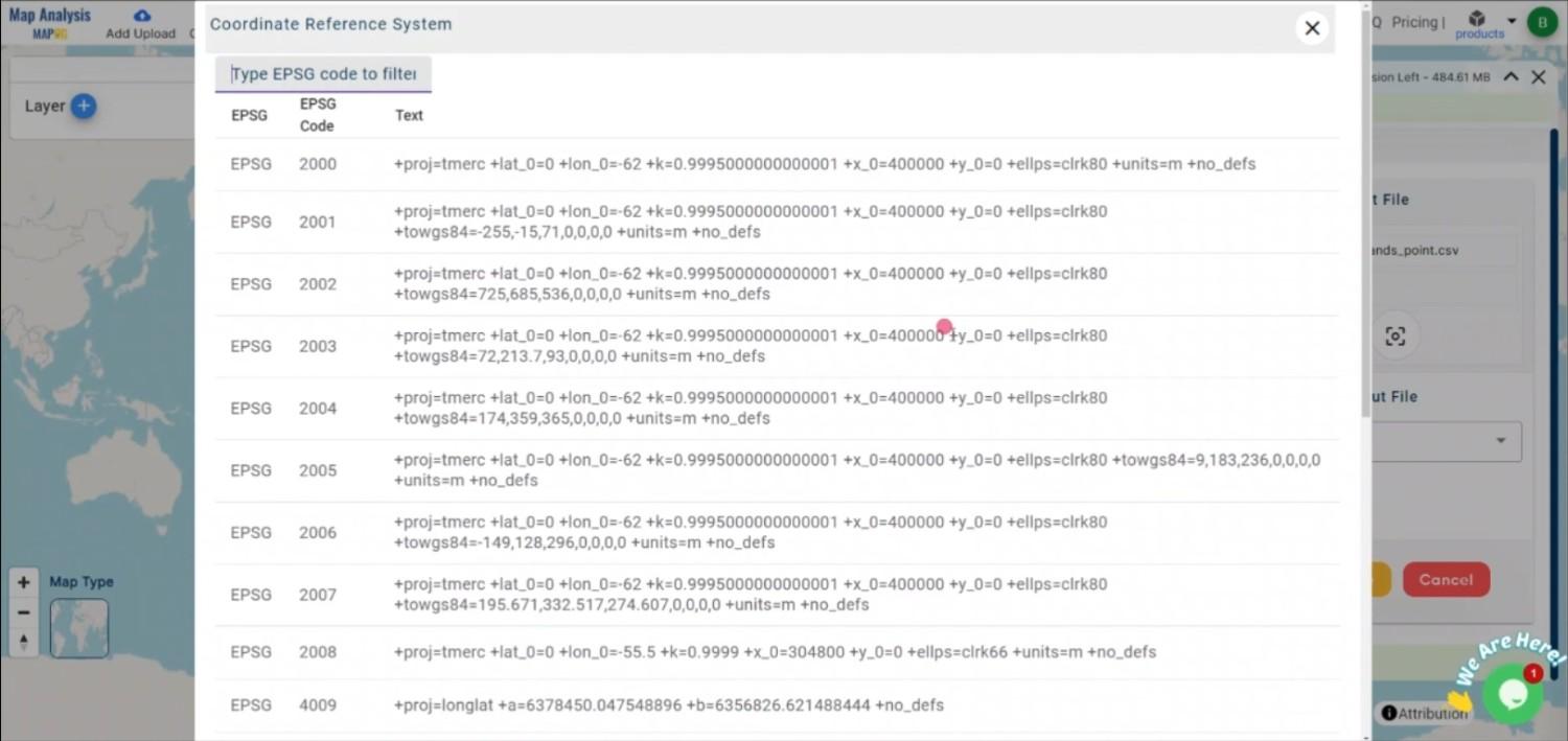
Step 3: Choose the Coordinate Reference System (CRS)

If your data includes spatial information, it’s important to select the correct CRS. The right CRS will ensure that your spatial data is accurately represented in the SQLite database. 

Convert CSV to SQLITE Online
Choose the Output CRS

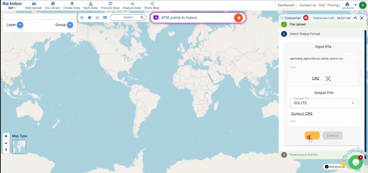
Step 4: Execute the Conversion

Once you have selected SQLite as the output format and mapped your fields, initiate the conversion process. The MAPOG tool will accurately convert your CSV data into an SQLite database, preserving both the attribute and spatial data.

Convert CSV to SQLITE Online
Execute the Conversion

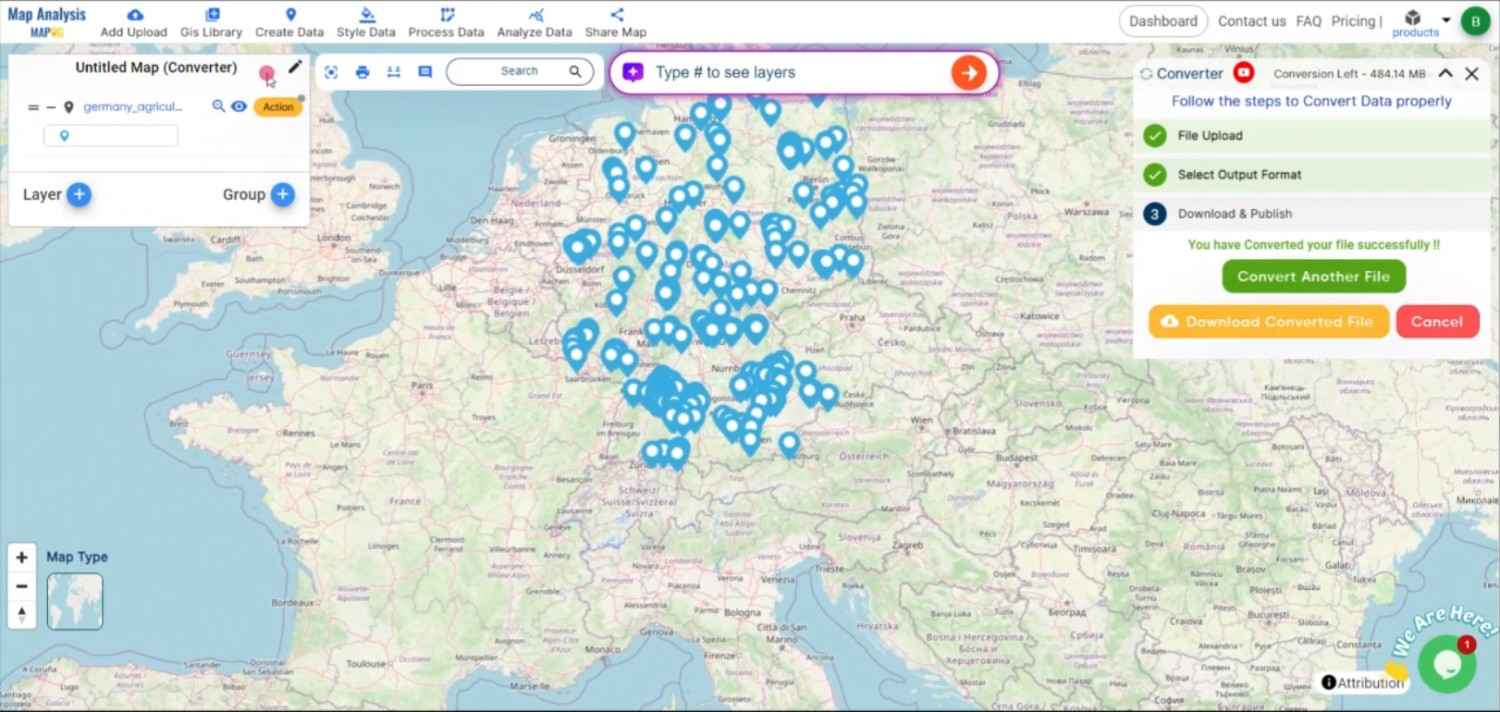
Step 5: Review and Download the SQLite File

After the conversion is complete, review the output file to ensure that all data has been accurately transferred and structured within the SQLite database. Once satisfied, download the SQLite file, which is now ready for use in any GIS software that supports SQLite.

Convert CSV to SQLITE Online
Review the Data

Conclusion:

The MAPOG Converter Tool makes the conversion of CSV to SQLite simple and efficient, allowing GIS professionals to transition from basic tabular data to a more structured database format. If you need to download any data file in CSV or in any other formats like KMZ, GPS, GPKG. visit GIS DATA. Here we have 900+ data layers for 200+ countries.

Feature Tool:
Story by MAPOG:

For users who want to create dynamic, eye-catching maps that bring their data to life, Story by MAPOG is ideal. You may create engaging narratives using maps that incorporate multimedia components like text and photos. Whether you’re showcasing a project or presenting research, Story by MAPOG makes it easy to generate material that can be shared.

Here are some other blogs you might be interested in:

Convert CSV to ESRI Shapefile Online: A Step-by-Step Guide

Converting geospatial data from CSV to ESRI Shapefile (SHP) format is crucial for users needing to utilize spatial data in various GIS platforms. The ESRI Shapefile format is widely recognized in GIS, representing spatial features such as points, lines, and polygons.

What is CSV File?

A CSV file (Comma-Separated Values) is a simple text file that stores data in a table format. Each line represents a row, and the values in each row are separated by commas, making it easy to organize and share information like a spreadsheet.

                                        ONLINE GIS DATA CONVERSION

Key Concept for Conversion CSV to ESRI Shapefile: 

MAPOG MapAnalysis‘s Converter Tool provides a user-friendly platform for converting CSV data into the ESRI Shapefile format. Here’s how to complete the conversion process using MAPOG.

Step-by-Step Guide to Converting CSV to ESRI Shapefile

Step 1: Upload the Data
Navigate to the “Process Data” section in MAPOG MapAnalysis and select the “Converter Tool” option. Upload your CSV file, ensuring that it contains the necessary spatial coordinates.

Convert CSV to ESRI Shapefile Online
Upload the Data

Step 2: Select the Format for Conversion
Choose “ESRI Shapefile” as the output format. This format is widely used for spatial data analysis and sharing across different GIS platforms.

Convert CSV to ESRI Shapefile Online
Select the Format

Step 3: Choose the Coordinate Reference System (CRS)
Select the appropriate CRS to ensure proper geographic representation in the shapefile. The CRS determines how the spatial features will be projected and interpreted.

Convert CSV to ESRI Shapefile Online
Choose the Output CRS

Step 4: Execute the Conversion
Initiate the conversion process. MAPOG’s tool will convert the CSV file into the Shapefile format, preserving spatial attributes and associated data.

Convert CSV to ESRI Shapefile Online
Execute the Conversion

Step 5: Review and Download
Once the conversion is complete, review the output to ensure that the spatial features and data were correctly processed. Download the Shapefile, which is now ready for use in GIS software like ArcGIS or QGIS.

Convert CSV to ESRI Shapefile Online
Download the Data

Conclusion:


MAPOG’s Converter Tool makes the process of converting CSV files to ESRI Shapefile format simple and efficient. By following these steps, you can easily integrate your CSV data into any GIS application that supports shapefiles. If you need to download any data file in CSV or in any other formats like KML, SHP, GEOJSON. visit GIS DATA. Here we have 900+ data layers for 200+ countries.

Feature Tool:
Story by MAPOG:

If you want to create maps that bring your data to life, Story by MAPOG is ideal for you. With maps and multimedia components like text and images, you can create engrossing stories. Whether you’re presenting research or showcasing a project.

Here are some other blogs you might be interested in:

Convert CSV to DXF Online: A Step-by-Step Guide

File conversion is a crucial step in working with GIS data, ensuring compatibility between different formats and applications. CSV files store tabular data such as geographic coordinates and attributes, while DXF is used for GIS software to represent spatial features. Converting CSV to DXF enables users to transfer geospatial data from a CSV format into GIS tools for design, mapping, and spatial analysis.

What is CSV File?

A CSV file (Comma-Separated Values) is a simple text file that stores data in a table format. Each line represents a row, and the values in each row are separated by commas, making it easy to organize and share information like a spreadsheet.

                                           ONLINE GIS DATA CONVERSION        

Key Concept for Conversion CSV to DXF: 

MAPOG MapAnalysis‘s Converter Tool offers a simple and effective solution for converting CSV files to DXF format, streamlining the process for GIS professionals and GIS users alike. Here’s a step-by-step guide to converting your CSV file to DXF format using MAPOG.

Step-by-Step Guide to Converting CSV to DXF

Step 1: Upload the Data: 

Start by navigating to the “Process Data” section in the MAPOG MapAnalysis interface. Select the “Converter Tool” option and upload your prepared CSV file. Ensure your CSV file is correctly formatted, with columns for geographic coordinates and any attribute data you want to include in the DXF output.

Convert CSV to DXF Online
Upload the Data

Step 2: Choose the Output Format (DXF): 

Next, select DXF as the output format. DXF is commonly used for transferring data into GIS software, making it ideal for spatial analysis and technical drawings.

Convert CSV to DXF Online
Select the Fomat

Step 3: Set the Output Coordinate Reference System (CRS):

 For accurate mapping, you may need to select an appropriate CRS based on your data’s geographic location. This step ensures the data in the DXF file is geographically accurate.

Convert CSV to DXF Online
Choose the Output CRS

Step 4: Execute the Conversion: 

Once you’ve specified all necessary options, execute the conversion. MAPOG will quickly convert the CSV file into DXF format, retaining both geometric and attribute data. 

Convert CSV to DXF Online
Execute the Conversion

Step 5: Review and Download the DXF File: 

After the conversion is complete, review the output to ensure it and download the DXF file. This file is now ready for use in GIS applications, enabling you to work with the spatial data in a technical drawing environment.

Convert CSV to DXF Online
Review the Data

Conclusion: 

The MAPOG Converter Tool simplifies CSV to DXF conversion, enabling seamless transitions from tabular geographic data to GIS-friendly formats. By following these steps, you can efficiently convert your CSV files to DXF, ensuring compatibility with GIS software for advanced spatial analysis and design purposes. If you need to download any data file in CSV or in any other formats like GML, GEOJSON. visit GIS DATA. Here we have 900+ data layers for 200+ countries.

Feature Tool:

Story by MAPOG:

For users who wish to employ interactive and eye-catching maps to bring their data to life, Story by MAPOG is ideal. It enables you to combine maps with multimedia components like text and photographs to create compelling narratives. Story by MAPOG makes it simple to produce shareable content, whether you’re promoting project, leading a tour, presenting research.

Here are some other blogs you might be interested in:

Convert CSV to MID Online: A Step-by-Step Guide For GIS Conversion

File conversion plays a vital role in GIS, ensuring that geospatial data can be used across different platforms and applications. CSV files are commonly used for storing tabular data, including geographic information like coordinates and attributes. MID is a format paired with MIF used in MapInfo GIS software, representing the attribute data of geographic features. Converting CSV to MID ensures seamless integration of tabular data into MapInfo systems.

What is CSV File?

A CSV file (Comma-Separated Values) is a simple text file that stores data in a table format. Each line represents a row, and the values in each row are separated by commas, making it easy to organize and share information like a spreadsheet.

                                              ONLINE GIS DATA CONVERSION

Key Concept for Conversion CSV to MID:

MAPOG MapAnalysis‘s Converter Tool provides a straightforward and efficient solution for converting CSV files to MID format. Here’s a step-by-step guide to help you convert your CSV file to MID using MAPOG.

Step-by-Step Guide to Converting CSV to MID

Step 1: Upload the CSV File
Start by navigating to the Process Data section in the MAPOG MapAnalysis interface. Select the “Converter Tool” and upload your CSV file. Ensure your file contains organized data, such as geographic coordinates or attributes, necessary for conversion.

Convert CSV to MID Online
Upload the Data

Step 2: Select the Output Format (MID)
Once the file is uploaded, choose MID as the output format. MID files store the attribute data of geographic features, which pairs with MIF to work in MapInfo GIS applications.

Convert CSV to MID Online
Select the Format

Step 3: Choose Output Coordinate Reference System (CRS)
If your CSV data includes geographic coordinates, select the appropriate CRS to ensure spatial accuracy in the resulting MID file. This step is crucial for correctly positioning features in GIS software.

Convert CSV to MID Online
Choose the Output CRS

Step 4: Start the Conversion
After selecting MID and setting the CRS, initiate the conversion process. MAPOG will convert the CSV data to MID format, preserving all attribute information and ensuring compatibility with MapInfo GIS.

Convert CSV to MID Online
Start the Conversion

Step 5: Review and Download
Once the conversion is complete, review the output to ensure everything was correctly converted. You can then download the MID file, which will be ready for integration into MapInfo GIS alongside its corresponding MIF file.

Convert CSV to MID Online
Review the Data

Conclusion:

The MAPOG Converter Tool offers a hassle-free way to convert CSV files to MID format, allowing GIS professionals to prepare their data for use in MapInfo systems. By following these simple steps, you can seamlessly convert your CSV data and ensure its compatibility with MapInfo GIS applications. If you need to download any data file in DXF or in any other formats like TOPOJSON, KML, DXF. visit GIS DATA. Here we have 900+ data layers for 200+ countries.

Feature Tool:
Story by MAPOG:

Story by MAPOG is excellent for users who want to bring their data to life through interactive maps. It allows you to tell Beautyful stories, blending maps with images and text. Whether you’re showcasing a project or guiding a tour, Story by MAPOG makes it easy to create a map.

Here are some other blogs you might be interested in:

Convert CSV to MIF Online: A Step-by-Step Guide to Online GIS Data Conversion

In order for the easy sharing and use of geospatial data across several platforms, file conversion is a crucial component of GIS processes. In MapInfo GIS software, MIF is frequently used to represent both geographic and attribute data. Data from CSV files can be easily integrated into MapInfo GIS applications by converting them to MIF format.

What is CSV File?

A CSV file (Comma-Separated Values) is a simple text file that stores data in a table format. Each line represents a row, and the values in each row are separated by commas, making it easy to organize and share information like a spreadsheet.

                                         ONLINE GIS DATA CONVERSION

Key Concept for Conversion CSV to MIF:

The MAPOG MapAnalysis Converter Tool provides an easy and efficient platform for converting CSV files to MIF format, streamlining the process for users working with MapInfo systems.

Step-by-Step Guide to Converting CSV to MIF

Step 1: Upload the CSV File
Begin by navigating to the “Process Data” section of MAPOG MapAnalysis. Select the “Converter Tool” option and upload your CSV file. Ensure that your CSV is properly formatted, containing geographic data and attributes that will be represented in the MIF file.

Convert CSV to MIF Online
Upload the Data

Step 2: Choose MIF as the Output Format
Next, select MIF as the desired output format. MIF is ideal for handling both spatial and attribute data, which makes it suitable for use in MapInfo GIS applications.

Convert CSV to MIF Online
Choose the Format

Step 3: Select the Output Coordinate Reference System (CRS)
If your CSV file contains geographic coordinates, select the appropriate CRS. This ensures that your data is accurately mapped in the resulting MIF file, with the correct geographic reference.

Convert CSV to MIF Online
Select the Output CRS

Step 4: Convert the File
Once you’ve chosen MIF as the format and set the CRS, initiate the conversion process. The MAPOG Converter Tool will accurately convert your CSV file into MIF format, preserving both the geographic features and their associated attribute data.

Convert CSV to MIF Online
Convert the File

Step 5: Review and Download
After the conversion is complete, review the output to ensure that the data has been properly converted. If everything looks good, download the MIF file, which is now ready for use within MapInfo GIS software.

Convert CSV to MIF Online
Review the Data

Conclusion:

The MAPOG Converter Tool simplifies the process of converting CSV files to MIF format, making it easier for GIS professionals to prepare their spatial and attribute data for use in MapInfo systems. By following this guide, you can efficiently convert your CSV data to MIF and ensure compatibility with MapInfo GIS applications. If you need to download any data file in CSV or in any other formats like SHP, GML. visit GIS DATA. Here we have 900+ data layers for 200+ countries.

Feature Tool:
Story by MAPOG:

For users who wish to employ interactive and eye-catching maps to bring their data to life, Story by MAPOG is great. It enables you to combine maps with multimedia components like text and photographs to create compelling narratives.

Here are some other blogs you might be interested in: